 Route Editor

| Guide | ♦ | 173 Triplogs | 0 Topics |
details | drive | permit | forecast | 🔥 route |
stats |
photos | triplogs | topics | location |
| 506 | 173 | 0 |
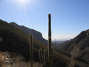
The ringing never ends by fricknaley  Phoneline Trail #27 in Sabino Canyon is as straightforward as it gets. This trail follows the tram road's southern side up into and along Sabino Canyon, albeit several hundred feet above it. It's a nice distance on an easy to follow trail with great views up into Sabino Canyon all along the way. This trail is also popular with trail runners as it is reasonably level after the initial elevation changes at either end. Phoneline Trail #27 in Sabino Canyon is as straightforward as it gets. This trail follows the tram road's southern side up into and along Sabino Canyon, albeit several hundred feet above it. It's a nice distance on an easy to follow trail with great views up into Sabino Canyon all along the way. This trail is also popular with trail runners as it is reasonably level after the initial elevation changes at either end.To reach the beginning of the Phoneline Trail, you start from the Sabino Canyon Visitors Center following the Bear Canyon Trail, which begins at the eastern corner of the parking lot, to the right of the visitors center. This first section follows a wide dirt track, formally a shuttle road, until it reaches a paved road section. Turn right on the paved road, and follow it downhill to another intersection, next to a building containing restrooms. Here, you'll turn right again and follow the road across Sabino Creek and uphill to the last intersection. Straight in front of you, the Phoneline trail leaves the road (at a small sign announcing its departure) and climbs a short distance up to the spine of a ridge where it splits. To the right, the Bear Canyon trail heads off toward Seven Falls. To the left, the Phoneline Trail leads gently up the ridge on its way into Sabino Canyon. Turn left here and formally begin your journey.
As you round the bend, great views up into Sabino and the Catalina high country will be your guide the rest of the way. You can also see the tram road climbing up the canyon as well. You are now hundreds of feet above it, and you can see little specks (people) cruising along the path. Thimble peak and Blackett's Ridge are up and to your right. As you pass these, new peaks guide you further into the canyon. The going is easy. Multiple large rock outcroppings on your left along the way provide good sites to have lunch. As you finally reach the end of the line, the trail starts switchbacking down. You can see the circular turnaround beneath you for the trams. Switchbacking down, the Phoneline meets up with Sabino Canyon trails (which continue up the canyon). Continue downward to the road. Enjoy lovely views, then reclimb and begin your trip back. Alternatively, for those inclined, you could always catch the tram back to the visitor center. If you choose to walk to and from the formal beginning of the Phoneline Trail, plan on adding about 2 miles to your total trip length, bringing the whole hike to about 11 miles or so. This is by no means a secluded hike, but it's a pleasant stroll along the upper walls of Sabino Canyon nonetheless. It's also kind of neat to tower hundreds of feet above the walkers and trams patrolling the roadway. As a side note, this trail is popular in Tucson for runners. If you encounter any, be courteous and give them the right of passage.
Check out the Official Route and Triplogs. Leave No Trace and +Add a Triplog after your hike to support this local community. One-Way Notice This hike is listed as One-Way. When hiking several trails on a single "hike", log it with a generic name that describes the hike. Then link the trails traveled, check out the example. | |||||||||||||||||||||||||||||||||||||||||||||||||||||||||||||||||||||||||||||||||||||||||||||||||||||||||||||||||||||||||||||||||||||||||||||||||||||||||||||||||||||||||||||||||||||||||||||||||||||||||||||||||||||||


