 Route Editor

| Guide | ♦ | 38 Triplogs | 0 Topics |
details | drive | permit | forecast | 🔥 route |
stats |
photos | triplogs | topics | location |
| 701 | 38 | 0 |
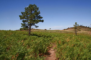
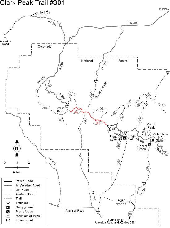
Amazing views!! by RedRoxx44  This trail exceeded my expectations. Mt. Graham and the Pinalenos are a spectacular sky island, with beautiful riparian trails and thick forests, scarred some by fires, as seems the norm in Arizona. It lacks a "ridgeline" trail system, most trails being up and down the mountainside. This trail has not escaped fire but is the closest to a ridgeline system. The views are fabulous. You start at the end of the dirt road on top. Unless you have 4wd and want to go through a few semi-permanent mud holes, ignore the small sign for "Clark Peak TH" and take the main road a little over three miles to the dead end, which happens to be the TH you want. This trail exceeded my expectations. Mt. Graham and the Pinalenos are a spectacular sky island, with beautiful riparian trails and thick forests, scarred some by fires, as seems the norm in Arizona. It lacks a "ridgeline" trail system, most trails being up and down the mountainside. This trail has not escaped fire but is the closest to a ridgeline system. The views are fabulous. You start at the end of the dirt road on top. Unless you have 4wd and want to go through a few semi-permanent mud holes, ignore the small sign for "Clark Peak TH" and take the main road a little over three miles to the dead end, which happens to be the TH you want.I only covered a little over 8 miles of this trail to Taylor Pass and did some off-trail ridge walking to see more views. The forest service recommends a 2-day trip to do an out and back of the almost 14-mile trail, which terminates on West mountain. I am not sure why. The part of the trail I hiked on was in fair shape, rollercoaster-like in elevation gain and loss, minimally overgrown. The trail grew faint as it descended the side of a ridge to Taylor Pass. Some other use-trails in the area go to great dry campsites or great view lunch sites. The trail starts at 9000 feet, skirts Clark Peak (look for a couple of cairns for a short walk up to the summit) at a little over 10,000 feet, then drops about 2000 feet to Taylor Pass in the 7000's; where I turned around, then climbs to West Peak at 8600 to meet an old FS road. The route is waterless, so you must carry all water. Several damp dirt areas look quite spring-like if they were dug out.
There are some connecting trails to FS roads that come out of Pima et al. if one wanted to do a long car shuttle. Or get dropped off at the top and picked up at the bottom somewhere. Better though to camp up top and do this trail as an in and out. You won't get tired of the views, that is for certain, lots of variety on this trial, and a new favorite for me.
Check out the Official Route and Triplogs. Leave No Trace and +Add a Triplog after your hike to support this local community. One-Way Notice This hike is listed as One-Way. When hiking several trails on a single "hike", log it with a generic name that describes the hike. Then link the trails traveled, check out the example. | |||||||||||||||||||||||||||||||||||||||||||||||||||||||||||||||||||||||||||||||||||||||||||||||||||||||||||||||||||||||||||||||||||||||||||||||||||||||||||||||||||||||||||||||||||||||||||||||||||||||||||||


