 Route Editor

| Guide | ♦ | 11 Triplogs | 1 Topic |
details | drive | permit | forecast | 🔥 route |
stats |
photos | triplogs | topic | location |
| 58 | 11 | 1 |
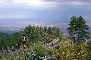
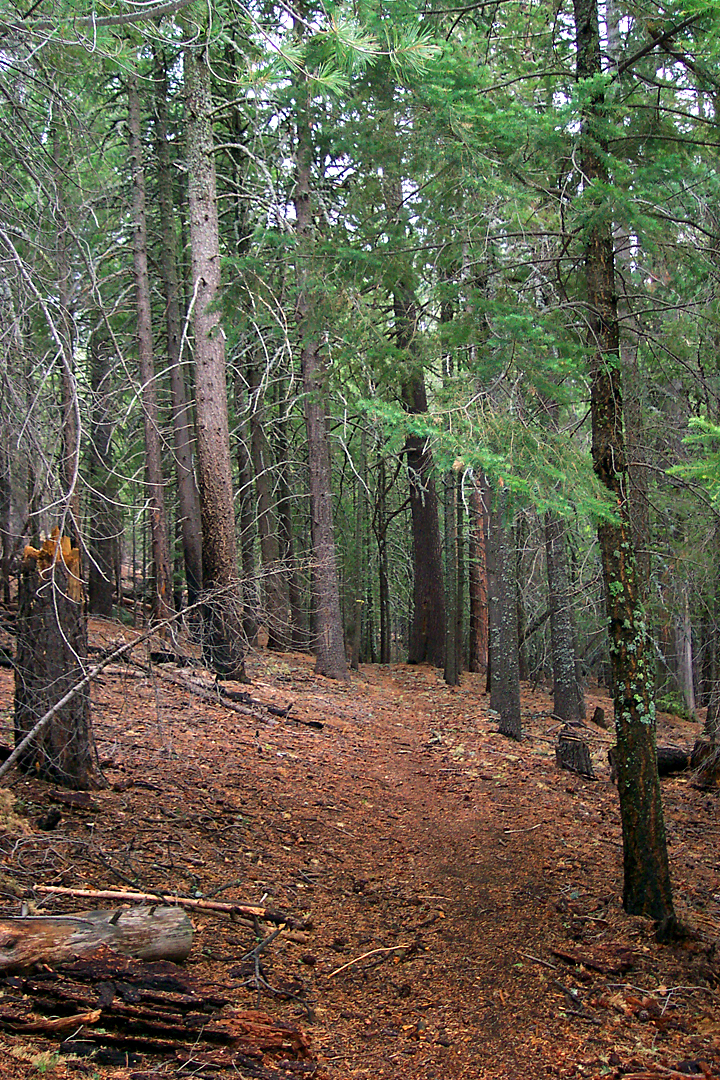
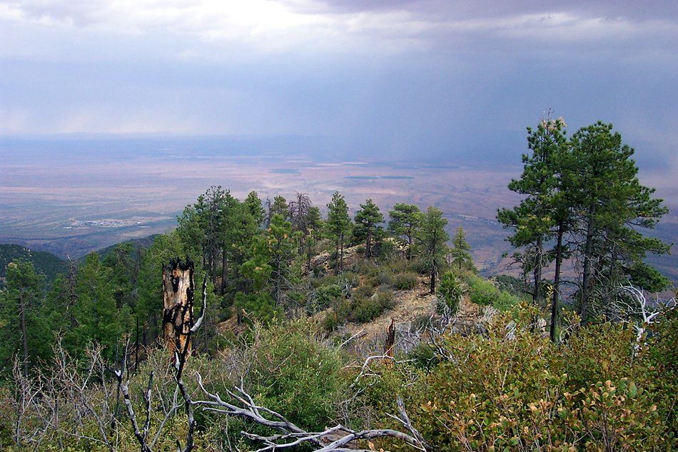
Trail to nowhere by PrestonSands  This short trail leaves Riggs Lake campground in the Pinaleno Mountains, travels through some beautiful forest, and dead ends on a high brushy ridge with some great views of Sulphur Springs Valley. This short trail leaves Riggs Lake campground in the Pinaleno Mountains, travels through some beautiful forest, and dead ends on a high brushy ridge with some great views of Sulphur Springs Valley.I arrived at Riggs Lake late in the afternoon, wanting to do one more hike before heading home for the day. After inquiring with the campground host, I parked at the end of the campground loop and headed west into the woods, following a faint path and yellow tape tied around trees. The ground was wet from recent rain, and the carpet of fir needles beneath my feet had a spongy feel to it. Before long, the trail left the thickly wooded area and arrived on a narrow brushy ridge covered in fallen logs from an old wildfire. Turning around, I saw Merrill Peak, named for an early forest service employee of the area. The topo map showed the trail continuing down the ridge until it stopped at a point about a mile from the campground. The trail was growing increasingly faint and soon disappeared completely, so I gave up trying to fight the thick brush. I stopped to watch a dust storm blowing across Sulphur Springs Valley and look out over the rugged western slopes of the Pinalenos. The Galiuro Mountains looked as if they were a thousand miles away across the vast sea of desert.
Check out the Official Route and Triplogs. Leave No Trace and +Add a Triplog after your hike to support this local community. | |||||||||||||||||||||||||||||||||||||||||||||||||||||||||||||||||||||||||||||||||||||||||||||||||||||||


