 Route Editor

| Guide | ♦ | 266 Triplogs | 2 Topics |
details | drive | permit | forecast | 🔥 route |
stats |
photos | triplogs | topics | location |
| 239 | 266 | 2 |
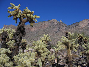
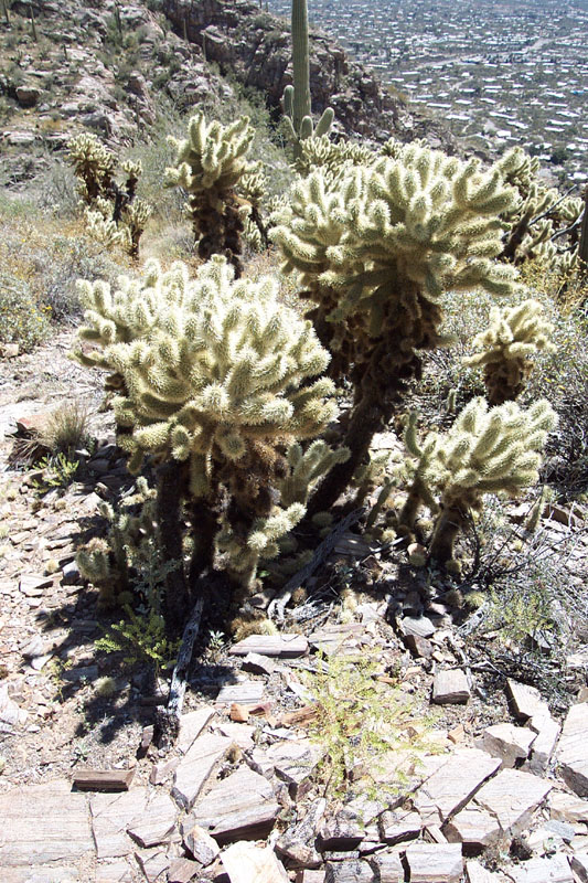
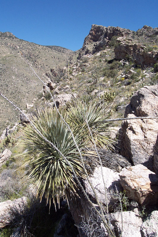
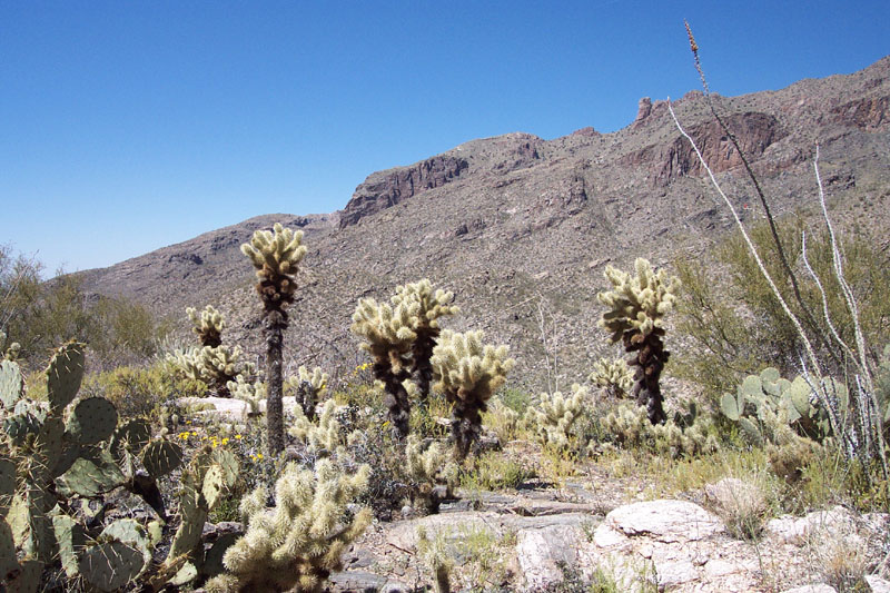
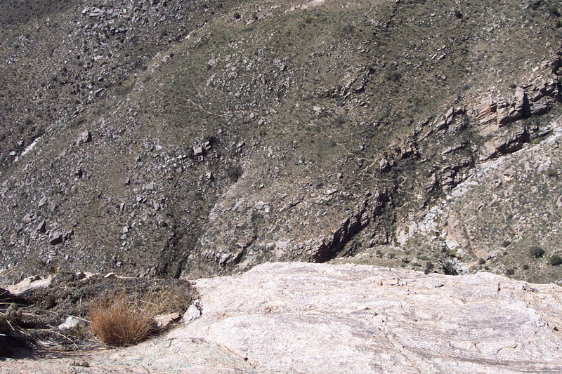
Short but Sweet! by brianb  2025 2025Formerly named Pontatoc Ridge Trail #411 Note: Page data is to popular high point past the end of the official trail. This hike to the top of a prominent ridge is a nice introduction to hiking the Catalinas. Part of what makes the Catalina range special is that many trails take you from the desert floor (about 2500 feet) all the way up to lofty peaks (6-9000 feet). But these routes range from 10-18 miles round-trip (Mt. Kimball, The Window, Cathedral Rock, etc.) If you're not up for a 16-mile hike, this is a nice route that will give you much of the flavor of the Catalinas and a nice view at the top like other Catalina trails, but without busting your butt too much. It's a characteristically steep ascent from the desert floor to a 'mini-summit' at the top of the ridge a couple of thousand feet up, which surrounds you with typical Sonoran desert flora - including a lot of nice "teddy bear cholla' - and an opportunity for a little 'bouldering' typical of the Catalinas. The trail is relatively easy to follow all the way to the top.
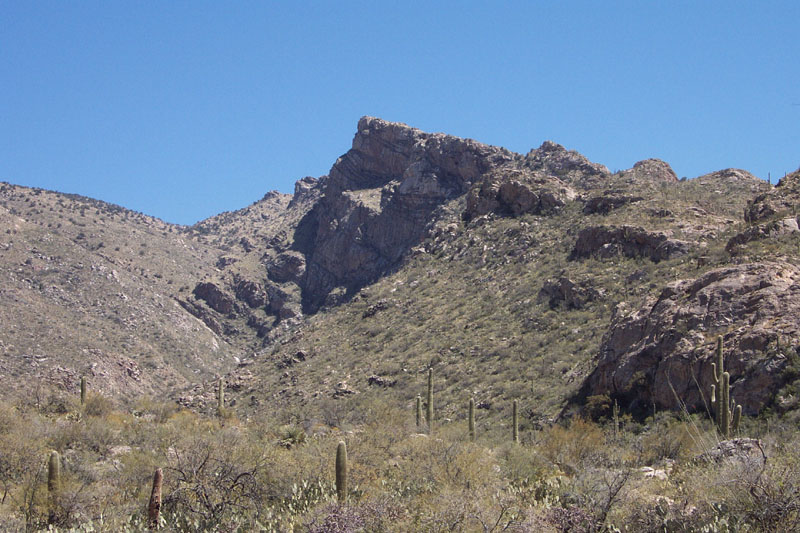
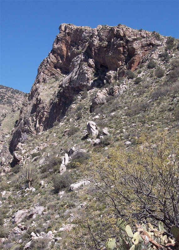
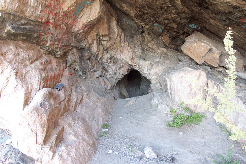
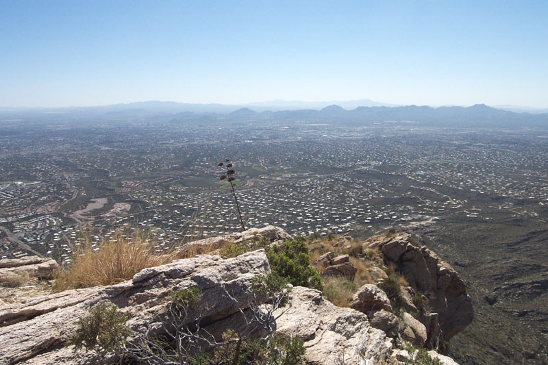
Follow the trail along the ridge for another 1.8 miles to the top. The actual top of the ridge is approximately 0.4 miles or so beyond the end of the official Pontatoc Ridge Trail. If you follow the official trail to its conclusion (just beyond a sign indicating such), you end up at an old abandoned mineshaft. You can explore the mineshaft (requires a flashlight!), but it's nothing special. A few hundred yards before the official end of the trail (and the mineshaft), the trail splits off going uphill, and continues to the top of the ridge. If you missed it and ended up at the mineshaft, head back down and watch for it (it should be marked with a cairn). The trail, from where it splits off to the top, is a little hard to follow, but stay generally towards the west (or the very top of the ridge) and you'll find it. You'll know when you're at the top because there's nowhere else to go! You'll be treated to nice views of the north range of the Catalinas and Tucson over 2000 feet below. If you look straight down to the west, you can see the hapless Pontatoc Canyon tail (and be glad you went this way instead.)
Coronado FS Details There are good views along both of these trails and plenty of evidence of mining activity left over from the days when the Santa Catalinas were the focus of extensive mineral exploration. At one time the Pontatoc Ridge Trail was even called the Old Spanish Mine Trail, but don't look for lost mines here. The reason these mines were abandoned is because they didn't pan out. Be careful around these dangerous old digs which can present a number of hazards for unsuspecting travelers or those too willing to take a dumb risk. Of the two trails, the Pontatoc Trail goes up the canyon of the same name, climbing in and out of the canyon bottom as it becomes more rocky and narrow. This trail presents good views of the Pontatoc Cliffs that form a deeply weathered and pockmarked face on the northeastern horizon. Extensive trampling of the area between the trailhead and Pontatoc Canyon has made it difficult to pick out the trail from all the incidental paths that have developed here, but once the trail enters the canyon it becomes easier to follow, at least for a while. Farther up in the canyon, it again becomes difficult to follow before disappearing entirely just beyond a point where it leaves the canyon floor. The Pontatoc Ridge Trail branches south off the canyon trail about 0.8 mile from the trailhead. It then climbs to the ridge top and changes direction to follow the ridge north to Pontatoc Saddle. At the saddle you'll be rewarded with excellent views of Tucson lying at the foot of the Catalinas and stretching toward other mountain ranges across the basin. You'll also get a closer look at the Pontatoc Cliffs and see a trail that leads to the base of those cliffs. Take care if you follow this trail; or better yet, don't follow it at all. It takes a steep and rocky course above a precipitous cliff. Better to enjoy the views from the more solid footing of the saddle. Attractions: Views of tall cliffs and Tucson Canyon or ridge top route Historic area Check out the Official Route and Triplogs. Leave No Trace and +Add a Triplog after your hike to support this local community. | |||||||||||||||||||||||||||||||||||||||||||||||||||||||||||||||||||||||||||||||||||||||||||||||||||||||||||||||||||||


