 Route Editor

| Guide | ♦ | 283 Triplogs | 0 Topics |
details | drive | no permit | forecast | route |
stats |
photos | triplogs | topics | location |
| 457 | 283 | 0 |
Moderate hike for great views by Al_HikesAZ  Overview OverviewThis is a very popular trail on weekend mornings. Casual hikers can get great views of Phoenix with moderate effort. A good place to bring out of town visitors. This is a separate trail from LV YatesTrail #8 which starts from the 40th St TH and goes across the north side of the preserves to Nature Trail #304. The north end of #8A connects to #8.
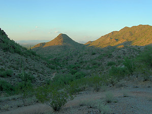
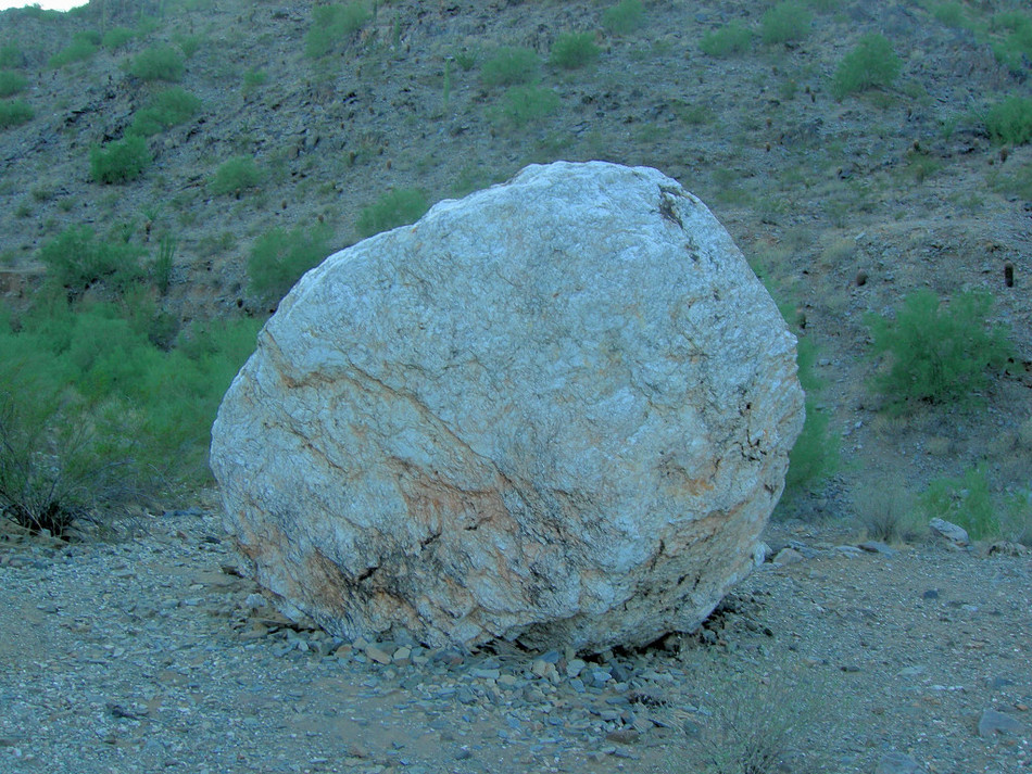
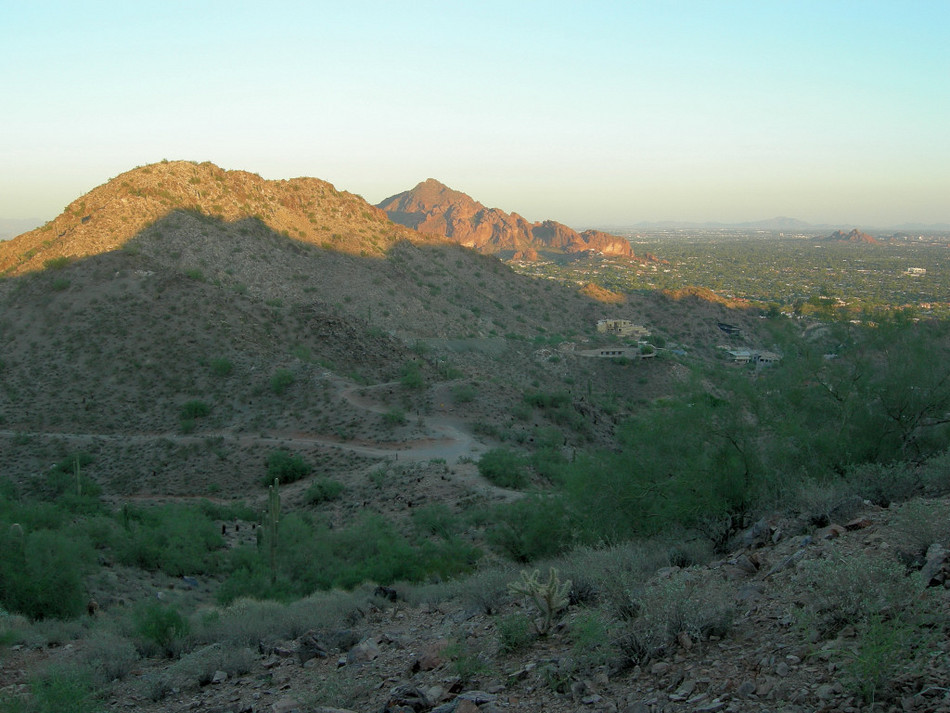
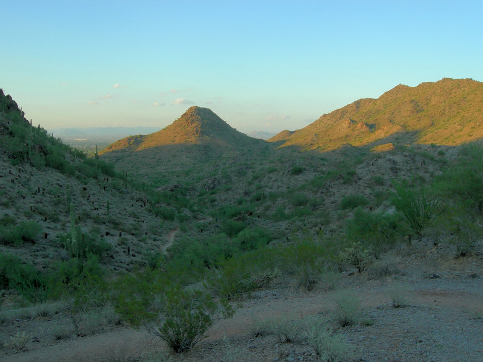
Trail #8A starts where North 32nd Street dead-ends at Lincoln Drive. Just north of Lincoln on 32nd Street turn right into a Trailhead with 23 parking spaces and 2 handicapped spaces. When this lot fills up, I have seen people parking across the street at the Loehman's Parking lot and crossing Lincoln Drive. I don't know what risk might exist with parking there. Hike From the 32nd St TH (elevation 1,395'), you have a wide trail and a nice gentle warm-up. You are on the west side of a wash. At 0.2 miles you reach a junction with Trail 200 which takes off to the left. At 0.3 miles (elevation 1,420') you cross a wash and proceed north along the east side of the wash. Along here you will see why this is named Quartz Ridge. At 0.37 miles you reach the large granite boulder. At 0.7 miles (elevation 1,560') you start to climb and the trail will start to narrow. You have a few switchbacks and a moderate climb (with a couple of step-ups) to a saddle at 1.1 miles (elevation 1,810'). Great views of Phoenix to the south and southeast. For many people, this saddle optimizes the "time & effort" to reward ratio so they turn around and head back. The stats listed for this hike are for the round trip to this saddle; if you go farther, you will need to adjust your stats. At this saddle you have four choices : 1) turn around and head back to the TH. That would be approximately 2.2mi RT. 2) Climb Trail 8B to the west. This is a steep climb to another saddle. This climb adds 1/8th mile one way and 90 feet of elevation gain. Then from this saddle, you can turn around and go back to Trail 8A or you can descend to the west for 3/8 mile to the main Piestewa Peak parking lot and hook into Quartz Ridge Trail 8; 3) Continue on Trail 8A which descends to the north. At 1.5 miles (elevation 1,645') you climb to the right out of a wash. At 1.8 miles (elevation 1,715') you intersect Trail 8 and Trail 8A officially ends. You can continue and combine trails to hike as far as you want in this inner part of the Preserve. Very few hikers continue on this section north of the saddle. Amazingly, you are in the middle of the 5th largest city in the US and yet you seem so far removed from a city; 4) Head east on 8B on the abandoned jeep road. This will take you to 36th street. At 36th Street you can hike north and eventually intersect Trail 8 or you can turn around and head back to the 8A saddle. I guess you could take 36th Street to Lincoln Drive but I can't imagine why you would want to. On a weekend morning, you will share this trail with families and dogs. I have been here during the week when there were only one or two other cars in the parking lot. Runners seem to like this trail.
Check out the Official Route and Triplogs. Leave No Trace and +Add a Triplog after your hike to support this local community. One-Way Notice This hike is listed as One-Way. When hiking several trails on a single "hike", log it with a generic name that describes the hike. Then link the trails traveled, check out the example. | |||||||||||||||||||||||||||||||||||||||||||||||||||||||||||||||||||||||||||||||||||||||||||||||||||||||||||||||||||||||||||||||||||||||||||||||||||||||||||||||||||||||||||||||||||||||||||||||||||


