 Route Editor

| Guide | ♦ | 49 Triplogs | 0 Topics |
details | drive | permit | forecast | 🔥 route |
stats |
photos | triplogs | topics | location |
| 252 | 49 | 0 |
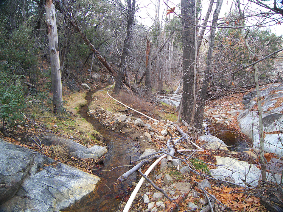
Transition zone water park by PrestonSands   This is a short and easy off-trail hike that you can do if the upper Pinaleno Mountains are snowed in. There is a lot of history in this pretty riparian area. This is a short and easy off-trail hike that you can do if the upper Pinaleno Mountains are snowed in. There is a lot of history in this pretty riparian area.From the Ladybug Trailhead, begin following the Ladybug Trail #329 up the brushy ridge away from the parking area. This is believed to be the route of the old Jacobson Sawmill road, built-in 1894 to access the sawmill that was located higher up in the canyon near the Turkey Flat cabins. The trail soon turns left, leaving the old wagon road. The Ladybug Trail begins heading downhill towards the creek and soon crosses an irrigation ditch on the side of the hill. This ditch provides Angle Orchard (near the Ladybug Trailhead) with water. Turn right, and begin following the little irrigation ditch upstream. Be careful not to damage the ditch when hiking beside it.
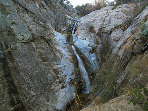
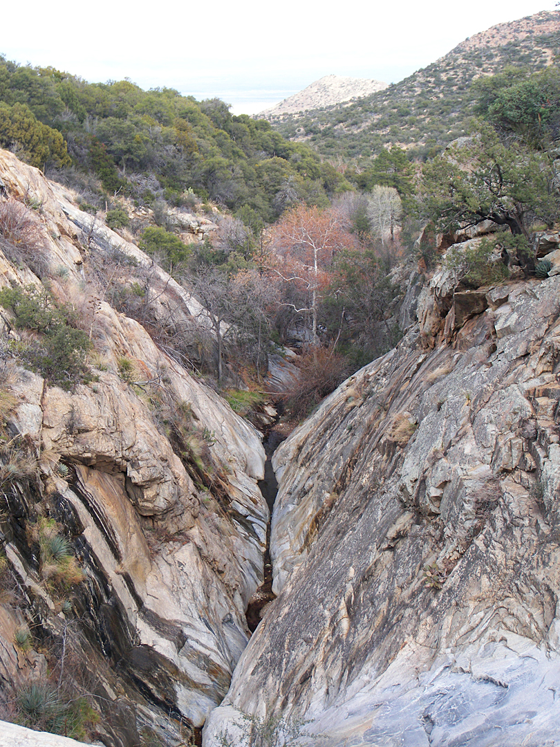
Heading back to Jacobson Creek, a short walk down the creek bed will take you to a couple of waterfalls where the creek passes through a deep crack in the earth and drops about 50 feet in a short distance. The short, cascading waterfalls slide over the polished, gray granite bedrock here, next to a flat sitting rock. There is a hot-tub-sized pool at the base of the upper falls. The rock around it is slick, so be careful if you choose to get in. One can enjoy looking down the perfectly straight cleft in the bedrock here, to the desert in the distance. When you are done, head back down the canyon, following the flume. If Angle Orchard (which has been operating since 1922) is open, and there is fruit to be had, get some. Probably the best-tasting apples I've ever had! Check out the Official Route and Triplogs. Leave No Trace and +Add a Triplog after your hike to support this local community. | |||||||||||||||||||||||||||||||||||||||||||||||||||||||||||||||||||||||||||||||||||||||||||||||||||||||||||||||||||||||||||||||||||||||||||||||||||||||||||||||||||||||||||||||||||||||||||||||||


