Fossil Creek spillover

Hiking Related – Not Trail Specific

Moderator: HAZ - Moderators

 Linked Area, etc none
Post Reply
User avatar
flagscott
Guides: 1 | Official Routes: 1
Triplogs Last: 2,953 d | RS: 0
Water Reports 1Y: 0 | Last: 2,939 d
Joined: Jan 03 2016 7:41 pm
City, State: Flagstaff, AZ

Fossil Creek spillover

Post by flagscott »

What solved one problem may have created another. Visitors flocking to Fossil Creek - - many from out-of-the-area - - are spilling over onto local sites when turned away from lack of permit.

"A lot of them end up at West Clear Creek and Bullpen. Does it have an effect on other places? Yes. We anticipate visitation in all other areas going up," said Francisca Adrian, the wilderness, trails and rivers coordinator for Coconino National Forest's Red Rock Ranger District.
Article here: http://cvbugle.com/main.asp?SectionID=1 ... leID=49582

I won't be surprised if, a few years from now, there's a permit system at Wet Beaver Creek, WCC, etc. Bleh*.

*Bleh because too many visitors can mess up wild places, not because I'm opposed to permits.
contribute to this member driven resource
ie: RS > Save/Share after hikes Route Scout GPS Topo Mapper on the App Store Route Scout GPS Topo Mapper on Google Play
User avatar
ASUAviator
Guides: 1 | Official Routes: 2
Triplogs Last: 3,036 d | RS: 0
Water Reports 1Y: 0 | Last: 3,099 d
Joined: Nov 06 2010 12:12 pm
City, State: Phoenix, AZ

Re: Fossil Creek spillover

Post by ASUAviator »

Im opposed to the permit system for this very reason. The trash Fossil Creek attracts infuriates me but at the same time it was mostly limited to fossil creek. The 'trash' is sure not to pay to play and since there are other options, why not go there?

As you say, it wont be long before other canyons in the Verde Valley area take the path of the permit system.

Perhaps this was the plan of the Forest Service all along...
contribute to this member driven resource
ie: RS > Save/Share after hikes Route Scout GPS Topo Mapper on the App Store Route Scout GPS Topo Mapper on Google Play
User avatar
Tough_Boots
Guides: 0 | Official Routes: 6
Triplogs Last: 2,457 d | RS: 20
Water Reports 1Y: 0 | Last: 2,597 d
Joined: Mar 28 2008 7:08 pm
City, State: Phoenix, AZ

Re: Fossil Creek spillover

Post by Tough_Boots »

I think that article might be jumping the gun on making any real conclusions-- the permit system has only been in place for a week :lol:
contribute to this member driven resource
ie: RS > Save/Share after hikes Route Scout GPS Topo Mapper on the App Store Route Scout GPS Topo Mapper on Google Play
User avatar
cw50must
Guides: 11 | Official Routes: 1
Triplogs Last: 251 d | RS: 0
Water Reports 1Y: 0 | Last: 3,142 d
Joined: Jun 09 2009 8:10 am
City, State: Mesa, AZ

Re: Fossil Creek spillover

Post by cw50must »

The last time I tried to go to Fossil creek the FS already had the road blocked due to too many people already being there. They also were handing out maps with nearby "similar" areas to visit instead. Wet Beaver was on there, so in a way they have already been redirecting people that way for a while.
contribute to this member driven resource
ie: RS > Save/Share after hikes Route Scout GPS Topo Mapper on the App Store Route Scout GPS Topo Mapper on Google Play
User avatar
arizona_water
Guides: 9 | Official Routes: 7
Triplogs Last: 2,141 d | RS: 1
Water Reports 1Y: 0 | Last: 2,338 d
Joined: Mar 06 2016 2:02 am
City, State: Salt River Valley

Re: Fossil Creek spillover

Post by arizona_water »

@ASUAviator
Perhaps this was the plan of the Forest Service all along...
I assure you, that has not been the plan of the FS all along. The first round of meetings for managing excessive traffic and waste at FC began in 2005. It took 11+ years to design, approve and implement the permit plan for this single site. Every future site would require just as long, or longer, depending on land ownership overlaps with other federal and state agencies and federal budget fluxes on spending for environmental assessments.
- there's nothing like finding Water in the Desert -
contribute to this member driven resource
ie: RS > Save/Share after hikes Route Scout GPS Topo Mapper on the App Store Route Scout GPS Topo Mapper on Google Play
User avatar
chumley
Guides: 94 | Official Routes: 241
Triplogs Last: 5 d | RS: 65
Water Reports 1Y: 78 | Last: 7 d
Joined: Sep 18 2002 8:59 am
City, State: Tempe, AZ

Re: Fossil Creek spillover

Post by chumley »

@arizona_water
Which isn't to say that the FS is not interested in creating fee-based recreation wherever possible (or creating the justification for it). I think Sedona's Red Rock Pass, and Coronado's attempt to charge every person to set foot on the Catalina Highway are good examples of that.

The agency is underfunded, and the more sites they can pawn off onto private concessionaires the easier it is for them.

Fossil Creek had a few extra hurdles to overcome including federal Wild and Scenic River designation, being on the border of two different national forests, dangerous road access that had to be closed, and a bunch of business interests in Strawberry, Pine, and Payson. Making Bull Pen a fee area wouldn't take nearly as much effort. The permit thing is more complicated.
I'm not sure what my spirit animal is, but I'm confident it has rabies.
contribute to this member driven resource
ie: RS > Save/Share after hikes Route Scout GPS Topo Mapper on the App Store Route Scout GPS Topo Mapper on Google Play
User avatar
flagscott
Guides: 1 | Official Routes: 1
Triplogs Last: 2,953 d | RS: 0
Water Reports 1Y: 0 | Last: 2,939 d
Joined: Jan 03 2016 7:41 pm
City, State: Flagstaff, AZ

Re: Fossil Creek spillover

Post by flagscott »

Tough_Boots wrote:I think that article might be jumping the gun on making any real conclusions-- the permit system has only been in place for a week :lol:
I'm going to go ahead and trust the FS people that track these things. And, if anything, it's going to get worse. Last weekend was the first full weekend of the permit system, and it was cold and wet for this time of year. So if the FS folks are already reporting more users than normal at the alternate sites, it's going to be a busy, busy summer in those places.
contribute to this member driven resource
ie: RS > Save/Share after hikes Route Scout GPS Topo Mapper on the App Store Route Scout GPS Topo Mapper on Google Play
User avatar
arizona_water
Guides: 9 | Official Routes: 7
Triplogs Last: 2,141 d | RS: 1
Water Reports 1Y: 0 | Last: 2,338 d
Joined: Mar 06 2016 2:02 am
City, State: Salt River Valley

Re: Fossil Creek spillover

Post by arizona_water »

@chumley
I agree about the Red Rock Pass, etc., but I believe there was more to the FC permit system than the hurdles you stated.

The significance of the Fossil Creek permit was born out of the relinquishment of the access rights by APS to the Feds for the dam removal. There was a period from 2004-2005 when the vast majority of traffic to the FC area were researchers from NAU and several government agencies. The NWSR designation didn't come until 2009. Prior to the dam removal, the ecology of the creek had been deeply disrupted (mostly abundance of invasive species and silt/sediment build-up limiting regular transfer of C and N from leaf litter to downstream users, mainly heterotrophs). The designation was granted under the Omnibus bill because the dam removal and subsequent restoration created the necessary conditions to meet the requirements of NWSR.
- there's nothing like finding Water in the Desert -
contribute to this member driven resource
ie: RS > Save/Share after hikes Route Scout GPS Topo Mapper on the App Store Route Scout GPS Topo Mapper on Google Play
User avatar
Tough_Boots
Guides: 0 | Official Routes: 6
Triplogs Last: 2,457 d | RS: 20
Water Reports 1Y: 0 | Last: 2,597 d
Joined: Mar 28 2008 7:08 pm
City, State: Phoenix, AZ

Re: Fossil Creek spillover

Post by Tough_Boots »

flagscott wrote:I'm going to go ahead and trust the FS people that track these things.
The meeting was held on 5/5 and the permit system began on 5/1. I don't believe that anything in this article is anything more than speculation. Anything they said was based on a single Sunday thru Thursday. I also don't believe anyone from the NFS was down at Bullpen tracking how much use it got last week. I have a feeling that this article is just typical small town paper poor reporting and the the author is making the NFS statements sound more definitive than they were probably meant to be taken. It just doesn't seem accurate or responsible to judge anything like this on a single five day period-- especially the first five days.
contribute to this member driven resource
ie: RS > Save/Share after hikes Route Scout GPS Topo Mapper on the App Store Route Scout GPS Topo Mapper on Google Play
User avatar
Tough_Boots
Guides: 0 | Official Routes: 6
Triplogs Last: 2,457 d | RS: 20
Water Reports 1Y: 0 | Last: 2,597 d
Joined: Mar 28 2008 7:08 pm
City, State: Phoenix, AZ

Re: Fossil Creek spillover

Post by Tough_Boots »

I'm not saying there won't be some spillover-- but I think this article is a small town paper trying to drum up some excitement.
contribute to this member driven resource
ie: RS > Save/Share after hikes Route Scout GPS Topo Mapper on the App Store Route Scout GPS Topo Mapper on Google Play
User avatar
chumley
Guides: 94 | Official Routes: 241
Triplogs Last: 5 d | RS: 65
Water Reports 1Y: 78 | Last: 7 d
Joined: Sep 18 2002 8:59 am
City, State: Tempe, AZ

Re: Fossil Creek spillover

Post by chumley »

@Tough_Boots
The way I read it indicated that some of the information is from previous years. Cars have been turned away for a couple of years now because of traffic problems. The specific use of a permit system doesn't really change the fact that there are people who planned on going to FC and now look for somewhere else to go.

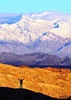
Doesn't matter how much they try to sell the great views of Mingus Mountain. Ain't nobody driving from California to see that! :lol:
I'm not sure what my spirit animal is, but I'm confident it has rabies.
contribute to this member driven resource
ie: RS > Save/Share after hikes Route Scout GPS Topo Mapper on the App Store Route Scout GPS Topo Mapper on Google Play
User avatar
Tough_Boots
Guides: 0 | Official Routes: 6
Triplogs Last: 2,457 d | RS: 20
Water Reports 1Y: 0 | Last: 2,597 d
Joined: Mar 28 2008 7:08 pm
City, State: Phoenix, AZ

Re: Fossil Creek spillover

Post by Tough_Boots »

chumley wrote:The way I read it indicated that some of the information is from previous years.
I didn't read it that way at all. Maybe that speaks to the quality of the journalism? :lol:
contribute to this member driven resource
ie: RS > Save/Share after hikes Route Scout GPS Topo Mapper on the App Store Route Scout GPS Topo Mapper on Google Play
User avatar
JoelHazelton
Guides: 16 | Official Routes: 1
Triplogs Last: 15 d | RS: 1
Water Reports 1Y: 2 | Last: 76 d
Joined: Mar 22 2006 7:45 am
City, State: Phoenix, AZ
Contact:

Re: Fossil Creek spillover

Post by JoelHazelton »

Isaac has no shortage of alternatives to offer visitors unable to gain entry into Fossil Creek. Isaac suggests full-moon flute concerts, astronomy presentations, kid camps and citizen scientist outings
:|
"Arizona is the land of contrast... You can go from Minnesota to California in a matter of minutes, then have Mexican food that night." -Jack Dykinga

http://www.joelhazelton.com
contribute to this member driven resource
ie: RS > Save/Share after hikes Route Scout GPS Topo Mapper on the App Store Route Scout GPS Topo Mapper on Google Play
User avatar
outdoor_lover
Guides: 7 | Official Routes: 5
Triplogs Last: 95 d | RS: 2
Water Reports 1Y: 18 | Last: 95 d
Joined: Aug 19 2011 7:49 pm
City, State: Scottsdale, AZ

Re: Fossil Creek spillover

Post by outdoor_lover »

JoelHazelton wrote:Isaac has no shortage of alternatives to offer visitors unable to gain entry into Fossil Creek. Isaac suggests full-moon flute concerts, astronomy presentations, kid camps and citizen scientist outings
Yes, yes, do that! Bull Pen, WCC, and Wet Beaver Creek are terribly dull by Comparison...You'll be much happier looking at Stars and listening to Music! :D
Life is not a journey to the grave with the intention of arriving safely in a pretty & well preserved body, but rather to skid in broadside, totally worn out & proclaiming, "Wow What a Ride!"
contribute to this member driven resource
ie: RS > Save/Share after hikes Route Scout GPS Topo Mapper on the App Store Route Scout GPS Topo Mapper on Google Play
Post Reply

Return to “General”