 Route Editor

The Rabbit Ears Trail is listed in HAZ. There is only one entry for this trail but not too many details. It appears to be somewhere between Courthouse Buttee Loop and Jack's Canyon Trail.
I cannot find any information for this trail anywhere. Is, maybe, Rabbit Ears and Big Park one in the same? Does anyone have any information on Rabbit Ears Trail in Sedona (Village of Oak Creek)?
Rabbit Ears Trail
Moderator: HAZ - Moderators
Linked Area, etc none
-
 Roba' KaiGuides: 0 | Official Routes: 0Triplogs Last: 7,663 d | RS: 0Water Reports 1Y: 0 | Last: never
 - Joined: Apr 13 2005 3:32 pm
- City, State: Sedona, AZ
contribute to this member driven resource
ie: RS > Save/Share after hikes 

-
 joebartelsGuides: 264 | Official Routes: 224Triplogs Last: 2 d | RS: 2064Water Reports 1Y: 28 | Last: 12 d
 - Joined: Nov 20 1996 12:00 pm
It's listed on site cause somebody posted the triplog long, long, long ago
Rabbit Ears is listed in the book Sedona Hikes. It appears to be a connector between Courthouse Butte Loop and Jacks near Lee Mountain. I haven't done it, but I'm curious if there's any access to Lee Mountain or if it's all sheer walls?
Rabbit Ears is listed in the book Sedona Hikes. It appears to be a connector between Courthouse Butte Loop and Jacks near Lee Mountain. I haven't done it, but I'm curious if there's any access to Lee Mountain or if it's all sheer walls?
- joe
contribute to this member driven resource
ie: RS > Save/Share after hikes
-
Roba' KaiGuides: 0 | Official Routes: 0Triplogs Last: 7,663 d | RS: 0Water Reports 1Y: 0 | Last: never
- Joined: Apr 13 2005 3:32 pm
- City, State: Sedona, AZ
Rabbit Ears Trail
Would you happen to know where it connects with Courthouse Butte Loop? I'll hike it today (Monday) and get back to you with details.
Roba' Kai
Roba' Kai
contribute to this member driven resource
ie: RS > Save/Share after hikes
-
joebartelsGuides: 264 | Official Routes: 224Triplogs Last: 2 d | RS: 2064Water Reports 1Y: 28 | Last: 12 d
- Joined: Nov 20 1996 12:00 pm
Re: Rabbit Ears Trail
Roba' Kai wrote: I'll hike it today (Monday) and get back to you with details.
did you go?
Interesting google on Lee Mountain for the spelunkers
http://community.webshots.com/album/65964022tniEuU
- joe
contribute to this member driven resource
ie: RS > Save/Share after hikes
-
Roba' KaiGuides: 0 | Official Routes: 0Triplogs Last: 7,663 d | RS: 0Water Reports 1Y: 0 | Last: never
- Joined: Apr 13 2005 3:32 pm
- City, State: Sedona, AZ
Re: Rabbit Ears Trail
I want to, but I have no idea where it is. I know where Big Park Loop connects to Courthouse Butte Loop in the big wash just before you head around the east side of the Butte, but I don't know where Rabbit Ears is.
I can't seem to find any informaiton on this Trail, mostly because "Rabbit Ears Trail" is a vauge google and brings up all kinds of things.
Does your guide book say where the two trails connect?
I can't seem to find any informaiton on this Trail, mostly because "Rabbit Ears Trail" is a vauge google and brings up all kinds of things.
Does your guide book say where the two trails connect?
contribute to this member driven resource
ie: RS > Save/Share after hikes
-
joebartelsGuides: 264 | Official Routes: 224Triplogs Last: 2 d | RS: 2064Water Reports 1Y: 28 | Last: 12 d
- Joined: Nov 20 1996 12:00 pm
contribute to this member driven resource
ie: RS > Save/Share after hikes
-
joebartelsGuides: 264 | Official Routes: 224Triplogs Last: 2 d | RS: 2064Water Reports 1Y: 28 | Last: 12 d
- Joined: Nov 20 1996 12:00 pm
It goes up this subtle ridge (just left of center) in the middle of this map
Last edited by joebartels on Jun 22 2005 1:23 pm, edited 1 time in total.
- joe
contribute to this member driven resource
ie: RS > Save/Share after hikes
-
Roba' KaiGuides: 0 | Official Routes: 0Triplogs Last: 7,663 d | RS: 0Water Reports 1Y: 0 | Last: never
- Joined: Apr 13 2005 3:32 pm
- City, State: Sedona, AZ
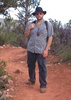
I went searching for it today. I took the Courthouse Butte Loop, but I couldn't find it. As I rounded the butte back in the sun on the north side I decided to turn back, since I wasn't going to find it. Just a few minutes later, across the wash, I spotted what looked like a trail through the trees.
I crossed the wash and started on the trail. It had a few foot prints, but nothing like the Loop. When it opened up on a large flat slick rock, I was pretty sure this was not Rabbit Ears. I was going to turn back and keep searching when fellow local came out of the brush on a bike.
I asked him if this was Rabbit Ears Trail and he chuckled. He said that Rabbit Ears does not really exist and the the FS is trying to dissolve it. He pointed me to a "trail" up the ridge that would connect to another trail that would take me to the Rabbit Ears "trailhead" across the street from the Jacks Canyon parking lot where my ride was going to pick me up.
It was a little rough getting up the ridge because there was no trail only thick manzanita. Once I got up I found the trial and then I passed the little trail I was supposed to use to get up there. Oh well.
The trail is actually a narrow rock filled wash. I wish I had worn boots instead of light hiking shoes because of the rocks.
It is slightly uphill most of the way along the ridge. There really isn't any major attractions except of LOT of javelina sign including fresh dug holes (very fresh).
Still, the view of the Village of Oak Creek is wonderful. I got a great shot of Gunsight to Cathedral. After the helpful guy on the bike down below, I passed nobody on the trail. There is something very peaceful being all alone high above the hustle and bustle of the city...okay, VOC Sedona is hardly city...but still.
At the end of the ridge the trail makes a right turn and begins to go down hill. Below are some very LARGE houses and ranches. Towards the bottom of the hill, just as I was told earlier, I came to a fork in the trail. The right fork is marred up by horses. I suspect this is the horse trail that is posted in the FS map at the Bell Rock trailhead that is supposed to branch from Courthouse butte Loop to Jacks Canyon Road. I went left as I was instructed.
Eventually I came to a new house being built on the hill and a gate. I went through the gate and started going downhill fast. I was already late but I had my handheld CB radio with me and I was talking to my ride who was waiting for me in the parking lot. I could see her truck and all the cars in the lot most of the time after the gate.
There trail is very narrow and the thick grass is very high. If you are afraid of snakes in the grass (I've talked to people who will not go near tall grass because of snake fear) this is not for you. It is a very nice piece of land. At the bottom is a creek (which I am sure is really a wash, but it was running today). On the other side of the creek, up a quick small hill, is another gate which is right on the road just east of the Jacks Canyon trailhead parking lot. It was dark when I reached the end.
I am not exactly sure where Rabbit Ears connects with Courthouse Butte Loop since I got on it in the middle where they are close across the big wash on the backside of the butte.
I plan on going back either tomorrow or the next day and going right at the top of the ridge instead of left to see where it takes me.
I think if somebody is looking for special attractions, this is not their trail. But if you are looking for a place tourists don't know about, this is it. I liked it and had a lot of fun...of course, that might have been because of the hunt and the fact I didn't know where I would be when the sun went down.
Roba' Kai
contribute to this member driven resource
ie: RS > Save/Share after hikes

contribute to this member driven resource
ie: RS > Save/Share after hikes
-
Roba' KaiGuides: 0 | Official Routes: 0Triplogs Last: 7,663 d | RS: 0Water Reports 1Y: 0 | Last: never
- Joined: Apr 13 2005 3:32 pm
- City, State: Sedona, AZ
I'm one of those freakish day hikers who takes EVERYTHING withe me, including a frozen tv dinner and two packs of microwave popcorn. Mostly because I start my hikes very late so you never know where you will be when the sun goes down so you might have to stay the night.
I started today walking from my house and it was very warm. As soon as I got up on the ridge, the wind was blowing very hard and it got cold real quick. Wouldn't you know it, I didn't brink a jacket or a sweater.
Certain places, because of the configuration of the rocks around, tend to be windy all the time.
Rob
contribute to this member driven resource
ie: RS > Save/Share after hikes
-
 pbaenzigGuides: 9 | Official Routes: 4Triplogs Last: 5,946 d | RS: 0Water Reports 1Y: 0 | Last: never
 - Joined: Mar 10 2002 1:49 pm
- City, State: Sedona, AZ
Re: Rabbit Ears Trail
There are at least three Rabbit Ears trails in Sedona. They all start from different trailheads but meet near Rabbit Ears. The shortest starts at Jacks Canyon Trailhead off Jacks Canyon Road near the Village of Oak Creek. Drive Jacks Canyon Road from SR 179 until you see a huge italianate villa on the left and a little dirt road labeled 179G on the right. Follow the few hundred yards on 179G to a huge, generally empty parking area which serves Hot Loop Trail and Jacks Canyon Trail, the two official trails. From the parking area walk back on 179G for maybe 100 yards. You'll see an unmarked but obvious trail going off to the right. Follow it down to where it crosses the road (two gates, one working, the other broken), then follow the clear trail up the hill, past a big mid-century modern home and through another gate. Turn right, ignore the trail going off to the left to another home. Keep on hiking for a bit more than a mile until you get to the crest of the hill. There you can rest and admire the Rabbit Ears or continue on down into the little valley at the foot of the Rabbit Ears.
This trail connects to the two other Rabbit Ears Trails, both starting from Courthouse Butte Loop.
This trail connects to the two other Rabbit Ears Trails, both starting from Courthouse Butte Loop.
Peter B
contribute to this member driven resource
ie: RS > Save/Share after hikes