 Route Editor

Thanks to suggestions from others, I want to do this via Dogie Trail. Should be interesting new part of AZ I haven't seen. According to Te-Wa we should prepare for it to be in the mid to low 20s probably during the night so be prepared if you want to come on this one.
Edit: Looks like we will also be taking the Casner Mountain trail out....adds a bit of mileage but the views should be worth the sore calves.
Sycamore Canyon Dogie to Taylor Cabin Jan 17-18
Moderators: HAZ Group Coordinators, HAZ - Moderators
-
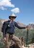
 rushthezeppelinGuides: 0 | Official Routes: 0Triplogs Last: 6,211 d | RS: 0Water Reports 1Y: 0 | Last: 6,387 d
 - Joined: Oct 25 2008 2:42 am
- City, State: Tempe, AZ
Sycamore Canyon Dogie to Taylor Cabin Jan 17-18
Last edited by rushthezeppelin on Dec 31 2008 9:39 am, edited 3 times in total.
contribute to this member driven resource
ie: RS > Save/Share after hikes 

-
 te_waGuides: 3 | Official Routes: 0Triplogs Last: 1,894 d | RS: 2Water Reports 1Y: 0 | Last: 2,093 d
 - Joined: Aug 22 2003 9:16 pm
- City, State: Mesa
Re: Taylor Cabin Jan 17-18
im in!
by "expect" I meant to say "prepare" (just in case ;) )
that is AZ's second largest canyon (give you a dollar if you can name the first )
)
beng such a cold sink and near the 2 swimming pools @ Taylor it may be 10° cooler than surrounding area. I almost made it to the cabin but turned around out of disinterest of all things... but I came in from the Kelsey trail so it was a really long day. Ended up staying the night @ Winter Cabin. You should love this area. There are rarely people in Sycamore (excluding the popular Parson's) even in peak season. They can have Sedona!
by "expect" I meant to say "prepare" (just in case ;) )
that is AZ's second largest canyon (give you a dollar if you can name the first
beng such a cold sink and near the 2 swimming pools @ Taylor it may be 10° cooler than surrounding area. I almost made it to the cabin but turned around out of disinterest of all things... but I came in from the Kelsey trail so it was a really long day. Ended up staying the night @ Winter Cabin. You should love this area. There are rarely people in Sycamore (excluding the popular Parson's) even in peak season. They can have Sedona!
squirrel!
contribute to this member driven resource
ie: RS > Save/Share after hikes
-
rushthezeppelinGuides: 0 | Official Routes: 0Triplogs Last: 6,211 d | RS: 0Water Reports 1Y: 0 | Last: 6,387 d
- Joined: Oct 25 2008 2:42 am
- City, State: Tempe, AZ
Re: Taylor Cabin Jan 17-18
OOO OOO Lower Fish Creek Canyon???? /end sarcasm : Pte-wa wrote:im in!
(give you a dollar if you can name the first
contribute to this member driven resource
ie: RS > Save/Share after hikes
-
te_waGuides: 3 | Official Routes: 0Triplogs Last: 1,894 d | RS: 2Water Reports 1Y: 0 | Last: 2,093 d
- Joined: Aug 22 2003 9:16 pm
- City, State: Mesa
Re: Taylor Cabin Jan 17-18
i broke out the ol Coconino map and looked at the Dogie to Taylor canyon trail area. The trail description by Vashti says you need a Red Rock pass for this trail. Upon inspection of the map, this is what I decided:
this trail never enters the Red Rock Wilderness. It simply starts at the end of 525C and goes directly into Sycamore Canyon Wilderness - Prescott National Forest. You dont have to give your money to the crooks in the RR wilderness. .This trail is listed on the Red Rock district hiking page however, one can only take a wild guess as to why.
i would rather do the Dogey trail as it saves about an hour of driving. whatcha think?
squirrel!
contribute to this member driven resource
ie: RS > Save/Share after hikes
-
rushthezeppelinGuides: 0 | Official Routes: 0Triplogs Last: 6,211 d | RS: 0Water Reports 1Y: 0 | Last: 6,387 d
- Joined: Oct 25 2008 2:42 am
- City, State: Tempe, AZ
Re: Taylor Cabin Jan 17-18
Hey I have no clue what this area is like so w/e you want to do I'm game for. BTW the trail description says the cabin is open to visitors.....does this mean we can actually bunk up in there with a nice warm fire for the night or what?
Another option is sleeping the cave near there....that would be nice to do as I love caves and I get to shave off a few pounds from my tent and tarp.
Another option is sleeping the cave near there....that would be nice to do as I love caves and I get to shave off a few pounds from my tent and tarp.
contribute to this member driven resource
ie: RS > Save/Share after hikes
-
te_waGuides: 3 | Official Routes: 0Triplogs Last: 1,894 d | RS: 2Water Reports 1Y: 0 | Last: 2,093 d
- Joined: Aug 22 2003 9:16 pm
- City, State: Mesa
Re: Taylor Cabin Jan 17-18
yes, there is a working pot belly stove. and amenities packed in by friendly horsemen. take a look behind the cabin and you'll see all the trees. that's where I'll be.
squirrel!
contribute to this member driven resource
ie: RS > Save/Share after hikes
-
rushthezeppelinGuides: 0 | Official Routes: 0Triplogs Last: 6,211 d | RS: 0Water Reports 1Y: 0 | Last: 6,387 d
- Joined: Oct 25 2008 2:42 am
- City, State: Tempe, AZ
Re: Taylor Cabin Jan 17-18
Okay after re-reading I'm not sure if the cave is near Taylor Cabin or some other cabin that's just near the end of Dogie. I think I'll choose the cabin to sleep in though. Get to shave off some weight as well as get to sleep in a cabin out in the middle of nowhere (something I've never gotten to do). Do you know what the water situation would be like there? It seems a bit vague as to whether we will have water easily accessible. Also should I just bring my stove and usual camping food or is there anything you can think of that would be good to cook in this potbelly stove?
contribute to this member driven resource
ie: RS > Save/Share after hikes
-
te_waGuides: 3 | Official Routes: 0Triplogs Last: 1,894 d | RS: 2Water Reports 1Y: 0 | Last: 2,093 d
- Joined: Aug 22 2003 9:16 pm
- City, State: Mesa
Re: Taylor Cabin Jan 17-18
well, brick oven pizza is a great way to make friends! (especially squirrel species)
squirrel!
contribute to this member driven resource
ie: RS > Save/Share after hikes
-
rushthezeppelinGuides: 0 | Official Routes: 0Triplogs Last: 6,211 d | RS: 0Water Reports 1Y: 0 | Last: 6,387 d
- Joined: Oct 25 2008 2:42 am
- City, State: Tempe, AZ
Re: Sycamore Canyon Dogie to Taylor Cabin Jan 17-18
So I could bring a Freshetta frozen pizza ehh?
contribute to this member driven resource
ie: RS > Save/Share after hikes
-
 SredfieldGuides: 4 | Official Routes: 4Triplogs Last: 102 d | RS: 0Water Reports 1Y: 0 | Last: 730 d
 - Joined: Sep 08 2002 1:07 pm
- City, State: Ahwatukee, AZ
Re: Taylor Cabin Jan 17-18
te-wa wrote: that is AZ's second largest canyon (give you a dollar if you can name the first
Shawn
The bear went over the mountain to see what he could see.
The bear went over the mountain to see what he could see.
contribute to this member driven resource
ie: RS > Save/Share after hikes
-
te_waGuides: 3 | Official Routes: 0Triplogs Last: 1,894 d | RS: 2Water Reports 1Y: 0 | Last: 2,093 d
- Joined: Aug 22 2003 9:16 pm
- City, State: Mesa
Re: Sycamore Canyon Dogie to Taylor Cabin Jan 17-18
sure, as long as the "fresh" in Freschetta means you toss the dough, slice the onions and peppers, sundried tomatoes and portabellos. Dont forget to milk that goat for some cheese either, Im not letting you off easy.
squirrel!
contribute to this member driven resource
ie: RS > Save/Share after hikes
-
rushthezeppelinGuides: 0 | Official Routes: 0Triplogs Last: 6,211 d | RS: 0Water Reports 1Y: 0 | Last: 6,387 d
- Joined: Oct 25 2008 2:42 am
- City, State: Tempe, AZ
Re: Sycamore Canyon Dogie to Taylor Cabin Jan 17-18
Hmmm I think I'll just stick to regular camp food. Be lighter anywho. BTW I do know how to toss pizza dough from my days in the food industry.te-wa wrote:sure, as long as the "fresh" in Freschetta means you toss the dough, slice the onions and peppers, sundried tomatoes and portabellos. Dont forget to milk that goat for some cheese either, Im not letting you off easy.
contribute to this member driven resource
ie: RS > Save/Share after hikes
-
 HoffmasterGuides: 0 | Official Routes: 0Triplogs Last: 6,320 d | RS: 0Water Reports 1Y: 0 | Last: never
 - Joined: Oct 04 2002 11:13 pm
- City, State: Canton, OH
- Contact:
Re: Sycamore Canyon Dogie to Taylor Cabin Jan 17-18
rushthezeppelin wrote: BTW the trail description says the cabin is open to visitors.....does this mean we can actually bunk up in there with a nice warm fire for the night or what?
I hope you like mice, mouse droppings, and hantavirus. If I were you, I'd pack a shelter as if there were no cabin there.rushthezeppelin wrote:I think I'll choose the cabin to sleep in though.
"I'm not a vegetarian because I love animals; I'm a vegetarian because I hate plants." A. Whitney Brown
contribute to this member driven resource
ie: RS > Save/Share after hikes
-
rushthezeppelinGuides: 0 | Official Routes: 0Triplogs Last: 6,211 d | RS: 0Water Reports 1Y: 0 | Last: 6,387 d
- Joined: Oct 25 2008 2:42 am
- City, State: Tempe, AZ
Re: Sycamore Canyon Dogie to Taylor Cabin Jan 17-18
Hoffmaster wrote:rushthezeppelin wrote: BTW the trail description says the cabin is open to visitors.....does this mean we can actually bunk up in there with a nice warm fire for the night or what?I hope you like mice, mouse droppings, and hantavirus. If I were you, I'd pack a shelter as if there were no cabin there.rushthezeppelin wrote:I think I'll choose the cabin to sleep in though.
Touche.....
contribute to this member driven resource
ie: RS > Save/Share after hikes
-
 hikeazGuides: 6 | Official Routes: 0Triplogs Last: 1,238 d | RS: 0Water Reports 1Y: 0 | Last: 1,237 d
 - Joined: May 13 2002 10:07 am
- City, State: Tempe, AZ
- Contact:
Re: Taylor Cabin Jan 17-18
The cave is a short way downcanyon (2-3 min.) from the cabin on creek right, up against (and IN) the wall.rushthezeppelin wrote:Okay after re-reading I'm not sure if the cave is near Taylor Cabin or some other cabin that's just near the end of Dogie.........
"The censorship method ... is that of handing the job over to some frail and erring mortal man, and making him omnipotent on the assumption that his official status will make him infallible and omniscient."
George Bernard Shaw
George Bernard Shaw
contribute to this member driven resource
ie: RS > Save/Share after hikes
-
rushthezeppelinGuides: 0 | Official Routes: 0Triplogs Last: 6,211 d | RS: 0Water Reports 1Y: 0 | Last: 6,387 d
- Joined: Oct 25 2008 2:42 am
- City, State: Tempe, AZ
Re: Sycamore Canyon Dogie to Taylor Cabin Jan 17-18
In response to hikeaz:
Looks like I might be hanging from the trees by then though. Mike is doing a darn good job of convincing me to join the hanging crew.
Looks like I might be hanging from the trees by then though. Mike is doing a darn good job of convincing me to join the hanging crew.
contribute to this member driven resource
ie: RS > Save/Share after hikes
-
 drewboyGuides: 0 | Official Routes: 0Triplogs Last: 5,275 d | RS: 0Water Reports 1Y: 0 | Last: 5,281 d
 - Joined: Aug 03 2004 4:09 pm
- City, State: Gold Canyon, AZ
Re: Sycamore Canyon Dogie to Taylor Cabin Jan 17-18
This is a great trip, one I've done several times. It definitely gets cold down there. BTW I was in Sedona last weekend and the lows were down in the teens. This time of year water availability will not be an issue - but the last time I went we had to do a fairly major creek crossing to get across where the trail reached the bottom of the canyon - no way to keep your feet dry. I'd agree with the hoffmaster on sleeping in the cabin. Only in a survival situation if a major blizzard blew in or something like that. A couple of times I have made this a loop hike and returned via Cassner Mtn. You get a lot of breathtaking views of the Canyon on that route, and for those who enjoy pain, the climb out is fairly steep. I think I have a gps track of the loop sitting around somewhere, it only adds a few miles to the hike. Tewa, I have never hammocked around Taylor Cabin but there are plenty of trees around. I need to verify that I can free up that weekend, but I'm interested.
contribute to this member driven resource
ie: RS > Save/Share after hikes
-
rushthezeppelinGuides: 0 | Official Routes: 0Triplogs Last: 6,211 d | RS: 0Water Reports 1Y: 0 | Last: 6,387 d
- Joined: Oct 25 2008 2:42 am
- City, State: Tempe, AZ
Re: Sycamore Canyon Dogie to Taylor Cabin Jan 17-18
How deep of a creek crossing do you think it is? I've got my boots that are waterproof standing in about 4 or so inches of water........think these will do or should I bring my lower cut non-waterproof shoes with some synthetic fast drying socks?.....or maybe even grab some cheap watershoes (I almost want to go with this option so I can get right back into my warm boots after the crossing since it's going to be fairly cold more than likely).
contribute to this member driven resource
ie: RS > Save/Share after hikes
-
drewboyGuides: 0 | Official Routes: 0Triplogs Last: 5,275 d | RS: 0Water Reports 1Y: 0 | Last: 5,281 d
- Joined: Aug 03 2004 4:09 pm
- City, State: Gold Canyon, AZ
Re: Sycamore Canyon Dogie to Taylor Cabin Jan 17-18
It really depends on how much recent rain (and snow runoff) there is. But last spring, we were up to our knees in water when crossing here. Every other time we just rock hopped across and stayed dry. Best plan always is to assume that your feet will get wet, and have a foot gear plan that can accommodate it. I always go with trail runners with breathable mesh that can dry out quickly. And merino wool socks that can still provide warmth when wet. Hiking in wet shoes is generally not an issue. Just be sure to bring along a spare pair of socks so your feet can get completely dried out at night. Water shoes might be another way around that, but to me more hassle and time consuming, and if the current is strong you could run the risk of losing one mid stream. You are also walking on boulders on the creek bed and a solid pair of shoes is important. I just blast across in 30 seconds and keep on hiking and let my body heat dry them off. Nice and simple.
Just edited this post and added a picture of the crossing that was taken last time.
Just edited this post and added a picture of the crossing that was taken last time.
rushthezeppelin wrote:How deep of a creek crossing do you think it is? I've got my boots that are waterproof standing in about 4 or so inches of water........think these will do or should I bring my lower cut non-waterproof shoes with some synthetic fast drying socks?.....or maybe even grab some cheap watershoes (I almost want to go with this option so I can get right back into my warm boots after the crossing since it's going to be fairly cold more than likely).
Last edited by drewboy on Jan 07 2009 3:00 pm, edited 3 times in total.
contribute to this member driven resource
ie: RS > Save/Share after hikes
-
HoffmasterGuides: 0 | Official Routes: 0Triplogs Last: 6,320 d | RS: 0Water Reports 1Y: 0 | Last: never
- Joined: Oct 04 2002 11:13 pm
- City, State: Canton, OH
- Contact:
Re: Sycamore Canyon Dogie to Taylor Cabin Jan 17-18
That's the only way to do this trip. You'd really be missing out on a spectacular part of the trip if you didn't climb up Casner Mtn. It's a brutal climb; really steep, a quad buster for sure. But man, at the top, you hike the ridgeline and to the right is Sycamore Canyon Wilderness and to the left is Secret Canyon Wilderness. Absolutely breathtaking!drewboy wrote: A couple of times I have made this a loop hike and returned via Cassner Mtn. You get a lot of breathtaking views of the Canyon on that route, and for those who enjoy pain, the climb out is fairly steep.
I've got no input on the creek. Last time I was there it as bone dry. Not even standing pools. We were freaking cause we were counting on filtering some pools. Luckily, there were a few gallons inside the cabin. Whew! Lesson learned.
"I'm not a vegetarian because I love animals; I'm a vegetarian because I hate plants." A. Whitney Brown
contribute to this member driven resource
ie: RS > Save/Share after hikes