 Route Editor

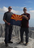
Superstition Peak 5057
Moderator: HAZ - Moderators
Linked Area, etc none
-
 Mattrgrs12Guides: 0 | Official Routes: 0Triplogs Last: 4,631 d | RS: 0Water Reports 1Y: 0 | Last: never
 - Joined: Jan 06 2009 9:24 pm
- City, State: Gilbert, Az
Superstition Peak 5057
Im looking to do the Superstion Peak 5057 via the Carney Springs TH tomorrow morning. Can anybody tell me if there is any technical climbing gear needed, what the weather is like at the top, and if the trail is well marked or not. Thanks for any info.
contribute to this member driven resource
ie: RS > Save/Share after hikes 

-
 joebartelsGuides: 264 | Official Routes: 224Triplogs Last: 3 d | RS: 2064Water Reports 1Y: 28 | Last: 13 d
 - Joined: Nov 20 1996 12:00 pm
Re: Superstition Peak 5057
It's currently as well cairned as I've ever seen it. The weather will be perfect with a morning start. There is no technical gear required.
- joe
contribute to this member driven resource
ie: RS > Save/Share after hikes
-
Mattrgrs12Guides: 0 | Official Routes: 0Triplogs Last: 4,631 d | RS: 0Water Reports 1Y: 0 | Last: never
- Joined: Jan 06 2009 9:24 pm
- City, State: Gilbert, Az
Re: Superstition Peak 5057
Cool...Thanks for the info
contribute to this member driven resource
ie: RS > Save/Share after hikes
-
 rushthezeppelinGuides: 0 | Official Routes: 0Triplogs Last: 6,212 d | RS: 0Water Reports 1Y: 0 | Last: 6,389 d
 - Joined: Oct 25 2008 2:42 am
- City, State: Tempe, AZ
Re: Superstition Peak 5057
A bit of scrambling getting the last bit up the peak but other than that joe nailed it. It is an incredibly easy trail to follow especially once you actually get up on the ridgeline out of Carney Spring.
contribute to this member driven resource
ie: RS > Save/Share after hikes
-
Mattrgrs12Guides: 0 | Official Routes: 0Triplogs Last: 4,631 d | RS: 0Water Reports 1Y: 0 | Last: never
- Joined: Jan 06 2009 9:24 pm
- City, State: Gilbert, Az
Re: Superstition Peak 5057
yea unfortunatly I did not have enough time to make it all the way to the peak. I did make it out of the carney spring and about half way to the peak. Im going to go another day to complete the hike when I know I have a full day to do it.
contribute to this member driven resource
ie: RS > Save/Share after hikes
-
 mr_squishyGuides: 0 | Official Routes: 2Triplogs Last: 2,342 d | RS: 0Water Reports 1Y: 0 | Last: 889 d
 - Joined: Jan 14 2009 4:09 pm
- City, State: Kodiak, AK
- Contact:
Re: Superstition Peak 5057
Check my photo set for jan 13 - trail is well marked. take lots of water although there is water available after you top out the West Boulder trail and head for the mountain.
Mr Squishy
Mr Squishy
Posted from my turquoise Princess rotary dial phone.
contribute to this member driven resource
ie: RS > Save/Share after hikes
-
rushthezeppelinGuides: 0 | Official Routes: 0Triplogs Last: 6,212 d | RS: 0Water Reports 1Y: 0 | Last: 6,389 d
- Joined: Oct 25 2008 2:42 am
- City, State: Tempe, AZ
Re: Superstition Peak 5057
Wow there's still running water up there?
contribute to this member driven resource
ie: RS > Save/Share after hikes