 Route Editor

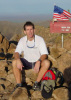
Just got in late last night (early this a.m. actually) from a fantastic hike to Tapeats Creek with Zenphx and GTG. The trip stretched from 10/15 (leave Phx and bunk at the N. Rim) to 10/21 (hike out from the Esplanade, shower and gorge ourselves on Grand Bull burgers at Jacob Lake, and get back to Phx). This was a beautiful experience in a remote and very rugged place. GTG and Zenphx are great hiking partners with wonderful experiences, stories, jokes, and knowledge to share. I recommend hiking with them at any opportunity.
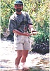
Our route followed the Bill Hall trail to Thunder River trail to Tapeats Creek (10.5 miles). We made camp at upper Tapeats and explored from there. Zenphx spent most of his time fly fishing and hiking around to different spots to do same. GTG and I made 2 side trips. First, down Tapeats creek to the Colorado and back slowly to sightsee and take photos, I believe it was about 6 miles round trip. If not GTG can correct me on this. This hike was reasonbly easy but did include several water crossings in fairly fast water (I was thankful for the use of one of GTG's trekking poles for the fords) as well as some high exposure on narrow trails. The exposure was a little nerve wracking in places but we managed. Our second trip was a loop down Tapeats, down the Colorado to Deer Creek, down/up the narrows of Deer creek, up Deer creek to the spring, up the canyon to Suprise Valley, across the valley to Thunder River, and back down Thunder river/Tapeats canyon to camp. Wow, I'm tired just typing it out. This trip was very rugged and very exposed and very beautiful. While I can't imagine it carrying a full pack (we just had daypacks) I'm already contemplating it and scheming the particulars. Our calculations for this hike was about 10 1/2 miles, but we now think it was somewhat longer. It is more of a route than a trail along the river and we spent a lot of time routefinding and experienced added distance crossing drainages.
Because I'm technologically challenged it may take me awhile to get all the photos edited and posted. I will put a few of the better ones in directly and a I'm sure the other guys will get their stuff in pretty quickly.
thunder river/tapeats backpack
Moderators: Backpack Specialist, HAZ - Moderators
Linked Area, etc none
-
 mtoomeyazGuides: 0 | Official Routes: 0Triplogs Last: 8,628 d | RS: 0Water Reports 1Y: 0 | Last: never
 - Joined: Apr 09 2002 7:08 am
- City, State: Gilbert, AZ
thunder river/tapeats backpack
Mike T
-------------------------------------------------
Less is more
-------------------------------------------------
Less is more
contribute to this member driven resource
ie: RS > Save/Share after hikes 

-
 joebartelsGuides: 264 | Official Routes: 224Triplogs Last: 2 d | RS: 2064Water Reports 1Y: 28 | Last: 12 d
 - Joined: Nov 20 1996 12:00 pm
contribute to this member driven resource
ie: RS > Save/Share after hikes
-
 arizonaheatGuides: 4 | Official Routes: 0Triplogs Last: 8,193 d | RS: 0Water Reports 1Y: 0 | Last: never
 - Joined: Sep 12 2002 2:13 pm
- City, State: Mesa, AZ
contribute to this member driven resource
ie: RS > Save/Share after hikes
-
 zenphxGuides: 0 | Official Routes: 0Triplogs Last: none | RS: 0Water Reports 1Y: 0 | Last: never
 - Joined: Apr 12 2002 10:32 am
- City, State: Phoenix, AZ
Thank You
Thanks Joe!!
And thanks for the compliment, ArizonaHeat. I've been on this trail a number of times, but this is the first time (thanks to my 'sturdy' digital camera) that I've been able to cover the route, Thunder River spring and Tapeats Canyon well photographically. I'm not sure how many of those hikes I have left in these legs, but now I have a good set of photos
Mike and Todd got lots of good ones too. It's always interesting to me to see 'the perspective' of other photographers shooting the same scenes. I know Todd is intending to post some of his pictures and I'm sure Mike has many other great ones.
That Was Zen; This is Tao
contribute to this member driven resource
ie: RS > Save/Share after hikes
-
zenphxGuides: 0 | Official Routes: 0Triplogs Last: none | RS: 0Water Reports 1Y: 0 | Last: never
- Joined: Apr 12 2002 10:32 am
- City, State: Phoenix, AZ
Great Pictures
Those are wonderful pictures Todd !! You and Mike both have a good eye for photos. And I never think to take 'detail' pictures, like the plaque for Bill Hall....or the Geological Survey marker. Of of course the 'scenes' are great. I particularly like the one of the junction of Thunder River and Tapeats Creek.
That Was Zen; This is Tao
contribute to this member driven resource
ie: RS > Save/Share after hikes
-
 GTG_AZHGuides: 1 | Official Routes: 0Triplogs Last: 8,474 d | RS: 0Water Reports 1Y: 0 | Last: never
 - Joined: Feb 03 2002 11:45 am
- City, State: Peoria, AZ - Originally from Rocket City USA
Which one?
Which confluence picture? Where we're wading or the one of the water by itself? I tend to take "detail" pictures, sometimes not enough though. I look at my pictures of the scenery I took and just shake my head in wonder. How do my pictures serve no justice to what I know I saw? Why didn't I take that shot at a better angle? Oh well, I guess it's a learning process and besides which, I've got memory to burn.
GTG
The boy from Rocket City USA.
GTG
The boy from Rocket City USA.
'Alright now look over here and smile! and pretend like you're having a good time!'
contribute to this member driven resource
ie: RS > Save/Share after hikes