 Route Editor

Hi gang. Has anyone been up to the Pine Mtn Wilderness recently? Was thinking of doing a little overnighter using the Nelson trail, shirt cut trail and bee house. Would like to know water situation and whether or not the area was negatively impacted by the fumire than ran thru there a few yrs ago. Love any feeback. Thanks gang,
Jamie D
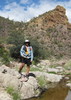
Pine Mtn Wilderness
Moderator: HAZ - Moderators
Linked Guides none
Linked Area, etc none
-
 k9hikerGuides: 0 | Official Routes: 0Triplogs Last: 8,556 d | RS: 0Water Reports 1Y: 0 | Last: never
 - Joined: Nov 17 2002 11:01 pm
- City, State: Phoenix, AZ
- Contact:
contribute to this member driven resource
ie: RS > Save/Share after hikes 

-
 chumleyGuides: 94 | Official Routes: 239Triplogs Last: 4 d | RS: 73Water Reports 1Y: 95 | Last: 2 d
 - Joined: Sep 18 2002 8:59 am
- City, State: Tempe, AZ
Re: Pine Mtn Wilderness
@k9hiker I was there last fall. The fire effects were minimal and not an issue. Nelson Place Spring should have perennial water, but the rest of the hike would likely be dry right now. It's probably a little low for elevation and would be warmer than my preference. There has often been cattle grazing in the area on my visits and they tend to congregate in the area of the spring, so that might be negative. Not sure if they graze there midsummer though. Note that the road to get there is an hour of bone-jarring misery.
If you're looking for somewhere for a relatively short backpacking trip with with water, I'd recommend somewhere on the [ Cabin Loop - Mogollon Rim ] . There are multiple road crossings where you can select your start and finish points, and a handful of reliable water sources along the way. [ Houston Brothers Trail #171 ] to Aspen or McFarland Springs are especially nice. Plenty of flat ground and camp spots to choose from too.
Nearer to Flagstaff, I might recommend the [ Sycamore Canyon Rim Loop ] . You don't have to do the whole loop, and there's water on the west side near Pomoroy Tanks.
I'm not sure what my spirit animal is, but I'm confident it has rabies.
contribute to this member driven resource
ie: RS > Save/Share after hikes
-
k9hikerGuides: 0 | Official Routes: 0Triplogs Last: 8,556 d | RS: 0Water Reports 1Y: 0 | Last: never
- Joined: Nov 17 2002 11:01 pm
- City, State: Phoenix, AZ
- Contact:
Re: Pine Mtn Wilderness
@chumley
Excellent info. Thank you. Was planning fir beginning of Sept. abd somewhere we've never been. Your other suggestions we've done. Although, it's been a coons age since I've done that Sycamore rim area. Good thought.
Excellent info. Thank you. Was planning fir beginning of Sept. abd somewhere we've never been. Your other suggestions we've done. Although, it's been a coons age since I've done that Sycamore rim area. Good thought.
contribute to this member driven resource
ie: RS > Save/Share after hikes
-
 nonotGuides: 107 | Official Routes: 108Triplogs Last: 109 d | RS: 0Water Reports 1Y: 9 | Last: 108 d
 - Joined: Nov 18 2005 11:52 pm
- City, State: Phoenix, AZ
Re: Pine Mtn Wilderness
Pine Mountain Wilderness is great to explore, and the trails are in OK shape in general. As Chum's mentioned, and from my experiences I would agree, the main problem is finding water this time of year and dealing with cattle. He's listed the info for the only reliable spring. Also, it is out of season due to its general low elevation. Better in fall or spring, IMHO.
http://hikearizona.com/garmin_maps.php
Hike Arizona it is full of sharp, pointy, ankle-twisting, HAZmaster crushing ROCKS!!
Hike Arizona it is full of sharp, pointy, shin-stabbing, skin-shredding plants!
Hike Arizona it is full of striking, biting, stabbing, venomous wildlife!
Hike Arizona it is full of sharp, pointy, ankle-twisting, HAZmaster crushing ROCKS!!
Hike Arizona it is full of sharp, pointy, shin-stabbing, skin-shredding plants!
Hike Arizona it is full of striking, biting, stabbing, venomous wildlife!
contribute to this member driven resource
ie: RS > Save/Share after hikes