The Cabin Loop Trail is the link between the earliest fireguard cabin network in this area of the Mogollon Rim and has its roots at the beginning of the Forest Service era here. The trail was developed between the General Springs Cabin, Pinchot Cabin, and Buck Springs Fire Guard Station. Administratively, the cabins were part of the Bly Ranger District, now the Blue Ridge Office of the Mogollon Rim Ranger District.
The Bly Ranger District had a winter administrative headquarters at the Old Bly Ranger Station located about 10 miles north of the present Blue Ridge Office. The summer headquarters for the Bly District was the Blue Ridge cabin near Rock Crossing Campground. These two cabins are no longer in existence.
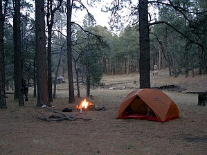
The trail passes through some of the most spectacular country in Arizona, and you will encounter a variety of landforms, vegetative communities, and several springs and perennial water sources. It is important to remember that trails such as the Cabin Loop Trail provide the only access to the country in the early days. This and other trails were used and maintained by early Forest Rangers, ranchers and settlers. Livestock was driven up the Rim from the Tonto Basin and grazed during the summer up on the Rim. Ranchers still use portions of the trails for moving livestock. Historical accounts tell us that the old-timers who made and used the trails blazed them to a height of 6 or 7 feet so the courses could be followed even after deep snow. Maintenance and repair of the old telephone line was a priority for the rangers each spring. Their accounts indicate that snow lasted late here, and it wasn't uncommon for them to have a ride over 4-foot drifts during spring rounds.
WARNING! Hiking and outdoor related sports can be dangerous. Be responsible and prepare for the trip. Study the area you are entering and plan accordingly. Dress for the current and unexpected weather changes. Take plenty of water. Never go alone. Make an itinerary with your plan(s), route(s), destination(s) and expected return time. Give your itinerary to trusted family and/or friends.
Permit $$
no fees or permits reported
if incorrect tell us about it
Directions
Road
FR / Dirt Road / Gravel - Car Okay
To hike 2007-09-10 Grasshopper writes: To start this Cabin Loop Hike near PINCHOT CABIN which will give you Parking and TH/Trail access to 3 of the 4 cabin loop trails: Fred Haught #141, Houston Brothers #171, U-Bar #28
Drive North of Strawberry on Hwy 87 for 12.5-mi to the Rim Road-FR300
Turn Right on FR300 and continue for 13.0-mi to the intersection with FR95
Turn Left on FR95 and continue for 7.6-mi to a signed parking area- Houston Draw- on Left side of FR95, parking for approx 5-6 vehicles at 6900ft elev.
Directly across the road from this parking area is a green metal gate with no signage
Go through this green gate and continue straight across Houston Draw drainage to dirt embankment on the other side
Climb up this dirt embankment to unsigned Old Logging Road
Turn Left on this Old Logging Road and continue for approx 0.125-mi to PINCHOT CABIN and beginning TH/Trail starts on Left side, just across Pinchot Springs drainage
 Route Editor