 Route Editor

Havasu to South Rim Hermit?
Moderator: HAZ - Moderators
Linked Area, etc none
-
 inluvwacGuides: 0 | Official Routes: 0Triplogs Last: 8,024 d | RS: 0Water Reports 1Y: 0 | Last: never
 - Joined: Jun 19 2002 5:35 pm
- City, State: Mesa, AZ
- Contact:
Havasu to South Rim Hermit?
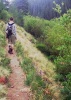
Does anyone know if there is any possible way or trails that connect Havasu Canyon to the Hermit Trailhead on the South Rim? Or is it even dooable? Mileage? I am looking for a monsterous outing sometime in the next 2 years.
contribute to this member driven resource
ie: RS > Save/Share after hikes 

-
 Davis2001r6Guides: 6 | Official Routes: 14Triplogs Last: 5,911 d | RS: 0Water Reports 1Y: 0 | Last: never
 - Joined: Dec 06 2003 3:27 am
- City, State: Bordeaux, France
- Contact:
Re: Havasu to South Rim Hermit?
In response to inluvwac's reply:
I don't think so, if you take the Hemit to the Tonto and head west you can take it for 30-50 miles? or so and end up doing the Royal Arch Loop, the furthest west trail head would be S. Bass. Check-out the royal arch loop and other canyon hikes.
TIM
I don't think so, if you take the Hemit to the Tonto and head west you can take it for 30-50 miles? or so and end up doing the Royal Arch Loop, the furthest west trail head would be S. Bass. Check-out the royal arch loop and other canyon hikes.
TIM
contribute to this member driven resource
ie: RS > Save/Share after hikes
-
inluvwacGuides: 0 | Official Routes: 0Triplogs Last: 8,024 d | RS: 0Water Reports 1Y: 0 | Last: never
- Joined: Jun 19 2002 5:35 pm
- City, State: Mesa, AZ
- Contact:
Re: Havasu to South Rim Hermit?
I guess I will just have to go to the map store and buy up. I guess it is possible, but I might have to do some nasty, nasty bushwacking and climbing to get off the trail and onto another trail, eh?
contribute to this member driven resource
ie: RS > Save/Share after hikes

contribute to this member driven resource
ie: RS > Save/Share after hikes
-
inluvwacGuides: 0 | Official Routes: 0Triplogs Last: 8,024 d | RS: 0Water Reports 1Y: 0 | Last: never
- Joined: Jun 19 2002 5:35 pm
- City, State: Mesa, AZ
- Contact:
contribute to this member driven resource
ie: RS > Save/Share after hikes
-
Davis2001r6Guides: 6 | Official Routes: 14Triplogs Last: 5,911 d | RS: 0Water Reports 1Y: 0 | Last: never
- Joined: Dec 06 2003 3:27 am
- City, State: Bordeaux, France
- Contact:
contribute to this member driven resource
ie: RS > Save/Share after hikes
-
 hikeazGuides: 6 | Official Routes: 0Triplogs Last: 1,244 d | RS: 0Water Reports 1Y: 0 | Last: 1,244 d
 - Joined: May 13 2002 10:07 am
- City, State: Tempe, AZ
- Contact:
See if you can find the book "A Man Who Walked Through Time" by Colin Fletcher. In it, he describes the route HE took.
As well, see Bob Marley's (he lives in Black Canyon City now) trip report
http://www.kwagunt.net/gctrek/gctrek1.html.
These two resources should get you started.....
As well, see Bob Marley's (he lives in Black Canyon City now) trip report
http://www.kwagunt.net/gctrek/gctrek1.html.
These two resources should get you started.....
"The censorship method ... is that of handing the job over to some frail and erring mortal man, and making him omnipotent on the assumption that his official status will make him infallible and omniscient."
George Bernard Shaw
George Bernard Shaw
contribute to this member driven resource
ie: RS > Save/Share after hikes
-
 TrionbryGuides: 0 | Official Routes: 0Triplogs Last: 7,269 d | RS: 0Water Reports 1Y: 0 | Last: never
 - Joined: Sep 14 2004 10:49 pm
- City, State: Glendale, AZ
There are no trails, if a off trail route is available your resource to use would be Harvey Butchart's Grand Canyon Treks. However, good luck getting the Tribal Council to grant approval to cross Havasupai Tribal Lands. If they do it will take some time to get an answer. I'm guessing this is because of the shoddy treatment by the government, the National Sierra Club, Natl Park Service, etc. in requiring their ancestral lands. Regardless of motivation, and from my own experience aquiring permission to hike the much more rugged & remote Topocoba Trail from Topocoba Hilltop to the village. they do not work at the same speed you may be accustomed. And a word of warning/extreme caution, if you have never hiked off-trail in the Canyon don't even think about a journey of this length as you should first tackle more established routes of shorter duration off-trail as the Canyon is an unforgiving place to the uninitiated.
contribute to this member driven resource
ie: RS > Save/Share after hikes
-
 skimrnGuides: 0 | Official Routes: 0Triplogs Last: none | RS: 0Water Reports 1Y: 0 | Last: never
 - Joined: Sep 14 2004 10:45 am
- City, State: Laveen, AZ
contribute to this member driven resource
ie: RS > Save/Share after hikes
-
 azbackpackrGuides: 34 | Official Routes: 30Triplogs Last: 41 d | RS: 0Water Reports 1Y: 8 | Last: 51 d
 - Joined: Jan 21 2006 6:46 am
- City, State: Eagar AZ
Colin Fletcher's hike was during the period of time just after the building of Glen Canyon Dam. They were filling Lake Powell at that time, so the river was extremely low. It has never been as low since then, which was in 1961 or so. If you read those passages in his book you'll see that he used an air mattress to float down the river where it cliffed out. I am not sure the Park Service still allows this, you'd have to check. They probably wouldn't issue you the permit if they thought you didn't have enough experience, either. They spend an awful lot of money rescuing people every year.
contribute to this member driven resource
ie: RS > Save/Share after hikes
-
skimrnGuides: 0 | Official Routes: 0Triplogs Last: none | RS: 0Water Reports 1Y: 0 | Last: never
- Joined: Sep 14 2004 10:45 am
- City, State: Laveen, AZ
contribute to this member driven resource
ie: RS > Save/Share after hikes
-
azbackpackrGuides: 34 | Official Routes: 30Triplogs Last: 41 d | RS: 0Water Reports 1Y: 8 | Last: 51 d
- Joined: Jan 21 2006 6:46 am
- City, State: Eagar AZ
They did not build Glen Canyon Dam in 1980! As I said, it was finished sometime about 1961 or '62. Colin Fletcher's hike (A Man Who Walked Through Time) was also about this time--soon after the dam was completed and the river was very low during this time to fill Lake Powell. His river rafting trip, he wrote about in a different book called, River, was in the early 90's I think, or in about 1989.
However you are most likely right about the rescues being billed to the person who was rescued. However, I don't think this is true ALL the time. I knew someone who was rescued, and she wasn't billed for it. Perhaps it depends upon the nature of the incident. Anyone know the answer to this?
However you are most likely right about the rescues being billed to the person who was rescued. However, I don't think this is true ALL the time. I knew someone who was rescued, and she wasn't billed for it. Perhaps it depends upon the nature of the incident. Anyone know the answer to this?
contribute to this member driven resource
ie: RS > Save/Share after hikes
-
 HoffmasterGuides: 0 | Official Routes: 0Triplogs Last: 6,326 d | RS: 0Water Reports 1Y: 0 | Last: never
 - Joined: Oct 04 2002 11:13 pm
- City, State: Canton, OH
- Contact:
I'm sure that there is a technical answer to the rescue question. But my guess would be this: If the circumstances that lead to a person needing a recue are out of that persons control, then that person might not be billed. But if they need rescued because they made poor choices, and got themselves into a situation that could have been avoided, well, if it were up to me, I'd send them a bill.
After researching online for a bit, the consensus seems to be that Glen Canyon Dam was officially completed in March of 1963. Where did 1980 come from? I reread the entire forum and could not find a reference to that year. Maybe I missed something.
After researching online for a bit, the consensus seems to be that Glen Canyon Dam was officially completed in March of 1963. Where did 1980 come from? I reread the entire forum and could not find a reference to that year. Maybe I missed something.
"I'm not a vegetarian because I love animals; I'm a vegetarian because I hate plants." A. Whitney Brown
contribute to this member driven resource
ie: RS > Save/Share after hikes
-
Davis2001r6Guides: 6 | Official Routes: 14Triplogs Last: 5,911 d | RS: 0Water Reports 1Y: 0 | Last: never
- Joined: Dec 06 2003 3:27 am
- City, State: Bordeaux, France
- Contact:
I've wondered about the rescue costs myself. I have seen a few places that say it's the taxpayers picking up the bill and then also a few other places saying it's an expensive bill to pick up if you need a rescue.
Who knows? Anyone know for sure?
I also read something a while back in outdoor or backpacker one of those that if you buy like a $60 membership to some sort of club (don't think it was sierra club but something similar) it included like a lifetime rescue insurance type thing. Wish I could remember where I saw that though.
contribute to this member driven resource
ie: RS > Save/Share after hikes
-
 PrestonSandsGuides: 170 | Official Routes: 86Triplogs Last: 505 d | RS: 0Water Reports 1Y: 0 | Last: 513 d
 - Joined: Apr 12 2004 10:59 pm
- City, State: Tucson, AZ
- Contact:
contribute to this member driven resource
ie: RS > Save/Share after hikes
contribute to this member driven resource
ie: RS > Save/Share after hikes
-
 DschurGuides: 13 | Official Routes: 0Triplogs Last: 3,433 d | RS: 0Water Reports 1Y: 0 | Last: never
 - Joined: Oct 25 2002 4:29 pm
- City, State: Payson, AZ
- Contact:
In response to davis2001r6's reply: My husbands last Rim to Rim at the Grand Canyon someone asked that question to the Ranger that was watching at the North Kaibab. They asked if it is 1000 or 2000 dollars to be rescued out of the canyon and if the person being rescued is charged that. The ranger said that is what they tell people but it isn't true the rescue out of the canyon is on the taxpayers but if you have to fly to a hospital in Flagstaff that is charged to the person and their insurance that is 5000 or so if it is daylight and more if it is at night...
Dawn
--On the loose to climb a mountain, on the loose where I am free. On the loose to live my life the way I think my life should be...For we only have a moment and a whole world yet to see...I'll be looking for tomorrow on the loose. ---unknown--
--On the loose to climb a mountain, on the loose where I am free. On the loose to live my life the way I think my life should be...For we only have a moment and a whole world yet to see...I'll be looking for tomorrow on the loose. ---unknown--
contribute to this member driven resource
ie: RS > Save/Share after hikes
-
Davis2001r6Guides: 6 | Official Routes: 14Triplogs Last: 5,911 d | RS: 0Water Reports 1Y: 0 | Last: never
- Joined: Dec 06 2003 3:27 am
- City, State: Bordeaux, France
- Contact:
Sorry to keep changing the subject, but here is a good article about rescues.
http://www.americanwhitewater.org/conte ... play/full/
http://www.americanwhitewater.org/conte ... play/full/
contribute to this member driven resource
ie: RS > Save/Share after hikes
-
hikeazGuides: 6 | Official Routes: 0Triplogs Last: 1,244 d | RS: 0Water Reports 1Y: 0 | Last: 1,244 d
- Joined: May 13 2002 10:07 am
- City, State: Tempe, AZ
- Contact:
Re: Havasu to South Rim Hermit?
This thread back from the dead........
I am perusing this area for a trip & see that the Topocoba Trail enters/exits Havasu Canyon via Lees Canyon (this USED to be the main trail to Supai village). Once on the rim it looks as if it's off-trail through sagebrush about 5 miles to Apache Point (although I suspect that there are at least game trails along this stretch.). At Apache Point one would drop down to the Esplanade (see Doug's notes here > (http://www.gloaming.com/rockgarden/GCRo ... Trail.html). Once on the Esplanade this route is cairned all the way to the South Bass intersection (+/- 18 miles) and is shown on most maps.
You may then head down the South Bass Trail and hike the Tonto east to Hermit, or detour down to Royal Arch and then east from Toltec picking up the Tonto @ Garnet and then over to Hermit.
I'd surmise that March would be best for this hike, with the best chance that the Esplanade would hold water in pockets on the Esplanade as well as through the Gems.
Last edited by hikeaz on Mar 23 2010 5:55 pm, edited 1 time in total.
"The censorship method ... is that of handing the job over to some frail and erring mortal man, and making him omnipotent on the assumption that his official status will make him infallible and omniscient."
George Bernard Shaw
George Bernard Shaw
contribute to this member driven resource
ie: RS > Save/Share after hikes
-
 big_loadGuides: 0 | Official Routes: 1Triplogs Last: 514 d | RS: 3Water Reports 1Y: 0 | Last: 2,717 d
 - Joined: Oct 28 2003 11:20 am
- City, State: Andover, NJ
Re: Havasu to South Rim Hermit?
I don't have a map handy. Does that route cross Supai or Hualapai land? It seems like it would have to.
contribute to this member driven resource
ie: RS > Save/Share after hikes