| Fliver |
| Fliver | 11 locations | Other |
|
|||||||||||||||
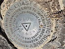
A Fliver is a round survey mark that was set by the U.S. Coast & Geodetic Survey (now called the National Geodetic Survey) or by the U.S. Forest Service. Flivers can include benchmarks, reference marks, azimuth marks, cadastral survey markers, and miscellaneous survey markers. Note that a Fliver is a round survey mark that is typically embedded in a rock or other hard surface. |
|||||||||||||||
| .: DixieFlyer :. | |
 |
|
Club Benchmark - Table Mountain | |
| .: John10s :. | |
 |
|
Davis 1880 | |
| .: wallyfrack :. | |
 |
|
Apache Leap loop | |
| .: chumley :. | |
 |
|
Mount Ajo | |
| .: chumley :. | |
 |
|
Munds Mountain Trail #77 | |
| .: DixieFlyer :. | |
 |
|
Peak 3513 - McCloud - Gray | |
| .: DixieFlyer :. | |
 |
|
Quail Mountain - Mount Minerva Hoyt | |
| .: DixieFlyer :. | |
 |
|
Queen Mountain - Joshua Tree NP | |
| .: DixieFlyer :. | |
 |
|
Black Salt River | |
| .: LosDosSloFolks :. | |
 |
|
Vulture Peak | |
| .: DixieFlyer :. | |
 |
|
Peak 5630 - Rockinstraw Mtn | |
|
|
|
|

| Information on this page has been gathered from member submissions. Effort has been made to avoid any infringement of copyright. Additionally, any use is anticipated to be within the "fair use" doctrine. If any copyright has been infringed, please notify the webmaster. The disputed information will be removed and your issue will be resolved. If you are a submitting member, please inform and discuss with HAZ if you think you are submitting any copyright issue. Please help us stay with the law. |