|
| | | Death Valley meanderings, CA | | | |
|
|
Death Valley meanderings, CA
| | |
| |
|
| Hiking | 17.00 Miles |
3,654 AEG |
| | Hiking | 17.00 Miles | 5 Hrs 11 Mns | | 3.28 mph |
| 3,654 ft AEG | | | | |
|
|
| |
| Partners |
|
none
[ show ]
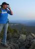
| no partners | | Had the week off, so made my way up to Death Valley. Seemed the right time of year to go. Unfortunately, the weather forecast was a little dreary, but that didn't deter me.
Telescope Peak could be seen pretty much from Mountain Springs in the Spring Mountains, but that would be the best view I got of it until the drive out.
Wednesday
Arrived from the Pahrump side, so it was convenient to visit Dante's View first thing. It wasn't completely socked in at this point, and the view of the valley was phenomenal, but still couldn't see above ~8000ft or so. Cloud ceiling eventually dropped to about 3,000 Thursday evening, so the timing worked out. Walked around just a bit, but some time in the future it might be fun to follow the trail north all the way to Mt. Perry.
Following this, drove down to Badwater Basin, where it was a bit of a zoo. Salt flat was OK I guess, not a super interesting spot, but now I can check off the lowest point in North America. Hooray!
On the way back north, I stopped at Golden Canyon and hiked in about a half mile, then scrambled up between some of the hills by the trail. This was fun, and provided a pretty good view of the canyon. I'll definitely come back to this one in the future to complete the rest of this trail system.
After lunch, I decided to go and set up camp at Mesquite Spring campground, and just spend the last couple hours of daylight relaxing, since I was anticipating rain. It pretty much started right at sunset, and continued to morning. Nothing too heavy though.
Thursday
Chilly breakdown, just basically stuffed everything in the back of my Jeep and headed up to Ubehebe Crater. This place was really bizarre and cool, and one of the highlights of the trip. Black sand everywhere, with pink sand sitting in the bowls. It was a weird landscape. Walked all the way around the crater, with a bit of jogging mixed in. Cold and drizzly, I think there were some snow flurries too. Almost all the way back around, I dipped about half way down into the crater, but decided I already caused myself enough extra work with that, and didn't go all the way to the bottom.
Next stop was Fall Canyon. By this time the rain was over, but it was still completely overcast. It didn't get really interesting until a couple miles in. Jogged most of the way down. This is a one-and-done for me; I almost would've rather walked up the Titus Canyon narrows since it was closed to vehicular traffic at the time.
Lunched in Stovepipe Wells (better than Furnace Creek actually), then headed up to Mosaic Canyon. With its yellow walls and black sand, this one is definitely a must-see.
After that, over Towne Pass in low-visibility conditions (snow on the ground starting at about 4,000 feet), then drove a little ways up the Panamint Dunes road to camp.
Friday
Set up camp and headed over to Darwin Falls for the last little meander of the trip. An oasis in the desert, with the creek flowing the last quarter mile or so. Nothing earth shattering if you've hiked along a perennial creek in AZ, but it's a big departure from any of the other trails in DV.
Left the park via the Panamint Valley, when the clouds finally started clearing just enough that I could see Telescope Peak and the Panamints in their snow-covered glory.
I'll definitely be back, this trip was really just to get a feel for the lay of the land; next time I'll have a more thorough plan. |
| _____________________
| | |
|
|
|
 Route Editor