|
| | | |
| |
|
| Hiking | 0.52 Miles |
84 AEG |
| | Hiking | 0.52 Miles | 15 Mns | | 2.40 mph |
| 84 ft AEG | 2 Mns Break | | | |
|
|
| |
| Linked |
|
none
[ show ]
| no linked trail guides |
| Partners |
|
none
[ show ]
| no partners | | Day 5 (Hike 3) – Gila Trip Gone Wrong
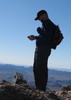
While there was no thunder or lightening during my super short trip of under 1/2 mile / under 20 minutes to the K P Benchmark, the large grey cloud that had me a bit concerned was still lingering around. Thus, I opted for as short an approach as possible to the Greenlee County Highpoint. I managed to find a spot along Hwy 191 that was in almost perfect alignment with the X on the topo that represents the highpoint, and I reached the summit in just 0.24 miles.
While there were some downed trees to hop over, it definitely was not at all terrible relative to the bad / moderately bad areas. The summit area looked more like a pretty meadow than the top of the mountain, and had the weather been more favorable, it definitely would’ve been nice to sit up there for a bit and enjoy the surroundings. However, in addition to the stormy skies, I wasn’t exactly digging the 30 degree temps. Thus, I made my way over to the summit cairn, signed the log, [which had a Gordon MacLeod / Barbara Lilley register and was filled with names due this ‘peak’ being a county highpoint], and then headed back down.
Upon returning to my Forester, I decided to head for the trailhead that is just to the West of Blue Peak, [at the end of FR 184], where I planned to car-camp for the night and then launch from the next morning. However, I missed the turn and didn’t realize it until I’d reached the Strayhorse campground area, just over 4 miles further down Hwy 191 [and nearly 1,500’ lower]. I toyed with the idea of just staying at Strayhorse [and then just beginning my adventure from the Raspberry Creek Trail #35 instead of from the one that takes off toward Blue Peak at the end of FR 184]; but for one reason or another, I decided to head back up the road and then down FR 184. While definitely not car-friendly, FR 184 was not a particularly difficult / pooey road for high clearance; just annoying slow due to about 4 miles of road that seemed to constantly alternate being having several feet of flat/excellent stretches followed by boulders that had me riding the brakes to ensure I wouldn’t hit bottom].
I reached the trailhead at the end of FR 184 just before dark and enjoyed some awesome views as the sun set. Ironically however, all of the backtracking was for naught; as fate would have it, I’d wake up on the morning of Day 6 at the Strayhorse campground and kick-off my adventure from the Raspberry Creek Trail #35… |
| _____________________
| God save the Prom Queen, cuz [reality check!] AEG's King...! |
| | |
|
|
|
 Route Editor