username
X
password
register
for free!
help
ArticlesGuidesRoutes
 
Photosets
 
 Comments
triplogs   photosets   labels comments more
Woods Canyon - Upper - 12 members in 20 triplogs have rated this an average 4.3 ( 1 to 5 best )
20 triplogs
login for filter options
Aug 23 2024
avatar

 Routes 46
 Photos 253
 Triplogs 47

19 male
 Joined Aug 13 2023
 Phoenix, AZ
Woods Canyon - UpperFlagstaff, AZ
Flagstaff, AZ
Canyoneering avatar Aug 23 2024
diabloTriplogs 47
Canyoneering12.20 Miles 2,200 AEG
Canyoneering12.20 Miles   8 Hrs   2 Mns   1.71 mph
2,200 ft AEG      53 Mns Break
 no routes
1st trip
Linked   none no linked trail guides
Partners none no partners
Wow. An extremely hard hike and this place could kill you if you’re not careful. It is complete off trail hiking and constant downclimbing. 2 rattlesnakes in 1 which I had a close call on stepping on. Roads were muddy which was very hard to navigate but I made it pretty close to the end FR 80 in a 2WD Ranger. Now the good :lol: woods canyon is absolutely beautiful and had a nice little flow in spots. Constant boulder hopping from start to finish. Pools were chilly but refreshing. We got to the ruins right as we noticed storm clouds coming in. Probably not the best place to be in a flash flood… :-s The place overall is beautiful but not to be taken lightly. Like I read on here, if you sprain your ankle in the wrong place in this canyon, you’re dead. 8-[
 Culture
 Culture [ checklist ]
[ checklist ]  HAZ Rides
 Named place
 Named place [ checklist ]
[ checklist ]  Woods Canyon
wildflower observationwildflower observationwildflower observationwildflower observationwildflower observation
Wildflowers Observation Light
  2 archives
Jul 08 2023
avatar

 Photos 11
 Triplogs 3

male
 Joined Apr 05 2023
 Tempe, AZ
Woods Canyon Trail #93 - SedonaSedona, AZ
Sedona, AZ
Backpack avatar Jul 08 2023
shmuelicTriplogs 3
Backpack15.00 Miles 615 AEG
Backpack15.00 Miles2 Days         
615 ft AEG25 LBS Pack
 no routes
1st trip
Partners none no partners
Left from Red Rock Visitor Center Parking lot at 11:30 am on July 8th with the goal of making it to I-17 the next day. There is an established trail for the first 5 miles - described in the Woods Canyon Trail #93 Guide. I saw a small dirty pool just as I started my hike but besides that the stream was completely dry through this section. Saw only one hiker coming opposite me on from this section of trail, unsurprising given high temps. I would not see another person until I got to the highway. I lost trail at one section and started rock-hopping before eventually finding it again (hint: it stays on the north side of the streambed/ left side going upcanyon). The trail terminates fairly abruptly with an 'End of Trail' sign. This section was sort of the drudgery before I got to the good stuff.

I continued past the end of trail sign, rock hopping upcanyon. Rocks were small enough to shift under my weight for this part. There were what seemed like multiple good potential camping spots on sand under shade towards the end and just past the end of the trail. About a mile past the end of the trail I found a pool of water I chose to take a swim in with lots of tadpoles in it. I kept going for miles of more rockhopping with some shade and some breaks from rockhopping with sections of slickrock. I saw cows and a lot of cowpies in this part. I also saw a coati and the native american ruins on the north side of the canyon. Water was intermittent through this part mostly small stagnant pools with lots of tadpoles. Eventually with the sun threatening to set I got cliffed out with my first mandatory wade and chose to set camp on flat rock. Unfortunately for me I had a leak in my camping pad and I had a long night.

I'd estimate I set camp at 34.8449, -111.6744 which puts me about 10 miles past the entrance, 5 past the end of the trail and 5 miles to go. Sunday was much more exciting than Saturday. It started with a wade followed by a few mandatory swims. My set up is a waterproof sack inside my bag with anything that shouldn't get wet inside. This was my first time using it, I had inflated a floatie to carry my bag in the past and I much preferred swimming with the pack on. The water was cold but a welcome relief in July. The last of the swims in this section ~mile 11 had a water level low enough that I could not climb out onto the large boulders choking the water channel. I was forced to go to a rocky side exit and climb my way around. I'm 5'11 and my feet cut loose and I had to mantle an overhanging boulder. Towing a dog/child up without a harness would be pretty tough. This was the hardest obstacle of the whole trip. I climbed down the backside using a tree. The pools gave way to more endless boulder hopping on grey rocks. The rocks were becoming larger which is my preference.

Just before the canyon makes its turn from running north-south to east-west (roughly 34.8573, -111.6705) begins the next set of swims, with one of them being the longest of the trip. Probably 40 yards long. About a mile more of rockhopping on large boulders takes you to the "waterfall", just a trickle in July (34.8575, -111.6554). It's not difficult to walk up. Above the "waterfall" things get greener which makes the going a little tougher and adds poison ivy. Maybe a quarter mile past is a large pool with another smaller drainage canyon coming in from the southeast. I think this is the drainage other posters complained about poison ivy in that people are using to access the canyon. I needed to make it to the highway to hitch back to my car so I kept going in the main canyon. I skirted the pool at the confluence but shortly after there were several more pools I was forced to swim through. Some of these pools had what looked to be eating sized fish, I think trout but I'm not a fishermen. I saw a small rattlesnake in this section didn't stick around to figure out what kind. Eventually the canyon got choked in with vegetation and there was a small consistent stream at the top here. I exited to the south and walked a few hundred yards to the forest road. You probably need a map to see where to exit to the road, there was no obvious sign of when to exit.

I walked out to the highway exit where the forest road started but there was no one around. I ended up walking along I-17 3 miles south to the scenic view where I got a ride from a nice couple 15 miles down the road to the turnoff for 179 to Sedona and very quickly got a hitch the last 8 miles to the red rock visitor center. In hindsight should've realized hitching from that section of I-17 would be nearly impossible. It's probably significantly easier to hitch the opposite direction but then you'd have to hike downcanyon the whole way which I'd rather not do. Staging cars would be very easy.

Overall fun hike in the heat of the summer with a bit of drudgery on either end. The solitude was excellent. If I come back I'm likely to park on the forest road, bring some people and just show them the top section of the canyon.
 
Aug 09 2014
avatar

 Guides 2
 Photos 1,691
 Triplogs 212

45 male
 Joined Aug 05 2004
 Peoria, AZ
Woods Canyon - UpperFlagstaff, AZ
Flagstaff, AZ
Canyoneering avatar Aug 09 2014
desert_boonieTriplogs 212
Canyoneering10.00 Miles 2,340 AEG
Canyoneering10.00 Miles   7 Hrs   30 Mns   1.33 mph
2,340 ft AEG
 no routes
1st trip
Linked   none no linked trail guides
Partners none no partners
Why did I want to do this trek? Not really sure, it is a brutal day for anyone that is a guarantee. So lets start with the drive in on FR 80. If you do not have high clearance then you are going to end up hiking a bit more. On the drive in I actually saw 2 vehicles parked on the side of the road that didn't make it all the way in. I got in no problem and parked by the old corral area Robbers Roost. The only thing I didn't like about this drive in was there was no mud.

From there it was just over 2 miles to the drop in at the top of the drainage. I was able to see about 8 or so elk in the distance at two different times so that was a nice start to the day. With about a mile to go to the drainage you cross a pretty well shaped road. I was surprised to see it in such good shape, I could have driven here. Oh well, the hike across country isn't that bad, but a lot of rocks to walk on starts the misery that later comes on the knees.

I make it to the top of the drainage and enter the brushy area. This wasn't pleasant as well, but it goes with the territory. There are a few good size down climbs for sure that most would probably be better off doing a rappel on. One of them I had to take my pack off and toss it a short distance down to negotiate the climb better. This is where more misery to my day was added. On the short toss down it dislodge my mouth nozzle on my bladder leaking out more than half of my 3 liters. Since this was a solo trek and I had 200 feet of rope in my pack and my regular items, this was the first time in a very long time I didn't have a Nalgene or Gatorade bottle as extra. You all know where this is going. I get down from the climb and notice the water. DAM!!!! I secure the end of my hose and fix it there but it was actually broken to where it would leak unless pointed up. I had to do a quick fix there and take a sip of the only little pool of water on the rocks there. Better to have it in me than go to waste. Yum dirt.

After this little problem I make my way down a few more down climbs which are no joke on the slick and loose sandstone. The drainage opens up with an incredible view of the Sedona area and a few small pools are to be passed here before reaching the rappels. I get to the top of the first rappel and see someone down below. Wow, just when I thought I was alone. It had to be the cars parked back on the road. They say they are almost done with the second rappel so I let them take a minute as I rig the 1st rap that could be down climbed but why risk it. I get to the second rappel and see one of the others in the party below me. I know that guy. I say hey from 100ft above.

The 3 rappels that you have to do are all pretty nice. The last one is awesome with the 30ft overhang or so of free rappelling. I get down all the raps and eat my pizza here before making my way down to Woods Canyon.

Great, let the rock hopping begin. After about 20 minutes I catch up to the group of 3 who were taking their lunch. I converse for a few minutes and head on my way. It was funny how up until this point it was overcast with good cloud cover. Even one of the guys said "at least the clouds are cooperating" well shortly after I left them the clouds were gone and it was full sun.

As I approach the first section of sandstone and pools I take a sip and after a second get that not so great sound of an empty bladder. I check to see if it was empty or just pinched since my pack was stuffed. It's empty. Good thing I have 4 miles to go. I had the option of waiting and asking if any of the guys could spare some extra or just go for it knowing I had plenty in the Jeep. I went for it. I was now in the sun but with water around me so I was able to stay cool most of the time. A wet shemagh wrapped around my head helped as well. After 2 hours though the dry mouth was not pleasant. I debated on whether to at least put some of the canyon water in my mouth and spit it out or just go. I didn't risk it, I just went on wanting a drink of water and laughed at the fact I was in water and had it all around me but couldn't take a drink.

I was able to hammer out the day and the last 3 hours without a drink which made seeing the Jeep at the end of the day the best sight ever. I told myself not to chug the water when I got there but take small sips. I tried, the first sip was small but then it was like I need water in my system I drank half a gallon in about 5 minutes. I laid down in the shade and actually fell asleep for about 20 or 30 minutes. Felt weak after I woke up but was able to urinate which told me I wasn't too badly dehydrated. I was going to camp there but wanted some more fluids and since I wasn't too far off the I-17 I headed to Camp Verde to get cold fluids and rehydrate properly. On the drive out I also saw the guys starting their drive out which was good to know they got out no problem as well.

Another good trek in the books I guess.
 Fauna
 Fauna [ checklist ]
[ checklist ]  Elk
_____________________
"Never Satisfied"
 
Jul 30 2011
avatar

 Guides 13
 Routes 38
 Photos 1,651
 Triplogs 577

60 male
 Joined Nov 15 2005
 Jackson, CA
Woods Canyon - UpperFlagstaff, AZ
Flagstaff, AZ
Canyoneering avatar Jul 30 2011
toddakTriplogs 577
Canyoneering12.00 Miles 1,500 AEG
Canyoneering12.00 Miles   11 Hrs      1.09 mph
1,500 ft AEG
 no routes
1st trip
Linked   none no linked trail guides
Partners none no partners
Dropped in from the east via the technical Bear Tank drainage, which puts you into Woods about a mile below the cliff dwelling. The Supai Pools are very cool, the swims were relatively clean and refreshing, but the miles of punishing basalt scrambling definitely takes a toll.
_____________________
 
Sep 05 2010
avatar

 Guides 264
 Routes 2,799
 Photos 14,514
 Triplogs 5,896

55 male
 Joined Nov 20 1996
 
Woods Canyon - UpperFlagstaff, AZ
Flagstaff, AZ
Canyoneering avatar Sep 05 2010
joebartelsTriplogs 5,896
Canyoneering11.50 Miles 2,509 AEG
Canyoneering11.50 Miles   9 Hrs   39 Mns   1.19 mph
2,509 ft AEG
Canyon Hiking - Non-technical; no rope; easy scrambling; occasional hand use
B - Up to light current; wading/swimming; possible wet/dry suit
 no routes
1st trip
Linked   none no linked trail guides
Partners partners
BobP
The_Eagle
Headed into Woods at 8am with borderline hot weather sweating immediately. This canyon is still a beauty in my vision. The non-stop bouldering is not for the timid. The pools seemed further than anticipated. Luckily they're 10 degrees warmer now than mid to late June. We had a turn around time of 1pm set for the ruins and made there with 8min to spare. Ate lunch while Bob looked for access to the ruins then headed back up canyon. We lucked out with non-forecasted cloud relief on occasion heading back. Many times if felt cooler with the breezes than our early morning jaunt. Under estimated the water needs carrying 5 litters. 6 or 7 would have made the return more enjoyable yet it all worked out. Bob treated at Quizznos in Camp Verde on the drive home. Which really hit the spot :)

Believe this is the first time I've come away from this canyon feeling so well. We didn't press it since Bruce was on his maiden canyon trip this outing. While his legs were sore coming back I think something else hurt more...

Saw an Arizona Mountain King snake (my 4th) and a small guy with a bright orange-ish stripe down his back. On a break at the Dip I spotted one of the maples to be a helicopter variety. The seeds on these were paired and needed to be pried apart to spin.

Wildflowers: A few good sized clusters of red wildflowers and a few tiny white long stem daisies of sorts.

Foliage: I'll go with Isolated since we did see two tiny four foot square areas of maple foliage. Though I'd guestimate 3-4 wks before the show. Not sure what would cause those tiny patches...
foliage observationfoliage observationfoliage observationfoliage observationfoliage observation
Autumn Foliage Observation Isolated
wildflower observationwildflower observationwildflower observationwildflower observationwildflower observation
Wildflowers Observation Light
_____________________
- joe
 
Sep 05 2010
avatar

 Guides 41
 Routes 1,627
 Photos 14,983
 Triplogs 2,762

69 male
 Joined Jan 20 2009
 Far NE Phoenix,
Woods Canyon - UpperFlagstaff, AZ
Flagstaff, AZ
Canyoneering avatar Sep 05 2010
The_EagleTriplogs 2,762
Canyoneering11.50 Miles 2,509 AEG
Canyoneering11.50 Miles   9 Hrs   39 Mns   1.19 mph
2,509 ft AEG
 
1st trip
Linked   linked  
Partners partners
BobP
joebartels
THIS WAS ONE SWEET HIKE!

First - If you are driving a car, don't even consider driving past the parking area right next to I-17 at exit 315.
Second - If it's at all wet or there's a chance of it being wet, I don't think 4x4 will even help you. If it's dry, high clearance is cool for the brave. All others, hike the extra 4 miles round trip.
Third - If you are a hiker and not a climber/canyon mad man/woman, prepare for some mighty sore quads the next day.

Make sure to follow the GPS track to drop into the first little canyon that roughly travels north to reach Woods Canyon, or else you might get to a spot you can not enter easily.

Prepare for 12 miles of boulder hopping your way to some of the Best Views in the State of Arizona. Also prepare to get wet. On this day we had 3 waders and 2 swimmers each direction. A Dry Bag is just about mandatory, and a nice Wallyworld float might help on especially the 1st swimmer.

The views are un matched... WOW....The carved and weathered red rocks, the green trees, the blue skies, and we were lucky enough for Fraley to make an appearance on the way out to keep it a bit cooler.

https://www.youtube.com/watch?v=NvGQK8n2kDo

Heard some elk bugling in the morning, a raptor calling out, a Garter and my first Arizona Mountain King Snake.

Made it to the Indian Ruins and started eating some lunch while Bob aka "Boulder Bob" aka "Bobby Goat" tried to find a way (with no luck) up the cliff to the Ruins.

The hike back up the canyon was just as beautiful. My quads really started getting rubbery on the way back, butt my two close hiking buddies were patient with me. Joe is normally the butt of the jokes on the hikes, butt this time is was my turn to be the butt of the jokes.

Thanks for the great time gentlemen..... and Dinner Bobby.
foliage observationfoliage observationfoliage observationfoliage observationfoliage observation
Autumn Foliage Observation Isolated
wildflower observationwildflower observationwildflower observationwildflower observationwildflower observation
Wildflowers Observation Light
_____________________
There is a very fine line between "hobby" and "mental illness."
Dave Barry 🦅
 
Sep 05 2010
avatar

 Guides 2
 Routes 251
 Photos 4,593
 Triplogs 3,214

63 male
 Joined Feb 26 2008
 Scottsdale, AZ
Woods Canyon - UpperFlagstaff, AZ
Flagstaff, AZ
Canyoneering avatar Sep 05 2010
BobPTriplogs 3,214
Canyoneering11.50 Miles 2,509 AEG
Canyoneering11.50 Miles   10 Hrs      1.15 mph
2,509 ft AEG
Canyon Hiking - Non-technical; no rope; easy scrambling; occasional hand use
B - Up to light current; wading/swimming; possible wet/dry suit
 no routesno photosets
1st trip
Linked   none no linked trail guides
Partners partners
joebartels
The_Eagle
I saw a side of Joe that was realllly nice...I saw a side of Bruce that I never want to see again. All in all it was a very enjoyable day with great company.
foliage observationfoliage observationfoliage observationfoliage observationfoliage observation
Autumn Foliage Observation Isolated
wildflower observationwildflower observationwildflower observationwildflower observationwildflower observation
Wildflowers Observation Light
_____________________
https://www.seeitourway.org
Always pronounce Egeszsegedre properly......
If you like this triplog you must be a friend of BrunoP
  1 archive
May 17 2010
avatar

 Guides 3
 Routes 4
 Photos 8,687
 Triplogs 931

46 male
 Joined Mar 28 2005
 Gilbert, AZ
Woods Canyon - UpperFlagstaff, AZ
Flagstaff, AZ
Canyoneering avatar May 17 2010
VapormanTriplogs 931
Canyoneering10.00 Miles 2,400 AEG
Canyoneering10.00 Miles   10 Hrs      1.00 mph
2,400 ft AEG
Intermediate Canyoneering - Difficult or dangerous; Tech Climb; rope reqd; descent anchor; exit technical;
B - Up to light current; wading/swimming; possible wet/dry suit
IV - Long, full day, bivy possible
 no routes
Linked   linked  
Partners partners
alpineclimber
Wow, what a burly long rock hop! :sweat: I had a 3-day weekend from a recent B-day and filled it up with more canyoneering. :GB: I've done the non-technical rock hop & swim down to the Supai Pools a few times over the years, but this was my first shot at the technical loop that drops in via a side canyon below the Supai layer into middle Woods Canyon. My buddy got us along that bumpy FR80 fairly far before we hopped out, geared up and made the almost 3 mile rim walk to the drop-in point. That side canyon is rather bushy with loads of tree fall to push thru before hitting a few 'Todd down climbs'. :o We manage to climb down most of them, but the top one had a good anchor already so we made a 50ft rappel out of it, and another we initially rappelled down but once we saw how easy it was my buddy climbed back up and dismantled the anchor. After we were done with all the down climbing, the canyon opens up with some nice angled Coconino sandstone slabs to descend and small pools to avoid before hitting the first of many drops in the Supai Sandstone layer . There was a good anchor there that we used for this 20ft drop but I suspect this is another 'Todd down climb'. :lol: Right after this drop is a super sweet 80ft rap down a dryfall covered in desert varnish followed quickly by another 80ft rap but the first 40ft are gently sloping until you hit the quick 40ft drop. Thinking we hit the 3 rappels already, we were kinna surprised to hit the final 70ft rappel that was very overhung; it was like rappeling off the edge of a dinner plate. :o The anchor is 30ft back so my 100ft rope barely made it down with only a few feet to spare... My friends isn't too experienced on overhanging rappel, so he butt slide off of it and got scraped up pretty good... After that is was some more down climbing and avoiding a Diamondback before hitting the rocky middle Woods Canyon around 2pm. I've yet to be this far down/up canyon, so it was kinna cool to finally see it and we started the long rock hop upstream before shortly running into yet another Diamondback. :o The coolest part by far was navigating our way thru the Supai Pools area and trying to find the best way to make our way upstream. It would have been nice to play in the flowing pools a bit but we were already pushing to make it out before dusk. We eventually made it back up to the Coconino layer were the canyon narrows up and we encountered a few chilly swimmers and we thru on our 3mm full wetsuits to make them bearable. ;) After nearly freezing our rears off, we slowly made it further up the long rock up as the boulder got slowly bigger and tougher to navigate thru. We eventually reached the basalt layer where the boulders get even bigger until we hit the basalt falls with 3 pools above it that require a wade or swim to get across. Once across those, we quickly reached our exit canyon with a huge pool and falls in upper Woods Canyon were we dropped our wetsuits, hiked up that side canyon a bit before climbing back up to the rim, and making the final 1.5 miles of rim walking back to our vehicle making it back just after sunset. :sweat:
 Culture
 Culture [ checklist ]
[ checklist ]  Throwing a Wendy
_____________________
Yea, canyoneering is an extreme sport... EXTREMELY dramatic!!! =p
 
Sep 12 2009
avatar

 Guides 3
 Routes 4
 Photos 8,687
 Triplogs 931

46 male
 Joined Mar 28 2005
 Gilbert, AZ
Woods Canyon - UpperFlagstaff, AZ
Flagstaff, AZ
Canyoneering avatar Sep 12 2009
VapormanTriplogs 931
Canyoneering11.00 Miles 1,140 AEG
Canyoneering11.00 Miles   9 Hrs   30 Mns   1.16 mph
1,140 ft AEG
Basic Canyoneering - Scrambling; easy climbing/downclimbing; frequent hand use; rope recommended; easy exit
A - Dry or little water; shallow or avoidable water; no wet/dry suit
III - Normally requires most of a day
 no routes
Linked   none no linked trail guides
Partners none no partners
I hadn't done this canyon in 2 summers and wanted to hit it again before the season is over. I just had my car, so I parked right off of the freeway exit and bushwhacked it towards the entry canyon. It was as scenic and challenging :sweat: as ever with the water levels being down maybe a little. I had it with me but didn't end up using my wetsuit for the two short frigid swimmers. I made it as far down as Supai Pools again with the water being rather murky since its late summer. I always tell myself I'm going to go farther this time, but my legs are so tired from all the boulder hopping that I give up at the same spot every time. :lol:
_____________________
Yea, canyoneering is an extreme sport... EXTREMELY dramatic!!! =p
 
Apr 27 2008
avatar

 Guides 6
 Photos 346
 Triplogs 225

69 male
 Joined May 13 2002
 Tempe, AZ
Woods Canyon - SedonaFlagstaff, AZ
Flagstaff, AZ
Canyoneering avatar Apr 27 2008
hikeazTriplogs 225
Canyoneering14.00 Miles 2,485 AEG
Canyoneering14.00 Miles   24 Hrs      0.58 mph
2,485 ft AEG
 no routesno photosets
1st trip
Partners none no partners
This is a world-class canyon!
We hiked this as a top-down trip, exiting out the Hot Loop/Jacks Canyon trails, as the new Sedona NFS Ranger Station snafus have precluded the use of the normal trailhead.
This adds about 2.5 or 3 miles to the distance.

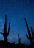
This trip exceeded my already-high expectations. From my first views in the 'feeder' canyon I knew that this would be a terrific trip, but once at what is described in the HAZ description as 'The Dip', it turned SENSATIONAL.
The first swim was about 50 degrees, the second was ALSO a swim and was colder, likely 45-46. Boy, THAT sure gets your heart racing! As we ventured further into the depths of Woods there was awesome scenery followed by spectacular scenery. I cannot tell you how many times I heard someone, including myself, gasp, 'WOW' as they came around a bend in the canyon.
We saw no sign of man, not even a bootprint on the whole trip until we exited the canyon. Yes, the boulder-hopping can get tedious at times, but I can tell you that I'd go back in an instant to hike this one again.
Our group of six was glad to have decided to backpack this rather than try and race through the canyon in a day, thus allowing more time for photos and sight-seeing.

For the record, we started about 10AM and after a VERY leisurely day of hiking, with over 2.5 hours of assorted breaks, camped about 6.75 miles in, stopping about 5:45PM. The front-runners reached the vehicles at the Jack's Canyon T/H about 12:30PM with an 8AM-ish start from camp.

There was running water all the way, even downstream of where the Hot Loop trail exits the canyon. In warmer months this may not be the case, plan accordingly.
The weather was perfect, moderate daytime temps (75 maybe) and a cool, but not cold, evening (45 as a guess-ti-mate). I would not prefer hiking this when it gets too much hotter, especially the Hot Loop/Jacks portion.

I would suggest to anyone that enjoys canyons that he/she get out and hike this canyon; it's a beauty!
wildflower observationwildflower observationwildflower observationwildflower observationwildflower observation
Wildflowers Observation Light
_____________________
"The censorship method ... is that of handing the job over to some frail and erring mortal man, and making him omnipotent on the assumption that his official status will make him infallible and omniscient."
George Bernard Shaw
 
Jul 21 2007
avatar

 Guides 3
 Routes 4
 Photos 8,687
 Triplogs 931

46 male
 Joined Mar 28 2005
 Gilbert, AZ
Woods Canyon - UpperFlagstaff, AZ
Flagstaff, AZ
Hiking avatar Jul 21 2007
VapormanTriplogs 931
Hiking8.00 Miles 1,140 AEG
Hiking8.00 Miles   7 Hrs      1.14 mph
1,140 ft AEG
 no routes
Linked   none no linked trail guides
Partners none no partners
We didn't drive to the end of the road due to how rocky it is, so we parked the truck and hiked the rest of the way in. I did the same route and went down to the same destination that I went to last year, but this time I brought a friend. The water level was much lower than last year; it was actually flowing last time. :? I went down to the pool in the Supai layer that most seem to go down to and we scrambled around & down to the pool where we swam and ate lunch. It's pretty sweet to traverse down this canyon thru the three different rock layers: Basalt, Coconino Sandstone, and Supai Sandstone. The skys up to this point had been clear after burning off the morning clouds, but once we finished lunch and scrambled back up from the pool, we saw an ominous cloud that had snuck in above the canyon wall. We planned on a quick trip so as to avoid afternoon monsoons, but they came in a bit sooner than expected. We got sprinkled on a bit, and heard lots of thunder, but we got lucky and avoided any walls of rain or flash flooding. :) Thankfully we had an uneventful hike out and I highly recommend both the wetsuits and helmets that we used on the trip.
_____________________
Yea, canyoneering is an extreme sport... EXTREMELY dramatic!!! =p
 
Jun 30 2007
avatar

 Triplogs 16

40 male
 Joined Sep 03 2004
 Tempe, AZ
Woods Canyon - UpperFlagstaff, AZ
Flagstaff, AZ
Hiking avatar Jun 30 2007
z71runnerTriplogs 16
Hiking5.00 Miles 1,140 AEG
Hiking5.00 Miles   13 Hrs      0.38 mph
1,140 ft AEG
 no routesno photosets
1st trip
Linked   none no linked trail guides
Partners none no partners
Took a trip to upper Woods canyon to explore the area for a future thru-hike of the canyon. This is a surprising canyon that I never knew existed! Without a high clearance vehicle we were unable to take FR-80 to its terminus, so we parked at exit 315 and began hiking along the dirt road. We saw lots of cool spider webs along the way and a lot of animal tracks. After approximately 2 miles we came to a barbed wire fence running north to south in the middle of a clearing in the forest where a large tree intersected the fence near the road. From this point we began walking northwest for about 5 to 10 minutes across the meadows and forest. We soon came upon the specacular Woods Canyon. The decent into the canyon is extreme! This was some of the steepest terrain I have ever decended. We followed game trails and our own intuition to reach the bottom sooner than we thought. Once at the bottom we were now in another world. Towering pines and green vines stretched along both sides of the boulder strewn creek bed. This was one wild looking place! These were also some of the largest boulders I have ever seen in a creek. There was no running water this time of year so we began to hike down stream. We only ended up hiking about a half a mile in the creek before calling it a night since it was getting dark. We camped next to a large pool filled with stagnant water and were paranoid most of the night since we heard there may be bears in the area (from Canyoneering Arizona book). We hiked out the next morning and upon reaching the top of the steep canyon wall we saw several large elk bounding away from us through the forest! If you plan to do this hike, drive all the way in along FR-80 and bring some topo maps unlike what we did! I can't wait to get back in this canyon and check out the mandatory swims, towering walls and Indian ruins that lie below where we hiked. We might even encounter a bear!
_____________________
http://arizonatrail2008.wordpress.com
 
Jun 23 2007
avatar

 Guides 107
 Routes 249
 Photos 2,067
 Triplogs 514

male
 Joined Nov 18 2005
 Phoenix, AZ
Woods Canyon - UpperFlagstaff, AZ
Flagstaff, AZ
Canyoneering avatar Jun 23 2007
nonotTriplogs 514
Canyoneering7.50 Miles 1,140 AEG
Canyoneering7.50 Miles   4 Hrs      1.88 mph
1,140 ft AEG
Canyon Hiking - Non-technical; no rope; easy scrambling; occasional hand use
B - Up to light current; wading/swimming; possible wet/dry suit
III - Normally requires most of a day
 no routesno photosets
1st trip
Partners none no partners
Pretty great area. You start off in pine forests and 40 degree weather on a summer morning. We headed south to the tributary that feeds the canyon, and did some somewhat steep down-bouldering. There is a mandatory swim a few miles in and a mandatory wade just after that. Towards the end you have the option to get wet again or try a thorny bushwhack around. The canyon boxes up on top and is quite beautiful with the black granite boulders contrasting against the yellow coconino sandstone which gives way to the red supai. It's slow going though. I added a mile because we didn't park at the "trailhead".
_____________________
http://hikearizona.com/garmin_maps.php

Hike Arizona it is full of sharp, pointy, ankle-twisting, HAZmaster crushing ROCKS!!
Hike Arizona it is full of sharp, pointy, shin-stabbing, skin-shredding plants!
Hike Arizona it is full of striking, biting, stabbing, venomous wildlife!
 
Jun 23 2007
avatar

 Guides 107
 Routes 249
 Photos 2,067
 Triplogs 514

male
 Joined Nov 18 2005
 Phoenix, AZ
Woods Canyon - SedonaFlagstaff, AZ
Flagstaff, AZ
Hiking avatar Jun 23 2007
nonotTriplogs 514
Hiking4.00 Miles 2,485 AEG
Hiking4.00 Miles
2,485 ft AEG
 no routesno photosets
1st trip
Partners none no partners
The ruins are truly fantastic and unspoiled, because they're inaccessible to anyone without a jetpack. The boulder hopping continues and begins to grind you down physically and mentally. Plus, the 90+ degree temps made an appearance and brought great suffering.
_____________________
http://hikearizona.com/garmin_maps.php

Hike Arizona it is full of sharp, pointy, ankle-twisting, HAZmaster crushing ROCKS!!
Hike Arizona it is full of sharp, pointy, shin-stabbing, skin-shredding plants!
Hike Arizona it is full of striking, biting, stabbing, venomous wildlife!
 
Jun 23 2007
avatar

 Guides 107
 Routes 249
 Photos 2,067
 Triplogs 514

male
 Joined Nov 18 2005
 Phoenix, AZ
Woods Canyon Trail #93 - SedonaSedona, AZ
Sedona, AZ
Hiking avatar Jun 23 2007
nonotTriplogs 514
Hiking3.00 Miles 255 AEG
Hiking3.00 Miles
255 ft AEG
 no routesno photosets
1st trip
Partners none no partners
Lower woods canyon adds more boulder hopping to the end of a long day. Luckily, there is a secret shortcut on the west banks that allows you to avoid much of the pain. 90+ temps at this point during the summer should discourage most individuals from attempting this.

Due to construction in Oak Creek, the lower trailhead was closed, so it is only accessible via Hot Loop as of this writing.
_____________________
http://hikearizona.com/garmin_maps.php

Hike Arizona it is full of sharp, pointy, ankle-twisting, HAZmaster crushing ROCKS!!
Hike Arizona it is full of sharp, pointy, shin-stabbing, skin-shredding plants!
Hike Arizona it is full of striking, biting, stabbing, venomous wildlife!
 
Mar 18 2007
avatar

 Photos 12
 Triplogs 9

41 male
 Joined Mar 11 2007
 Flagstaff, AZ
Woods Canyon - UpperFlagstaff, AZ
Flagstaff, AZ
Hiking avatar Mar 18 2007
dionysiusTriplogs 9
Hiking6.50 Miles 1,140 AEG
Hiking6.50 Miles
1,140 ft AEG
 no routes
1st trip
Linked   none no linked trail guides
Partners none no partners
_____________________
 
Aug 26 2006
avatar

 Guides 3
 Routes 4
 Photos 8,687
 Triplogs 931

46 male
 Joined Mar 28 2005
 Gilbert, AZ
Woods Canyon - UpperFlagstaff, AZ
Flagstaff, AZ
Hiking avatar Aug 26 2006
VapormanTriplogs 931
Hiking8.00 Miles 1,140 AEG
Hiking8.00 Miles   8 Hrs   15 Mns   0.97 mph
1,140 ft AEG
 no routes
Linked   none no linked trail guides
Partners none no partners
What an amazing canyon adventure this turned out to be in another of AZ's secluded, yet gorgeous canyons. This trip turned out to be so much more scenic and energizing than I thought it would be. I had temporarily forgotten how much I enjoyed a good solo excursion every now and then. This canyon feels so remote, yet you are fairly close to Flagstaff, Sedona, I-17 and a few airports.

I drove up the night before and went on the bumby FR80 until I was driving about as fast as I can hike, pulled off the side and spent the night. Early the next morning, I hiked the remaining of the FR until I hit the meadow (here's where I saw a few elk) and then trekked SW until I hit the rim of a bushy side-canyon. The hike down to the bottom and up from this canyon is the toughest part of the trip, but it's not as bad as it looks. I scouted out a good line/game trail to the bottom and hiked down this creek to the confluence with Woods Canyon. This part of the canyon is lined with Basalt cliffs and boulders and you encounter a few pools and waterfalls. At the bottom of the larger falls is a boulder dam that impedes the flow of the water a bit and it doesn't pick back up until you hit the Coconino sandstone. This next section reminded me a lot of a canyon up in Zion NP. It narrows up at least twice and give you some nice pools you have to swim across. The canyon then widens up a bit and you soon hit the Supai sandstone, that's the same stuff you can see in Sedona or Havasupai. You also hit some more scenic pools below small falls in this section. Here is where you start looking for a good turnaround point and I found mine near the bottom of the zigzags in the canyon, which is only a little past where Joe recommends turning around. If you don't mind bushwacking, most of the pools here can be bypassed, but why bother if all your gear is waterproofed anyways. Unless you can't make it back up that waterfall, then you're glad to know there is a way around it. Don't go down anything that you're unsure if you can go back up it. It's a much longer hike to SR179 than I-17.

When you're done just backtrack up to that large pool at the confluence and hike a good 10-15 mintues up that side-canyon or you'll do what I did and hit a cliff band up near the rim. Good/bad thing I'm also a rock climber, so I just climbed up a not so sketchy section. :o Then hike NE back to where you parked your car. Just a reminder from the description, once you hit the canyon it's boulder hopping the whole time you're down there. Unlike Wet Beaver Creek or West Clear Creek, the boulders/rocks in the creek are not slick and provide good traction. No bushwacking required in the canyon, just in that section from the rim down to the canyon. Have fun, be safe, and make wise decisions when hiking in remote locations. I also recommend bringing a helmet and wetsuit in colder/rainy months, both of which I was wishing I had brought. :D
_____________________
Yea, canyoneering is an extreme sport... EXTREMELY dramatic!!! =p
 
May 24 2006
avatar

 Photos 5
 Triplogs 3

63 male
 Joined Dec 07 2003
 Tucson, AZ
Woods Canyon - UpperFlagstaff, AZ
Flagstaff, AZ
Hiking avatar May 24 2006
tiferethTriplogs 3
Hiking6.50 Miles 1,140 AEG
Hiking6.50 Miles   4 Hrs   30 Mns   1.44 mph
1,140 ft AEG
 no routesno photosets
1st trip
Linked   none no linked trail guides
Partners none no partners
_____________________
 
Sep 11 2004
avatar

 Triplogs 52

50 male
 Joined Sep 14 2004
 Phoenix, AZ
Woods Canyon - UpperFlagstaff, AZ
Flagstaff, AZ
Hiking avatar Sep 11 2004
SkervyTriplogs 52
Hiking6.50 Miles 1,140 AEG
Hiking6.50 Miles
1,140 ft AEG
 no routesno photosets
1st trip
Linked   none no linked trail guides
Partners none no partners
_____________________
 
Aug 09 2003
avatar

 Photos 7
 Triplogs 6

55 male
 Joined Apr 20 2003
 Phoenix, AZ
Woods Canyon - UpperFlagstaff, AZ
Flagstaff, AZ
Hiking avatar Aug 09 2003
mcopelaTriplogs 6
Hiking6.00 Miles 1,140 AEG
Hiking6.00 Miles   5 Hrs      1.20 mph
1,140 ft AEG
 no routes
1st trip
Linked   none no linked trail guides
Partners none no partners
We dropped in from FR#80 around 10:00. Finding the way down seemed to be the difficult part. I think we took the same route down as Joe did, accessing a narrow canyon to the southwest.
Once in the small canyon we picked our way down to Woods.
If you like boulder hopping this trail is for you. Once entering the main canyon there is no flat areas. The only relief you have is when you wade though the numerous pools. A couple of the pools are negotiable to the side but be careful cuz a fall here could bust your cranium.
We hiked as far as we could before many factors made us turn around, a huge thunderstorm, water depletion, heat!!! (101)+++
Never made it to the liquid pools of ice but the many pools we passed on the way in were a blessing on the way back.

All in all a beautiful hike for the boulder hoppine enthusiast.
Start early, wear boots with lots of ankle support,bring lots of water.
Enjoy the canyon!! Even though I was cussing it on the way out I can;t wait to go back and hike the whole thing.
_____________________
 
average hiking speed 1.22 mph

WARNING! Hiking and outdoor related sports can be dangerous. Be responsible and prepare for the trip. Study the area you are entering and plan accordingly. Dress for the current and unexpected weather changes. Take plenty of water. Never go alone. Make an itinerary with your plan(s), route(s), destination(s) and expected return time. Give your itinerary to trusted family and/or friends.

helpcommentissue

end of page marker