username
X
password
register
for free!
help
ArticlesGuidesRoutes
 
Photosets
 
 Comments
triplogs   photosets   labels comments more
Pomona Mine Trail #116 - 2 members in 7 triplogs have rated this an average 4 ( 1 to 5 best )
7 triplogs
login for filter options
Oct 19 2024
avatar

 Routes 255
 Photos 8
 Triplogs 261

54 male
 Joined Feb 19 2015
 Phoenix
Brown Canyon Trail #115Tucson, AZ
Tucson, AZ
Hiking avatar Oct 19 2024
bjonsonTriplogs 261
Hiking9.46 Miles 2,395 AEG
Hiking9.46 Miles   3 Hrs   55 Mns   2.51 mph
2,395 ft AEG      9 Mns Break
 
no photosets
1st trip
Partners none no partners
Route Scout Route Recorded  on Route Scout | Pop | Map | Popup | MapDEX
_____________________
 
Dec 11 2019
avatar

 Guides 44
 Routes 162
 Photos 24,766
 Triplogs 2,411

75 male
 Joined May 04 2004
 Mesa, AZ
Brown Canyon Pomona Mine Trail, AZ 
Brown Canyon Pomona Mine Trail, AZ
 
Hiking avatar Dec 11 2019
CannondaleKidTriplogs 2,411
Hiking5.50 Miles 1,150 AEG
Hiking5.50 Miles   2 Hrs   29 Mns   2.37 mph
1,150 ft AEG      10 Mns Break20 LBS Pack
 no routesno photosets
1st trip
Partners none no partners
After mid-30's overnight we weren't exactly fired up so we got a late start.
About halfway up the Pomona Mine Trail Tracey reminded me she still wanted to do the AZT #1 hike from Montezuma Pass to the US/Mexico Border.
Since if we didn't cut this hike short and really cruise back we would be hiking the return leg from the border near sunset, so we skipped the mine, turned back and made like JJ for the return trip.
_____________________
CannondaleKid
  2 archives
Apr 23 2019
avatar

 Guides 187
 Routes 989
 Photos 12,068
 Triplogs 864

72 male
 Joined Jun 27 2015
 Tucson, Arizona
Brown Canyon Pomona Mine, AZ 
Brown Canyon Pomona Mine, AZ
 
Hiking avatar Apr 23 2019
markthurman53Triplogs 864
Hiking12.20 Miles 3,622 AEG
Hiking12.20 Miles   7 Hrs   17 Mns   2.26 mph
3,622 ft AEG   1 Hour   53 Mns Break15 LBS Pack
 
1st trip
Partners none no partners
Two more trails that I haven’t been on yet, Brown Canyon and the Pomona Mine Trail. I started this hike at the Brown Ranch which is a restored ranch open to the public. The trail starts at the ranch and heads up Brown Canyon. This canyon is another riparian area that birders like, it is not as crowded as Ramsey Canyon and there is no fee. The first 2 miles to the junction with the Pomona Mine trail are quite pleasant. You will pass by a grave site for Henderson (I believe that’s right, had a hard time reading the marker) and some historic home sites. There is also an old cast iron stove in dire need of maintenance and other odd kitchen piece parts.

At 2 miles in I took the Pomona Mine Trail. This is a steep Trail, follows an old jeep trail for the first 1.1 miles where the trail leaves the road. The road continues on another .2 miles to the lower Pomona Mine. I did not go to the lower mine mainly because I was unaware that it was there. I will have to go back to visit this area again because from what I have seen this is a little more interesting than the upper mine. Where the trail leaves the road it starts getting really steep. It was a steep climb up so far but this is steep on steroids, any steeper and it would be a cliff. Actually it is about 45 degrees at the worst part but the lose rock and dirt made it hard walking. I was on hand and feet for some portions. At one point I thought of throwing in the towel but when I looked at my GPS it was just a quarter inch away, I wasn’t going to let it beat me. Once at the mine you realize it was worth every gasp for air and drop of sweat to get here. There are great views mainly to the east. Sierra Vista Looks like it is straight down from where you are. The Tram wire that goes from the lower mine to the ridge 120 feet higher up is still suspended above you at this point. One large piece of equipment that looks like a drive for the tram is also still up here. I did not go to the saddle above which is another 120 feet up but there is more equipment up there. The Tram cable is also tethered up there. This is well worth the trip, might be a good hangover cure. The trip down to where the trail left the old jeep trail was as slow going down as it was coming up. The loose rock and dirt made the going slow. You wouldn’t want to fall here; it isn’t a cliff you would fall over but a steep jagged rocky slope. By the time you got to the bottom of the slope you would probably think it would have been better if it were a cliff. This was a great side trip to the Brown Canyon Trail.

I continued on the Brown Canyon Trail that eventually crosses a ridge and drops into Ramsey Canyon. The Brown Canyon Trail would be worth doing even without the side trip up to Pomona Mine, very scenic Canyon. Once in Ramsey Canyon I had the option of returning on the Brown Canyon Trail or taking the Ramsey back to where I started. I chose to go down Ramsey. What more can be said about Ramsey Canyon, it is just amazing at least the portion before you get to the Nature conservancy part. Not bad mouthing the conservancy because they did an excellent job preserving the canyon but it is just so touristy. Ramsey creek was running and the scenery so captivating that I was lost in picture taking and sightseeing. I literally did get lost (I know how do you get lost in a canyon? Maybe I should say I was a might bit confused for a while). I continued down the canyon looking and taking pictures and missed the trail where it heads uphill to avoid a narrowing of the canyon. I got down about a quarter of a mile where the trail got hard to follow and ended up at an impassable choke point without getting wet. Something was wrong I don’t remember the trail being like this. I came out of my sightseeing daze and remembered that the trail heads uphill to avoid this narrowing. I back tracked to get back on trail. Not sorry I made that mistake though. The rest of the trip was uneventful. The Ramsey Canyon Park is closed on Monday and Tuesday so I passed on through. Not sure if there is a fee for passing through here. I headed down the Paved Road and back to the Brown Ranch.

Great hike with perfect weather. The hike up to Pomona Mine took a lot out of me, I think without that little excursion this would be a very pleasant in and back hike or a loop like I did here. After today’s hike I don’t feel guilty at all if I stop and down 2000 calories of BBQ ribs and all the fixens. Come to think of it I very seldom feel guilty about doing that.

water 1 out of 5water 2 out of 5water 3 out of 5water 4 out of 5 Brown Canyon Ranch Tank 76-100% full 76-100% full

water 1 out of 5water 2 out of 5water less than maxwater less than max Brown Canyon Spring Quart per minute Quart per minute
The creek had a light flow

water 1 out of 5water 2 out of 5water 3 out of 5water less than max Ramsey Canyon Medium flow Medium flow
_____________________
 
Jul 21 2018
avatar

 Guides 5
 Photos 26,458
 Triplogs 807

female
 Joined Feb 15 2003
 outside, anywher
Pomona Mine Trail #116Tucson, AZ
Tucson, AZ
Hiking avatar Jul 21 2018
RedRoxx44Triplogs 807
Hiking1.70 Miles 1,759 AEG
Hiking1.70 Miles
1,759 ft AEG
 no routes
1st trip
Linked   none no linked trail guides
Partners none no partners
Hiked this a very long time ago, maybe not on Haz then, not sure. Posting here but hiked part of Brown canyon to get to turn off. Parked at ranch. My back is about 85% mended and is a little stiff now, but did ok. Kinda soupy air and got pretty warm at the end; but it was a good nice solid hike. Did do some off trail which is probably why I am a little sore. The description states no good camping in the area. There is at the mine portal and if you follow the cable up to the rim the saddle there has nice camping in the trees or open. The helipad is grown in but there is fresh tree cutting in area to keep it clear. Pretty much no trash from illegals. In Browns saw several mtn bikers and hikers but no one on this trail. Mult use trails in area and I took all the "blocked" trails to mostly old mining remains. For the rock hounds some really nice quartz and some nice limestone erosion features.
_____________________
 
Jun 29 2012
avatar

 Guides 1
 Routes 43
 Photos 666
 Triplogs 78

60 male
 Joined Mar 15 2012
 Sonoita, AZ
Brown Canyon Trail #115Tucson, AZ
Tucson, AZ
Hiking avatar Jun 29 2012
MAVMTriplogs 78
Hiking7.60 Miles 2,294 AEG
Hiking7.60 Miles   5 Hrs   35 Mns   2.05 mph
2,294 ft AEG   1 Hour   53 Mns Break18 LBS Pack
 
Linked   linked  
Partners none no partners
My original encounter with the Brown Canyon area comes from years ago while mountain biking about the Baja Arizona. The Ramsey Canyon Rd. access gives both biking & hiking this area bordering Ft. Huachuca several options for access and route altering. Its proximity to Sierra Vista makes it high on the local home range return trip checklist for certain. The Brown Canyon Ranch house operated by the USDA Forest Service, provides a secondary parking option if you'd like to shorten your outing and such... The main TH for Brown Canyon Trail #115 is clearly marked and located just off Ramsey Canyon Rd. with abundant shadeless parking. You can take the cut-off as documented in my GPS route and avoid the ranch all together as well.

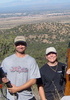
I headed-out in the early afternoon - hoping for a seasonally predictable Chubasco overcast to mute the ultra-violet - and got exactly what I'd hoped for! An auspiciously timed, most excellent cloud bank filtered the solar intensity and adding so much to the day's aesthetic (not so great for cell phone camera photos). The rumbling thunder went on-and-on for hours with just a bit of rain here and there - the world stopped for an unknown quantity of time - it was just the deer and I in afternoon twilight, along with the intervalic reverberation of the atmosphere echoing off the range now and then. I made my way up past a couple of grave sites that helped add to the aura of the spellbound hike that the day had brought. I had not thought much about this route as a hike, and was pleasantly surprised over and over again. Two-and-a-half miles in from the trailhead, I found the Pomona Mine Trail #116. This was the spur route I'd sought and the spell was broken as a true double-track mining route (reminded me somewhat of mining roads in the Dragoons) and the 1,000+ FPM elevation gain now began. This was an enjoyable contrast as it brought the surrounding area into full panoramic viewing quickly. I made my way up a mile to just before the Tungsten tailing pile, and rested for a while before the journey back down. Evidence of Bears on Pomona Mine Trail is obvious, but not overwhelming. Slowly is how one descends Pomona Mine Trail. I was pleased that I managed to stay upright the entire way down. Upon reconnoitering Brown Canyon Trail, I literally flew back down the canyon so I might to poke about the area of the ranch house on my way out...

Brown Canyon Ranch was built a century ago by a local pioneer family and includes their ranch house, storeroom, corrals, water system, and a pond that is the habitat of an endangered frog species. The property in Brown Canyon was first permanently occupied by John Thomas Brown and his family who settled there around 1800. It passed through the hands of other users during the latter part of the 19th century until the house was built by James and Tom Haverty between 1905 and 1907. James and his wife, Lessie, homesteaded the ranch in 1912 and owned the property until 1921, when they sold it to William and Margaret Carmichael. The Carmichaels were major land owners and significant philanthropists in early Sierra Vista. During their ownership, Harvey James, the owner of several mining claims up Brown Canyon, and who lived way up in the canyon in the summer, sometimes rented the house in the winter. He and his wife would often invite friends to the ranch for a social potluck and dance in the living room. Also during the time of the Carmichaels, a Yaqui Indian named Chico Romero lived there with his wife and daughters. In 1946, the Carmichaels sold the ranch to Roy and Stella Rambo, who operated it as a cattle ranch. They in turn sold the property to Samuel and Cecile Barchas in 1957, together with their additional ranch holdings across South Highway 92 (OY Ranch). The Barchas family did not live at Brown Canyon, but in a stone house at OY Ranch. Sarah Barchas obtained Brown Canyon Ranch through gift deeds from her parents in 1960 and 1961 and she owned the site until 1997. Brown Canyon Ranch is also known as the Barchas Ranch and was acquired by the USDA Forest Service in a land exchange in 1998. The Ranch is currently under renovation, but is open to walk around the property. Source: Friends of the Brown Canyon Ranch

MTB Notes: Going clockwise from the trail head up Ramsey Canyon Road for a steep technical climb and a gradual downhill, or go counterclockwise for a gradual rocky climb and a very fast downhill taking you back to Brown Canyon Rd. Trail ranges from wide trail to tight single track throughout. Beware of the loose rock on a lot of the trail and some soft sand near the TH - about the best in Sierra Vista. Definitely not for beginners...

AEG 2294'- FPM 302' - Grade 12.6% GPS Route Available
_____________________
The MaNtiS - Assume & be Damned!
http://www.mavm.com
 
Nov 28 2008
avatar

 Photos 16
 Triplogs 4

male
 Joined Sep 14 2008
 Mesa, az
Pomona Mine Trail #116Tucson, AZ
Tucson, AZ
Hiking avatar Nov 28 2008
mcolson6Triplogs 4
Hiking1.45 Miles 1,650 AEG
Hiking1.45 Miles   4 Hrs      0.36 mph
1,650 ft AEG
 no routes
Linked   none no linked trail guides
Partners none no partners
Decided to give my youngest daughter something worth remembering this year that was different from the same o' movie theater adventures she's been stuck with living in the city. This year I took her up the Old Pomona Mine Trail I hiked many times as a kid. I had hiked it last year with my wife on a semi-day hike with little water and little food, this time I was planning to stay a couple days at the top, and unfortunately there is no reliable source of water, which meant a heavy pack.

Going a little over a mile with a gain of about 2000ft on a overgrown path next to a steep cliff was more than I remembered, but was soon reminded as the pack got heavier and heavier. I was impressed with how well she was doing, except for the constant- " are you sure this is a trail, this is not a trail, we're lost". Once to the top took multiple pictures and set up camp. Nice and cold as the Thanksgiving storm cleared out and the temperature dropped leaving everything frosted over nice in the morning.

The next day we decided to head down to allow better hunting since the deer had moved out due to lack of a good rainy season. Overall a good hike, green from recent rain, lots of bear scat, looking at the old mine, cable trolley, house, water filtration systems, flat top engine blocks, pulley systems, really makes you wonder what it was like. Once again being able to complete the journey was a great achievement, but to share it with someone who can really look back on it a something unique for her accomplishments makes it that much better.
_____________________
Don't Eat Yellow Snow....
 
Sep 14 2008
avatar

 Photos 16
 Triplogs 4

male
 Joined Sep 14 2008
 Mesa, az
Pomona Mine Trail #116Tucson, AZ
Tucson, AZ
Hiking avatar Sep 14 2008
mcolson6Triplogs 4
Hiking1.75 Miles 2,000 AEG
Hiking1.75 Miles   3 Hrs      0.58 mph
2,000 ft AEG
 no routes
Linked   none no linked trail guides
Partners none no partners
:sweat: Interesting history and structures at above mine. Old forest service heli-pad also at saddle above mine. Steep grade all the way. Nice overlook at top. Watch where you roam, Ft. Huachuca boundry just North and West of mine. Seeing the cable trolly and old house at the top are excellent. I Entered differant directions on how to get to the trailhead, but they did not post. Lower portion of Brown Canyon is very popular for walking, this would be quite a step up. :)
_____________________
Don't Eat Yellow Snow....
  1 archive
average hiking speed 1.96 mph

WARNING! Hiking and outdoor related sports can be dangerous. Be responsible and prepare for the trip. Study the area you are entering and plan accordingly. Dress for the current and unexpected weather changes. Take plenty of water. Never go alone. Make an itinerary with your plan(s), route(s), destination(s) and expected return time. Give your itinerary to trusted family and/or friends.

helpcommentissue

end of page marker