username
X
password
register
for free!
help
ArticlesGuidesRoutes
 
Photosets
 
 Comments
triplogs   photosets   labels comments more
Dixon Lewis Trail - Fossil Creek Waterfall - 14 members in 43 triplogs have rated this an average 3.9 ( 1 to 5 best )
1, 2, 3  Next
43 triplogs
login for filter options
Nov 23 2024
avatar

 Guides 4
 Routes 491
 Photos 10,890
 Triplogs 1,257

55 male
 Joined Nov 20 2012
 Phoenix, AZ
Fossil hell, AZ 
Fossil hell, AZ
 
Hiking avatar Nov 23 2024
BiFrostTriplogs 1,257
Hiking12.28 Miles 1,841 AEG
Hiking12.28 Miles   7 Hrs   34 Mns   2.10 mph
1,841 ft AEG   1 Hour   43 Mns Break
 no routes
1st trip
Partners partners
chumley
First time in Fossil Creek so when Chumley suggested it sounded good. His triplog is a very good description of how the trip went. After walking the trail to the damn and checking out the Fossil Creek springs source it was time to venture off trail down canyon.

I'm not going to rehash all the details that Chumley described but after we were cliffed out during the off trail our progress came to a halt. As mentioned it took almost an hour to travel 500 feet in the canyon. However, about 15 minutes of that time was spent at the bottom of the ravine checking to make sure I was still able to walk after the mishap down the slope.

After the ravine experience it was decided we should just bail on the off trail and head back to the real trail. Of course we had to cross the creek which was a swim but the water was not that cold. The brush was thick but managed to forge the jungle and make it through to the other side and eventually the trail.

Followed the trail down to the where we again went off trail to link up with the waterfall. Waterfall was nice and nobody around since it was about 430 by that time. Enjoyed a well earned beverage at the waterfall before finishing off the hike on trail back to the vehicle!
foliage observationfoliage observationfoliage observationfoliage observationfoliage observation
Autumn Foliage Observation Moderate
_____________________
  1 archive
Nov 23 2024
avatar

 Guides 94
 Routes 840
 Photos 22,055
 Triplogs 1,993

52 male
 Joined Sep 18 2002
 Tempe, AZ
Fossil hell, AZ 
Fossil hell, AZ
 
Hiking avatar Nov 23 2024
chumleyTriplogs 1,993
Hiking12.28 Miles 1,841 AEG
Hiking12.28 Miles   7 Hrs   34 Mns   2.10 mph
1,841 ft AEG   1 Hour   43 Mns Break
 
1st trip
Partners partners
BiFrost
Route Scout Route Recorded  on Route Scout | Pop | Map | Popup | MapDEX
Yeah, so.

I hadn't been to Fossil since the Backbone Fire of 2021, and somehow Karl had never been anywhere near here ever. Making a loop of the flume, Bob Bear, and 708 seemed to be an awful lot of boring road walking, and I wondered if it wouldn't be more fun to head up flume and make an off-trail route along the creek from the dam back down to the waterfall. The off-trail is only about 2.5 miles after all.

Out of the 12,000 fossil area triplogs on HAZ, there was only a single one that reported having done this before. Over a decade ago, toddak reported having canyoneered downstream from the dam. His post seemed to provide evidence of survival.

Except for the technical things, some of the higher mileage things, the cycling, or climbing Eagletail Peak, I'm usually comfortable doing things that toddak has done. But I still messaged a handful of the more adventurous people I know to ask if anybody knows why it seems to be so infrequently traveled. After all, who doesn't like following the watery rim canyons in Arizona? Sycamore, West Fork, Woods, Wet Beaver, West Clear, East Verde, Real Verde, Tonto, Haigler, Canyon, etc. They all have ample detailed reports of passage. But not Fossil.

So we set off on a lovely late-November day. The last time I hiked the flume road there was an actual flume here. Seeing how nicely APS crews had dismantled and removed this historic infrastructure was simultaneously impressive and a little sad. I'm glad I got to see it 20 years ago when it was still in use. It probably would have burned 3 years ago anyway.

We made quick time to the dam and I took Karl on a tour of some highlights in the spring area. A handful of people were hanging out at the dam, the only others we encountered today.

My map recon led me to believe that the best route to head downstream would be on the south side of the creek, so I knew we would want to cross somewhere early in our adventure. This is where the day took a turn.

There are no easy routes to reach the creek. It is surrounded by some of the most dense flora that I've encountered in Arizona. There are the intertwined thickets of thorny shrub that literally cannot be penetrated short of leading with electric hedge trimmers. Then there are the forests of reeds. These can sort of be pushed through by a determined soul with some serious effort, and indicate shallower water as they tend to grow on the travertine dams or shorelines.

Speaking of travertine dams, they're very cool. And high. And what that means is that they create some impressively deep pools behind them. These are all mandatory swimmers. There is no shallow wading here. And these dams are beautiful living gardens, untouched by the feet of visitors like they are far downstream. So they're difficult to see and cross. And there are treacherous mysteries and surprise plunge pools waiting at every turn. But the water is crystal clear with a touch of aqua. Visibility to the sandy bottom a dozen feet down is really special.

I found a thicket of something partially penetrable on the opposite shore where I was somehow able to fight through to dry ground. I had lost Karl along the way. After a few minutes we made shouting contact and I spent the next 10 minutes trying to direct him through the mess to get to me. There was crawling involved.

Finally across the creek it was time to turn downstream. In under 50 yards pushing through the shoreline hell we got cliffed out. There was no way we would turn around and attempt to cross back over.

The only option was up. And it was awful. After what was apparently less than 200 feet of near-vertical scree, dirt, ash, and locust we found ourselves on a high slope above the creek. All of this is just 3 years out of the Backbone burn so the locust and other shrub was reasonably avoidable with a pinball maze of routefinding. We headed back down toward the lower bench immediately above the creek hoping to find some wildlife routes that might be typical in similar terrain elsewhere in the state.

Nope. That wasn't to be. More locust. Occasional bonus catclaw, and not a chance in hell of dropping down the final 20 feet to the creekside wall of not-gonna-get-through-it. So we headed back up again, figuring our route downstream would have to stay up 100+ feet above the creek in the burned former juniper range.

This seemed to be going ok until we reached a drainage that was barely visible on topo but looked a lot like Grapevine Creek or any of the other Grand Canyon side drainages that the Tonto Trail goes around. There was no crossing it. So we started heading up canyon to get around it. And then we stopped.

This is just stupid. What the hell are we doing?

The flume road was nicely visible just across the valley and we decided getting to it was the best option. We knew it would suck to get to it. And it did. From when we decided to bail, it took 55 minutes to move 500 feet.

Along the way, Karl took a 25 foot tumble down a 60 degree slope, stopped by the boulders at the bottom of a ravine. The button almost got pushed. Somehow the things that hurt all still worked the way they were supposed to and we got back to making our way toward the creek -- and the flume road on the other side.

Have I mentioned Arizona Grape yet? At least it's not thorny. But those vines will grab you for miles. There is no pushing through them. We found a pool with a boulder on the opposite shore. Finally a possible landing on the other side of the creek. No attempts at staying dry were made. It was a thankfully pleasant day and we knew the flume road would have plenty of afternoon sun, so in we went. The boulder gave us a chance to regroup for the next 10 yards which would take its toll before pushing out into delightful burned desert scrub. Cockleburs and catclaw and whatever that grass crap is that will never come out of my socks have never been so welcomed. The road was only a 50 foot climb above us.

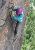
Karl wasn't complaining too bad, and I was surprised that I was able to convince him to take the LPtrekkinEagleJoe route down to the creek near the waterfall. After all he'd never been here before. He HAD to see the waterfall, right?

It was almost dark. There was nobody else in the canyon anymore. We enjoyed a beer. It was EARNED! Amazingly it hadn't exploded during the fall or other pumpkintery today. It was nice to be on the very-well traveled Dixon trail as daylight waned. It got cold. It probably would have helped if I wasn't soaking wet from getting in the water at the falls. #doinitforthegram ;)

Oh, and the road back to the 260 is currently in the most miserable washboard shape I have recently experienced. 14 miles of bone-jarring vibrations. It would have destroyed a bobblehead mounted to the dash.

So. In review: No. You can't hike downstream from the dam to the waterfall. Don't bother trying.

* It might be fun to attempt a swim/float/paddle in warmer months. But I think you would be in the water 90% of the time.
 Culture
 Culture [ checklist ]
[ checklist ]  Old Rusty Stuff
foliage observationfoliage observationfoliage observationfoliage observationfoliage observation
Autumn Foliage Observation Moderate

water 1 out of 5water 2 out of 5water 3 out of 5water 4 out of 5 Fossil Springs Gallon + per minute Gallon + per minute
_____________________
I'm not sure what my spirit animal is, but I'm confident it has rabies.
 
Oct 25 2024
avatar

 Guides 170
 Routes 148
 Photos 5,914
 Triplogs 2,097

48 male
 Joined Apr 12 2004
 Tucson, AZ
Dixon Lewis Trail - Fossil Creek WaterfallCamp Verde, AZ
Camp Verde, AZ
Hiking avatar Oct 25 2024
PrestonSandsTriplogs 2,097
Hiking2.65 Miles 275 AEG
Hiking2.65 Miles
275 ft AEG
 no routesno photosets
1st trip
Linked   none no linked trail guides
Partners partners
Chapman
jtaylor
Fossil Creek day trip with Jason, John and his sons, and 2 other friends. We left the valley at 6:30 am and took the hideously wash-boardy road into Fossil Creek canyon, regrouping at the trailhead. Easy hike in to the waterfall area where the trail appears to end. Jason and I climbed up the little cliff and explored a bit further. Not many people on the trail or pools, mostly older hikers. Had some swimming time in the big pool, lunch, and then started back. Closer to the trailhead we stopped at a small, deep pool where we all had some quality rope swinging, like we used to do at Fossil Creek in our youth. Nice to see John’s sons, the “next generation”, enjoying the rope swing. Headed back to Phoenix mid-afternoon. Nice to visit Fossil Creek again, it had been 20 years since John and I had last been.
_____________________
"…you never know when a hike might break out" -Jim Gaffigan
 
Dec 02 2023
avatar

 Routes 386
 Photos 49
 Triplogs 792

43 female
 Joined Jun 23 2015
 Phoenix, AZ
Dixon Lewis Trail - Fossil Creek WaterfallCamp Verde, AZ
Camp Verde, AZ
Hiking avatar Dec 02 2023
emilystardustTriplogs 792
Hiking2.42 Miles 290 AEG
Hiking2.42 Miles   1 Hour   46 Mns   1.99 mph
290 ft AEG      33 Mns Break
 no routesno photosets
Linked   none no linked trail guides
Partners none no partners
_____________________
 
Jun 11 2021
avatar

 Guides 2
 Routes 25
 Photos 1,890
 Triplogs 604

41 male
 Joined Sep 13 2009
 Mesa, AZ
Dixon Lewis Trail - Fossil Creek WaterfallCamp Verde, AZ
Camp Verde, AZ
Hiking avatar Jun 11 2021
jochalTriplogs 604
Hiking2.20 Miles 210 AEG
Hiking2.20 Miles
210 ft AEG
 no routes
Linked   none no linked trail guides
Partners none no partners
_____________________
 
Aug 22 2020
avatar

 Guides 33
 Routes 286
 Photos 445
 Triplogs 251

35 male
 Joined Oct 23 2017
 Tempe
Dixon Lewis Trail - Fossil Creek WaterfallCamp Verde, AZ
Camp Verde, AZ
Hiking avatar Aug 22 2020
KingLeonidasTriplogs 251
Hiking2.48 Miles 249 AEG
Hiking2.48 Miles   1 Hour   40 Mns   1.91 mph
249 ft AEG      22 Mns Break12 LBS Pack
 
no photosets
1st trip
Linked   none no linked trail guides
Partners none no partners
Route Scout Route Recorded  on Route Scout | Pop | Map | Popup | MapDEX
Hiked Waterfall Trail at Fossil Creek with my wife.

We finally got around to seeing Fossil Creek, it did not disappoint!

Permits seem to be a hot commodity, we were able to get some by logging in to recreation.gov the morning they became available and got one without much difficulty, the permit was $6.

The drive in was several miles of forest road. It was listed as high clearance recommended but a regular car could have made it at least to the Fossil Creek Bridge without any trouble (we were in fact followed out by a sedan). There is a fairly rough patch after the ridge but it it was no problem for a small 2wd pickup.

Permit enforcement was pretty strict, there were 2 sets of rangers you had to present your permits to in order to get in.

We parked at the 2nd parking lot and walked to the 1/4 mile to the trailhead from there.

The trail is short and partially shaded with trees. Along the way there are several spots where the creek is visible and accessible as tranquil swimming holes and small waterfalls of various sorts. As the day progressed more and more of these became occupied. The trail was mostly sandy with a large bolder wash section and a few log bridges over muddy sections. Following the creek made navigation trivial.

At the end of the trail is a 10-15' high waterfall which had a large pool and a grotto. This was the most popular place to hang out and it was well populated but not too crowded. The pool at the base of the waterfall was large and deep enough for swimming, there was a current but it didn't seem to be terribly strong. The grotto could be accessed along the right hand side by traversing along the travertine slick rock. Water shoes with good traction were a great asset for reaching this spot. I wouldn't try to access it by swimming, the current seemed to be pulling towards the falls in this area...

The waterfall is also a popular spot for cliff jumping, popular enough to warrant a permanent sign warning of possible underwater hazards. As far as cliff jumping spots go it is pretty good. Getting to the top is done by a quick and relatively easy scramble, even with wet feet, up some rocks on the right hand side. The height of the cliff is moderate and the target area is pretty large, it was very deep and not hard to hit. You aren't threading the needle as is sometimes necessary at places like "The Crack" or having to fight the current as is necessary at "Secret Falls". The creek level was relatively low when we were there, maybe 6" above average summer minimums at 3' of depth (at least according to the Verde River Hydrograph).

This was a good "hang out at the swimming hole all day" sort of spot and is the easiest one to get to (that I know of) in Arizona. This is probably why it is so popular and needs a permit system to keep from getting overused. I would definitely do it again and plan to stay longer.

Hike Video:
[ youtube video ]
_____________________
  3 archives
Sep 08 2019
avatar

 Guides 1
 Routes 1
 Photos 17
 Triplogs 17

31 male
 Joined May 28 2019
 Phoenix
Dixon Lewis Trail - Fossil Creek WaterfallCamp Verde, AZ
Camp Verde, AZ
Hiking avatar Sep 08 2019
jregan0502Triplogs 17
Hiking2.20 Miles 210 AEG
Hiking2.20 Miles   1 Hour      2.20 mph
210 ft AEG
 no routesno photosets
Linked   none no linked trail guides
Partners none no partners
Took a friend from Phoenix up to Fossil Creek for the day. Easy hike from Parking at Tonto Bench. Note that there were a lot of folks with off-leash dogs on the trail... two problems with that: 1) Those dogs were 100% not trained. 2) We came across a Diamondback crossing the road and a guys dog took interest in it off-leash so we had to hold it down until the owner could come up the 300ft he was behind his dog. KEEP YOUR DOG ON A LEASH.
 
Jul 20 2019
avatar

 Guides 1
 Routes 1
 Photos 17
 Triplogs 17

31 male
 Joined May 28 2019
 Phoenix
Dixon Lewis Trail - Fossil Creek WaterfallCamp Verde, AZ
Camp Verde, AZ
Hiking avatar Jul 20 2019
jregan0502Triplogs 17
Hiking2.20 Miles 210 AEG
Hiking2.20 Miles   1 Hour      2.20 mph
210 ft AEG
 no routesno photosets
Linked   none no linked trail guides
Partners none no partners
Absolutely love the permit system that the Forest Service has implemented at Fossil Creek. Took a day trip up with some friends and their dog, Wilbur. Walked about 20 minutes in and pulled off at a pool 1/4 mile from the waterfall where there was a tree to jump off and a nice sandbar to sit on in the sun. Great spot for dogs as there is no abrupt drop-off into the pool. Headed up to the waterfall and bruised my tailbone on the highest jumping spot, couldn't get my damn legs underneath me!
 
Nov 16 2018
avatar

 Routes 297
 Photos 6,928
 Triplogs 552

49 male
 Joined Dec 30 2007
 Avondale,Az
Dixon Lewis Trail - Fossil Creek WaterfallCamp Verde, AZ
Camp Verde, AZ
Hiking avatar Nov 16 2018
StoicTriplogs 552
Hiking2.20 Miles 210 AEG
Hiking2.20 Miles   2 Hrs      2.20 mph
210 ft AEG   1 Hour    Break
 no routes
Linked   none no linked trail guides
Partners none no partners
Some friends from California spend a few days camping in the Sedona area. I joined them for a day and showed them some sites around the Verde Valley Area. We checked out Montezuma's Well, Montezuma's Castle, Fossil Creak and camped at the Child's Campground.
_____________________
 
Oct 06 2018
avatar

 Routes 137
 Photos 1
 Triplogs 105

44 female
 Joined Oct 21 2016
 Tempe, AZ
Flume TrailCamp Verde, AZ
Camp Verde, AZ
Hiking avatar Oct 06 2018
MAPTriplogs 105
Hiking8.10 Miles 1,180 AEG
Hiking8.10 Miles      20 Mns   24.30 mph
1,180 ft AEG
 
no photosets
1st trip
Partners none no partners
Highly recommend doing the whole loop! The Fossil Creek Trail from Strawberry is really cool. I used to drive down Fossil Creek Rd years ago when there were no permits and only maybe a few other people down at the FC waterfall. That is definitely not the case anymore. :o I'm happy they closed the road though because the hike is waaaay better. Fossil Creak Trail goes down to the less populated springs and from there connects with the Flume Trail. The Flume Trail is cool because you can see down to the creek and all the smaller turquoise waterfalls along the way. There's no access to the creek from the Flume Trail and it's a pretty steep drop down pretty much the whole way. Caution about attempting the Flume Trail when it is warmer out because it is not shaded and no water access. The Flume Trail eventually drops down to FC waterfall where the hoards of people hang out. Seriously, it's a madhouse down there and looks MUCH different from 8-10 years ago which seems like somewhat of a short time for so much change. We hiked back up Fossil Creek Rd and see why it is closed now. It was always treacherous but there are whole chunks of road missing now. Also, at the turn near the top you can see a bunch of cars that didn't make the turn and went over the edge. Yikes! Pretty crazy to see. Oh and we also saw a bunch of coatis near the springs from the Fossil Creek Trail! Very cool! :)
_____________________
 
May 20 2018
avatar

 Photos 377
 Triplogs 579

female
 Joined Jun 19 2009
 AZ
Dixon Lewis Trail - Fossil Creek WaterfallCamp Verde, AZ
Camp Verde, AZ
Rafting avatar May 20 2018
oceanwithinTriplogs 579
Rafting2.20 Miles 210 AEG
Rafting2.20 Miles
210 ft AEG
 no routesno photosets
1st trip
Linked   none no linked trail guides
Partners none no partners
A beautiful day to packraft off some waterfalls. :y:

**Helmets, PFDs and packrafts you don't mind shredding are required**
_____________________
  3 archives
May 03 2018
avatar

 Routes 297
 Photos 6,928
 Triplogs 552

49 male
 Joined Dec 30 2007
 Avondale,Az
Dixon Lewis Trail - Fossil Creek WaterfallCamp Verde, AZ
Camp Verde, AZ
Hiking avatar May 03 2018
StoicTriplogs 552
Hiking3.00 Miles 210 AEG
Hiking3.00 Miles   4 Hrs   30 Mns   1.09 mph
210 ft AEG   1 Hour   45 Mns Break
 no routes
Linked   none no linked trail guides
Partners none no partners
Took the pups and and 2 friends out the waterfall.
_____________________
 
Mar 17 2018
avatar

 Guides 41
 Routes 1,626
 Photos 14,983
 Triplogs 2,762

69 male
 Joined Jan 20 2009
 Far NE Phoenix,
Fossil Springs Loop, AZ 
Fossil Springs Loop, AZ
 
Hiking avatar Mar 17 2018
The_EagleTriplogs 2,762
Hiking14.02 Miles 2,596 AEG
Hiking14.02 Miles   6 Hrs   35 Mns   2.34 mph
2,596 ft AEG      35 Mns Break
 
Up in Pine with one of my sons for the weekend. He'd never been to Fossil Springs before and this one fit the bill perfectly.

We got this in before the permit system starts again on April 1st.

It was cool enough to keep the crowds down, not not cold enough to keep people from swimming. There was even a guy that was just finishing up in a wet suit and an air tank at the waterfall off the Waterfall Trail.

Beautiful clear skies with puffy Fraley's. We hiked the CCW route, opting for the steady climb to finish.

The Dam Waterfall Area
[ youtube video ]

Slow Motion Waterfall off the Waterfall Trail
[ youtube video ]


water 1 out of 5water 2 out of 5water 3 out of 5water 4 out of 5 Fossil Springs Gallon + per minute Gallon + per minute
Unlikely to ever dry up in my lifetime
_____________________
There is a very fine line between "hobby" and "mental illness."
Dave Barry 🦅
 
Nov 09 2017
avatar

 Guides 1
 Routes 38
 Photos 3,193
 Triplogs 467

55 male
 Joined Jul 26 2008
 San Tan Valley,
Dixon Lewis Trail - Fossil Creek WaterfallCamp Verde, AZ
Camp Verde, AZ
Hiking avatar Nov 09 2017
TheNaviG8RTriplogs 467
Hiking3.10 Miles 210 AEG
Hiking3.10 Miles
210 ft AEG
 no routes
1st trip
Linked   none no linked trail guides
Partners none no partners
 Culture
 Culture [ checklist ]
[ checklist ]  HAZ Rides
_____________________
 
Jul 05 2017
avatar

 Guides 3
 Routes 632
 Photos 8,235
 Triplogs 604

54 male
 Joined Apr 13 2011
 Gilbert, AZ
Dixon Lewis Trail - Fossil Creek WaterfallCamp Verde, AZ
Camp Verde, AZ
Hiking avatar Jul 05 2017
ddgrunningTriplogs 604
Hiking4.00 Miles 210 AEG
Hiking4.00 Miles
210 ft AEG
 no routes
1st trip
Linked   none no linked trail guides
Partners none no partners
My second daughter came home from college for the 4th of July weekend. Heading back up to school tomorrow, so we decided to end her visit by getting out and enjoying some AZ outdoors! I got a parking permit a couple of weeks ago, but not soon enough to get the closest parking area. No big deal. We just hiked the road from the Tonto Bench parking area.

Left Phoenix at 6 a.m., and were the third car in at the permit area, according to the ranger. The early start meant we only had to share the waterfall with one other couple, until we had had most of our fun. By the time we were leaving, the place was crawling with humanity.

On our way back, we stopped and enjoyed several of the swimming holes and rope swings.

Looks to me like the permit system is helping keep the place cleaner, as we saw little trash along the trail :y:

A beautiful place. We will be back and next time bring some goggles for clearer vision under water, and hiking poles to help navigate along the creek itself.

Good times with the family!
 Culture
 Culture [ checklist ]
[ checklist ]  HAZ - Selfie
_____________________
 
Dec 04 2016
avatar

 Guides 94
 Routes 840
 Photos 22,055
 Triplogs 1,993

52 male
 Joined Sep 18 2002
 Tempe, AZ
Dixon Lewis Trail - Fossil Creek WaterfallCamp Verde, AZ
Camp Verde, AZ
Hiking avatar Dec 04 2016
chumleyTriplogs 1,993
Hiking3.79 Miles 424 AEG
Hiking3.79 Miles   4 Hrs   12 Mns   1.56 mph
424 ft AEG   1 Hour   46 Mns Break
 
Linked   none no linked trail guides
Partners partners
pyro4lif
After seeing Arnett Creek was a week or two behind normal, I figured that some higher elevation spots that I had long-since written off might still have some color. Fossil Creek did not disappoint!

Apparently people don't normally think of swimming in December, but the springs produce water at 72 degrees year round, so the swimming was quite pleasant, though it was a little chilly in the shade once out of the water. Nonetheless, it's very nice to enjoy this area when there's nobody else around. We passed the four other people in the two other cars just as we were on our way in, and there wasn't a sign of anybody else all day. :y:

After a couple hours of of swimming and jumping, we took a leisurely photography tour on the way back to the truck and then stuck around until dark to get some late light photos. It was nice to meet Trish, and thank you to Brian for altering my plan of going to Snowbowl for the day, though I'm guessing it's the first time the FC parking lot had a vehicle with a snowboard on it. :)
foliage observationfoliage observationfoliage observationfoliage observationfoliage observation
Autumn Foliage Observation Moderate
About a week past peak, but still tons of color in the entire valley. Some cottonwoods were still at prime.
_____________________
I'm not sure what my spirit animal is, but I'm confident it has rabies.
 
Aug 21 2016
avatar

 Routes 8
 Photos 17
 Triplogs 12

36 male
 Joined Jan 27 2016
 Tempe, AZ
Dixon Lewis Trail - Fossil Creek WaterfallCamp Verde, AZ
Camp Verde, AZ
Hiking avatar Aug 21 2016
scikopasTriplogs 12
Hiking4.40 Miles 420 AEG
Hiking4.40 Miles
420 ft AEG
 no routesno photosets
1st trip
Linked   none no linked trail guides
Partners partners
zartunindi
This was a nice easy hike to fossil creek! I wanted to take the long trail, but for this trip our group decided to just have a fun relaxing day swimming and hanging out at the waterfall. We tried hiking further along the river after the waterfall to where I thought there might be a place to cross and met up with the flume trail, but it started to become tough going and I didn't want to mess stuff up by going off any already existing footpaths. Anyway, fun day hanging out with friends. The falls were quite busy, and we packed out a full bag of other people's garbage with us. I hope people start to respect this place a little more instead of treating it like a water park. I have high hopes for the new management proposals I've seen since.
_____________________
  1 archive
Jul 30 2016
avatar

 Photos 6
 Triplogs 1

female
 Joined Jul 26 2016
 Phoenix, AZ
Dixon Lewis Trail - Fossil Creek WaterfallCamp Verde, AZ
Camp Verde, AZ
Hiking avatar Jul 30 2016
SakebomberTriplogs 1
Hiking6.61 Miles 505 AEG
Hiking6.61 Miles
505 ft AEG
 no routes
1st trip
Linked   none no linked trail guides
Partners none no partners
Started at the Homestead parking area. Walked along the road to the waterfall trail, approx 2 miles (next time I'd walk along the creek in the shade), and then the waterfall trail until it's end. Humid but pretty!
_____________________
 
Jul 14 2016
avatar

 Routes 386
 Photos 49
 Triplogs 792

43 female
 Joined Jun 23 2015
 Phoenix, AZ
Dixon Lewis Trail - Fossil Creek WaterfallCamp Verde, AZ
Camp Verde, AZ
Hiking avatar Jul 14 2016
emilystardustTriplogs 792
Hiking2.20 Miles 210 AEG
Hiking2.20 Miles
210 ft AEG
 no routesno photosets
Linked   none no linked trail guides
Partners none no partners
_____________________
 
Apr 22 2016
avatar

 Routes 54
 Photos 1,508
 Triplogs 325

39 male
 Joined Mar 18 2015
 Payson, AZ
Fossil Springs Loop, AZ 
Fossil Springs Loop, AZ
 
Hiking avatar Apr 22 2016
The_NTriplogs 325
Hiking13.65 Miles 2,790 AEG
Hiking13.65 Miles   5 Hrs   14 Mns   3.83 mph
2,790 ft AEG   1 Hour   40 Mns Break
 no routes
1st trip
Partners none no partners
I wanted to get in a visit to Fossil before the summer crowds. There were about 20 young boys getting ready in the parking lot so I boogied on down to get on some time at the falls before they arrived. It worked out well, it was just me and 3 small groups of lady day hikers at the falls. I swam, ate, swam again before heading on down the trail. Beyond the falls I only saw 2 hikers the entire time. I jogged a good portion of this. At the spot where I crossed the creek I made sure to jump in one last time before the hike out. A group appeared as I was getting out and I encouraged them to jump in, which they did. The wind and wet clothes made for a pleasant walk along the closed FR back to the TH. The sun was toasty but temps were not too hot, just warm enough to enjoy the water. Water temps were absolutely perfect. The area is surprisingly clean, for now. Didn't start noticing trash until hike out on the dirt road.
 Culture
 Culture [ checklist ]
[ checklist ]  HAZ - Hike HAZard
wildflower observationwildflower observationwildflower observationwildflower observationwildflower observation
Wildflowers Observation Moderate
_____________________
If there is no struggle, there is no progress.
  1 archive
average hiking speed 1.97 mph
1, 2, 3  Next

WARNING! Hiking and outdoor related sports can be dangerous. Be responsible and prepare for the trip. Study the area you are entering and plan accordingly. Dress for the current and unexpected weather changes. Take plenty of water. Never go alone. Make an itinerary with your plan(s), route(s), destination(s) and expected return time. Give your itinerary to trusted family and/or friends.

helpcommentissue

end of page marker