username
X
password
register
for free!
help
ArticlesGuidesRoutes
 
Photosets
 
 Comments
triplogs   photosets   labels comments more
Apache Creek Trail #9905 - 10 members in 24 triplogs have rated this an average 4 ( 1 to 5 best )
1, 2  Next
24 triplogs
login for filter options
Jan 06 2025
avatar

 Routes 1
 Photos 108
 Triplogs 11

32 male
 Joined Aug 16 2018
 MP, AZ
Graver Wash - Apache Creek - FR 95B - FR 95A, AZ 
Graver Wash - Apache Creek - FR 95B - FR 95A, AZ
 
Hiking avatar Jan 06 2025
OllieDoodTriplogs 11
Hiking14.61 Miles
Hiking14.61 Miles   6 Hrs   24 Mns   2.28 mph
 no routes
1st trip
Partners none no partners
I've been wanting to get out to Apache Creek for a while but I thought the access would be tricky due to the private property along Walnut Creek Rd. I came out here a few weeks prior and hiked up the hill in the northwest corner of the wilderness boundary but once the dogs and I got to the top, descending the steep, rocky, cactus covered south slope did not seem appealing. We ended up hiking along the South Fork of Walnut Creek which was beautiful and flowing nicely for most of its length. On the drive home I took a detour up FR 95 to see if there was access towards Apache Creek and check the road condition. FR 95 is in good condition and easily passible in a 2002 Honda CRV.

So I returned and was eager to explore Apache Creek. I parked at a small pullout (34.90213, -112.85529) off of FR 95A when the road became too rough. The short hike to the Graver Wash Trail and down the Graver Wash Trail to Apache Creek was filled with Pinyon Pine and was very pleasant. Apache Creek is the eastern boundary of the wilderness and gets lots of use from cattle ](*,) . I didn't see any cows on this day but we saw plenty of cow poop.

The Apache Creek trail crossed the creek several times but was never too hard to follow. Once the trail leaves the creek there is less sign of cattle use and more granite outcrops. We took a break on a large low angle granite slab right off the trail about a mile northeast of Granite Knob. There were great view of Juniper Mesa to the north, Walnut Creek and the ranches along it to the east, and Hyde Mountain to the south. There was more cattle sign near the south end of the trail as we neared Hyde Creek. We took FR 95B and 95A on the way back and saw Upper Hyde Spring. It's hard to miss since it is in the middle of FR 95B.
 Flora
 Flora [ checklist ]
[ checklist ]  One-seed Juniper
_____________________
On the first part of the journey
I was looking at all the life
There were plants and birds and rocks and things
There was sand and hills and rings
  3 archives
Oct 07 2022
avatar

 Routes 1
 Photos 21
 Triplogs 2

63 female
 Joined Sep 08 2015
 Phoenix, AZ
Apache Creek Trail #9905Prescott, AZ
Prescott, AZ
Backpack avatar Oct 07 2022
vscott1Triplogs 2
Backpack5.60 Miles 612 AEG
Backpack5.60 Miles
612 ft AEG
 
1st trip
Linked   none no linked trail guides
Partners none no partners
I have a high clearance vehicle but not 4WD so we made it fine using the directions from https://www.fs.usda.gov/recarea/prescot ... &actid=104 We opted to hike in on FR 95A which just added 1 mile to the trip.

Originally Lois and I were thinking of backpacking to Hutch's Pools near Sabino Canyon, Az. After reading some reviews we weren't super thrilled about it so we chose Apache Creek Wilderness. I'd never heard of Apache Creek Wilderness and it butts against the Prescott National Forest. I looked at Alltrails/RouteScout/Gaia maps, reviews, reports and The Prescott National Forest website. OK, feeling good about this choice! I download every map I find. Originally our plan was to do a loop. This isn't going to be a hard hike. Not a lot of AEG and only about 12 miles for a 3 day 2 night trip. Easy. After Lois and Cindy meet at my house, we decide to change our plan from a loop to, more of a base camp and and explore the creek, and then back out the same way. An out-n-back. Better option for sure! Temps were predicted to be 78/49 all days.
I love hiking with these girls. We stop often to look at plants, rocks or just anything interesting. It's not a rushed point to point trip. It's laid back and look around you kind of trip! And Apache Creek did not disappoint! It's a hidden flourishing, beautiful riparian area. Perennial water source and wildlife. No one else around this little treasure! We set up camp just up away from the creek. We expect rain on Saturday but hiking in on Friday after setting up camp, we got drizzled on. It was welcome and cooling. I'd forgotten that the full moon 🌔 is coming up so after dinner we were just admiring the sky. Not only was this close to the full moon, but also a meteor shower! Lois saw 2! 🌠
Saturday after breakfast we hike down the creek. Trail #9905 is the only maintained trail in the Apache Creek Wilderness area. But you must watch for the cairns! There is some overgrowth and areas of bushwacking but nothing we couldn't handle. The creek is beautiful and we stop and look around on this cliff admiring a waterfall. Lois says "A bear! A bear!" I look and see it's butt hightailing it out of there! HOW COOL (and yet scary at the same time)! 🐻 Later on down the trail Cindy sees a Javalina across the way. Just watching us. We boogie on down the trail. 😂 After lunch on the creek we head back to camp. We know there will be afternoon rains so we want to beat it. Once back at camp we huddle under an attempt of a shade/rain tarp. These trees SUCK! The ground was too soft for tent stakes so we attempted to hang it from tree branches. We rigged something up but none of us trusted it if a wind came up! 🤣 Back to Scouts camp for us! 🤦‍♀️ We stayed there until the wind came up and then ran to our tents! 🤣 Thunder is a beautiful sound as long as lightning isn't anywhere near you. It was nice. We don't experience a lot of rain in the desert, so this was fine. It cleared up pretty quick and we mirrored the evening before. It felt colder but we figured it was really just all the dampness that makes it feel colder.
Sunday we take our time and slowly break down camp. We hit the trail and the hike back to the vehicle was easy and cool in the shaded areas. We stop in Chino Valley for lunch and a celebratory drink! Cheers to another great backpacking trip!
foliage observationfoliage observationfoliage observationfoliage observationfoliage observation
Autumn Foliage Observation Isolated
Just starting to turn colors.

water 1 out of 5water 2 out of 5water 3 out of 5water 4 out of 5 Apache Creek Seep Gallon + per minute Gallon + per minute
Plenty of water in the entire creek.
_____________________
  1 archive
Apr 14 2022
avatar

 Guides 34
 Routes 138
 Photos 931
 Triplogs 111

68 male
 Joined Dec 26 2018
 Phoenix, AZ
Apache Creek Wild Explore, AZ 
Apache Creek Wild Explore, AZ
 
Backpack avatar Apr 14 2022
GrangerGuyTriplogs 111
Backpack23.60 Miles 2,750 AEG
Backpack23.60 Miles1 Day   5 Hrs   37 Mns   
2,750 ft AEG23 LBS Pack
 
1st trip
Partners none no partners
There are two ways to get to the Apache Creek Trail #9905. I drove to both ends to check them out, connecting by driving the length of FR95 which is a good road, but I was glad I had 4WD, as there are 4 running streams to cross.

You can start at the north end at the Graver Wash #9904 Trailhead. As indicated in previous reports, the last bit of FR95A is not very nice, but it was no problem in my Jeep Cherokee 4x4. Or you can start at the south end, from FR95B. The three miles of FR95B from Stringtown Wash to the trailhead would be possible but very challenging in my Cherokee 4x4. I think a stock Wrangler could do it no problem. I chose to walk it.

Walking in from Stringtown Wash, once you get to the intersection of FR95B/95A, the corner of the wilderness, the countryside becomes very pleasant. Upon entering the wilderness at the trailhead (there is a sign there now), it gets even better. In mid-April, there was filterable water in the stream at the trailhead.

Climbing to the first pass on trail #9905, I found the trail well marked by cairns, and the forest a pleasant mix of alligator juniper, prickly pear cactus, scrub oak, and pinyon pine. The trail drops to Apache Creek at 2.4 miles from the trailhead. There is good camping here and for the next mile or so along the trail.

I continued following the trail north, as it follows along the wilderness boundary. In mid-April, this section was OK, but not very exciting to me. It is a broad valley bottom, and spring does not seem to have arrived yet. The walking is easy, and there are many creek crossings. At the intersection with Graver Wash Trail #9904, I turned around and returned to the point where Apache Creek and the trail diverge.

This time I followed the creek off-trail upstream 0.7 miles to “The Swimmin’ Hole,” near which I spent a very pleasant no-trace night. In the morning I was serenaded by owls and woodpeckers. It was an easy off-trail route. Going upstream I stayed mostly to the north of the creek and going downstream I stayed mostly to the south of the creek. The going is much easier to the south of the creek.

On day 2, I hiked back out to my car, about 6.6 miles including FR95B.

I drove north on FR95, encountering 5 cattle who blocked the road and stared at me expectantly, as though I would offer them something to eat. After a couple gentle beeps of my horn, they wandered off. Coming around to the Graver Wash #9904 trailhead, I hiked down to the intersection with Apache Creek Trail, effectively closing the loop.

So, which is the best way to the middle? It is a tough call. I thought the scenery of coming in from the south superior to coming in from the north. However, coming in from the north is much easier, flatter hiking.
 Flora
 Flora [ checklist ]
[ checklist ]  Common Mullein
 Fauna
 Fauna [ checklist ]
[ checklist ]  Black Bear
wildflower observationwildflower observationwildflower observationwildflower observationwildflower observation
Wildflowers Observation Isolated
Nothing worth photographing.

water 1 out of 5water 2 out of 5water 3 out of 5water less than max Apache Creek - Apache Creek Wilderness Medium flow Medium flow
There was plenty of water in the creek almost everywhere, but it was easily crossed without getting wet.
 
Mar 23 2022
avatar

 Routes 154
 Photos 1,505
 Triplogs 266

31 male
 Joined Jun 02 2019
 Phoenix, AZ
Hyde Mountain Loop, AZ 
Hyde Mountain Loop, AZ
 
Hiking avatar Mar 23 2022
LJWTriplogs 266
Hiking26.51 Miles 3,707 AEG
Hiking26.51 Miles   10 Hrs   20 Mns   2.84 mph
3,707 ft AEG   1 Hour    Break
 
Route Scout Route Recorded  on Route Scout | Pop | Map | Popup | MapDEX
Thinning operations are taking place SW of the Hyde Mountain area around Camp Wood and Yolo Ranch. Thinning will be taking place for approximately two months, with logging traffic on the road. The closure area will spread north as thinning continues into the slated 627 acres. From now until monsoon season, I would consult PNF on closure status for accessing Apache Creek Wilderness.

Wanted to remix a hike from last year to include Apache Creek from the springs down, as well as try out an alternative ending using an old ranching track and Dead Steer Basin Trail. Got going with Stringtown Wash heading toward Hyde Mountain.

Memories of Stringtown only a year old undersold. Tight walls and a bed of slick rock in the middle turns into relaxing open pine forest on the upper end. Good flow of water where it mattered, some of the way it was underground. Catching the trail on the upper end from the creek bed is tricky.

Hyde Mountain trail rocky and loose to hazy views. Almost no snow left on the shady slopes. Down 7up to Browns Spring and then up to the saddle and onto Pinetop Mountain. Followed the fenceline up and found a gate on top near the end of the road. Delighted by the big junipers and pines on top. Easy road walk to Apache Springs.

Apache Creek along the trail is easy going, defined by the grassy meadows, open pine forest, and lazy creek flow. From the springs to that point it's a gnarly canyon of granite boulders and outcroppings, forested but with healthy undergrowth. Can follow the water down except for in several spots where the water pours off and work-arounds are necessary. Some scrambling, light bushwhacking. The best of the creek is above the trail.

The Upper Graver Wash/Apache Creek jct is grassy and could be confusing heading up. Graver and the way down Apache Creek Trail is obvious. Decided not to cut it short and went all the way down to Graver, then walked the road back to Upper Graver TH. To the east there is a corral and an obvious trail. The trail leads down into Hyde Creek and dead ends at another corral. At that point I went over the ridge and into Dead Steer Basin, where I found the trail.

Dead Steer Basin Trail is an old double/OHV track. It is less pretty than the trail to Hyde Creek; it got burned over pretty bad. It's easy to follow and in good shape until the last creek crossing near where I picked it up. Once to the TH and FR95, the diversion started to make sense. The rest of the roadwalking back to Stringtown is through some awesome forest. The new sections and route finding made for a more engaging but difficult way to end.
wildflower observationwildflower observationwildflower observationwildflower observationwildflower observation
Wildflowers Observation Isolated


water 1 out of 5water 2 out of 5water less than maxwater less than max Apache Springs Quart per minute Quart per minute
Total guess, good enough creek flow

water 1 out of 5water 2 out of 5water 3 out of 5water less than max Pinetop Trick Tank 51-75% full 51-75% full

water 1 out of 5water less than maxwater less than maxwater less than max Stringtown Wash Pools to trickle Pools to trickle
  3 archives
Apr 03 2021
avatar

 Guides 13
 Routes 38
 Photos 1,651
 Triplogs 577

60 male
 Joined Nov 15 2005
 Jackson, CA
Graver Wash Trail #9904 - Prescott NFPrescott, AZ
Prescott, AZ
Hiking avatar Apr 03 2021
toddakTriplogs 577
Hiking24.00 Miles 3,000 AEG
Hiking24.00 Miles   10 Hrs      2.40 mph
3,000 ft AEG
 no routes
1st trip
Long haul out to this area but worth it, thanks to @LJW for the recent report. I would have never thought anywhere in AZ could have this much flowing water right now, still don't know how the small, relatively low Santa Marias apparently stay relatively wet. No doubt I'll be back.

Parked about 3/4 mile from the trailhead, did the loop CCW. Apache Creek and the summit of Hyde Mtn are great, most of the road walking is not unpleasant. Stringtown from the west side follows the creek before climbing SE out of the drainage fairly close to the route shown on the FS map, and there is a decent path cut through the manzanita and pink ribbons help stay on track. Even so I eventually lost it, but easy to continue east to hit FR95.
_____________________
  1 archive
Apr 01 2021
avatar

 Routes 154
 Photos 1,505
 Triplogs 266

31 male
 Joined Jun 02 2019
 Phoenix, AZ
Hyde Mountain Loop, AZ 
Hyde Mountain Loop, AZ
 
Hiking avatar Apr 01 2021
LJWTriplogs 266
Hiking23.21 Miles 3,063 AEG
Hiking23.21 Miles   7 Hrs   49 Mns   3.17 mph
3,063 ft AEG      30 Mns Break
 
Route Scout Route Recorded  on Route Scout | Pop | Map | Popup | MapDEX
Original plan was to do a shuttle from Hyde Mountain through the full length of Apache Creek Trail with a stop at Granite Knob. Ended up solo, so I tried to come up with a loop and decided to forgo Granite Knob on account of the added miles. Came up with this one that starts at Stringtown Wash near the Camp Wood area and circles back using roads from the Graver Wash TH. Went clockwise around 8:15am.

FS maps show a road on the east side of the wash and the trail only going about half way through from the west. Figured it wouldn't be too much to work up the wash and connect them. Cows roam Stringtown, so there's all sorts of trails, almost to the point that the FS could just stick plastic cairns in the ground, update their maps, and call it a day. Ended up unexpectedly one of my favorite parts of the trip. There was water trickling through the wash, a few small cascades and a tiny waterfall. Nice forest of pine that gets nicer farther west. It is a little tricky to find where the trail picks up to the west, but if it comes down to it following the wash the whole way makes it to the road.

Brief road walk to Hyde Mountain Trail. Quickly works its way up to the summit. Rocky and loose in parts. Really nice views of Northern and Western AZ from the top.

Down the west side of the mountain the trail conditions are deteriorated but not too bad and it's easy to follow. Made it down to 95B and walked that to the upper Apache Creek TH. Really nice stretch of road through the pines. Goes along Hyde Creek, which had a light flow of water. Most every creek and drainage was flowing, and there was some snow left on the north side of Hyde Mountain.

Apache Creek Trail starts on the north end in a beautiful clearing in the pines. Not much in the way of parking or signage. There's a small wilderness sign that leads across the creek to the trail. Upper end is steep and the views are big and bouldery. Personal favorite stretch was everything after linking up with Apache Creek. Trail's in good shape, creek had a good flow of water. For a while it's all meadows and pines. The oaks have yet to regrow their leaves.

Graver Wash trail to swing back round. It had the only FS signage and register box by the TH of the trails I saw. It's in good shape and is a nice trail especially for the looping options it affords, but after Apache Creek it won't stop anybody in their tracks. 95A and 95B between the TH and Camp Wood are mighty rough. Road walk was frankly too long but gets good closer to Camp Wood where it enters the forest. Day ended up partly cloudy, low 40s to low 70s. Didn't see anyone on the hike.

water 1 out of 5water 2 out of 5water 3 out of 5water less than max Apache Creek Medium flow Medium flow

water 1 out of 5water 2 out of 5water less than maxwater less than max Brown Spring Quart per minute Quart per minute
A guess, but there was a light flow in the creek

water 1 out of 5water 2 out of 5water less than maxwater less than max Stringtown Wash Light flow Light flow
  4 archives
Mar 28 2021
avatar

 Routes 175
 Photos 2,335
 Triplogs 191

44 female
 Joined Jan 21 2019
 Pine, AZ
Apache Creek Trail #9905Prescott, AZ
Prescott, AZ
Hiking avatar Mar 28 2021
jillyonanadventureTriplogs 191
Hiking5.80 Miles 718 AEG
Hiking5.80 Miles   2 Hrs   55 Mns   2.00 mph
718 ft AEG      1 Min Break
 
1st trip
Linked   none no linked trail guides
Partners partners
jharvey33
Route Scout Route Recorded  on Route Scout | Pop | Map | Popup | MapDEX
Let me first say this road was INSANE. I decided to continue because I wanted to challenge myself, but it was super intimidating driving it. I was sideways, using literally every rock crawling function my vehicle has to offer after getting a bit stuck on some rocks. There were also some pretty deep water crossings that were questionable (but sooo fun to drive through! :y: ). We did finally make it ALL the way to the TH without damaging Tessa (well, she got more pinstripes for sure!). I couldn’t drive faster than 5 mph so it’s honestly probably better to just walk it at that point. The trail was nice, well defined with several cairns & no bushwhacking and that was pretty sweet! There’s a lot of interesting rock formations on either side of the trail and it’s very pleasant, easy walking downhill to the creek. We explored around the creek a bit and visited the spring as well. The water was flowing and clear, although much lower than other pics I’ve seen here. We hiked until the junction & then headed back the way we came. We were limited on time since we were hammocking & relaxing at camp in the morning, plus it took forever getting down the road, otherwise we would have continued to the larger swimming pool. Will need to revisit that one! Also should note there were a ton of fresh feline prints in the sand near water. We sadly did not see any bears. It’s a really nice wilderness area that I’d like to research a bit more and see what else it has to offer. Extremely peaceful out there without people though!

water 1 out of 5water less than maxwater less than maxwater less than max Pine Creek Seeps Dripping Dripping
water report recorded in the field on our app Route Scout
_____________________
Restless between adventures...
 
Oct 15 2020
avatar

 Routes 174
 Photos 471
 Triplogs 184

51 male
 Joined Mar 16 2019
 Phoenix
Apache Creek Trail #9905Prescott, AZ
Prescott, AZ
Hiking avatar Oct 15 2020
AugustWestTriplogs 184
Hiking10.26 Miles 628 AEG
Hiking10.26 Miles   4 Hrs   11 Mns   2.86 mph
628 ft AEG      36 Mns Break
 
1st trip
Route Scout Route Recorded  on Route Scout | Pop | Map | Popup | MapDEX
Nice day out in this beautiful and wild area. I was hoping for more water, but the only water I saw all day was at the first crossing of Apache Creek at the bottom of Graver Wash. The creek was flowing pretty nicely at that point and it instilled a sense of optimism that ended up in disappointment.

I started out on the Graver Wash TH off Forest Rd 95A at a little before 11. The temp was already up to 80 degrees. The only people I saw all day were on 95A. On the drive in a dog ran out from the forest barking at my truck. The Australian Shepherd had a hiking pack and its people ran out of the bush pretty quickly yelling at the pooch. It was a pretty random spot and I didn't see any cars around at all.

This is a trail that fit my lazy and lethargic mood perfectly. It is flat, partially shaded, easy to follow and forested most of the way. The pine, oak and walnut forest is healthy, mature and intermingled with interesting granite formations.

At the point where Apache Creek Trail turns away from the dry creek bed, I continued up the wash for about a half mile off trail. The search for water was fruitless. It is dry as a bone out here except for at the very start of the trail.

After making my way back to the path, I followed Upper Graver Wash trail back to 95A after about 1.25 miles. Upper Graver Wash has some interesting geology at the start. The road walk back to my truck wasn't bad at all. The temperature at my truck on the way out was up to 90.

The trail register at the start of Graver Wash has 17 entries since the beginning of May so this area is getting some use and the very easy follow tread is indicative of this.

The final mile or so of the ride to the TH was definitely high clearance, but I didn't feel that engaging the 4WD was necessary any point. Going any further past the trailhead on 95A could get squirrely without a well equipped offroad vehicle.
foliage observationfoliage observationfoliage observationfoliage observationfoliage observation
Autumn Foliage Observation Light
Some early yellows in the AZ Walnuts

water 1 out of 5water 2 out of 5water less than maxwater less than max Apache Creek - Apache Creek Wilderness Light flow Light flow
Good flow at the intersection of Graver Wash and Apache Creek Trails.
_____________________
Wildflower seed in the sand and wind
May the four winds blow you home again
 
Jul 15 2017
avatar

 Triplogs 6

49 male
 Joined Jul 15 2017
 Kingman, AZ
Apache Creek Trail #9905Prescott, AZ
Prescott, AZ
Hiking avatar Jul 15 2017
scottysnowskiTriplogs 6
Hiking6.00 Miles 612 AEG
Hiking6.00 Miles   4 Hrs      1.50 mph
612 ft AEG
 no routesno photosets
1st trip
Linked   none no linked trail guides
Partners none no partners
Getting to the trailhead takes a little work. It is really hidden away in the backcountry north of Prescott. A fun loop along the creek most of the way. Trail is not marked very well, if you lose track of the way, stop and look around. It shouldn't be too hard to find again. Water level was not very high when we did it (July) not a suprise. Enjoy the wilderness.
_____________________
 
Jan 18 2015
avatar

 Routes 2
 Photos 125
 Triplogs 20

45 female
 Joined Nov 19 2012
 Prescott, AZ
Upper Graver Apache Creek Loop, AZ 
Upper Graver Apache Creek Loop, AZ
 
Hiking avatar Jan 18 2015
bendorbreakTriplogs 20
Hiking7.20 Miles 540 AEG
Hiking7.20 Miles   3 Hrs   10 Mns   2.88 mph
540 ft AEG      40 Mns Break
 no routesno photosets
1st trip
Partners none no partners
Did this hike with a group of people. We made a loop using Upper Graver, Apache Creek, Graver Wash and FR95a for a total of 7.2 miles. Great day for a hike, the weather was perfect. The creek had more water in it than last time I was out there. I'm still itching to complete the rest of the Apache Creek Trail and find some water holes. Hurry up summer!!
_____________________
 
Oct 18 2014
avatar

 Routes 2
 Photos 125
 Triplogs 20

45 female
 Joined Nov 19 2012
 Prescott, AZ
Apache Creek Trail #9905Prescott, AZ
Prescott, AZ
Hiking avatar Oct 18 2014
bendorbreakTriplogs 20
Hiking6.00 Miles 612 AEG
Hiking6.00 Miles   3 Hrs   30 Mns   1.71 mph
612 ft AEG
 no routes
1st trip
Hiked a portion of this trail in conjunction with Upper and Lower Graver Wash Trails.

We started off at Lower Graver Wash Trail #9904 in the early afternoon. The trail was well marked with lots of cairns along the way. It was a bit rocky along the way but a nice easy trail that wound mostly downhill. After a mile we crossed Apache Creek and started onto Apache Creek Trail #9905. This trail seems to be a cow trail, and we were hiking behind a herd that kept running just a little ways ahead of us and stopping. It was rather amusing... except for the big bull that kept looking at us!! We stayed on this trail for only a couple miles and camped for the night just past the junction to Upper Graver Wash Trail #9906. In the morning we woke up and hiked out trail #9906 to FR95B, which we took back to our vehicle near the Trail for Lower Graver Wash. This was a pretty trail with water available along the way. Will probably do more hiking in this area, as there was much more to see. This time was a quick overnight, as it was my 9 year olds first time backpacking.
foliage observationfoliage observationfoliage observationfoliage observationfoliage observation
Autumn Foliage Observation Light
There were still a few trees changing, but many had lost leaves already.
_____________________
 
Sep 13 2014
avatar

 Guides 2
 Routes 10
 Photos 42
 Triplogs 893

58 male
 Joined Jul 12 2012
 Oro Valley, AZ
Apache Creek Trail #9905Prescott, AZ
Prescott, AZ
Hiking avatar Sep 13 2014
SpiderLegsTriplogs 893
Hiking13.00 Miles 2,172 AEG
Hiking13.00 Miles   6 Hrs      2.17 mph
2,172 ft AEG
 no routesno photosets
1st trip
Partners partners
FOTG
John9L
te_wa
tibber
HAZFest started off with some quick re-navigation out of town on Friday afternoon. Heading up I-17 and right around the Cactus exit the traffic report said that the freeway is closed up near Bumblebee for an accident. So told my co-pilot what do we want to do? Thought about going up and hoping for the best until we heard it was a motorcycle crash. Had about 5 minutes to make a decision and then Detour Dan said that the only way anyone is going north tonight is to head to Wickenburg and take the back way into Prescott. So what would have been a three hour trip turned into a 4 hour trip. Luckily we were the first car to take the detour and pretty much had no traffic to deal with up the climbs to Yarnell and near Wilhoit.

This was the hike of choice at HAZFest this year and it was a good one. Thanks to Chumley for suggesting the route and dropping us off at the beginning of the hike at the trailhead to Upper Graver Wash. First part of the route had us hiking through some rather gentle terrain and along Apache Creek. As Chumley put it, while you might not always be hiking in the shade, you are never more than a few feet from it.

About halfway through the hike it was time to go off trail and explore the swimming hole. Worked our way up the creek bed and the bushwacking wasn't too bad. Found the beach and swimming hole and stopped for our lunch. Grabbed a bite to eat and jumped into the water, took a few laps around the hole and came back to dry off. Then worked our way back to the main trail.

This is when things started to get interesting. Tibber mentioned the incoming clouds and how it might be nice to have a little cloud cover to hike under. She got her wish and the clouds rolled in along with huge raindrops, thunder & lightning. The next hour of the hike went through some beautiful country, but I was too cold and wet to really pay much attention. Nobody in our group seemed to pack rain gear so all of us were in the same boat. (However as a quick aside, guess I'm not the sharpest tool in the shed. When I unpacked my day pack to throw out on my porch to dry out I noticed that I did indeed have my heavy duty rainjacket stuffed at the bottom of my pack. Put it in my pack last month to do Humphrey's Peak and never took it out.)

One of the highlights of the trip was watching Lee's dogs Cupcake & Blanco providing us with amusement as they chased deer, squirrels, cows and other assorted wildlife. My current dog is pushing 15 years old and her hiking days are long over. So it was fun to have dogs tagging along with our group.

Last highlight of the trip was meeting up with Chumley and an ice chest of beer. Hiked the last half mile or so back into camp along with John with a cool malted beverage in my hand.

Overall a great area to explore and can't wait to go back up there.
_____________________
See my pics on Instagram @tucsonexplorer
 
Sep 13 2014
avatar

 Guides 94
 Routes 840
 Photos 22,055
 Triplogs 1,993

52 male
 Joined Sep 18 2002
 Tempe, AZ
Walnut Creek Exploration, AZ 
Walnut Creek Exploration, AZ
 
Hiking avatar Sep 13 2014
chumleyTriplogs 1,993
Hiking5.03 Miles 375 AEG
Hiking5.03 Miles   1 Hour   47 Mns   2.82 mph
375 ft AEG
 
1st trip
After dropping off the group at Graver Wash for their Apache Creek hike, I decided to further research access to this wilderness from the north. The forest service doesn't have any indication of access, but it is so close that I just had to try. After all, the drive to the Graver Wash trailhead really is quite a chore, and if you hike the 95A road, it adds unnecessary and boring miles.

I started at a nice turn out on FR95 at the east end of the valley, having previously seen an old roadbed that leads away from the Graver Wash trail just east of where it crosses Apache Creek. I got lost, turned around, chased by hungry horses, and eventually spotted by a farmhand working in the fields on a tractor.

I quickly continued to the west, over a route that was much longer than I had remembered or expected from looking at maps. Finally I reached the wilderness and decided to investigate the more direct route directly north to Walnut Creek Road to exit the wilderness. My map showed that I had just 1/4 of a mile of private property that needed to be crossed. To get there, I had to hike nearly half a mile along the wilderness fence line over a small hill.

From there, I passed through a gate and took the most direct route. I was back at the road in no time, but not before encountering some more horses as I got a bit closer to a corral and ranch home than I would have liked. I spent a little bit of time investigating better options before hiking the road back to my truck.

At no point did I see any No Trespassing or Private Property signs. Some of the gates did have locks on them though. I got home and did some research. Contact information for the ranch owners is easy to come by, and having been there once, I think that's by far the best course of action before the next visit.
_____________________
I'm not sure what my spirit animal is, but I'm confident it has rabies.
 
Sep 13 2014
avatar

 Guides 21
 Routes 1,182
 Photos 36,858
 Triplogs 1,570

69 female
 Joined Feb 26 2004
 Phoenix, AZ
Graver's Wash - Apache Creek - 95B&A&B, AZ 
Graver's Wash - Apache Creek - 95B&A&B, AZ
 
Hiking avatar Sep 13 2014
tibberTriplogs 1,570
Hiking15.10 Miles 1,705 AEG
Hiking15.10 Miles   7 Hrs   22 Mns   2.32 mph
1,705 ft AEG      52 Mns Break
 
1st trip
Partners partners
FOTG
John9L
SpiderLegs
te_wa
This hike was suggested by HAZ host Chumley (except for the 95A part; that was a detour I apparently decided to challenge my skills or lack thereof :roll: ). I uploaded the routes to Scout III, good thing too! Lesson One, when you have the option to load the waypoints, select YES! Based on the hike desc it is only a 5.6 mile hike. Apache Creek Trail is 5.6 mile hike but if you come in from the north, you have to hike Graver's Wash first and at the end you have to road walk about 3 miles to get to the other TH. Once we figured this all out before leaving from camp, we were good to go. Oh and on the way since Chumley thot a few of us would be hiking separately, he said be sure to take a left at the road.

It was a little warm and we got a bit of a late start but it was nice to hang around camp and take our time getting ready. Chumley was kind enough to shuttle us up to the northern TH. Once you turned on the road to the TH, it was more like driving a trail :o! He dropped us just slightly before the official start of Graver's Wash. We signed in and continued our way down the wash with great views of Juniper Mesa.

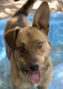
Soon some water and a creek came into view; the dogs promptly headed down and into the creek. We came to the area for us to step stone across. After making our way through some very tall green flora, we came to an open grassy plain reaching the Wilderness sign around 10:50. I decided this would be a great group photo and perhaps can be an addition to the Arizona Wilderness Brewery wall. I took a few of the folks and then decided we needed to have Blanco and Cup. I kept shooting photos while they were trying to get the dogs to cooperate. It turned into a cute sequence I think.

Anyway, this was a pretty area but we kept on at a pretty good clip for me. I felt as long as I could get a good visual of them that I was keeping up enough. Somewhere around the 3 mile mark, I realized the track did not reset so I reset it. I did but at the end of the hike in all the commotion of my emotions, I forgot to save MY track, DRAT! We crossed over a wider channel of the wash and continued on our way. The landscape would change from time to time always keeping me interested which met Tibber Moviemode was in full swing even if my legs were moving much faster than normal :lol: . We did stumble upon two FS crew and their ponies. Always love to visit with a horse; should have borrowed it for the rest of the day.

At 11:40 we arrived at the junction with Apache Creek Trail. And I think it was around noon when we went off trail toward the swimming hole. At this point you are walking in the creek bed and along the creek. This is always a fun challenge but now I would really fall behind because I literally fell forward while going over a tree snag wanting to get a picture :oplz: . OUCH! I didn't hurt too bad but would take a couple ibuprofen just in case. And yep, I would have many bruises and sore places to remind me of this beautiful area.

I kept on keeping on and got to a wider area of the creek bed not sure where to go except to follow the creek. Decided to head to the middle where Lee caught up from their break and led the rest of the way encouraging me, it's just up here. It sure is a nice place with the sandy beach and all. Lee jumped right in, the dogs were having none of this swimming over to the other side despite Lee's beckoning. Kim walked just a little way into the water and James went in, swam to the other side and also tried to test for the bottom which was pretty deep.

Around 1 we left the swimming hole to go back to the main trail. We started hearing voices and thot it was Karl and Bruce so we yelled out but didn't get much but hellos back; mostly since they were forest service workers (Lee went back) doing tamarisk eradication which the FS workers we met earlier had mentioned. Meanwhile, Blanco was not happy that we were leaving Lee behind and a couple times he reminded us not to forget. It was the cutest thing :) .

So off we went soon to be entering the Apache Creek's Wilderness of the Rocks. The group was getting pretty far ahead by this time so once I got within ear shot of John I told him to go ahead and if an area got tricky to follow, they would wait for me. This was fine with me because now I could stop and enjoy this incredible scenery and get some more pictures. There were quite a few areas that I had to study the topography to figure out where I needed to go. Sorry BobP but I could have used just a few more cairns. I was always relieved when I chose the right route. A couple times I would go back a bit just to be sure that this was the best way to go.

And then Mother Nature decided she would give me a real test with lightning, LOUD thunder and then the rain :gun: . Couldn't be just a light rain but a pouring one so I pulled out the umbrella. Fortunately the trail is mostly open so the umbrella didn't get caught up on anything but it does obstruct my vision a bit; especially because I held it close to my head - didn't want the lightning to get any ideas.

The hike was still beautiful despite my anxiety and even though I couldn't really see all the sites; really a shame too because I think this is probably the prettiest section of the hike. But I continued on hiking : rambo : since I was so far behind. I figured if the group could find cover, they would yell out at me. And if they were hiking, they would really pick up the pace. The weather would be difficult from time to time and then it let up for a bit. I still tried to enjoy my hike and once I hit the road, I thot I was home free and so relieved. I came to another slight fork in the road where it looked like I could take the road right or left but I continued left since I presumed Tonto Jr was to the east of where I had been hiking.

I don't know how long part of the road becomes more grassy and meadow-like. I passed some cattle, walked around a downed tree and thru the opening of a wire fence. The weather turned again so I held the umbrella tight and continued. Can't remember if I saw the 5B sign or not. Not knowing I had missed the right turn south, I continued on my merry way hoping the rain would stop as I could see blue sky.

I crossed a couple creek/drainage area and was then presented with a rocky hill. So I figured I had to skirt the side of this hill and it would eventually take me back down. I recalled from reading previous trip reports that they all complained about this road walk. But THEN I was presented with another rocky hill that seemed to go up quite vertically. I'm thinking, surely Chumley would have mentioned this but nonetheless I trudged ahead. I decided I would go for another couple miles with the hopes I would eventually head down hill but THEN another hill. I finally topped out and hiked for awhile until I came to a barbed wire fence with a tight wire gate (like the one on the 95B). :out: .

So I raced down the hill knowing that would be a possibility even as I climbed it. I looked at my clock to see it was 4 so I still had a few good hours of daylight to try and figure this out :-k . I mentally went thru my pack to figure if I had enough food, liquid and an ability to hang out if got dark. My only concern was the cold. I was going to hike back to 95B and wait there if need be. I knew the gang would come looking for me if it got too late and it would be best to go to a place they could easily find me.

It's amazing how quickly I flew down that mountain considering it was a little slick with the rain and all. Oh, on the way up I did take a few pics but on the way down I took one. I do wish I had taken a pic at the gate so then I would at least know how far I had gone. I kept hiking and hiking the same way I had come. Pretty country.

At some point once I got down I decided to see if I could figure out where that darn road was on my GPS but I couldn't find it for nothing. So I decided to pull up the Hyde Mountain route figuring it could at least get me in the direction of camp. Fortunately I had loaded up the waypoints that Chumley had put together and there was one for HAZfest :D ; not the one we were at but the campsite he had originally planned which was almost right next to the TH. Sure glad he pointed that out on our way past it to the TH (a hop, skip and jump). So I said "GO" to Scout III and I would check the mileage to make sure it was getting less and it was.

At 4:26 I came upon the 5B sign; the 95B sign. I looked to the south and by gosh, there was a road road. But I'm looking at the arrows on these signs that run east/west and just shaking my head. THIS road had to be the right road didn't it? HOW did I miss this sign?! ](*,) ](*,) ](*,) . You can even hear me berate myself in the video for it. All of that anguish over a stupid mistake on my part. Once again I pulled out Scout III to see that I was still inline for HAZfest. I checked the mileage; I think it said I had almost 3 miles to go.

I had decided coming down the hill that I would not stop hiking until I got to a recognizable place or back to the road. But I was still anxious so I just took a restroom break and drank some of my Gatorade. The scenery was quite lovely the rest of the way and despite my weariness, it was nice to enjoy. The weather was also cooperating now so between that and my surroundings and the view, it soothed me. I came to a barbed wire fence that the gate was so tight, I could hardly budge it. I thot even if I could get it open, I will never get it closed so I decided to go over the wire; it looks like others had done that too. Surely a gate assist should be available with that and the gate on top.

Now I was playing the GPS game guessing how far I had gone in a certain time frame. The trail had a bit of water still running thru it so I had to pay attention to my footing. Surprising it takes a long time to get down this long hill. And then you skirt the forest before coming to another fork in the road. I continue hanging left and finally I see the vehicles we saw this AM :DANCE: which means Tonto Jr will be right there. I assumed the others would have walked back to camp; I should have given them my keys. I saw that Karl's vehicle was still there. I took a pic of Scout III's screen; thot I had saved the track but :doh: and sipped on some Gatorade thanking my lucky stars that this all turned out so well.

As I'm driving down the road a little after 6PM I see my rescue crew en route to come find me. We were all happy about that meeting on the road. Chumley & Lee say they had stocked up on beer and such if they needed to entice some of the quad folks for assistance. SO glad that wasn't necessary. SO glad I didn't totally panic; did think about giving up hiking forever though :lol: .
The weather contributed to the problem; if it hadn't rained I would have easily met up with the rest of them. As it was, I ended up at the right place less than 2 hours after they did. I'm glad I have a pretty good sense of direction and I'm glad I had a gps and downloaded routes and waypoints. WISH I would have had a land map of some sort showing the roads.

As Lee said, "that kind of experience makes you a stronger hiker". Anyway, I enjoyed my time with the other hikers on this trail. It really was a great day. I wouldn't mind going back and getting another look at those last two miles along the Apache Creek Trail.

I have 4 videos for you, as of 9-16-2014:

a bit of the trail drive, hiking Graver's Wash http://youtu.be/rTDTJ-31uiU
Graver's Wash, Apache Creek Trail and swimming hole http://youtu.be/UQWQbxmwfz8
Apache Creek Trail, the rain, 95A http://youtu.be/sh5JtCxTSfg
95B and some of my discussion with myself about the detour http://youtu.be/EOasy-Bvzww
 Named place
 Named place [ checklist ]
[ checklist ]  Juniper Mesa
_____________________
For me, sometimes it's just as much about the journey as the destination.
Oh, and once in awhile, don't forget to look back at the trail you've traveled.
  1 archive
Sep 13 2014
avatar

 Guides 41
 Routes 1,626
 Photos 14,983
 Triplogs 2,760

69 male
 Joined Jan 20 2009
 Far NE Phoenix,
Stringtown - Pinetop - Apache Creek Loop, AZ 
Stringtown - Pinetop - Apache Creek Loop, AZ
 
Hiking avatar Sep 13 2014
The_EagleTriplogs 2,760
Hiking19.93 Miles 3,270 AEG
Hiking19.93 Miles   10 Hrs   18 Mns   2.28 mph
3,270 ft AEG   1 Hour   34 Mns Break17 LBS Pack
 
1st trip
We made the drive out to HAZVille and arrived to a mostly awake camp at 7:45.

After our quick hellos to the gang, a scan to see if we had any takers on our hike, Karl and I headed out with no takers.

I wanted to head up the Stringtown Wash from the east, to see if we could find any sign on the Stringtown Trail #9917. The Prescott Nat. Forest web site description and the PNF GPS track don't come close to agreeing with each other. We did find remnants of the trail starting at about .75 miles from it's Western TH continuing to that spot.

On the Hyde Mountain Trail #6 now, I turn west off the Grapevine Springs Trail #9825 to try something new. The trail name didn't make any sense to me, because the actual spring is to the east and this trail goes to the west off of #6. Checking Sat. views now, it appears there's a faint unofficial trail that goes towards the spring, and what could be a spring box/s .1m off #6, a 1/3rd of the way to the spring location.
Anyway, Karl went up to the top of Hyde to check out the views and we met back up at the lush Brown Spring.

From Brown Spring, we were on a new to me section of the 7up to Hyde Mountain #5 Trail. We went up the saddle and down to the western terminus of this trail by the dry, Camp Wood Tank. We were able to find a blood free route to the top of Pinetop Mountain to check out one of them most elaborate tanks I've seen. This covered tank, uses the roof to funnel the water into the tank. Chumley's math placed it at 22,000 gallons.
FR19 took us off the top of Pinetop Mountain, with it's big views to Juniper Mesa and the Apache Creek Wilderness area we'd be in next.

The 3 mile trek from the Springs to "The Swimmin' Hole", through the water, slots and boulders is the reason we were doing this loop. Wow is this a sweet little off trail jaunt!!
Highly Recommended..... I suppose with a little work you could avoid the water, and like us you'll try for awhile, but don't waste your time. enjoy it!

When we started the day, the skies were blue, with not a single cloud. With only a 30% chance of rain, there was no reason to bring the Chrome Dome, Rain Jacket or waterproof GoPro. Yep we got dumped on and had electric spears thrown at us for almost an hour (back at HAZVille, they did not see a drop).

There was a brief pause where we thought we were in the clear, then a Flash/Boom with zero delay. That was close. 50 yards further up was a Ponderosa that was struck and spewed a 7' section of pine, another 50' away. Based on some of the weather I've hiked in this year, I'm glad I don't have Astraphobia or Ombrophobia... but I should.

With the rain now stopped, we took a dip in "The Swimin' Hole". On the Apache Creek Trail #9905 it was clear sailing back to HAZVille now for some Burgers, Dogs and Barley Pops with the crew.


Video :next: http://youtu.be/NJnKPAy2p_o
 Meteorology
 Meteorology [ checklist ]
[ checklist ]  Forecast  Lightning
wildflower observationwildflower observationwildflower observationwildflower observationwildflower observation
Wildflowers Observation Light

water 1 out of 5water 2 out of 5water 3 out of 5water less than max Apache Creek - Apache Creek Wilderness Medium flow Medium flow
Plenty of filterable water the entire length we hiked.

water 1 out of 5water 2 out of 5water less than maxwater less than max Apache Springs Quart per minute Quart per minute
Spring areas were lush green and water could probably be found. No need though because there was water for the entire length of the Apache Creek

water 1 out of 5water less than maxwater less than maxwater less than max Brown Spring Dripping Dripping
Enough to filter if needed, creek below was flowing with large holes. Careful of cow activity in the area

dry Camp Wood Tank Dry Dry
Dry as a bone even after recent rains

water 1 out of 5water 2 out of 5water less than maxwater less than max Panther Spring Quart per minute Quart per minute
Hard to tell where the spring source was with all the water in the area

water 1 out of 5water 2 out of 5water 3 out of 5water 4 out of 5 Pinetop Trick Tank 76-100% full 76-100% full
7' tall and 30' around filled with filterable water

water 1 out of 5water 2 out of 5water less than maxwater less than max Stringtown Wash Light flow Light flow
Water almost the entire length we hiked next to. Recent rains I'm sure contributed

water 1 out of 5water 2 out of 5water less than maxwater less than max Upper Hyde Spring Quart per minute Quart per minute
Searched for source with no luck. Plenty of water in the wash area, beware of cattle activity.
_____________________
There is a very fine line between "hobby" and "mental illness."
Dave Barry 🦅
 
Sep 13 2014
avatar

 Guides 4
 Routes 491
 Photos 10,890
 Triplogs 1,257

55 male
 Joined Nov 20 2012
 Phoenix, AZ
Stringtown - Pinetop - Apache Creek Loop, AZ 
Stringtown - Pinetop - Apache Creek Loop, AZ
 
Hiking avatar Sep 13 2014
BiFrostTriplogs 1,257
Hiking19.72 Miles 3,498 AEG
Hiking19.72 Miles   10 Hrs   19 Mns   2.34 mph
3,498 ft AEG   1 Hour   54 Mns Break
 
1st trip
Bruce put this loop together in an area that's been on the list. And it happened that Chumley planned HAZfest there as well so after leaving the valley early Saturday morning we rolled into Camp Chumley to find everyone up and about. Took some time to catch up with friends and see if anyone wanted to join on our loop but no takers.

Finally started a bit late after 8am and heading up Stringtown Canyon which was off trail and very cools narrows section about 1 mile from the TH. From there we headed out of Stringtown and linked up with Hyde Mountain Trail. Headed up Hyde Mountain to check out the lookout with great views on top. Spent a few minutes enjoying the views of Juniper Mesa and Humphreys to the north.

The next objective was Pinetop Mountain which required about 1/2 mile bushwhack up steep terrain but turned out to be easier than expected (less Manzanita). Once on top we hiked over to the coolest tank I've ever seen...it has catchment roof system that drains all the water into 6 foot high about 30 foot wide tank. After taking several pics of the area we headed down the road from Pinetop Mountain. The views were better than expected especially looking down into Apache Creek area that we were heading to.

We took roads off Pinetop Mountain but once into Apache Creek it's all off trail. It's not too long before pools of water show up and then some flow to the creek. Soon the best part of the loop develops with nice sections of boulders and narrow slots with small pools. This section continues for about 2 miles but unfortunately for us the thunderstorms rolled in and a downpour ensued. Some of the lightning was very close the last big boom in particular maybe 50 yards away. We smelled burnt pine and sure enough a ponderosa had been struck with pieces of tree lying around. Eventually after more than an hour of hard rain it stopped near the end of the boulder section. There is a nice pool right at the end that we took a swim and a few jumps. Definitely want to do this section again in better weather.

Once out of Apache Creek we hit the trail and then the road for the last 6 miles back to the vehicle. Pretty easy hiking and made it back by 630. Then back to Camp Chumley to socialize and grill some burgers and dogs and share some beverages. Nice to hang out a bit after the hike :)
_____________________
  3 archives
Sep 13 2014
avatar

 Guides 6
 Routes 183
 Photos 5,612
 Triplogs 1,647

male
 Joined Mar 12 2004
 Scottsdale, AZ
Apache Creek Trail #9905Prescott, AZ
Prescott, AZ
Hiking avatar Sep 13 2014
John9LTriplogs 1,647
Hiking13.14 Miles 1,417 AEG
Hiking13.14 Miles
1,417 ft AEG
 no routesno photosets
1st trip
Partners partners
chumley
FOTG
SpiderLegs
te_wa
tibber
While attending HAZfest a group of six of us made a hike through the Apache Creek Wilderness. This is such a beautiful area and very enjoyable hiking! Along our trek we stopped by the swim hole and then continued south. About a mile later the skies opened up and the temps dropped. We continued hiking in the rain and made the most of it. The scary part was the thunder and lightning. It was too close for comfort! Luckily the weather lasted about an hour. We continued on and noticed the ground was dry. Soon after we reached the cars and then walked the last mile back to camp which didn’t receive any rain. This was a nice hike and a good group.
_____________________
 
Sep 13 2014
avatar

 Guides 37
 Routes 556
 Photos 10,872
 Triplogs 1,052

43 male
 Joined Jan 21 2013
 AZ
Apache Creek Trail #9905Prescott, AZ
Prescott, AZ
Hiking avatar Sep 13 2014
FOTGTriplogs 1,052
Hiking12.74 Miles 2,172 AEG
Hiking12.74 Miles   5 Hrs   46 Mns   2.54 mph
2,172 ft AEG      45 Mns Break
 no routes
1st trip
Partners partners
chumley
John9L
SpiderLegs
te_wa
tibber
A nice group hike on the second day of HAZ Fest. I was able to add some new hiking partners to my list and revisited a great swimming hole discovered on a previous hike with Bruce. We got rained on pretty good and did lose a Tibber momentarily, however, everyone was safely back at camp enjoying the festivities by night fall.
_____________________
  3 archives
Aug 23 2014
avatar

 Guides 94
 Routes 840
 Photos 22,055
 Triplogs 1,993

52 male
 Joined Sep 18 2002
 Tempe, AZ
Granite Pinetop Apache Loop, AZ 
Granite Pinetop Apache Loop, AZ
 
Hiking avatar Aug 23 2014
chumleyTriplogs 1,993
Hiking15.93 Miles 2,719 AEG
Hiking15.93 Miles   8 Hrs   59 Mns   2.55 mph
2,719 ft AEG   2 Hrs   44 Mns Break
 
1st trip
Partners none no partners
This area has caught my attention and each successive visit does not disappoint!

I have now hiked the entire length of Apache Creek, from the source at Apache Springs to the confluence with Walnut Creek.

I tried to cut some miles off my hike by driving up FR95B, but despite having hiked it just 6 days earlier, apparently I forgot what a hellish road it really is. I gave up after a mile or so and a tire pressure warning after scraping a sidewall on a really narrow section. Since I didn't want to have to drive out that road on a spare, I decided to park right there and head out.

My first goal was Granite Knob, the most prominent peak in the Wilderness. It ended up being more choked with manzanita than I thought it would, but was still not too bad. The top was fun with a class-4 climb to the summit. No register or any sign of anybody else having been there. Despite not being the highest peak in the area, the views were spectacular.

From the knob, I headed west and up Pinetop Mountain. Along it's flat top, I encountered Pine Trick Tank, by far the most impressive wildlife catchment/cistern/tank setup I have encountered in Arizona. From here a road leads down the mountain, and I followed it for a bit - encountering two bow hunters looking for deer. At the saddle I turned downhill on the old FR9890A road which is nearly non-existant. After a mile, the old road disappeared completely and water appeared in the drainage. I didn't see any actual springs, but groundwater is apparently feeding the surface water here, and has for a while. A bunch of corrals and fences indicate this area was used extensively for grazing in the past.

Downstream from the springs was an adventure of off-trail creek hiking. It's been a wet monsoon, and the creek was flowing nicely. But it is generally shallow, with only some small pools, usually only a couple of feet deep. I did take the time to swim a couple of times when I encountered a pool that was 4-5 feet deep. The creek alternates between some flatter sections and some that drop dramatically, requiring some easy down climbs or short bypasses. There are countless cascades and small waterfalls, and a few 10-foot plus falls. The vegetation is sparse, so it's not at all a fight to get through.

Eventually, I reached the deep pool we had been to last week, and I took the opportunity to jump and swim for a few minutes again before heading the last half mile back to the trail.

I forgot how much uphill this trail is going south. Or maybe I was just tiring after so many off trail miles. I encountered fresh scat on the trail for BOTH bear and kitty. :scared: 
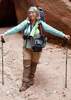
Hiking alone in this wilderness with the highest concentration of mountain lion in the state, I had my gun holstered at my side all day. If nothing else, it made me feel better.

Ended up hiking the same road back to my truck that I had done exactly a week before, fighting daylight just as we had done last week. This time, my truck was a couple of miles closer, so I was enjoying a beer sooner, and back at camp with a fire going before dark. Not too bad!

water 1 out of 5water 2 out of 5water less than maxwater less than max Apache Creek - Apache Creek Wilderness Light flow Light flow
The entirety of Apache Creek was flowing with an estimated 1-3cfs. There is a deep pool at this location (at least 10 feet deep) that appears to contain water all year, even if the creek flow dries up.

water 1 out of 5water 2 out of 5water 3 out of 5water 4 out of 5 Apache Springs Gallon + per minute Gallon + per minute
Exact source of springs was not determined but ample surface water appears in the drainage here and was flowing for the entire length of Apache Creek to the confluence with Walnut Creek at the north edge of the Wilderness.

The water has a distinct red tint, but had no offensive flavors when drinking. (Filtered).

It has been a very wet monsoon. I can't be sure that water will exist here during dry seasons.

dry Panther Spring Dry Dry
I was unable to locate this spring. Ample water was flowing in the creek so it wasn't actually dry here, but I don't know if this would be a reliable source of water if the creek was not otherwise flowing.

Panther Spring does not appear on any maps I've seen, so I don't know if it really ever existed here?

water 1 out of 5water 2 out of 5water 3 out of 5water 4 out of 5 Pinetop Trick Tank 76-100% full 76-100% full
See photoset. This is a 22,000 gallon tank under a large structure to gather rainwater. It was absolutely full.

water 1 out of 5water less than maxwater less than maxwater less than max Upper Hyde Spring Dripping Dripping
Seep with good size pool of water in the grass. Hard to tell what kind of flow it was producing. But plenty of water in adjacent Hyde Creek.
_____________________
I'm not sure what my spirit animal is, but I'm confident it has rabies.
  1 archive
Aug 16 2014
avatar

 Routes 67
 Photos 2,708
 Triplogs 755

89 male
 Joined Mar 28 2008
 Phoenix, AZ
Hyde Mountain - Apache Creek Loop, AZ 
Hyde Mountain - Apache Creek Loop, AZ
 
Hiking avatar Aug 16 2014
Tough_BootsTriplogs 755
Hiking25.00 Miles 3,468 AEG
Hiking25.00 Miles   11 Hrs   16 Mns   2.79 mph
3,468 ft AEG   2 Hrs   18 Mns Break
 no routes
1st trip
Partners partners
chumley
FOTG
John9L
The_Eagle
long day... cool hike... so so company ;)
wildflower observationwildflower observationwildflower observationwildflower observationwildflower observation
Wildflowers Observation Moderate
_____________________
 
average hiking speed 2.39 mph
1, 2  Next

WARNING! Hiking and outdoor related sports can be dangerous. Be responsible and prepare for the trip. Study the area you are entering and plan accordingly. Dress for the current and unexpected weather changes. Take plenty of water. Never go alone. Make an itinerary with your plan(s), route(s), destination(s) and expected return time. Give your itinerary to trusted family and/or friends.

helpcommentissue

end of page marker