username
X
password
register
for free!
help
ArticlesGuidesRoutes
 
Photosets
 
 Comments
triplogs   photosets   labels comments more
Cactus to Clouds - 18 members in 51 triplogs have rated this an average 4.7 ( 1 to 5 best )
1, 2, 3  Next
51 triplogs
login for filter options
May 28 2024
avatar

 Guides 25
 Routes 377
 Photos 5,927
 Triplogs 347

40 male
 Joined Mar 01 2018
 Chandler, AZ
Cactus to CloudsBig Bear - Jacinto, CA
Big Bear - Jacinto, CA
Hiking avatar May 28 2024
John10sTriplogs 347
Hiking21.78 Miles 10,804 AEG
Hiking21.78 Miles   11 Hrs   22 Mns   2.24 mph
10,804 ft AEG   1 Hour   39 Mns Break
 
1st trip
Partners none no partners
Route Scout Route Recorded  on Route Scout | Pop | Map | Popup | MapDEX
I've wanted to hike C2C for 5+ years and was getting to the point where I was going to just hike it on my own soon, but my brother was interested and our schedules lined up for late May. I drove to Palm Springs on Monday and picked him at the airport after his late flight was delayed even later, so he landed a little before midnight, and we started the hike behind the museum a little after 3AM on Tuesday morning.

One benefit of starting in the dark was not seeing how much "up" was above us--it forced us to focus on the next few steps that we could see in our flashlight beams. I worked up a good sweat over the first few miles as it climbed steeply and consistently, and it was nice to get better and better views of the lights of Palm Springs, and eventually the sun rising over the mountains.

Around sunrise, ~4 miles over ~4,000' in, the terrain transitions into more yucca and taller foliage. We passed three people on their way up and then got into more manzanita as the steepness increased. The last few miles leading up to Grubbs Notch were the steepest and toughest of the day, and my brother felt like his legs were on the verge of cramping. I had serious doubts that he was going to be able to finish the hike if he started cramping, and it wasn't looking good with 12+ miles and ~3,000' of elevation ahead of us.

But he pushed through, and we took a break once we reached the Notch, where the terrain changed again. We stopped at the Long Valley Ranger station, which was closed at that time, and filled our bottles from the hose in back (there was a sign warning about haloacetic acid levels in the water, so we filtered the water as we refilled). We had five or six more miles to the peak, and it was a relaxing hike through pines with water flowing in the creek (in hindsight, we could've filtered that more easily than the hose water), and the grade was much less steep.

We encountered the first snow along the trail at ~8,500' and more as we climbed, but it was generally well-packed and easy to cross without sinking in. We took another short break at Wellman Divide and passed another person in that area. The terrain changed again, with more boulders and low brush along both sides of the trail and fewer pine trees over the last two miles to San Jacinto peak.

We encountered deeper snow on the final scramble to the top, and we arrived a little before 11:30AM had it to ourselves. The views were fantastic in every direction...I wished that I'd brought a big DSLR camera to zoom in on all the landmarks. Baldy and San Gorgonio both had a lot of snow on top, and there was a thick blanket of low clouds over the Pacific. We spent ~40 minutes on top eating, relaxing, and taking pictures before we packed up and started down.

We talked briefly with the guy we'd passed near Wellman Divide as he was coming up, then started to see more people from the tram farther down. One couple on their way up asked if we'd come up on the first tram, and when we told them we hiked up from Palm Springs, the woman had the line of the day: "Motherf*****...congratulations!" :)

We cruised down at a good pace and saw more and more people as we got closer to the tram...it felt like a different place with crowds and left me feeling grateful that we'd seen so few people on the way up and had the peak to ourselves. We dropped off our permit at the ranger station and headed into the swarms of tourists at the tram station and rode down...I could've done without the music and singalongs, but it was cool to see the mountain from that angle.

Overall, it was a great day and things worked out as well as we could've hoped. The weather was perfect from start to finish and I was comfortable in a T-shirt all the way, including at the peak. And I felt great physically--food and water made a big difference...I have a bad habit of not stopping often enough to eat and drink on hikes, so I made an effort this time to eat/drink before I got hungry/thirsty. I carried ~180oz of liquids (and a purifier) and ended up drinking a little less than that, and my brother drank close to 240oz. I finished the day with more energy and felt better than I typically do on much less demanding hikes.

C2C lived up to the expectations--it was a fun challenge, and it was beautiful seeing the sunrise over Palm Springs, and I enjoyed hiking up through so many different environments between ~500' and 10,800'. It was great to having my brother join me for this. In addition to his near-cramping, he was battling pain in a tendon in his foot and had to stop fairly often to take his boot off and stretch it, but he fought through it and did great : rambo : . Hopefully I can hike this one again sometime, and next time I'll pack a little lighter and bring a better camera :).
  7 archives
May 17 2024
avatar

 Guides 1
 Routes 168
 Photos 384
 Triplogs 161

32 male
 Joined Aug 13 2017
 Tempe
Cactus to CloudsBig Bear - Jacinto, CA
Big Bear - Jacinto, CA
Hiking avatar May 17 2024
clayncallawayTriplogs 161
Hiking19.74 Miles 10,413 AEG
Hiking19.74 Miles   13 Hrs   8 Mns   1.66 mph
10,413 ft AEG   1 Hour   14 Mns Break
 
1st trip
Linked   none no linked trail guides
Partners none no partners
At long last... Cactus to Clouds. I have known about this hike for roughly four years and have been considering it more seriously in the last two. My long time hiking partner and I decided that May 17th was going to be the day. We tend to plan chaotic hiking trips. The only other time I have been to California was last year to climb Mt. Whitney. Drove a rental car in on August 11th. Started hiking at 1 AM on August 12th. Finished around 1 PM and made it back home that same night. This trip was similar. Drove in Thursday night. Pretended to sleep. Got about one hour. Alarm went off at 2:30 AM. On the trail by 3:30 AM. Finished around 4:30 PM. Back home in Phoenix by 10 PM.

To start off, the Skyline trail/route is very well maintained. The white dots are well placed and following them along with a GPS route made for casual route finding. Looking down at Palm Springs all lit up while you gain elevation is great. Almost feels like you are looking out of an airplane. The sun rose about half way up our ascent to the ranger station. The middle zone was unlike anything I have hiked before. Lots of plants I have never seen. I thought I was looking at weird Century plants for a while, but they are apparently called "Parry's Beargrass". At a certain elevation range these things are everywhere. The bees love them. Several miles of this hike were packed with bees. Every once in a while on the ascent you get a peak down a different canyon. The mountain is so large it is hard to put it in perspective.

I used to eat very little on hikes and when I kicked that habit I saw my performance skyrocket. If you don't eat constantly on this one you will suffer. Cliff Blocks, Tailwind, Bagels, Goos, whatever you can get down. Once you hit the first tree line (before the tram) it gets a bit steeper but it really wasn't anything crazy. I was expecting something else from the videos I watched. Sometimes hiking videos sensationalize aspects of trips for clicks to such a level that it distorts what it actually feels like to hike them. We topped out by the first Ranger Station/tram area in a little over six hours.

I refilled my Camelback at the Ranger Station. Probably drank 2 L on the way up out of my 3L. The water at the Ranger Station was out of a hose in the back. It had some sort of warning about drinking the water routinely. You know how California is with the Cancer warnings. I guess if I grow another hand or something I will know where it came from.

In the weeks leading up to this hike the biggest concern was the snow. There was a lot of snow after the Ranger Station. The first mile or so wasn't bad but it slowed us down in the next five. At certain points there were snow paths leading to nowhere and the "correct" snow path didn't always follow the GPS route. It was the kind of snow that makes people have trust issues. Sometimes you are on firm ground, other times you are post holing. The miles to the peak once the snow was a factor were slower going. Once we got above the second tree line the area opens up and you can start to get a sense of the range.

The peak was packed with snow. There were minimal clouds (slightly disappointing) but the views were still fantastic. Made peak at the 10 hour mark. Lots to look at to the West. Many peaks in the distance that I am unfamiliar with. Another 3 hours back, and we were at the Tram. We walked in the visitor center as victors and boarded a Tram full of people who smelled a lot better than we did. Wasn't expecting the party vibes on the Tram. A couple of Sweet Carolines and we were down at the tram station parking lot.

I play mind games with myself on long hikes. For example, the miles back never count in my head. It could be five it could be ten. Doesn't matter. They don't count. Planning for this one I didn't think much about the miles after the Ranger Station because I was so concerned about that desert ascent. The last six miles to the peak actually felt longer.

Great day. Took all of 24 hours for me to think about doing it again but faster.

Watch said 19.74 miles and 10,413 ft of gain. Probably the last big route I do with the Garmin Instinct Solar.
 Flora
 Flora [ checklist ]
[ checklist ]  Bigelow Nolina
_____________________
 
Jun 20 2022
avatar

 Guides 38
 Routes 183
 Photos 1,605
 Triplogs 233

40 male
 Joined Dec 09 2014
 Gilbert, AZ
Cactus to CloudsBig Bear - Jacinto, CA
Big Bear - Jacinto, CA
Hiking avatar Jun 20 2022
jacobemerickTriplogs 233
Hiking19.97 Miles 11,461 AEG
Hiking19.97 Miles   10 Hrs   27 Mns   2.15 mph
11,461 ft AEG   1 Hour   10 Mns Break
 
Linked   none no linked trail guides
Partners none no partners
Route Scout Route Recorded  on Route Scout | Pop | Map | Popup | MapDEX
Been a year, and the temps looked agreeable, so tried this again. Got a few blinks of sleep outside of Joshua Tree and in the morning I realized I had made two mistakes: forgot my trekking poles and misjudged the tramway locked gate (I had brought my bike and had planned on locking it below the fee station, but the road is locked way down by Palm Canyon Drive - only way to do this would be to drop it off the day before during their operating hours, ugh).

Miles 1-3
This felt really easy. 78F temps at 2am, dropped quickly with elevation. More flat and downhills than I remembered, giving legs a chance to breathe. Light from half-moon wasn't as helpful as I had hoped. Had to force myself to take a break at the 3 mile mark to make sure I didn't burn out too early.

Miles 4-6
Cruising time. More vegetation, a slowly waking sky, and only between 400' and 700' of climb each mile. The cold started to get to me here, shivers in the shade, but I was too soaked in sweat to justify adding layers. Just like last year, I was all smiles on this section.

Miles 7-9
This is where the climb starts lol. Was able to start with a decent pace, and then that last mile hurt. 1200' of gain over a mile is no joke. Trail seemed better defined this time, only a few deadfall. Reached the top at 8am, paused long enough at the top to let the sweat dry and pull on a sweater.

Miles 10-15
Very quiet up here in the morning, since I beat the tram up. Definitely aiming for this on future trips. Ranger station was closed and I didn't find a tap, so I filled out the permit outside and pushed on - still had half my water in my pack anyways. Legs felt good and the altitude never got to me, strangely enough, and I reached summit around 1030am. Saw a few groups of people coming from the Idyllwild side and a father-son duo who had also done C2C, starting about 2 hours before me. After a few stories and views it was time to return.

Miles 16-19.9999999999
Reaching the tram before noon wasn't in the cards without jogging, so I decided to take the scenic route back. High / Willow Creek Trail was less groomed than Round Valley, though all the trails up here are pristine, so its like the difference between an A+ and A. Great views of the surrounding peaks thanks to some thinner forests, and more level / downhill sections than the direct route. When I returned to the tram things were predictably very busy, so I scowled at my almost-20 mile route, put on a face mask, grumped through the tram ride down, and got an Uber to return to the Jeep.

Carried 5L with the plan to water up at top, didn't need to. Supplemented water with a few bumps of tailwind. Brought 3000 calories, ate maybe a thousand, mostly in blocks and corn nuts. Never missed my trekking poles. Will probably use a vest next time. Felt amazing the whole time, no death marches, and no bonks either. Gonna aim for 9 hours next year : rambo :
_____________________
 
May 14 2022
avatar

 Guides 3
 Routes 633
 Photos 8,249
 Triplogs 605

54 male
 Joined Apr 13 2011
 Gilbert, AZ
Cactus to CloudsBig Bear - Jacinto, CA
Big Bear - Jacinto, CA
Hiking avatar May 14 2022
ddgrunningTriplogs 605
Hiking22.12 Miles 10,667 AEG
Hiking22.12 Miles   14 Hrs   23 Mns   1.98 mph
10,667 ft AEG   3 Hrs   12 Mns Break
 
1st trip
Partners none no partners
Route Scout Route Recorded  on Route Scout | Pop | Map | Popup | MapDEX
Our adventure began on Friday afternoon, as we left the East Valley around 2 pm and made the 4-5 hour drive to Palm Springs to a VRBO home we had rented for Friday and Saturday nights.

I wasn't generally worried about my overall fitness, BUT, unavoidable work commitments had me working 15-20 hour days, with very little sleep the entire week leading up to the trip. So, I was pretty sleep-depleted going into the weekend. After finishing work on Thursday, I was hoping for a good night's sleep, but somewhat surprisingly, I didn't actually sleep all that well.

Back to the drive, it ended up taking a little longer because we had to fight rush-hour traffic to get out of Phoenix.

We arrived in Palm Springs around 7-ish. We didn't actually stay in Palm Springs, but rather "across the freeway" in Desert Hot Springs, where the rental prices were a little better.

We stopped for dinner and then picked up some last-minute supplies from the grocery store and admired the substantial homeless population in the area :-/

We had originally planned to be on the trail at 4 a.m., but with the temperature in Palm Springs scheduled to spike to 106 degrees on Saturday, we decided to move our start time to 3 am instead. That meant getting up at 1:45 a.m. to get our packs ready, etc. so we could leave by 2:30 am, as it was a 20-30 minute drive from our rental to the trailhead.

We arrived at the TH just before 3 am and were a little surprised to see so many cars filling the roadside parking area. Luckily, we were able to squeeze into a spot just outside the no parking zone.

There was a solid moon in the sky and but for the fact that it was setting behind the western side of the mountain, it likely would have dispensed with the need for headlamps.

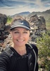
We got on the trail right about our planned 3 am start time, and with headlamps on, we started the climb. And climb we did--right out of the shoot, the first mile gained close to 900 feet. We were keeping a pretty good pace, and despite it being 3 am, it was already warm. While I'm not a fan of white dots on the rocks, they did help us avoid taking the plentiful spider paths over the first section of the trail in the dark.

At the mile mark, my brother almost decided to turn back, saying that he was not prepared to keep that kind of a pace going. I was just feeling the adrenaline rush and told him we could dial back the pace. With a little encouragement, he decided to soldier on, and we did slow down our pace.

We made good progress and were about 4,000 feet up before the sun broke the horizon around 5:45 a.m. Prior to that, we enjoyed the views of the city lights below, as well as watching the dawn come on and the sun finally announce the arrival of the day.

Shortly after that though, my brother began having trouble with his nutrition and was struggling to keep any food or liquids down. At about the 4,500 mark, he began throwing up. We were little concerned but just took it even more slowly with more breaks, including a stint where we took a 20 minute break in the shade and he just rested.

Passing the two emergency rescue boxes, we found both full of water and related nutrition to help under-prepared hikers.

At about the 6,000 mark, we came across a hiker doing even worse than my brother. The guy was laying face down in the middle of the trail in the shade of a manzanita bush, with his shoes and socks off, dealing with severe dehydration/heat exhaustion. His hiking group of 4-5 people were there with him and had already called for an emergency rescue. We offered to help, but they indicated they had what they needed to care for him as best they could until the rescue team arrived. So, we carried on, and my brother could at least console himself that he wasn't anywhere near that stage!

As we continued up to the 7,000 foot level, we saw the helicopter hovering down below and eventually extracting the hiker (we learned later from one of the people in his group that he was taken to a hospital and, hopefully, will be okay).

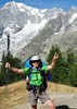
Meanwhile, we had reached the most difficult part of the climb up to Grub's Notch, consisting of a narrow chute next to the prominent rock outcropping named Coffman's Crag, and which climbs Flatiron-like up 1100+ feet in a mile before reaching Long Valley--the first "flat" section of the hike and the location of the upper landing for the Palm Spring Tramway. Taking several breaks and relying on willpower, my brother made it up to Long Valley--despite not being able to keep any fuel down.

At the top of Grub's Notch, there is a group of rocks named "Hallelujah Rocks," as they mark the end of the intense 8,000 feet of climbing from the TH. We joined in the hallelujah chorus as we enjoyed the new sensation of walking on nearly level ground for the first time since setting foot on the trail.

It was a short .4 of a mile to the base of the tram station, where we left my brother to recover and either wait for us to summit/return, or take the tram down and coordinate a pick up by my wife and another friend who were on shuttle duty.

From there, the remaining three of us stopped at the ranger station to fill up on water, get a permit, and fuel up for part two of the hike--an 11 mile round trip to the top of San Jacinto Peak at 10,834 feet.

From the tram station/ranger station at 8,300, we still had another 2,500 feet of elevation to gain. Thankfully, the trail from this point was not quite as steep, with the elevation gain a little more spread out. Plus, by that time, we were up in the shade of the pine trees and the temperatures were much nicer.

There was still snow on the climb, but the trail was mostly clear (just a few patches to hike over--no need for microspikes). The climbing went fine until about a mile before the summit when I, unexpectedly, bonked. I hit the wall and struggled to have the energy to keep going. But there was no way I was NOT going to make the summit, and with a little mental engagement and a few more breaks, we eventually got there. Being that close, I didn't really consider NOT summiting, but it was more taxing than I imagined. This may have been my weeklong sleep deprivation kicking in, but I also think I may have not paid close enough attention to my hydration strategy after leaving the ranger station. I also think the extra hours on the trail due to my brother's struggles may have also played a part.

Over the last mile, we visited with several hikers descending from the summit, including a guy form Sweden (living in San Diego) who was pushing for a fast time, but came up short of expectations--though still a solid time, and a guy from England who was hiking solo at that point but with his wife and a few friends another half mile or so back. He was so full of energy and excitement that he apparently really ticked his pregnant wife off and he decided he needed to "create a little space" on the return hike. We promised to put in a good word for him when we passed her later on. We tried, but I don't think it worked--she still seemed rather mad at him :lol:

In any event, we finally did make it to the summit--YAY--at about 3 pm, 12 hours after starting our hike. The summit was relatively crowded (mostly with folks who were making the climb from the tram station or from the Round Valley campground--including a group of 30 girl scouts).

We took summit photos and tried to enjoy the moment, but I still was not feeling good at all, so I rested and tried to get a few more calories and liquid in for the descent.

Although I wasn't feeling well, going downhill proved much more doable, and I managed to keep a good 20-minute mile pace on the way back to the tram station.

At the tram station, there is a long set of paved switchback ramps that were agonizing to go up after all of that climbing. Then, after you enter the tram station building, you have climb another set of stairs to purchase your tickets!

It felt good to be done, but I was ready to get back to a hot shower and start recovering with some Sprite and Pringles--my go to options for settling my stomach after an exhausting hike.

The tram ride down was cool. The sheer steepness of that ravine is impressive. Also, they blared "Celebration" by Kool and the Gang from the speakers, which was an appropriate conclusion to this epic adventure.
_____________________
 
Jun 25 2021
avatar

 Guides 38
 Routes 183
 Photos 1,605
 Triplogs 233

40 male
 Joined Dec 09 2014
 Gilbert, AZ
Cactus to CloudsBig Bear - Jacinto, CA
Big Bear - Jacinto, CA
Hiking avatar Jun 25 2021
jacobemerickTriplogs 233
Hiking19.69 Miles 10,989 AEG
Hiking19.69 Miles   12 Hrs   31 Mns   2.02 mph
10,989 ft AEG   2 Hrs   46 Mns Break
 
Linked   none no linked trail guides
Partners none no partners
Route Scout Route Recorded  on Route Scout | Pop | Map | Popup | MapDEX
Original plan for this weekend was an easy stroll in the Supes (still dealing with some lingering shin/calf pain from Bryce Canyon) but when TNF did the impossible this week decided on a Plan B in Cali. Drove out Thursday afternoon, camped outside of Joshua Tree, and got a few hours of sleep before a 2:30am start from Palm Springs.

Miles 1-3
Full moon + city lights made for an easy stroll, kept a hand light accessible for route verification. Trail is steep, steeper than I had imagined, and the humidity made for a pretty sweaty morning. There are a few forks to lookouts and plenty of cut-off switchbacks, route-finding was overall straightforward. Oh, and almost no overgrowth to contend with.

Miles 4-6
This was the sweet spot. Sun was coming up, interesting vegetation along the trail (including some variety of manzanita with fuzzy bark?), and there were a few saddles and flat sections to break up the previously relentless uphill grind. Stopped a few times to stretch calves and water up. V enjoyable section.

Miles 7-9
Things got steep and, once under the pines, path was sandy and tricky. Found myself pausing and turning full circles trying to get back on tread a bunch of times. As much as I enjoyed the forest and rock formations I was pretty burnt out by now and just wanted to crest. Once I did I bee-lined over to the ranger station to water up and fill out a permit for the wilderness.

Miles 10-12
Somehow I pictured Long/Round Valley as a flat, easy stroll. Nah, there's more elevation to gain, between 200-500' per mile. Pine trees were huge and pleasant and the trail was an impeccable shape. Lots of friendly hikers to chat with, including a PCT section-hiker who had some dandy gear times. Took my time on this section and just soaked up the experience.

Miles 13-15
The haul up to summit was... tough. Sure, some leg fatigue, but the altitude messed with me too. Stopped every mile to take in water and views and try to acclimate. Trail was fantastic and as close to alpine as I've been. When I reached the summit I was bummed to see just how crowded it was, lots of people seemed to be just hanging out and getting sunburnt, so I found a little ledge to take a few photos before scurrying back down.

Miles 16-20
Cruise mode. It was getting toasty by now, though it was all downhill so I didn't care too much. Trees up here are ginormous. Made it to the tram with little fanfare, got a one-way ticket and caught the next ride down. Descending on that thing gave a neat perspective of just how insane this hike is.

NOTE: reception at the bottom is spotty, it was difficult to coordinate an Uber.

Carried 4L capacity, drank most on the main climb, watered up at ranger station but only consumed 3L more (probably should have pushed more water to help w/ altitude). Consumed ~2k calories and a ton of caffeinated things. Burned 7k calories. Trail runners worked great, wished I would have done shorts instead of pants. Temps cooperated, started in the 80s and felt a noticeable drop as I climbed. Sun was hot on top, breeze helped. Will definitely be back.
_____________________
 
Jun 24 2021
avatar

 Guides 69
 Routes 37
 Photos 3,010
 Triplogs 2,387

55 male
 Joined Oct 24 2010
 Phoenix,Az
Cactus to CloudsBig Bear - Jacinto, CA
Big Bear - Jacinto, CA
Hiking avatar Jun 24 2021
mt98dewTriplogs 2,387
Hiking18.98 Miles 9,100 AEG
Hiking18.98 Miles   12 Hrs      1.58 mph
9,100 ft AEG
 no routesno photosets
1st trip
Linked   none no linked trail guides
Partners none no partners
Cactus to the clouds failure :( But I did do Cactus to the Crowds and tacked on the Round Valley Loop :) This hike has been on my radar for awhile and my wife adjusted our vacation plans to make it happen. Got to Palm Springs on Wednesday with hotel rooms for two nights. This allowed for 5 hours of sleep and a 2am wake up call. I was traveling with family and last minute my son in law decided he wanted to hike this as well. He’s young, but hikes maybe 4-5 times a year. Wife and daughter were going to ride the tram up and meet us at the top. Using HAZ and a couple of other web sites felt pretty good for this mammoth venture.

Got to the TH around 3am and we were off. One of the descriptions that I relied on heavily had several references that we looked for as we climbed. Both as a way to gage our progress, but also to confirm that we were on trail. First “marker” were the picnic tables. About a mile in and a 1000 ft up (1 Piestewa). About .5 miles past that someone had created a workout station with a set of dumbbells and a pull up station. :o Next “marker” was Rescue Box #1. About 2.5 miles in and 2500 ft up (roughly 2.5 Piestewas). This box had waters and snack bars and is considered to be the “point of no return.” That is, if you are going to turn around, this is your last chance…to do it safely. People have died attempting this hike and apparently the deaths are just as common when people have turned around after this point. We were feeling good at this point. Actually left one of my liters in the rescue box. Trail was pretty easy to follow up to this point because of the abundant white dots that helped marked the trail. It was still dark out at this time so they were quite helpful. The white dots become less frequent as we continued so it was nice to have the downloaded route on my Garmin. The trail does “fray” quite a bit as it works its way up, but more times than not the trail “threads” would reconnect and it was only afterwards that we realized that we had been on one of those “threads.” Only once did I have to use my Garmin to get back on the main trail. We managed to keep a pretty good pace until the second rescue box, about 5400 ft up (about 5 Piestewa). About 8 miles in John started to feel guilty about the frequent breaks and urged me to continue on at my own pace. Hung with him for about .5 miles and then decided to press on with the hope hitting the peak and meeting up with John and family at the tram. That was just before what is referred to as the “traverse”; the final push to Grubb’s Notch. Wow! That had me gasping and puffing every couple of switchbacks! :sweat: :sweat: That, plus the sketchiness of the trail had me concerned for John’s ascent. Made it to Grubb’s Notch unsure what to do?? Go back and down and hike up with John (once was enough….didn’t really want to do that….not even sure if I could have to be honest) or continue to the peak and trust in John’s ability to persevere. I did neither. Upon consultation with a nearby Ranger I hung at the notch to await John’s hopeful arrival. (I was also chastised by the Ranger to never leave your “wingman” :oops: ). About an hour later, he clambered into view : app : Amazing! John hikes several times a year (4-5 miles) and he just climbed about 8 Piestewas! :worthy: We were due to meet the my wife and daughter in a couple of hours. John decided to stay at the tram station and take advantage of their concessions. I knew I didn’t have time to hit the peak in that time, but I still wanted to get some miles in so I opted to hike the Round Valley Loop. Worked out well. I got see a little more of the C to C trail and I finished the loop as the family was arriving at the Ranger station.

Not exactly the end result that I was hoping for, but an awesome shared experience and a chance to bond or perhaps lose a son in law :lol: . The attempt makes me feel optimistic for a return trip with a successful summit :) However, John said, “that next time he’ll take the tram.” :lol:
_____________________
 
Oct 26 2019
avatar

 Routes 5
 Photos 162
 Triplogs 18

31 female
 Joined Nov 26 2018
 Phoenix, AZ
Cactus to CloudsBig Bear - Jacinto, CA
Big Bear - Jacinto, CA
Hiking avatar Oct 26 2019
WalworthjordynTriplogs 18
Hiking21.00 Miles 10,800 AEG
Hiking21.00 Miles   8 Hrs   56 Mns   2.35 mph
10,800 ft AEG
 no routes
1st trip
Linked   none no linked trail guides
Partners none no partners
This came across my radar after seeing it in Backpacker Mag as the 5th top hardest day hike in America. Wanted to put myself through another good challenge, and James was happy to join. We pushed ourselves, and made the trek over an hour faster than I thought we would. We paced ourselves nicely and passed a lot of people that started 2 hours before us, felt good to feel in shape and ready for it. TBH did not really know what to expect since it is so unlike any other hike I have done. It definitely was a challenge, much different than doing a rim to rim to rim. The skyline trail leaves no room for "taking it easy." Took the tram down after a well deserved drink at the bar.
  2 archives
May 26 2019
avatar

 Routes 7
 Photos 1,242
 Triplogs 61

57 female
 Joined Nov 21 2015
 Phoenix
Cactus to CloudsBig Bear - Jacinto, CA
Big Bear - Jacinto, CA
Hiking avatar May 26 2019
PicklesTriplogs 61
Hiking17.00 Miles 9,725 AEG
Hiking17.00 Miles   13 Hrs   30 Mns   1.26 mph
9,725 ft AEG25 LBS Pack
 no routes
1st trip
Linked   none no linked trail guides
Partners none no partners
te-wa and I started this hike at 3:00am in t- shirts and temps in the 60s. We ended our hike 2 miles from San Jacinto Peak surrounded by blizzard conditions! Our attempt to summit came during the 3rd snowstorm of the week.
I am delighted we got as far as we did but both of us are experienced enough to know when to it isn't safe to continue, so we didn't! Fighting the snow, ice. 40mph winds and mid 20 temps made that summit less appealing than it was several hours earlier when sweat was rolling down my back. Perhaps another day?
 Culture
 Culture [ checklist ]
[ checklist ]  Gallydoll Pose
_____________________
 
May 26 2019
avatar

 Guides 3
 Routes 2
 Photos 1,156
 Triplogs 338

54 male
 Joined Aug 22 2003
 Mesa
Cactus to CloudsBig Bear - Jacinto, CA
Big Bear - Jacinto, CA
Hiking avatar May 26 2019
te_waTriplogs 338
Hiking17.00 Miles 9,725 AEG
Hiking17.00 Miles
9,725 ft AEG
 no routesno photosets
1st trip
Linked   none no linked trail guides
Partners none no partners
ma nature showed us her bad temper. got SO close to the peak, turned around from fighting 40mph winds carrying sleet and snow. good choice, I believe. ah, jacinto will still be there next time I summit her. still, a superb hike and lotsa memories. neither Lesa nor I have done 9,700' in one day, so that was a record (that needs to be broken). :D
_____________________
squirrel!
 
Apr 29 2018
avatar

 Routes 54
 Photos 1,508
 Triplogs 325

39 male
 Joined Mar 18 2015
 Payson, AZ
Cactus to CloudsBig Bear - Jacinto, CA
Big Bear - Jacinto, CA
Hiking avatar Apr 29 2018
The_NTriplogs 325
Hiking20.00 Miles 10,800 AEG
Hiking20.00 Miles   9 Hrs   7 Mns   2.49 mph
10,800 ft AEG   1 Hour   5 Mns Break
 no routes
1st trip
Linked   none no linked trail guides
Partners partners
DallinW
Feeling a bit out of shape, we decided on C2C to knock off the rust. Turned out to be a perfect day for this one. Departed Phoenix at midnight and started hiking at 440am. By 1130am we were atop Jacinto enjoying lunch and a summit beer. What an awesome trail from bottom to top. Plenty of folks from the tram up. Many wanted to stop and chat with us, likely just to stop for a breather. Great views all day. Tons of wildflowers in the lower portions. Definitely a hike I'd repeat.
_____________________
If there is no struggle, there is no progress.
 
Oct 07 2017
avatar

 Routes 10
 Photos 93
 Triplogs 6

female
 Joined Jun 17 2010
 Chandler,az
Cactus to CloudsBig Bear - Jacinto, CA
Big Bear - Jacinto, CA
Hiking avatar Oct 07 2017
fan3992Triplogs 6
Hiking20.00 Miles 11,024 AEG
Hiking20.00 Miles   12 Hrs   23 Mns   2.13 mph
11,024 ft AEG   3 Hrs    Break15 LBS Pack
 no routesno photosets
1st trip
Linked   none no linked trail guides
Partners none no partners
I finally did this famous deadly day hike toke me almost 12.30 hrs to finish from bottom to the peak then back to the tram. I confused my GPS what tell me how many time I took to hike(moving) or stop(break). started at the trailhead around 5:20 am with group 11 people and back to the tram 5:40pm. my GPS showing moving speed 2.5 but after download the computer only showing 1.5 m/h. which one is correct? anyway I did it and due to know that will be long day and 10,000 ft climbing I controlled my speed from start point. take easy one step to another step. I did not know I can finish C2C at the start point. I never climb over 7000 ft in one day before. So that is good enough for me. Do I want to do again? No. one is enough.
_____________________
  5 archives
Oct 29 2016
avatar

 Routes 11
 Photos 260
 Triplogs 423

64 male
 Joined Mar 12 2011
 Cave Creek, AZ
Cactus to CloudsBig Bear - Jacinto, CA
Big Bear - Jacinto, CA
Hiking avatar Oct 29 2016
Hiking_FoolTriplogs 423
Hiking20.00 Miles 10,795 AEG
Hiking20.00 Miles
10,795 ft AEG
 no routes
1st trip
Linked   none no linked trail guides
Partners none no partners
This was a great hike! It was challenging and the views were a lot better than I had expected.
_____________________
 
Oct 24 2015
avatar

 Guides 94
 Routes 842
 Photos 22,068
 Triplogs 1,994

52 male
 Joined Sep 18 2002
 Tempe, AZ
Cactus to CloudsBig Bear - Jacinto, CA
Big Bear - Jacinto, CA
Hiking avatar Oct 24 2015
chumleyTriplogs 1,994
Hiking19.99 Miles 10,997 AEG
Hiking19.99 Miles   9 Hrs   29 Mns   2.34 mph
10,997 ft AEG      57 Mns Break
 
1st trip
Partners partners
joebartels
JuanJaimeiii
sbkelley
The most difficult thing I've ever done.
 Culture
 Culture [ checklist ]
[ checklist ]  Benchmark  Cag Shot
 Meteorology
 Meteorology [ checklist ]
[ checklist ]  Sunrise
_____________________
I'm not sure what my spirit animal is, but I'm confident it has rabies.
  2 archives
Oct 24 2015
avatar

 Routes 596
 Photos 9,610
 Triplogs 2,402

58 male
 Joined Jan 30 2011
 Chandler, AZ
Cactus to CloudsBig Bear - Jacinto, CA
Big Bear - Jacinto, CA
Hiking avatar Oct 24 2015
JuanJaimeiiiTriplogs 2,402
Hiking19.74 Miles 10,950 AEG
Hiking19.74 Miles   9 Hrs   30 Mns   2.35 mph
10,950 ft AEG   1 Hour   5 Mns Break
 
Linked   linked  
Partners partners
chumley
joebartels
sbkelley
We have been planning a trip to Death Valley to hike Shorty's Well to Telescope Peak for quite some time now. Actually last weekend we were going to go and hike it however the forecast called for rain and thunderstorms. Given the complexity of this hike we opted to push it out a week.

We were all set to go this weekend with the forecast looking just perfect. Scott, Joe and myself would hike Shorty's to Telescope and Chumly would be our shuttle driver. He would circle around in and go to Mahogany Flats in the morning and then hike up to Telescope and meet us. The plan was perfect. So we thought....

2PM Friday I pick up Chumley and Scott in Tempe and we head off to pick up Joe. We drive for hours, passing the Hoover Dam, Vegas, then dinner in Pahrump, Nevada. From there we would head towards Furnace Creek in Death Valley. Upon arriving we went to make our turn down the 18 mile dirt road to the point where we planned to start our hike at 4am. One problem! The road was closed! What the heck? How could this possibly be?

We went to Furnace Creek Inn and inquired as to what was going on? Several roads in the National Park had been washed out in multiple places from the rain and flooding. Getting to our starting point would not be possible.

We contemplated many ideas including Mount Charleston in Nevada, a trip to Telescope Peak from Mahogany Flats, a possible trip from top down and back up, and then a wild card of Cactus to Clouds in Palm Springs. None of the solutions were enough to over come our disappointment. Scott was leaning towards Charleston, Joe towards C2C, Me towards getting a room and sleeping on it and Chumley was neutral. After much discussion we decided to flip a coin on it. I flipped, Chumley called and Cactus to Clouds it was. 4.5 more hours of driving thru the night and we were at Palm Springs.

4:30am we arrived at the Palm Springs Museum. We could see headlamps heading up the side of the massive mountain. We put our gear on and off we went. Four strong with little to no sleep we started pushing our way up. Eventually we would all reach the Ranger Station without issue.

Along the way I passed EIGHTY TWO others hiking from the Museum to the Tram Level. This is by far the most people I have ever encountered doing this trail. We got our permit and took a quick break. Then it was off to the summit. Again all of us made it without issue.

We returned to the tram and headed down where we would take a taxi back to the Jeep. This trip turned out to be pretty awesome! Naturally we were all disappointed in not being able to do Telescope Peak. However we took that Lemon and made some Lemonade!

My hats off to Chumley for doing this one from bottom to top without much preparation. After all he was supposed to be our driver and only do a 14 mile hike with 3500 feet of AEG. The other three of us got a similar hike to what we had planned for minus 1000 feet.

In the end it turned out great! We will be back another day to take care of the Shorty's Well to Telescope Hike.
_____________________
  5 archives
Oct 24 2015
avatar

 Guides 264
 Routes 2,798
 Photos 14,514
 Triplogs 5,895

55 male
 Joined Nov 20 1996
 
Cactus to CloudsBig Bear - Jacinto, CA
Big Bear - Jacinto, CA
Hiking avatar Oct 24 2015
joebartelsTriplogs 5,895
Hiking19.80 Miles 10,800 AEG
Hiking19.80 Miles   9 Hrs   32 Mns   2.42 mph
10,800 ft AEG   1 Hour   22 Mns Break14 LBS Pack
 
Linked   none no linked trail guides
Partners partners
chumley
JuanJaimeiii
sbkelley
We drove to Death Valley to hike Telescope from Shorty's Well. Perfect weather, perfect everything... except all roads to the holy land were flooded. We didn't bring a boat for Death Valley Lake. We discussed options and ultimately flipped a coin as midnight drew closer.

Sleep is over rated so we set off for San Jacinto to hit up C2C. Everyone except CHUMS has tackled this beast multiple times. He was our shuttle driver. With a shuttle no longer needed he joined in and knocked it out!

Absolutely perfect weather. Slightly crowded above Mountain Station. The disappointment of Death Valley caviar dreams was tough. In the end I think we all enjoyed Jacinto.
foliage observationfoliage observationfoliage observationfoliage observationfoliage observation
Autumn Foliage Observation Isolated
One nice area of yellow trees near Mountain Station.
_____________________
- joe
 
Oct 24 2015
avatar

 Guides 6
 Routes 13
 Photos 1,377
 Triplogs 184

41 male
 Joined Mar 29 2007
 Reno, NV
Cactus to CloudsBig Bear - Jacinto, CA
Big Bear - Jacinto, CA
Hiking avatar Oct 24 2015
sbkelleyTriplogs 184
Hiking19.74 Miles 10,800 AEG
Hiking19.74 Miles   9 Hrs   30 Mns   2.35 mph
10,800 ft AEG   1 Hour   5 Mns Break
 no routes
Partners partners
chumley
joebartels
JuanJaimeiii
A good day, but a tad bittersweet. Telescope Peak continues to prove elusive, but the power of water is something to behold in an area like Death Valley. After it became clear that hiking 18 miles to Shortys Well wasn't a great idea, we convened a meeting of the minds on the front porch of the Furnace Creek Inn. Part of what happened next was certainly my fault - upon kicking around ideas, I asked "how far away is Palm Springs?" Oops. Though my vote was officially for Mt Charleston (closer, and had done C2C a few times before), the coin said otherwise and off we went on what twisted and turned into a great adventure.

Some things I learned: that last 2,000' to the tram always is a party that leaves your legs feeling as special as always. I love the first few thousand feet of this trail and the sunrises that hit around 5,000': always will. Five Hour Energy gives you the antithesis of wings, despite what others will tell you, and the summit is great when there's no wind. Great group and good laughs along the way. Did I say I was retired from C2C? Huh.
_____________________
 
Oct 03 2015
avatar

 Routes 67
 Photos 966
 Triplogs 694

51 female
 Joined Jan 05 2012
 Phoenix,AZ
Cactus to CloudsBig Bear - Jacinto, CA
Big Bear - Jacinto, CA
Hiking avatar Oct 03 2015
slowandsteadyTriplogs 694
Hiking19.92 Miles 10,946 AEG
Hiking19.92 Miles   14 Hrs   51 Mns   1.61 mph
10,946 ft AEG   2 Hrs   29 Mns Break
 no routesno photosets
1st trip
Linked   none no linked trail guides
Partners partners
BiFrost
The draw of this hike was the personal challenge, the list of HAZers who have done the hike, is pretty intimidating, but I gave it a try anyway.
We took a different approach to our start; we decided to be fully rested. The night before, we scoped out the trailhead, went and had a nice dinner and went to bed early in a comfy motel.
We were ready to begin our hike just before 4:15am at the museum. A solo hiker started just after us, and we would leap frog each other all the way to the summit. We probably should have just taken breaks at the same time to avoid the awkward “hello again.”
SBKelley had written in a previous hike, that they would hike an hour and take a five minute break. We intended to take this approach. In the end, we mostly stuck with the Five Minute Rule on break time, but Karl let me take breaks as I needed. Karl made sure we stayed on the GPS track, we backtracked a time or two to make sure we stayed true. Our solo buddy wasn’t concerned with staying on trail and just plowed his way up, it all works. We took time for photo ops at the Painted Rocks and looking back down on Palm Springs. At 4000 feet, the sunrise was in full affect. We took a break and seven people came by. They were not on the exact same trail as us, so it is pretty common to just find a route that works and just head up hill. These seven definitely looked like it wasn’t their first rodeo. A group of three said they were just headed for the Tram.
Karl would announce each time we arrived at another 1000 feet up. I would just think, “OK, one more Squaw Peak.” (As if that makes it easier to do 1000 feet!) I had read that the fun begins at 6,000 feet and eight miles. It’s definitely fun to leave the cactus and get into the trees. I kept repeating “get to the tram” in my head. At the same time, I wanted to enjoy the moment. We trained for so long, I didn’t want to just get it over with. I wanted to look around, I wanted to sit for a moment and enjoy. On one last break before Long Valley, one of the trail runners that had passed us at 4000 feet was now passing us going back down! Karl’s parents and friend Scott were going to meet us at the Ranger Station. There are switch backs before you reach Long Valley, and as we turned a corner we could see the top of part one, and there was Scott waiting for us. We’d accomplished the first goal, getting to the Ranger Station area!
It is a little bit of a stroll down to the Ranger Station. It was a shock to the system to see all the people that had ridden up on the Tram. We spent at least 45 minutes at the Ranger Station. We used the restroom, filled up on water, got our permits and chatted with a Ranger, a volunteer, and other hikers. A Ranger felt that a 4:15am start time was a little late to begin. He asked us how many people we had seen and if anyone seemed in distress. Our Solo buddy was at the station, so everyone we had seen was accounted for. We met a group of three who had started at 3 am, and we ended up reaching the summit before them. I think their fatigue of leaving their home in LA in the middle of the night to start hiking at 3am affected their progress.
Then off to San Jacinto Peak! Lots of hikers were heading back down. The rhythm was interrupted a few times, as it didn’t seem that people hiking up hill had the right of way. We took a break in Round Valley and then another at Wellmans Junction. If you aren’t into breaks, at least walk over and see the view at Wellmans. After Wellmans, our objective was then less than two miles away on beautifully made switchbacks. You can hear hikers on the summit just above you, but the trail will sweep you away before bringing you back.
For extra fun, to reach the summit your tired aching knees get to climb up some boulders. We arrived at the summit and as we sat to enjoy the accomplishment, the clouds rolled in, to officially inform us we had made it from the cactus to the clouds!
This is definitely one of my bigger accomplishments, my hike time won’t break any records, but I enjoyed the hike and proved that your average hiker can do Cactus to Clouds!
_____________________
 
Oct 03 2015
avatar

 Guides 4
 Routes 491
 Photos 10,890
 Triplogs 1,257

55 male
 Joined Nov 20 2012
 Phoenix, AZ
Cactus to CloudsBig Bear - Jacinto, CA
Big Bear - Jacinto, CA
Hiking avatar Oct 03 2015
BiFrostTriplogs 1,257
Hiking19.92 Miles 10,946 AEG
Hiking19.92 Miles   14 Hrs   51 Mns   1.61 mph
10,946 ft AEG   2 Hrs   29 Mns Break
 
1st trip
Linked   none no linked trail guides
Partners partners
slowandsteady
First time doing Cactus to Clouds leaving museum parking area at 4am. Cool to see Palm Springs light show on the ascent before sunrise with perfect temps to start. The trail is a bit rocky and offshoot trails in the dark make it more interesting to follow for the first mile. After that the trail is in good condition which made getting into a pace easier. The good trail conditions continue until about 8 miles when it gets more rugged and much steeper. The last 1.5 miles up to the tram is the steepest section of the entire hike making it feel longer. Finally made the tram in just under 8 hours before picking up permits for the San Jacinto hike at the ranger station.

After break and topping off water we started up San Jacinto. Lots of people on this part with tourists coming off the tram. We started to feel the fatigue of 8000 plus AEG on the final climb. Slow going but we finally made it up top with some clouds rolling in over the peak. Chilly on top taking a nice break and the celebratory pic enjoying the moment. Headed back down and made it to the tram by sunset happy to ride instead of hike. Great to complete this hike after reading so much about it :D
 Flora
 Flora [ checklist ]
[ checklist ]  Coulter Pine
_____________________
  1 archive
Jul 04 2015
avatar

 Guides 37
 Routes 556
 Photos 10,872
 Triplogs 1,052

43 male
 Joined Jan 21 2013
 AZ
Cactus to CloudsBig Bear - Jacinto, CA
Big Bear - Jacinto, CA
Hiking avatar Jul 04 2015
FOTGTriplogs 1,052
Hiking19.70 Miles 10,795 AEG
Hiking19.70 Miles   8 Hrs   45 Mns   2.34 mph
10,795 ft AEG      20 Mns Break
 no routes
1st trip
Linked   linked  
Partners partners
JuanJaimeiii
I asked JJ if he was interested in a Mazzie Peak, Ord two for one. He called my Mazzie, Ord Peak special and raised me a Cactus to Clouds. He told me we would leave at midnight, with minimal to no sleep, drive straight through, hit the trail at four and then tackle perhaps the most AEG one can get in a hike in the U.S. I said you had me at minimal to no sleep. I also thought what a great way to celebrate the birthday of the greatest country in the world.

We hit the trail at four on the dot. We quickly caught another group of hikers and passed them like they were standing still. As it turns out they were not standing still, but probably a little in over their heads and just moving very slowly. We later learned that a ranger had to bring them water down to 7000 feet as we were finishing. Probably ten hours on the trail for them by that point and they were still 1000 feet below the tram.

Ok back to the hike. The ease at which JJ flew up that mountain, made me feel like I did not even belong on this hike! Nevertheless, I was able to plug my way up the hill to some respectable splits 4:40 to the skyline and under seven to the summit. We had a good time on the summit, old glory was a hit, we chatted and joked with several of the hikers on the way dow and spread as much Fourth of July spirit as we could.

The tram was bumping and the ride down was pretty cool; a great way to finish the day. After the tram it was a quick taxi ride back to the museum and some Del Taco of course. Got away with another sub four dollar lunch and that is always reason for celebration.

A big thanks to JJ for driving and setting up probably one of my sure to be all time favorite day hikes.

Finally, all I can say is hike California it rocks! ;)
_____________________
  5 archives
Jul 04 2015
avatar

 Routes 596
 Photos 9,610
 Triplogs 2,402

58 male
 Joined Jan 30 2011
 Chandler, AZ
Cactus to CloudsBig Bear - Jacinto, CA
Big Bear - Jacinto, CA
Hiking avatar Jul 04 2015
JuanJaimeiiiTriplogs 2,402
Hiking19.68 Miles 10,951 AEG
Hiking19.68 Miles   8 Hrs   46 Mns   2.46 mph
10,951 ft AEG      46 Mns Break
 
Linked   linked  
Partners partners
FOTG
This would be trip number 5 for me on this Winner of a Hike. This time around Lee (FriendofThundergod) and I tackled this beast. We left Phoenix last night at midnight from the dog sitters house. With the help of a road machine built by some very capable Germans we were there in 3.5 hours.

We geared up and hit the trail at 4am as planned. I don't know for sure but my guess is that it was around 85 degrees when we started. Up we went and then up some more. I arrived at the Tram level in 4:18. From there I went to the station to fuel up on some liquids. First tram folks were just arriving. There was even a group of 38! :o Quickly I went over to fill out the permit and shortly thereafter Lee arrived. We were fortunate to get out in front of the large group.

This part of the hike is always a treat. Weather was perfect and it was an enjoyable trip from the Ranger Station to the Summit. Lee brought an American Flag which was a HUGE hit up top with photo ops.

Finally we cruised back down to the Tram Station and caught a ride back down into the oven. Shorty after we arrived out Taxi showed up and took us back to the Art Museum.

A quick bite and it was back to Phoenix. We were home before 6pm. What a whirlwind of a trip! Now that is how I like to do this one! Thanks a bunch Lee for a Great trip!
 Flora
 Flora [ checklist ]
[ checklist ]  Sugar pine
 Culture
 Culture [ checklist ]
[ checklist ]  Old Glory
_____________________
  1 archive
average hiking speed 2.07 mph
1, 2, 3  Next

WARNING! Hiking and outdoor related sports can be dangerous. Be responsible and prepare for the trip. Study the area you are entering and plan accordingly. Dress for the current and unexpected weather changes. Take plenty of water. Never go alone. Make an itinerary with your plan(s), route(s), destination(s) and expected return time. Give your itinerary to trusted family and/or friends.

helpcommentissue

end of page marker