|
| | | |
| |
|
| Hiking | 7.50 Miles |
800 AEG |
| | Hiking | 7.50 Miles | | | |
| 800 ft AEG | | 10 LBS Pack | | |
|
|
| |
| Partners |
|
[ show ]
| partners | | This is the write-up from AZ Wandering Bear about this trip:
The record cold and wet winter of 2019 scuttled several planned low elevation desert expeditions. Impatience, boredom, and cabin fever set in. A break in the rain finally provided an opportunity, or so we thought.
Anza-Borrego is a large preserve in California southwest of the Salton Sea. The topography is low mountains and scrub desert cut with sandy washes. The area provides some excellent offroad driving opportunities as well as a few decent hikes. My mapping software was chock full of routes and waypoints in the area offering a week of fun, adventure, and a few challenges.
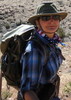
No two adventures are the same. My last few trips had been solo. MJ was understandably anxious to get out too. We split the preparation tasks with her concentrating on menus and food preparation while I handled all other details. Adding a second person changes the volume of gear required and thus how the 4Runner is configured and packed. This trip would also to be a test of a new cockpit setup using RAM mounts to position an iPad and iPhone for navigation and trip management from the passenger seat.
Day one saw us off in high spirits. MJ has this thing for Popeye’s fried chicken. We stopped for lunch in Blythe where MJ emphatically repeated three times to the nice Popeye’s cashier that she wanted “a very large spicy breast”, showing with her hands just how large it needed to be, more turkey size than chicken size. But the staff dutifully went through all their chicken inventory to select the largest available. OK, you had to be there to appreciate it, but it was pretty funny.
Ancient and historic travel routes intrigue me, so we departed pavement to drive the Bradshaw Trail. The trail is an ancient trading route converted to a old stage route laid out by William Bradshaw for prospectors and miners in California to travel to the newly found gold fields near Prescott, Arizona. Bradshaw also built a ferry to cross the Colorado River near present day Blythe charging a handsome fee for its use. The Bradshaw Mountains southeast of Prescott are named for William and his enterprising brothers.
The Bradshaw proved easy enough, plenty bumpy, but mostly unremarkable. Two large abandoned boats left us scratching our heads since there isn’t a decent body of water anywhere close. Several vehicles had met their demise along the route as well, now rusting overturned burned out hulks urging caution. Later, an oddball collection of six vehicles were parked trailside. One of them had broken a tie rod end. A field repair was underway. We offered assistance, but had neither relevant material or skills to contribute.
After 70 miles of constant jostling, we made camp on the edge of a sandy wash against a cliff. And immediately discovered the reconfiguration had led to leaving behind the rack for the little Weber grill on which we planned to prepare almost every meal. The rack isn’t left in the grill for transport since it bounces around inside and does damage. But on previous trips everything grill related had ridden in a single packing box inside the truck. With the reconfiguration the grill went up onto the roof rack, but the grill rack never found a home. Yes, we have wonderfully detailed checklists for our expeditions. And they always work, assuming you slow down and use them. Now we had only a small single burner stove, a tiny fry pan and small pot to heat water. To save room, I’d even tossed out the small generic little rack I occasionally use over a fire. Our planned juicy grilled steaks became fried steak bites. And we’d have to scramble to change up the menu to match our limited capability. MJ stepped up and started making it work.
Day two put us back on the Bradshaw, which had turned into a rutted mogul filled track forcing us to creep along slowly. Luckily we were only 20 miles from the end. We agreed the Bradshaw, however historic it is, was a one-and-done for us.
We hit pavement along the eastern shore of the Salton Sea. MJ insisted we stop so she could dip a toe. The smelly water and crushed shell and ground granite beach changed her mind. It was interesting to be in shorts on a beach, albeit a stinky beach, and seeing the snow capped San Bernardino mountains to the west. We ran south along the Salton.
If you remember the movie Into the Wild, the story of Christopher McCandless, a rebellious free spirit who ended up dead in an old school bus in the wilds of Alaska, then you have seen Salvation Mountain. In 1984, Leonard Knight moved into the area near Niland, CA known as Slab City, a gathering place for counter-culture freedom seekers. Leonard had undergone a religious conversion a few years prior. He embarked on a mission to spread the word of God through the creation of Salvation Mountain, a task that occupied him until his death 28 years later. Living in his truck with no electricity or running water, Leonard scrounged paint and other materials from the local dump. He shaped a small hill with clay and straw and bonded it with layer upon layer of paint, all colorfully spelling out his vision of his faith. Today volunteers maintain and enlarge Salvation Mountain. We spent time wandering up and around this unique piece of Americana.
At the other end of Slab City is East Jesus, a quirky art collective. Discarded objects are repurposed as art. Mostly it looks like a creative junk yard. One of the main displays is a two-story high wall of old televisions with messages painted on the screens. It is both funny and extremely thought provoking. The old car with thousands of Barbie dolls attached to it was just wrong in so many ways.
We cut around the south end of the Salton Sea through the agricultural Imperial Valley, a productive but uninspiring area. The day was hot and we hadn’t had lunch yet. About 20 miles south of Borrego Springs, we stopped at a roadside joint called the Iron Door Bar hoping for a cold beer and maybe a burger. There was no burger, but the cold beer was served by a gaunt, leather-skinned desert dwelling woman who sized us up and asked, “are you here to look at the weeds?” Apparently the rain had resulted in a super bloom of desert wildflowers in the area. Thousands were flocking to the area to see the blue and violet spectacle of blooming weeds. We said we weren’t, ordered the worst hot dog we’ve ever eaten, and were totally entertained by our hostess until the sun receded enough to let us continue on our way.
We hiked Elephant Trees trail which is improperly named. Only a single elephant tree, a species that lives in this austere desert climate and nowhere else, lives along the one mile of the trail. I think there were once others but they are dead now. So it should be Elephant Tree trail. MJ thought the tree smelled like oranges. She often stops to smell the trees.
The sandy Fish Creek Wash took us to the wind caves. An ascending trail leaves the wash leading up to sandstone outcrops cut with whimsical alcoves shaped by wind and erosion over several millennia. We climbed in and over the terrain, admiring the views, hot but with a nice breeze.
During the drive back out along Fish Creek, I mentioned the nearby Ocotillo Wells OHV (Off Highway Vehicle) Area had showers and that the hamlet of Borrego Springs wasn’t far away and thus a plan was born. At Ocotillo Wells, four quarters buys you a stream of hot water that feels like heaven. Carmalita’s wasn’t the best Mexican fare we’ve had by far, but we didn’t have to deal with a missing grill rack either. We set up camp a decent distance from a convenient pit toilet back at Ocotillo Wells and called the day well and done.
MJ made a nice breakfast as I packed camp the next morning just as the sun lit up the sandy desert. A slot canyon hike was our first order of business. Having done amazing slot canyons in Utah and northern Arizona, we were a little disappointed. But the canyon provided shade and a few giggles as we squeezed through the tight spots.
Artist Ricardo Breceda creates massive rusted metal sculptures of elephants, horses, eagles, dinosaurs, serpents and other fanciful imaginings. While large, the sculptures possess minute attention to detail, though stationary they all seem in motion. Over 130 of his statues are scattered throughout the desert around Borrego Springs, most connected by sandy dirt driving trails. The morning was warming quickly, so we drove amongst the sculptures south of town.
El Borrego is a legendary local dive, a family operated eatery with a carpeted seating area under a huge tree. Lunch was some basic fish tacos, made extraordinary by the secret sauce of El Borrego, which can be taken back home in a plastic bottle for only $12. But it is worth it. Trust me.
We aired down the tires for some sandy driving at the mouth of Fonts Wash. MJ took the wheel and I navigated. The 4Runner handled the deep sand easily. Fonts Point provides a nice overlook of the badlands area of Anza Borrego. We cut east on Short Wash and then south again to Vista del Malpais, another nice overlook.
I hadn’t gotten much wheel time on the trip and wanted to play in the sand, so MJ reluctantly relinquished her spot on the driver’s side. We discussed gear selection, throttle control, and proper tire pressures in sand as we worked over towards Arroyo Salado.
Lots of folks were boondocking in vehicles of all kinds near the head of Arroyo Salado. We eased on down the easily driven wash and stopped at 17 Palm Oasis, a small seep with, you guessed it, 17 palm trees surrounded by barren sand dessert. A small vehicle parked by us as we returned from the short walk up to the palms. An older gentleman immediately strode up and complimented the 4Runner in a very proper English voice. He was very familiar with the area and offered a constant statticco listing of places we should see interspersed with random adulations about our truck, all delivered in the Queen’s tongue. We were mesmerized. Just my opinion, but the most interesting of characters seem to congregate at remote desert oases.
The Pumpkin Patch was our destination on this drive. The pumpkins are actually sandstone concretions, sand cementing itself together into hard formations, often round or spherical. In this particular area, the wind has uncovered and rounded concretions in such a way they look like a patch of pumpkins left out in the desert. Always a sucker for unique geology, I wandered around gawking at the variations in the sandy formations.
The day had been long, nonstop. We were thinking of a nice dinner, maybe another shower, and a good night’s sleep under the moon and stars. But before that could happen, the largest Mercedes Sprinter van made was astride the wash and sunk into the sand. Sprinters have become all the rage among the RV set. Some variants even have modest, and I do mean modest, off-pavement capability. This one did not, yet it was a half mile down a sandy wash and totally blocking our escape route.
Seems the driver realized he didn’t belong here, attempted a turn around, but had a turn radius that far exceeded the width of the wash. Now he was broadside, rear wheels sunk into a few inches of sand, and totally without the skills or equipment to extricate himself. I won’t mention the license plate was from the most southwestern state of the contiguous 48. I have lately become loathe to get involved in recovering people and their machines, too much friction in the world. But with a half dozen people standing around and doing nothing, their problem was obviously now my problem.
A quick walk around showed we needed to back the rig up about six feet to get enough room to head back down canyon. The rear wheels had been spun down into the sand a few inches, enough to essentially chock the overweight and under-powered metallic monstrosity. The driver looked shell shocked, his wife sat in the cab and looking straight ahead. Others in his party milled about aimlessly. I fetched the shovel and handed it to MJ. “See if anyone knows what this is and get them to dig out the back tires.” I climbed up on the roof rack where my orange MaxTrax ride and freed two from their mounts, tossing them down to the sand.
The one guy who knew how to operate a shovel had done a poor job of clearing the tires, so I explained a little more what we needed. Then I got the driver to focus and explained exactly how we’d maneuver his condo on tiny wheels. With enough sand finally out of the way, I wedged the MaxTrax under the back of the tires and walked the driver again through what we’d do, admonishing him to watch only me and respond to my commands, warning I’d not be happy if he spun his tires and damaged my prized recovery equipment.
The van slipped free easily enough. Moving the sand by hand and using the van’s floor mats under the stuck tires would likely have been adequate had any of the group possessed the most miniscule of off road experience or knowledge. I recovered and remounted all my gear on the 4Runner eager to be underway. Sprinter van dude still sat in a narrow portion of the wash blocking all traffic. MJ went to tactfully ask him to move, my supply of tact all used up. Amazingly, not a member of their group once voiced appreciation.
El Borrego advertised live music and cold margaritas. We didn’t resist. The one-man band was entertaining, the food flavorful, the patrons mellow. With a full moon on the rise we didn’t worry about setting up camp before sunset. We had enough quarters to splurge on showers, the luxury of consecutive nights of cleanliness not lost on us.
Southern California is subject to unpredictable winds known as the Santa Ana. Between the shower and reaching our chosen camp spot for the night, Saint de Ana came calling. With gusts at 40 miles per hour, setting up a tent was hopeless. Our best bet was to hunker close to the ground on our cots and protect ourselves with our blankets and hope the wind subsided. Any of our bedding not held down blew away. We chased pillows, wrestled blankets, laughed, and swore. We love adventure, some aspects of it more than others. The wind did not abate yet we each amazingly got a little sleep, very little.
With dawn we faced a decision point. We knew the forecast for the next few days showed wind, of course not like this, but still wind. We had no confidence the Santa Anas would die down and if they did that they would not return. We packed our bedding quickly and left for breakfast in town. Bedraggled, we reluctantly decided to end the trip by visiting the remaining unseen Breceda sculptures and then drive homeward.
Adventure isn’t easy. It is not predictable. Attention to detail is mandatory. You learn from each failure, each mistake. Adventure isn’t win or lose You only lose if you never try. |
| _____________________
| | |
|
|
|
 Route Editor