|
| | | Goldfield Ovens - Stewart Dam Petroglyphs, AZ | | | |
|
|
Goldfield Ovens - Stewart Dam Petroglyphs, AZ
| | |
| |
|
| Hiking | 9.68 Miles |
1,018 AEG |
| | Hiking | 9.68 Miles | 4 Hrs 4 Mns | | 2.63 mph |
| 1,018 ft AEG | 23 Mns Break | | | |
|
|
| |
| Partners |
|
[ show ]
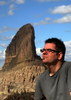
| partners | | Denny asked Bruce to create a 2-mile New Year's hike and he'd bring the iconic prop glasses we all look forward to wearing.
Since we started right next to the river we went down to check it out. The flow is marshland mucky at 19 CFS. For reference, it's generally a thousand in tubing season.
The first mile was a better-than-anticipated trail. Throngs of hikers everywhere, seven if not eight. I only know this area from Salt River tubing and thought we were near the cliff swallow mud nest cliffs. Looking at a map now, that appears to be 2.6 mi downstream.
Healthy saguaros, lots of paloverde, mesquite, and more hackberry bushes than I've been aware of anywhere. Luckily, I understand the difference between wolfberry and hackberry now thanks to Greg.
In this Blue Point vicinity, we heard the beautiful sounds of birds chirping the highway roaring. Overlooking the river was cool. Several fishermen cast from the shore. One was wading among autumn colors now a week into winter, with a week of spring showers on the immediate horizon.
We turned the corner to the Coke Oven and the adventure began! The tread is a loofah-grade therapeutic joy... sand.
Chuparosa and Canyon Ragweed enter the mix of flora. Staying on the horse use-trails made the sand navigation a little easier.
The coke oven is intriguing for a minute or two. Bruce darted off. Figuring he was headed for a 10-100 the balance of the group waited patiently in Horse Apple Ravine swarming with flies. As it turns out he went to bag a nearby peak.
Continuing, the depth of the sand increased. The equine use-trail didn't help as much. Travel was easier on the hard-packed edges. However, zigzagging the snagging brush nixed the advantage.
Density of Jojoba Bush was substantial for a stretch. At least two in the group took the opportunity to snack on the lotion-bearing seeds.
Only six miles of sand until the trail ascended out of the wash to lake views. With Four Peaks angled in the background, views were finally almost as good as the parking lot.
We all reminisced about the good old days when Denny brought party glasses while taking group photos into the sun once or twice. 0.7 miles babbling about skiing snakes, cow slapping, and whatnot brought us back to sand. We crossed the highway and found more sand. Looked like the Bush Fire II was underway in the distance.
We stopped at the turn-off to the petroglyphs while Denny sneaked away. As previously reported, there is a huge sign stating federal and state trespassing fines. It's a non-typical state or federal sign with no state or federal insignia and did not return as private land when I checked last month. Perhaps a Homeland security issue with the dam below or duck hunters trying to scare folks away from their hood.
Synopsis
Slightly over 2 miles and no 2023 party favor glasses. By chance, I enjoy hikes over 2 miles. The sand was not as bad as anticipated. Weather was perfect. Albeit repetitive and boring to most, the Sonoran brush and such is well-watered and intense throughout.
I found the NE quarter of the loop to be the most intriguing. No desire to hike it again but it was shockingly worthy once, in nice weather with good company. Thanks for dragging me through kicking and screaming. |
|
Autumn Foliage Observation Light
Not what most seek but the edge of the river was lined in tamarisk and other trees turning color. |
|
|
Wildflowers Observation Isolated
past prime chuparossa |
|
| _____________________
| | |
|
|
|
 Route Editor


 .
.