|
| | | |
| |
|
| Hiking | 9.39 Miles |
1,575 AEG |
| | Hiking | 9.39 Miles | 4 Hrs 53 Mns | | 2.05 mph |
| 1,575 ft AEG | 18 Mns Break | | | |
|
|
| |
| Partners |
|
[ show ]
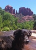
| partners | | My first real hike back in AZ, and Bruce thought I should ease into it. Wally and I carpooled from Mesa up to Bruce’s cabin, and we rode with Bruce from there to the Kinder trailhead. The final half mile of road is rough, but Subaruable, although might be a little tougher after rain. We passed one parked Tacoma, whose driver had wimped out.
The hike down to Kinder Crossing from the west was nice. Trail was easy to follow, rocky in places, but fine. At the water, Bruce declared to water level to be higher than usual, making his desired crossing point deeper than expected. It would have been a swim, not a wade. We wandered back and forth, looking for a better crossing, and also found the two hikers from the Tacoma, who were also looking for a way across. We finally carefully scrambled across some rocks, making it to the other side, leaving behind the two hikers who were apparently made of sugar and unwilling to risk getting wet.
Vegetation was thick along the creek, lots of pushing thru brush. Lots of hidden holes in the ground, making for unstable footing in many places. We didn’t bother with keeping our feet dry, and the cold water felt good on the thorn scratched legs.
The trail was pretty vague heading up the east access trail. Again, lots of brush, and downed trees higher up. High cloud cover most of the day was much appreciated. Walking the forest roads over to the east access for Horse Crossing went by quickly.
Descending the east Horse Crossing trail was another adventure in almost non-existent trail, thorny vegetation, and downed trees. Climbing over some of the burnt trees made me glad I was already wearing black. Probably the toughest section of the day.
Once at the water, we splashed thru it again, then fought more brush to get over to the trail leading west. The climb out was on a fairly visible trail and mostly clear. Clouds were building, but none were an imminent threat. Again, once up top, it was easy road walking to complete the loop. It was a nice loop, but would definitely benefit from some trail clearing. |
|
Wildflowers Observation Light
|
|
| _____________________
| Stop crying and just go do the hike. |
| | |
|
|
|
 Route Editor


 We ended up both using cheap flip-flops.
 After cooling off, we got out, walked along the creek to the little cascades, and played around there.