username
X
password
register
for free!
help
ArticlesGuidesRoutes
 
Photosets
 
 Comments
triplogs   photosets   labels comments more
Jumpup-Nail Trail - 7 members in 17 triplogs have rated this an average 4.3 ( 1 to 5 best )
17 triplogs
login for filter options
Oct 21 2022
avatar

 Guides 12
 Routes 192
 Photos 863
 Triplogs 356

42 male
 Joined Nov 30 2015
 Phoenix, AZ
Deer / Kanab loop, AZ 
Deer / Kanab loop, AZ
 
Backpack avatar Oct 21 2022
ShatteredArmTriplogs 356
Backpack45.00 Miles 7,500 AEG
Backpack45.00 Miles3 Days   4 Hrs   52 Mns   
7,500 ft AEG
 no routes
1st trip
Partners none no partners
This one had been on the list since I first visited Deer Creek years ago, and finally decided to give it a go. The original plan was to go to Deer Creek, then do two aggressive days to get to Showerbath, and then take it easy on the way out, with an extra night in the Kanab Creek Wilderness. But I hadn't communicated that intent clearly to a couple of the participants, and they were planning on 4 days. I communicated better with my other friends, who planned for up to five nights, so we just figured we could split up after Showerbath.

Camped at a nice campsite a mile from Sowats, dropped a couple cars in the morning, then headed to Indian Hollow, since most of us had already seen Bill Hall trail.

Friday - Indian Hollow to Deer Creek - ~12.5 miles

The first part of this was new to me. Nothing particularly noteworthy, although it was nice getting views of the area from a different angle. Cranberry Canyon really stuck out. Once on the esplanade, the walking was easy, and before we knew it, we were at the Bill Hall junction, where it becomes a superhighway. Got a little hot down in Surprise Valley. One member of our party was struggling a little bit by the descent into Deer Creek, which we had chalked up to lack of sleep, or the heat (they didn't get to Sowats until 3am due to a closure on 89 which required a significant detour). A group of 3 beat us to the campsite and took the nice big area, although they were cool enough and I set my tent up in one of the outlying parts of the big site. Talked to them a little about various canyon adventures we've done. This would be the only day when we would have any amount of "chill" time in the afternoon.

Saturday - Deer Creek to Kanab Creek - ~9.5 miles

Woke up at 5:30am because we knew we'd need all day for the hike to Kanab Creek. NPS insists this stretch is 11 miles, but my GPS had it right at 9.5, and we all know GPS tends to overestimate in canyons. In reality it's probably about 9.

We bypassed the narrows, although nobody in my group seemed to like my decision to do that. Why would we do something harder than necessary? I'm a bit of a wuss when it comes to narrow shelves with a heavy pack.

Once off the main trail, things started getting rough. The path away from the overlook is pretty rough, but not too bad until we got to the river and started picking our way through rocks. Then under a cliff band, and out where we could see the tapeats cliff we'd have to traverse over. At this point, our guy who was struggling yesterday started cramping up. Other friend suggested they turn around (which was the right decision, as we still had about 7 hours of hiking left), so it was down to three of us, and I'd now be doing this trip in four days.

The traverse across the top of the tapeats was by far the easiest stretch of the day, and it was over too soon. After Fishtail it got downright miserable, and I never thought I'd appreciate walking on sand so much. Fortunately it was also mostly shady after Fishtail, on account of the sun being below the opposite cliffs. "Peak BS" occurred about a mile and a half before Kanab, when I narrowly avoided falling into the river thanks to some impossibly strong grass. Would've gone above the cliff had I known what awaited us down there. After that gem of a stretch, the walking got a lot easier the rest of the way to Kanab, which took us a full nine hours from Deer Creek.

It started getting really gusty right before Kanab, so we wanted to find a more sheltered location than right at the confluence. Around the first bend, dropped packs to scout around, and we were getting a bit discouraged, when I found a nice bench at the 2nd bend with some grassy clearings that could easily accommodate our tents, with some mesquites that could maybe provide some meager protection. I declared this our best option, and it actually turned out to be a spot the strongest winds largely avoided. When we went to bed, I discovered my new sleeping pad is garbage, and managed to pop on nothing sharp at all.

Sunday - Lower Kanab to Showerbath Spring - ~10 miles

Gave ourselves an extra half hour until alarm time this morning, which was nice because the drizzle was just ending. We knew this would be another hard day, but we saw the creek in the morning and the prospects were worse. It was several inches higher, and silty. That meant the 100 or so creek crossings would be deeper and require us to check every step. Fun.

The nice thing is it was a heck of a lot more enjoyable than the nonsense along the Colorado.

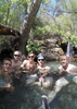
Stopped at the Whispering Falls grotto for a break, and I took advantage of its clear water for filtering. Kanab had some stretches of easy hiking, and then a few stretches of utter nonsense that let us know that a serious injury could be just one bad step away. Getting to Scotty's Hollow seemed to take forever, and by the time we did, it was almost 4pm, so we didn't have a lot of time to explore it. Just went up to the falls for a quick look.

The rest of the way to Showerbath wasn't too bad compared to earlier in the day, and we got to camp with a good hour of sunlight left. Found the nice campsite a little ways upstream from Showerbath. It was considerably colder this evening than previous nights, but we were happy to have the hard stuff out of the way, and presumably easier walking the next day. Still, we were so tired that we didn't stay up super late, and the three of us couldn't even manage to kill the full 12oz of high proof bourbon I had left.

Monday - Sowats Point via Jumpup and Kwangunk Hollow - ~13 miles

We woke up early again (5:30am) since they had to drive home after, and of course the creek was nice and clear again now that we had the hard stuff out of the way. Barely had to get my feet wet the rest of the way, and the rest of Kanab Creek felt like a dream. Got to Jumpup before 9am.

Jumpup was really impressive, and one of my favorite parts of the trip. There were several flowing springs - not sure if they're all reliable, or if it was just because of the rain. Got to Indian Hollow, but didn't really explore it since we were on a schedule.

Kwangunk started out a little messy, and I was starting to dread it, but once at the bypass to the large pour-offs, things got more interesting. There was a really nice campsite between the two large pouroffs, and then a third (smaller) pouroff where we got to do our only real wall climb of the trip. Great handholds, so a novice climber like myself had no issues, although I'd probably consider lowering the pack if I were going the other direction. I actually really enjoyed Kwangunk Hollow overall, despite slightly less easy walking than Jumpup (but easier than lower Kanab).

Before we knew it, we were at the cottonwood thicket, and back on official trail. The climb out was a grind, but over quickly. Got to the cars at around 2:30pm, and I decided I may as well just drive home since I could get there at a reasonable hour (plus it was freezing up there at this point, and I had no sleeping pad). The muddy road back from Sowats Point provided a bonus adventure, fortunately nobody got stuck.

This was a ridiculously hard route, one that I'm glad I did, but won't do again. The Kanab Creek Wilderness definitely warrants some future exploration, however. The last leg of this trip was by far the most enjoyable (even though the mileage was highest and it had the most climbing).

dry Deer Spring Dry Dry
First time I've seen it dry.

dry Fishtail Canyon Dry Dry
No water at Colorado River

water 1 out of 5water less than maxwater less than maxwater less than max Jumpup Canyon Pools to trickle Pools to trickle
Pools here and there. No flow of course. Couple of flowing springs in the lower stretch.

water 1 out of 5water 2 out of 5water 3 out of 5water less than max Showerbath Spring Gallon per minute Gallon per minute
_____________________
 
Oct 27 2021
avatar

 Guides 6
 Routes 183
 Photos 5,612
 Triplogs 1,647

male
 Joined Mar 12 2004
 Scottsdale, AZ
Deer Creek / Kanab Creek Loop, AZ 
Deer Creek / Kanab Creek Loop, AZ
 
Backpack avatar Oct 27 2021
John9LTriplogs 1,647
Backpack52.00 Miles 6,000 AEG
Backpack52.00 Miles5 Days         
6,000 ft AEG
 no routes
1st trip
Linked   linked  
Partners partners
BiFrost
chumley
GrottoGirl
slowandsteady
This hike has been on my list for a few years now. I hiked the Deer Creek Trail in October 2014 & I was in the Kanab Creek area in March 2018. I wanted to see the lower reaches of Kanab & learned about the route along the river that connects the two drainages. One can hike down Deer Creek & then link up to Kanab along 8+ miles of river. I thought this made for a great loop! I didn’t realize how difficult & demanding this route would be. The route along the river is known for “extreme exertion” and the route did not disappoint. The following is our day by day triplog from the adventure.

Day 1 – Bill Hall to the Deer Creek Patio
We would drive up the night before & car camped near Sowats Point. We had two vehicles & we left one at the Jump Up Nail Trailhead & then we all packed into one vehicle & drove to Monument Point & started hiking around 10am. You start by climbing a couple hundred feet to Monument Point. From there you drop & then traverse & make a healthy drop to the top of the Esplanade. We continued on & took a break by the junction of the Thunder River Trail. We noticed several potholes of water in the slick rock. The area had ran a couple days before & that made the drive in a muddy mess. We would continue & take another break at the top of the Redwall & then made the final push to the creek. We passed the “Throne Room” and noticed the waterfall shooting right out of the wall was dry. I would continue down while the others made stop. I arrived at the camp area & found two tents set up. They were a couple of guys from Albuquerque that were doing the Deer Creek Thunder River loop. We would set up our tents & then spent some time at the Deer Creek Patio as dusk set in. We would spend the rest of the evening enjoying dinner under our camp lights.

Day 2 – Deer Creek to Kanab Creek via the Colorado River Route
We started day 2 relatively easy as we packed up and headed out around 8am. We have a very hardy day planned with 8+ difficult miles along the river. I had some anxiety about this stretch. I’ve known about this route for years & knew it went but I didn’t know the details as well as I should. There were only a few triplogs & they commented on the difficulty & sun exposure. Plus they spent two days crossing the section. We’re going for one day.

The route started with our descent through the Deer Creek Patio & then the exposed narrows & then Deer Creek Falls along the Colorado River. That all went well & we took a variety of pics. The route was on my mind & I was eager to begin. We would start out along the river & pushed through some reeds & other brush. It was obvious this was going to be difficult. We found some semblance of a route but it was not consistent & disappeared at times. About a mile in we climbed high to avoid a possible cliff along the river. I started questioning if this section was a good idea. It was hot & I knew we’re in for a challenge. The others assured me they were good & this reduced my anxiety. We would climb up a ridge to the top of the Tapeats & then started a long stretch several hundred feet above the river. This section was cairned & relatively easy to follow. I focused in & pushed through with a quick stop at a spring along one of the drainages. I would continue as a set of boaters passed below. I was wishing we were lower & could thumb for a boat ride to Kanab Creek. We were too high up & that was not possible. I would eventually drop back to the river & took a break and waited for the others. We were about a third of the way across & I knew the rest of the route was right along the river. We were fully committed at this point.

The others joined me & we continued after a break. The next mile went well & we took another break at Fishtail Canyon. This is the spot most people camp. We were in good shape so Karl got some water from a pool a few minutes up canyon. After that it was a long slow grind along the river. Some sections made for relatively quick travel while others slowed us down. It was hard & slow travel but we made progress. We were delighted to see shade as the sun was low in the sky & was blocked by the south rim thousands of feet above. We kept at it as the day ticked away. I filtered water at some point & we took another break. Next up was a section that had large boulders & slowed progress. I had sweat dripping off my face but knew we were running out of daylight. I pushed ahead and arrived at the mouth of Kanab Creek right before dusk. I would canvas the area & found a decent campsite a few hundred yards down river. The others arrived around nightfall & I led them to our camp. We were finally done & couldn’t be happier! The hike pushed us to our limits & is the hardest segment of a backpacking trip I have ever done. I was glad it was over. We would settle in to dinner & a fairly early bed time.

Day 3 – Kanab Creek to Scotty’s Hollow
Our day 3 had a slower start but we knew we have another hard day ahead of us. The going up Kanab Creek is not easy & we wanted time to explore Whispering Falls & Scotty’s Hollow. We would walk out of camp around 9am and headed up Kanab Creek. The going went well as it was a relatively wide canyon with a good creek bed. We could tell the creek flashed a few days before due to all the mud. This was not an issue as we made our way up canyon. We arrived at the junction with Whispering Falls around 11:30am and took a short break & then started the hike up canyon. We arrived at the lower pool and Karl filtered water. We would climb the embankment & headed up stream for Whispering Falls. You arrive at a pool that appears to be a swimmer. There’s the option to wade through waist deep water on the right or hug the wall on the left. The left wall worked well and once across the pool you climb a narrow slot & then arrive at Whispering Falls. It’s a stunning grotto that feels indoors. Another group arrived at the same time as us & we all enjoyed it together. Some of them swam but that water was too cold for my desert blood. After we had our fill we returned to Kanab Creek & loaded up and continued north.

It was coming up on 1pm and we had a lot of miles ahead of us. We pretty much put our heads down and pushed onward. The other group mentioned a couple of swimmers but admitted there could be a bypass. I was hoping for a dry way around. We followed the canyon & weaved our way around rocks & other obstacles. The deepest water we encountered was knee deep but we spent a lot of time & energy working our way around the deep pools. We eventually hit an area I had a waypoint labeled “difficult boulders”. I looked ahead and saw the channel lined with rocks of varying sizes and some ranged up to the size of a small house. This section was a lot of fun as we searched for a dry route. With much effort we found a manageable route. It took a lot but we were getting through. We eventually found a deep pool that appeared to be surrounded by large boulders. I’m sure the other group swam here. I looked around and found a potential route on the left. I climbed up and found a wedge on the far left wall. I took a closer look and found it very awkward & slippery but I was able to scramble up. I noticed an easy way down the other side & we had our dry bypass! I yelled out to the others and we worked as a team to get everyone up. We continued on.

Our plan was to make it to Showerbath Spring & that’s after the side trip with Scotty’s Hollow. It was approaching 4pm & we only had about two hours of daylight. Plus we’re all tired from hard hiking. Chumley & I talked & agreed to start looking for campsites, preferably something near Scotty’s Hollow. We kept hiking & found a couple of possible sites along the way but we’re hoping for something right at the turnoff for the Hollow. We arrived at the mouth of the side canyon but there wasn’t a camping site there. We would backtrack five minutes to a nice site just above the creek. It was another long day & we had just enough time to set up camp before nightfall. It was another evening enjoying dinner & then on to bed around 9pm.

Day 4 – Scotty’s Hollow to Jump Up
We have another big day planned so we packed up relatively early and were hiking around 8:20am. One of the challenges of this hike was short days. Sunrise was 6:45 am & Sunset was around 5:30pm. Mornings were cold & we were slow to get started. After cutting our hike short the day before, we started with Scotty’s Hollow. This was my first time in this section but we had time constraints. We admired the waterfall at the start of the side canyon & then scrambled up the rabbit hole. Once above we headed up canyon which is wonderful! There is flowing water & fantastic geology. We wanted to go to the turnaround point roughly 1.5 miles up canyon but had to turn around short due to timing.

Once back to Kanab Creek we loaded up and continued heading up canyon. The going went well and we navigated more boulder problems and crossed in knee deep water. It took us just over an hour to get to Showerbath Spring and sure enough there was one final pool right below the spring. We were able to climb over a boulder & had to pass packs over. Once we were over it we took an extended break at the spring. I’ve been to Showerbath in March 2018 when it was my turnaround point. I knew we had relatively easy going for the rest of our hike. After our break we continued hiking & worked our way north. The going is easy as the rocks are smaller and easy to hike through. We took a break at the junction with Kanab Creek & Jump Up Canyon. From there we headed up Jump Up and enjoyed a few miles of narrows. This section is a real treat. We made a short side trip up Indian Hollow and then continued up and passed Kwagunt Hollow. The last few miles to our camp was a grind but we arrived with about an hour of daylight. We would camp just above the junction of Jump Up Canyon & Sowats Canyon. We would settle in for our final night in the canyon.

Day 5 – Jump Up to Sowats Trailhead
Our last day in the Grand Canyon. We had a moderate hike ahead of us but we have a long drive back to Phoenix. Once again we were up fairly early & on trail around 8:15am. We would follow Sowats Canyon to the Jump Up Nail Trail and follow that back to one of the vehicles on the rim. Sowats Canyon had a light flow in the creek & is a bit rocky but was fairly easy. We worked our way up canyon as the sun beamed overhead and the temps rose. We made a stop at Mountain Sheep Spring and admired the glyphs by the campsite. From there we hiked the last mile to our trail junction exit and we took a short break there. We would then hike up the first real trail we’ve seen in four days! It’s a solid climb to the Esplanade but was nice heading up. Once up top we traversed across the top and headed for the Cottonwood trees near the final junction that led back to the rim. We took another short break at the water just a bit downhill. From there it was the typical grind back to the rim. I was delighted to top out and that ended our trip. The others would top out and we then drove back to Monument Point and retrieved the other vehicle. From there it was a solid six hours back to Phoenix with a stop at NiMarcos in Flagstaff. Another trip comes to an end!

Final Thoughts
This was an extremely difficult hike. Especially along the river route & the section of Kanab Creek below Showerbath Spring. I honestly don’t recommend this hike.

Kanab Creek is an absolute joy to hike but takes a lot of time & effort. I wish we had another day or two for this trip.

We had good water at each of our campsites. The Colorado River was mostly clear despite rain a week before. The bottom of Kanab Creek was muddy but cleared as we ascended the canyon.

The short days was a blessing & a curse. Mornings were cold & we were slow to begin. And then it was dark by 6pm. Longer days would be nice but that means more sun exposure along the river route.

Thanks to Chumley & Karl for driving!
 Named place
 Named place [ checklist ]
[ checklist ]  Bridgers Knoll
_____________________
  1 archive
Oct 27 2021
avatar

 Guides 4
 Routes 491
 Photos 10,890
 Triplogs 1,257

55 male
 Joined Nov 20 2012
 Phoenix, AZ
Deer Creek / Kanab Creek Loop, AZ 
Deer Creek / Kanab Creek Loop, AZ
 
Backpack avatar Oct 27 2021
BiFrostTriplogs 1,257
Backpack52.00 Miles 6,000 AEG
Backpack52.00 Miles5 Days         
6,000 ft AEG
 no routes
1st trip
Linked   linked  
Partners partners
chumley
GrottoGirl
John9L
slowandsteady
Another great loop in the canyon albeit a difficult one! John arranged the permits and we car camped near Sowats trailhead the night before. In the morning we setup the shuttle leaving one vehicle at Sowats and then driving over to Bill Hall Trailhead and Monument Point.

Day 1

Ready to go about 10am on a beautiful morning made for some excellent views descending off Monument Point. We dropped down to the Esplanade to find numerous water pot holes. After the big drop from the rim the Esplanade is an easy stroll with big views. Eventually we finished crossing the Esplanade and dropped to Surprise Valley. We hit the junction and turned for Deer Creek dropping again to Deer Creek Spring which unfortunately was dry. After that just a short scramble down to the Deer Creek camp where two other tents were already there. We found a spot and settled in for the night except for a quick trip to the Patio just above the Deer Creek Narrows.

Day 2

This day we had marked as most likely the hardest day of the loop so mentally we had prepared somewhat for what lay ahead. First up though we enjoyed the Deer Creek Narrows and falls which are why probably 98% of the people make the trip down here. I’d been here in 2014 and it was just as I remember a beautiful spot so we took our time enjoying the section and the waterfall at the bottom.

Done with Deer Creek now it was time for the hard part and relatively unknown part of the day. The descriptions were all mentioned as difficult and some had made the river hike to Kanab Creek in 2 days instead of 1 like our plan. Lots of ups and down with some hiking on a cliff band above the river which was probably the easiest part of the difficult route. There were some cairns and faint route for most of it. Eventually we dropped back closer to river level and the fun begins. What I would call extreme bouldering and no real path to speak of. Everyone would cheer when we would find a 50 foot section of sandy beach to hike but this was extremely rare. The relentless bouldering continued to Fishtail Creek and a short break where I found some good water and filtered a few liters. This is also the spot where some people camp to break up the river hike.

After Fishtail it was more of the same bouldering and by this time we were all tired so it made travel slow and tedious. The afternoon dragged but we finally made it to Kanab Creek just as it was getting dark. John had scouted ahead and found a suitable camp site for the night. Now dark we setup camp but really we were just happy to finish the toughest part of the loop and be at camp.


Day 3

Next morning we got started about 9am. We had another day that was thought to be difficult but not as much as the previous day. We started up Kanab Creek and the towering walls that were very photogenic in the morning light. Really liked this section and the first few hours relatively easy with minor wading in the creek. Eventually several miles up stream we made it to Whispering Spring/Falls side canyon. We dropped packs and headed up the side canyon to a small grotto. We stopped for a short break before heading up to the main grotto and falls. The main grotto is really cool area and spent time around the pool and checking out the falls. We headed back out to Kanab Creek and continued up stream for the next goal of the day Scottys Hollow. Unfortunately we didn’t quite make the time we wanted and decided to stop just short of Scottys Hollow but we did find a really nice camp spot on a bench.

Day 4

Next morning we were close to Scottys Hollow so that was first up. It’s a great side canyon with water, pools and interesting geology. We spent about an hour checking it out but wish we had more time for sure. Back down at Kanab Creek we headed for Showerbath Spring and another highlight of Kanab. It’s a cool hanging garden as advertised and we filled up water and spent time enjoying the spring. Continuing up canyon next stop was the confluence of Kanab Creek and Jumpup Canyon where we had lunch. I camped here in 2018 and it’s the park boundary so north of the confluence is outside the park. Nice to see the previous camp site. After lunch we continued up Jumpup Canyon and through the narrows. Much easier hiking since Showerbath Spring but still very scenic. Jumpup is several miles long so no shortage of great hiking and we also stopped for a quick side trip up Indian Hollow narrows. Not too far above Indian Hollow the canyon opens up as Jumpup passes the confluence of Kwagunt Hollow and finally Sowats Canyon. From there we hiked a bit further on Jumpup to our camp for the night. Another long day but easier than the previous two.

Day 5

Last day in the canyon was by far the easiest. We had to hike out about 7 miles with majority of it on real trail which we had not seen in almost 4 days. From there we headed up Sowats Canyon to the spot where Jumpup Nail Trail crosses. Then followed the trail up to the Esplanade and across the flats over to junction with Kwagunt Hollow. There is some water just down from the junction in Kwagunt so we took one last break and filtered enough water for the hike out. Good grind uphill to the Sowats Trailhead where we had left a vehicle first day. Then we all piled in and drove back to Bill Hall to retrieve the other vehicle. Physically demanding but a great loop trip that could have benefited with one extra day!
_____________________
  2 archives
Oct 27 2021
avatar

 Guides 94
 Routes 840
 Photos 22,055
 Triplogs 1,993

52 male
 Joined Sep 18 2002
 Tempe, AZ
Deer Creek - Kanab Creek Loop, AZ 
Deer Creek - Kanab Creek Loop, AZ
 
Backpack avatar Oct 27 2021
chumleyTriplogs 1,993
Backpack52.00 Miles 7,397 AEG
Backpack52.00 Miles5 Days         
7,397 ft AEG
 no routes
1st trip
Partners partners
BiFrost
GrottoGirl
John9L
slowandsteady
GPS says 69.6 miles and just short of 61,832 feet of gain. Such is what happens when you walk through narrow canyons for five days! John knocked it down to 52 miles and 6,000 feet, which is probably under-doing it a little bit. Regardless of the actual stats, the totals were a lot. And most of the miles and feet were hard. Really, really hard. No pain no gain. What an amazingly beautiful trip!

Tuesday
Drove to the north rim. It had rained and snowed overnight leaving some nice winter scenes at the highest elevations and dust-free driving on the dirt roads. We camped at Sowats on a chilly night that dropped into the upper 20s, and the road there was a deeply rutted, freshly muddy 4wd adventure mess. The kind of drive that a truck loves. It took me 25 minutes in the high-pressure self-wash after the trip to get all the mud cleaned off. :y:

Wednesday - 9.45 miles, -4778ft, 847aeg, 5:37
Left my truck at Sowats and piled in Karl's truck and drove over to Monument Point. The mud was noticeably better after just an extra night of drying out. Even midweek at this time of year, we were surprised to find only 3 cars at Bill Hall. We got started with the climb up to Monument and the familiar descent down to the esplanade where numerous pools of water remained after a day of rain. After a chilly start, it warmed up and by the time we dropped through the redwall break down into Surprise Valley, it became a bit warmer than my preference. I was ready for last push down into the Deer Creek drainage to be over. I took the time to stop at the throne room again. There are more thrones than the last time I was there. There was no water flowing from the spring, but it's not called the Deer Creek Spring Room, it's called the Throne Room ... thus still a worthy stop, and only a few steps off the route.

Deer Creek has flooded hard recently and there's a lot of damage. Water made its way through the camp area though it's still in mostly fine shape. BUT for a zone with "two" camp sites, NPS should really get out there and clean up some of the post-flood growth and deadfall debris. There is really only one site now, though it's certainly big enough to handle two groups. You just get to be social with anybody else who has a permit on the same night.

We headed down to the patio for a sunset happy hour bevvy before heading back up to camp for dinner and relaxation time before bed.

Thursday - ~11.4 mi, -558ft, ~1000aeg, 10:04
This was our unknown day. We had no gps route and only a couple of online reports of people having done it before. It started easy enough with the beautiful push through the Deer Creek Narrows and the drop down to the river (with great new steps constructed since last I was here - rafter permit $$$ being spent well!) along with a stop at the always spectacular falls. From here it was supposed to be about 9 miles of winging it along the Colorado. In a perfect world we could hitch a ride from boaters. But with a group of 5 that was highly unlikely. And we didn't see any boaters until we were more than halfway there anyway!

I will say this quite definitively. We would not have been able to complete this day if not for the shade that the lower angle of the sun provided along the river. I would say that anytime before October 15 or after March 1 (3 weeks before/after the equinoxes) will result in too high of a sun angle and not enough shade to do this stretch in one day. Remember ... it SNOWED on the rim the day before we started. It was not hot. River-level daytime highs were in the 70s. But while there were occasional stretches with signs of previous travel, this stretch should be considered to be 9 miles of off-trail boulder-hopping. While always "right there", the river is not always accessible. At one point we stopped near a beach to filter some water, but found it to be very difficult to get down to the water level without risking the inability to get back up! When hiking in the sun, it was physically draining. Stretches of canyon shade were critical relief.

There's one main stretch where the only route climbs about 300 feet above the river to traverse a cliff band. This is by far the easiest part of the day! The rest is an absolutely exhausting clusterF. It's also stunningly beautiful, wild, remote, and simultaneously enjoyable. We averaged 1mph on the day. There were parts where were able to move at a somewhat more normal backpacking pace, but that means that there were also really rough parts were it was taking us 2 hours to go a single mile.

As the day progressed we realized that daylight might not be a thing when we got to Kanab Creek. It was nice to mentally prepare for that a few hours out, so when we had to light up our headlamps in the last 15 minutes or so it wasn't as defeating as it could be. We set up camp in the dark on the beach adjacent to Kanab Rapid, cooked up dinner and all went to bed relatively early.

Friday - ~10.2 miles, 691ft, ~900aeg, 7:57
After a rough day along the Colorado, it was a relief to begin heading up Kanab. The water was a little bit turbid after the rain a few days earlier, but became clearer as we headed upstream, and was always fine for filtering. The lower stretch of Kanab was a pleasant creek walk. There was a little bit of mud and lots of shallow water crossings. But as the miles went on, it was still a little slow going. When we reached the side canyon for Whispering Falls, we dropped our packs and headed up. Here we encountered the only other people on our hike other than at the Deer Creek Camp. A group of four that was camped farther up Kanab had day hiked down to see the falls and we were all there at the same time. Whispering is a really special spot and worthy of the little side trip.

After the falls, we headed upstream with the goal of reaching Showerbath for camp. The canyon got rougher as we went along. Deeper pools, larger boulders, slower travel in general. After yesterday's suckfest along the river, we were all a bit exhausted. We were in unknown territory yesterday and today, but Karl and 9L had both been to the upper part of Kanab previously and assured us that travel would improve tomorrow. As I did math based on travel speed, miles to go, daylight, etc. I started to suggest that perhaps we consider an option for camp near Scotty's Hollow, more than a mile less than our plan. I didn't hear any arguments, and I think we were all happy to find a great shelf to camp at less than an hour before sunset that would prevent a second consecutive day of arriving at camp in the dark.

Saturday ~13.8mi, 1050ft, ~1650aeg, 8:23
We started the day by taking the side trip up Scotty's Hollow. There's a picturesque little waterfall near the beginning and the route up above it goes through a cool little rabbit hole. We proceeded about a mile up canyon, a narrow, winding canyon with a pleasant creek flowing through it. Next time, I'll plan an extra day to spend in this part of Kanab as there is much to explore and we simply didn't have the time to give it the attention it deserved.

Back to Kanab proper, we began our upstream progress and realized how happy we were to stop where we did last night. This first mile or so between Scotty's and Showerbath is a pretty slow section with huge boulders and some water obstacles. We took a break at Showerbath, filtered water and took a few photos.

As promised, from this point up, the canyon was easier to hike through (and quicker). The water dried up in about 2 miles and we finally started to dry our feet out for the first time in two days. We stopped at the Jumpup Kanab junction before heading up into the Jumpup narrows. A couple of miles up the narrows we took a break at Indian Hollow and another short side trip into this scenic side canyon before heading upstream again.

A couple more miles and the narrows open, and the views open and reminded us all that we were in Grand Canyon. Another mile or so and we reached our planned night 4 camp where we set up along a trickling creek for a relaxing evening.

Sunday 6.7mi, 2451ft, ~3000aeg, 3:59
Easy like Sunday Morning! A couple miles of creek hiking through golden autumn cottonwoods in Sowats Canyon led us to where the Jumpup Nail trail crosses and we were happy to be back on a developed trail. Along the way I ignored Mountain Sheep spring. It had nice water flowing. I wasn't interested and kept going! A short climb out of Sowats landed us back on the esplanade, where we enjoyed a couple of the most pleasant miles of walking since the last time we were on the esplanade 4 days earlier!

Once we topped off our water at Kwagunt, it's about 2 miles and 2000 feet to reach the trailhead back at Sowats point. Of course, we missed the wilderness boundary and had to do a quick backtrack for the obligatory wilderness sign photo. Back at the truck, we found a couple of gifts from friends we knew would be in the area.

We shuttled back to Bill Hall where there were now a dozen vehicles. A few days of drying had the Sowats road in pristine condition. It's impressive how such a mess could recover so quickly. It's a mandatory 4wd road when wet, but a careful driver could have gotten out there in a sedan when dry.

Stopped at Jacob's Lake and ran into Wendy and friends and chatted for a bit. Always fun to find other Hazzers out an about on hiking adventures!

Recap
A truly phenomenal trip through some amazing, beautiful, wild, and remote country. Very difficult hiking and easy to underestimate. Weather/heat/sun is critical especially during the river portion and could easily overwhelm even experienced desert hikers. Obviously Kanab and Jumpup are subject to flooding and that's always a factor when planning a trip here. I could have easily done this as a 6 night trip instead of 4. This is a trip that will be fodder for stories I tell the grandkids one day. :sweat:
_____________________
I'm not sure what my spirit animal is, but I'm confident it has rabies.
  3 archives
Oct 14 2021
avatar

 Guides 37
 Routes 556
 Photos 10,872
 Triplogs 1,052

43 male
 Joined Jan 21 2013
 AZ
Jumpup-Nail TrailNorthwest, AZ
Northwest, AZ
Backpack avatar Oct 14 2021
FOTGTriplogs 1,052
Backpack42.00 Miles 6,000 AEG
Backpack42.00 Miles
6,000 ft AEG
 no routes
Linked   linked  
Partners none no partners
Katie and I completed a four day backpack through the Kanab Creek Wilderness and Grand Canyon National Park over my fall break. The drive in was a bit of an adventure. There were several closed roads and the recent storm made the final nine miles to Sowats Point attention getting to say the least.

Day 1: 14.7 miles, AEG 2,410

We started off down the Jump Up Trail, just after seven, on Thursday morning. It was a chilly morning, confirmed by mud-caked, frozen shut doors and icicles hanging from my 4Runner to remind us of our adventure driving in the night before. After only a quick couple of miles and a steep descent we were already at our point where we would leave the trail until our fourth day on this trip. We left the Jump Up Trail shortly after the cottonwoods and began looking for our use trail to the unofficially named Ojojojo Canyon. It did not take long to pick up the trail and we cruised across the esplanade to Oj3. The canyon was a little brushy at first, but then the walking got easier and the scenery more scenic. Aided by a few stretches of running water, gurgling cascades and idyllic hanging garden springs with crystal clear pools below them. The culminating attraction was a several foot tall waterfall that had a light, but steady flow. We bypassed the fall hikers right. After reaching a suitable campsite at the confluence of Oj3 and Indian Hollow, we packed the day packs and headed for the next objective of the day, Racetrack Knoll. Indian Hollow was an absolute treat and the going up canyon was not overly hard, however, we were definitely ready for our turn off down the unnamed arm that would lead us out of Indian Hollow and up onto the esplanade. The unnamed side drainage we took is on hikers right when heading upstream. Its the first Canyon that clearly "goes" out of Indian Hollow and it was about 2.5 miles up canyon from Oj3. After a short walk, a surprisingly well worn trail took us around an impassable dry fall section and then shortly after that Katie spotted what could be an easily missed side drainage that took us up to the esplanade. After picking our way through a couple of shelves, we were on top and making our way to the steep ridges of RTK, which actually went pretty nice compared to our last couple hour of boulder hopping. The summit itself has enough room for about two people to sit on a crumbling block of hermit. We signed the register, which only had two entries since its placement in 2019 and then headed back down. We both felt a little fatigued for the final couple miles down canyon back to camp, but the magical lighting and photo ops kept our spirits high.

Day 2: 9 miles

We left camp a little after seven again, on day two. There was no need to leave any earlier, as we were anticipating some swimmers to get through the rest of Indian Hollow and we wanted at least some slivers of sun rays on us for those. Our first obstacle came up rather quickly, there may be a bypass there, but we ended up just opting for a light down climb and a neck deep wade with packs on our heads. After that there was nothing overly notable until we got to the final obstacle, a chockstone with about a 20 foot drop into a deep swimmer. I cut out a rats nest of tat off a boulder with a pinch point and then slung a new piece of webbing with a single rap ring. Some guidebooks suggest the obstacle can be down-climbed, but we had brought rope and there was no interest in down climbing it for us. After Katie made the first rap and swim, I took the rope and our packs along an edge to a point just past the swimmer and then lowered them to Katie, after that, I rigged the rap again and descended. The beautiful narrows of Indian Hollow revealed themselves next. At the intersection with Jump-Up Canyon we cached our rope and harness and headed down Canyon. The hike to the boundary and confluence went pretty quick, but the final miles to Showerbath Spring seemed to drag on a bit, which may have been aided by the fact that Kanab Creek was flowing pretty nicely from the recent storms. It was chocolate milk the whole way, which made the crossings more tedious and our lines of travel less direct. We were both pretty beat after day two and barely made it past six before crashing.

Day 3: 13 miles

We found ourselves stepping off around seven again, on the third day. It took us only 39 minutes, with our light packs, to reach Scotty's Hollow. We explored up Canyon, to around the area I turned around at last time. Scotty's is a true gem and I recommend the side trip if ever in the area. After Scotty's we headed back to camp, packed up and made off up stream; passing the park boundary and then passing Indian and Kwagunt Hollows until we reached our campsite, near Sheep Mountain Spring. The rest of the day, and early evening, were spent doing the usual camp chores and looking at the various glphys in the area.

Day 4: 5.4 miles, 2,719 AEG

We left camp at 6:30 a.m and were back at the TH by 10 a.m. on the final day. The hike out on real trail and good tread was pleasant and the golden hour on the esplanade proved to be perfect ending to our four day trek.
 Named place
 Named place [ checklist ]
[ checklist ]  Racetrack Knoll

water 1 out of 5water 2 out of 5water 3 out of 5water 4 out of 5 Mountain Sheep Spring Gallon + per minute Gallon + per minute
_____________________
  2 archives
May 30 2021
avatar

 Guides 6
 Routes 183
 Photos 5,612
 Triplogs 1,647

male
 Joined Mar 12 2004
 Scottsdale, AZ
Jumpup-Nail TrailNorthwest, AZ
Northwest, AZ
Hiking avatar May 30 2021
John9LTriplogs 1,647
Hiking16.75 Miles 3,800 AEG
Hiking16.75 Miles   9 Hrs   24 Mns   2.02 mph
3,800 ft AEG   1 Hour   7 Mns Break
 no routes
1st trip
Linked   none no linked trail guides
Partners partners
BiFrost
This area has been on my radar since we visited in March 2018. I was very intrigued by the Sowats approach from the east. The timing is key since winter access is difficult & it’s too hot in summer. I felt the timing was right and we went for it & I’m glad we did.

We drove up the night before and then headed for the trailhead. The roads to Sowats Point are in excellent condition. The final stretch on FR233 was high clearance & easy going. We arrived at the trailhead and scouted the area. That included driving to Sowats Point where we hiked to a knoll that had a perfect vantage of our hike below. We looked down Kwagunt Hollow which cuts its way below the Esplanade. From there our route makes a clockwise loop to Sowats Canyon & then back to the Esplanade & on to the rim. We could see our trail below. I was very excited! We would camp in a nice grove of Junipers about a mile back from the trailhead.

The sun rose early & I couldn’t sleep so I was up before 6am and we packed up and were on trail at 7am. This is my first time on the Jump Up Nail Trail and I was pleasantly surprised. The trail is in great condition! We headed down and noticed how steep the descent was. We had to be careful. We continued on as the trail traverses & then makes a steep & rugged descent through the Coconino Sandstone. This part took great care. With much effort we reached the bottom and took a short break near some cottonwood trees. Our junction was up ahead and we would see the only four people of the day. They were a group of four backpackers on their way out. We had a nice chat & continued down.

The going down Kwagunt Hollow is a mix of easy & hard. Most of it is in a dry creek bed with some mild rock hopping. We took care with each step and were glad to be wearing day packs. This kept us light & nimble and this helped us keep a respectable pace. We would hit water and lush sections of canyon with magnificent cottonwoods. We really enjoyed & admired the rugged canyon. There is a hardy bypass along the way with some off camber footing. Slow going & careful footing & it’s all good. We would finally reach the junction with Jumpup Canyon where we took another break. The sun was beating down and I was wondering if this was a good idea. (It was!)

After break we started north as we ascended Jumpup Canyon. There’s no trail as you follow the wash. It was mostly dry but we found water as we proceeded. There are some very scenic sections but our eyes were on the NW corner for the best part. We arrived at the junction with Sowats Canyon but we continued another mile up Jumpup. This is my favorite stretch. It’s a magnificent canyon loaded with cottonwoods & running water. The water had a light flow but was still respectable for early summer. We would work our way to the actual “Jump Up” where there used to be a primitive ladder. The ladder is gone & is replaced by a frail rope. It was beyond our comfort level so we turned around after taking another break & filtering water.

From here we had to retrace our steps to the junction with Sowats Canyon. Once there we started our way up this canyon. We found travel relatively easy as the creek bottom was mostly flat. We made good time and encountered water along the way. That water would increase until we hit Mountain Sheep Spring which was gushing right out of the wall. It was covered in foliage and was a nice sight to see. After that we continued up canyon which was dry the rest of the way. We proceeded about a mile to the junction with the Jumpup Nail Trail. Once there I took another break while Karl went to check on Bitter Spring. He would return and we started our exit.

The hike out went well and we were pleasantly surprised by the trail construction. They put in some quality work. We headed up and arrived on top of the Esplanade. Once there you head across relatively flat ground that’s covered in cryptobiotic soil. You basically follow the cairns as a path winds its way through. After a bit we arrived back to the junction near the cottonwood trees. From there it’s about two miles & lots of climbing back to the rim. We topped out and were glad to be done. It was a long day with some hard miles but everything went great. We would head east to camp closer to the highway. We have Old Bright Angel planned for the next day.

water 1 out of 5water 2 out of 5water 3 out of 5water 4 out of 5 Mountain Sheep Spring Gallon + per minute Gallon + per minute
Gushing!!!
_____________________
  1 archive
May 30 2021
avatar

 Guides 4
 Routes 491
 Photos 10,890
 Triplogs 1,257

55 male
 Joined Nov 20 2012
 Phoenix, AZ
Jumpup-Nail TrailNorthwest, AZ
Northwest, AZ
Hiking avatar May 30 2021
BiFrostTriplogs 1,257
Hiking16.75 Miles 3,800 AEG
Hiking16.75 Miles   9 Hrs   24 Mns   2.02 mph
3,800 ft AEG   1 Hour   7 Mns Break
 no routes
1st trip
Linked   none no linked trail guides
Partners partners
John9L
Kanab Creek Wilderness on the North Rim Grand Canyon. We started from Sowats trailhead which I had not been out to. Fair amount of dirt road driving but nothing too rough. After car camping the night before started down from Sowats trailhead on good trail. Down to the Esplanade and the top to Kwagunt Hollow. From there it was off trail down Kwagunt boulder hopping and passing a few pools along the way. Eventually it drops to Jumpup Canyon where we hiked upstream . More pools in Jumpup heading up canyon until we reached a pour off taking a break. There was a mini grotto and small pool for the break and much needed shade. There also used to be a ladder for access to Jumpup Nail Trail above but now only a rope. No confidence in the rope this was our turn around point.

After the break we back tracked down Jumpup to Sowats Canyon. Then up Sowats with some more boulder hopping but easier than Kwagunt. There was also more water in Sowats and we learned why about 1 mile up finding a nice spring filling the creek. Above the spring it's dry and eventually we hit the Jumpup Nail trail that crosses Sowats Canyon. Now back on trail it was fairly quick across the Esplanade back to Kwagunt Hollow and closing the loop. Then back up trail to the rim about 16 miles in total on the day. Only ran into 4 backpackers all day, not bad for a holiday weekend. Great hike in some new country!
 Named place
 Named place [ checklist ]
[ checklist ]  Mountain Sheep Spring
_____________________
  1 archive
Nov 23 2020
avatar

 Routes 1
 Photos 48
 Triplogs 3

38 male
 Joined Mar 15 2014
 Tucson
Jumpup-Nail TrailNorthwest, AZ
Northwest, AZ
Hiking avatar Nov 23 2020
gloopeTriplogs 3
Hiking50.00 Miles
Hiking50.00 Miles
 no routes
1st trip
Linked   none no linked trail guides
Partners none no partners
I just got back from a great six-day trip from the Jumpup Cabin Trailhead down to the Colorado River with detours to Scotty's Hollow and Whispering Falls. I had a number of questions before I departed about the difficulty of the old "ladder" section in Jumpup and the ascent of Scotty's Hollow, so I figured I should make a post on them now that I'm back.
The old ladder made of logs and rope that helped you descend from (or ascend to) Lower Jumpup Spring is gone and has been replaced with a rope and a precarious pile of rocks. I've seen triplogs with photos of it from Oct 2019 so it must have been removed in the last year. I was able to descend fairly easily by first lowering my pack off the cliff then lowering myself off the ledge with the rope. From a sitting position on the ledge my feet were only about 12 inches from the top of the rock pile (check out photo) so it was easy to lower myself. I didn't attempt to ascend but it looked like it would take a lot more effort to ascend as you would have to pull your full body weight up using the rope and somehow get your feet onto the narrow ledge. On my way back I took the detour up Sowats Canyon and across the Esplanade on the trail to avoid this part.

The ascent of Scotty's Hollow from Kanab is quite easy for the first 1.5 miles and is absolutely spectacular. There is a small waterfall that appears to block passage near the bottom of scotty's but there is an easy way up through a short cave between boulders on up-canyon right. After this it is smooth sailing up to a significant obstacle at 1.5 miles. There are two chest deep pools in this section that you need to wade through but they are in spring water which isn't that cold even in late November. I took a wet suit but would have been fine without it.

Also, Whispering Falls is a terrific side trip from Kanab Creek about halfway from Scotty's to the Colorado. If you are making the effort to get down to the river don't miss it!

I'll let my photoset do the rest of the speaking for me.

-Gloope
 Named place
 Named place [ checklist ]
[ checklist ]  Kanab Rapids
_____________________
 
Jun 05 2020
avatar

 Routes 137
 Photos 1
 Triplogs 105

44 female
 Joined Oct 21 2016
 Tempe, AZ
Jumpup-Nail TrailNorthwest, AZ
Northwest, AZ
Backpack avatar Jun 05 2020
MAPTriplogs 105
Backpack11.30 Miles 1,724 AEG
Backpack11.30 Miles   21 Hrs   58 Mns   0.51 mph
1,724 ft AEG20 LBS Pack
 
no photosets
1st trip
Linked   linked  
Partners none no partners
Parked at the Jumpup Cabin Friday. We were actually planning to stay at the cabin & explore doing day-hikes but our reservation was cancelled because of Covid. Started hiking around 1:30 pm. Temps were mid 70's at the cabin and overcast. The hike was warm but not something where you're breaking under every other bush with a sliver of shade. The clouds helped big-time. So did the wind & patches of rain drops here and there. 1st stop: Upper Jumpup Spring. There is a rectangular concrete tank holding spring water & a pipe feeding the tank. The water is very clear & it's a very nice area to hang out for a bit. The canyon is beautiful and starts out more narrow, widens out quite a bit, then becomes narrow again near Lower Jumpup Spring. The Lower Jumpup area is suuuuuper pretty. Lots and lots of flowing water & there were even a few pools deep enough to take a mini-dip in. Unfortunately we missed the ladder. We got to the edge of the drop & dumbly assumed that was as far as we could go without rappelling gear. So dumb. ](*,) We ran into a couple on our way out and they asked about the ladder...we had completely forgotten about reading that previously. Oh well. Guess we will have to go back! I'm not sure where people usually camp near Lower Jumpup Spring but we camped on the flattest slab of rock we could find. It was either thick brush or rock. The rock would've been fine but it was so so windy & there was little to secure our tents to. We ended up using rocks to tie down the tents. They were very noisy though. Also, it got HOT. I am always cold and this is possibly the first time I can remember just laying in my tent sweating - no sleeping bag, no clothes, no nothing. It was really strange especially since it had not been that hot during the day.

The next morning we hiked out. I ran up the esplanade (Ranger Trail #41) for a bit to get a taste of the views. They were spectacular! Can't wait to go back and hike the Ranger Trail along the esplanade. The original plan was to do a loop starting at Jumpup Cabin, down to the lower spring, back up to the Ranger Trail along the esplanade, down to Kanab Creek, and finally hiking out Slide Canyon. I was wondering why there weren't any routes on here for that loop but, after hiking down to Kanab the following day, I have a few guesses. Anyway, there is A LOT to explore just in this one canyon. Great place to bring some rap gear and have more time to explore the esplanade and the canyon.

water 1 out of 5water 2 out of 5water 3 out of 5water 4 out of 5 Lower Jumpup Spring Gallon + per minute Gallon + per minute
Flowing water
Pools of water waist deep for shorter people - clear, clean
_____________________
 
Mar 17 2018
avatar

 Guides 37
 Routes 556
 Photos 10,872
 Triplogs 1,052

43 male
 Joined Jan 21 2013
 AZ
Hack Cyn to Jumpup CynNorthwest, AZ
Northwest, AZ
Backpack avatar Mar 17 2018
FOTGTriplogs 1,052
Backpack63.00 Miles 2,500 AEG
Backpack63.00 Miles
2,500 ft AEG
 no routes
1st trip
Partners partners
BiFrost
John9L
John, Karl and myself completed a four day foray into the Kanab Creek Wilderness and it was prettty spectacular. We began our modest trek via the far lengthier Hack Canyon approach, as winter weather had access via Sowats Point out of the question.

Day one was reserved for getting to our base camp at the junctions of Jumpup Canyon and Kanab Creek. It was a 15 mile day, but the lack of AEG and long stretches of nice trail along the benches of the creek made for quick hiking. Apart from what appeared to be a perennial stretch along Kanab Creek the hike in was very dry. In fact, there was no water a camp and we had to filter water from some left over pot holes a few tenths of a mile from camp. We knew rain was coming from the time we set up camp, so we ate our dinner a little sooner than usual. Around seven, the rain chased John and I to our tents for an early night, but Karl endured a little longer. It never really rained hard throughout the night, but there was a pretty steady light period of rain after midnight that lasted for a couple of hours, but nothing to make anything too uncomfortable.

Day two was a trip up to the Jumpup “obstacle” via Jump Canyon and Lower Jumpup Canyon. This route was a tad heavy on the boulder hopping, but big on the reward side. There was an awesome narrows secttion reminiscent of Buckskin along with some dramatic stretches with towering walls through Jumpup Canyon. Eventually the narrows relented to the much more open lower Jumpup Canyon, which was a real treat. There was flowing water, countless cascades and small waterfalls topped off by some excellent views of a snow dusted rim in the distance. I got an itch to explore a cave about a half a mile from the “obstacle,” so I let John and Karl explore that while I checked out the cave. The cave was a dud for prehistory, but offered some cool views. After meeting back up, we headed down to Indian Hollow. We held off on exploring Kwagunut and Sowats in order to save more time on what looked like a promising Indian Hollow. The beginning of Indian Hollow proved worthy with a short but spectacular little slot section, however, the excitement quickly wore off when we reached an impassable chockstone not too far in. A little disappointed, we turned around there and headed back to camp with modest plans to explore an unnamed canyon downstream of camp. The unnamed canyon proved to be a little bit of a dud, but nobody was complaining after the first rate hike up Jumpup earlier in the day.

Showerbath Spring and maybe a peak in Scotty’s Hollow was the goal of day three. Kanab Creek becomes a whole different world one you hit the stretch when it begins to flow above the surface and although it was a boukder hop, the hike to Showerbath was pleasant. Showerbath itself is also a pretty cool destination, complete with some nice deep swimming holes occupied by some rather large and unexpected fish. John went back to camp from Showerbath, while Karl and I headed further downstream to Scotty’s Hollow. This proved to be a worthy side trip, as we both left Scotty’s Hollow very impressed. A scenic little waterfall and grotto greets your entry into this special canyon and it just get better with each step further up canyon. We turned around at the “swimmer” as we were not planning on getting wet and we knew we still had a six mile camp relocation to complete once we got back to camp. The hike back up stream was boulders for days and a little redundant at times, but we still made decent time. Once we got back to camp, it was a quick breakdown and then back on the trail to set up camp six miles closer to the trailhead along a flowing stretch of Kanab Creek.

Day four was just a brisk 8.5 mile hike back to the trailhead. The recent snow had made some of the views in the distance nicer, but the last stretch to the Hack Canyon trailhead was certainly a little more mundane than the previous stretches from the days before.
 Named place
 Named place [ checklist ]
[ checklist ]  Scotty's Castle  Showerbath Spring
_____________________
 
Mar 17 2018
avatar

 Guides 4
 Routes 491
 Photos 10,890
 Triplogs 1,257

55 male
 Joined Nov 20 2012
 Phoenix, AZ
Hack Canyon - Kanab Creek - Jump Up Canyon, AZ 
Hack Canyon - Kanab Creek - Jump Up Canyon, AZ
 
Backpack avatar Mar 17 2018
BiFrostTriplogs 1,257
Backpack59.00 Miles 2,500 AEG
Backpack59.00 Miles4 Days         
2,500 ft AEG
 no routes
1st trip
Partners partners
FOTG
John9L
Great place to spend 4 days. John put the trip together and with a slight adjustment to the trailhead moving to Hack Canyon instead of Jumpup or Sowats we were ready to go. The trail in on Hack Canyon is easy to follow and very fast with little AEG. It’s 6 miles down to Kanab Creek which we headed downstream once at the confluence. Then about 9 miles down to the confluence of Jumpup and Kanab Creek camp spot. So it was 15 miles but pretty fast track which left us time to explore a bit once at camp.

At camp we already knew there was rain forecast for that night and it did rain but not too hard and by next morning it had stopped. That morning we day hiked up Jumpup Canyon exploring the narrows which were one of the highlights even though the creek was dry. We pass Sowats and then Kwagnut which shortly after that Jumpup stated to flow. The next several miles were another highlight of the trip with cascades, pools, and general awesomeness! Snow capped the rim above the canyon from the overnight snow just to add more flavor to an already fun day. Eventually in Jumpup we reached the ladder obstacle which is a bypass to get around the waterfall. We turned around here after checking out the ladder and headed back. On the way back we hit Indian Hollow but this turned out to be bit of disappointment since we only made it short ways up canyon before running into chock stone we couldn’t bypass. We then headed back to camp to call it a day. Settled into camp that night this time with no chance of rain and had relaxing night.

Next day we headeded down Kanab Creek towards Showerbath Spring. It's several miles and Kanab Creek starts to flow just mile or so upstream of the spring. Nice spring with hanging garden and we took a break taking quite a few pics. After that Lee and I continued another mile down to Scotty's Castle and Hollow. The hollow was really cool side hike with several waterfalls, a rabbit hole climb and many pools. We spent about an hour up and back exploring Scotty's Hollow and definietly worth the extra side trip. Then headed back to camp and packed up to move up Kanab Creek about 6 miles. John had picked out a nice spot with water and relaxing location to enjoy our last night.

Next morning it was just about 9 mile hike back out to the trailhead. We had a really cool fly over by F22 jets just before
[ youtube video ]
reaching the vehicles. Another great trip in the Canyon! Thanks for putting it together John!


 Named place
 Named place [ checklist ]
[ checklist ]  Scotty's Castle  Showerbath Spring
_____________________
  1 archive
Oct 11 2016
avatar

 Guides 37
 Routes 556
 Photos 10,872
 Triplogs 1,052

43 male
 Joined Jan 21 2013
 AZ
Jumpup-Nail TrailNorthwest, AZ
Northwest, AZ
Hiking avatar Oct 11 2016
FOTGTriplogs 1,052
Hiking4.04 Miles 1,748 AEG
Hiking4.04 Miles
1,748 ft AEG
 no routes
Linked   none no linked trail guides
Partners none no partners
This was the last hike with Jackie and the dogs before I headed down below the rim for my three day backpack. I was originally going to complete a three day backpack in this area with some colleagues from work, but wanted to get more quality time with the girlfriend and dogs over fall break, so settled on just an exploratory hike. I was told by a reputable source on HAZ that Kanab Creek from Jump Up may have been their most memorable canyon trip. I can certainly see why!

Like any good canyon trail, Jump up blows you away from the start with some tremendous views. One can immediately see the famous Kwagunt Hollow and numerous other finger like canyons that make their way to Kanab Creek and eventually the Colorado. It took less than five miles to determine, but this is an area I am already planning a return trip. So many option for exploring, so remote and so much to see in this unique wilderness area.

The trail down is rugged and a little steep, but generally in great shape. Jackie learned her first hard lesson of the canyon, in terms of what goes down, must come up, but she handled it fine and was very happy to get a real hike below the rim. Meanwhile, I left with my mind racing about future backpacks and trips. A return to this area is a certainty.
_____________________
  2 archives
Apr 27 2016
avatar

 Guides 13
 Routes 38
 Photos 1,651
 Triplogs 577

60 male
 Joined Nov 15 2005
 Jackson, CA
Kanab Creek to the CO River, AZ 
Kanab Creek to the CO River, AZ
 
Backpack avatar Apr 27 2016
toddakTriplogs 577
Backpack45.00 Miles 4,500 AEG
Backpack45.00 Miles3 Days   8 Hrs      
4,500 ft AEG
 no routes
1st trip
Linked   linked  
Partners none no partners
Rugged non-technical canyoneering route into pristine lower Kanab Creek, where springs, streams and waterfalls abound. Started at the Sowats Point trailhead and dropped down the Jumpup-Nail trail for a couple of miles, then off-trail down beautiful Kwagunt Hollow, on down Jumpup Canyon through a section of narrow slots, then down winding Kanab Creek to the Colorado, with sidetrips up Scotty's Hollow and to Whispering Falls grotto. Didn't see another soul, a scrap of trash, a trampled campsite or a fire ring for 3 days - wonderful!

No need to worry about water sources on this one. Kwagunt had light flow and pools along much of its length. Jumpup and the first 3 miles in Kanab are dry, then water suddenly appears and grows to a lovely year-round creek that persists to the Colorado. Showerbath Spring is amazing.

FR #233 to the trailhead is deeply rutted - high clearance probably required, and it will be very muddy if wet.

More hike details can be found in Todd Martin's Grand Canyoneering book or on his website. Just don't follow his advice to turn around before reaching the Colorado - the walking gets easier the further you go, and the scenery is just as spectacular.
 Named place
 Named place [ checklist ]
[ checklist ]  Showerbath Spring
_____________________
  4 archives
Oct 08 2015
avatar

 Photos 39
 Triplogs 9

31 male
 Joined Sep 25 2011
 Flagstaff,AZ
Jumpup-Nail TrailNorthwest, AZ
Northwest, AZ
Hiking avatar Oct 08 2015
GatekeeperTriplogs 9
Hiking35.00 Miles
Hiking35.00 Miles
 no routes
1st trip
Linked   none no linked trail guides
Partners none no partners
Spent 6 days in the area for a class in college. Started at Sowats Point and headed down into the canyon. The first night we spent on the esplanade right above Indian Hollow Canyon. The next day our route went straight down into Indian Hallow to Jumpup Canyon. There was some scrambling over some boulders and a swimming hole in Indian Hollow. We went down Jumpup Canyon to Kanab Creek where we spent the night on an island at the confluence of Jumpup and Kanab. From this point up to an area called the ledges the water is contaminated with old uranium tailings. Although half way between the confluence there is a water source at the bottom of crack baby canyon which can give you enough water to make it to the next water source. In between Crack Baby Canyon there is a sweet side hike up a side canyon that has petroglyphs and pictographs all over. After spending a night at the ledges we hiked cross country to the nail trail leading us to seasonal watersource. Highlights of this trail are one indian ruin which had shards here and there and petroglyphs near the ruin. This night we had slept near a drainage where we were visited by a tarantula and a few scorpions. Moving on the next day we headed into back towards Sowats Point which if I remember correctly we ended up walking through a few different canyons and left Jumpup Canyon for the last canyon of the trip and headed to a rock formation at the bottom of Sowats Point called the space station for our last night. Kanab Creek is a magical area to explore and is a mirror for self reflection.
_____________________
  1 archive
May 26 2015
avatar

 Routes 6
 Photos 94
 Triplogs 4

85 female
 Joined Feb 07 2008
 Tucson, AZ
Jumpup Backpack, AZ 
Jumpup Backpack, AZ
 
Hiking avatar May 26 2015
ElisabethTriplogs 4
Hiking
Hiking
 
1st trip
Linked   linked  
Partners none no partners
Ray, Kathy and I enjoyed a 3+ day backpacking adventure into the vast and magnificent depths of the largest drainage from the north rim of the Grand Canyon — the Kanab Creek Wilderness via Jumpup TH and Canyon. From Jacob’s Lake we traveled backroads to Jumpup Cabin where we camped the first night. We took a hike down to Upper Jumpup Springs and viewed the petroglyphs on the canyon wall. The next morning we backpacked down Jumpup Canyon to the Ranger/Jumpup Nail trail junction. The wildflowers in the streambed were prolific. We did an exploratory hike past Lower Jumpup Spring to the Jumpoff Pouroff to view the wooden ladder which descends the side of the pouroff. We decided we would prefer to climb up the ladder on our return rather than down it. We returned to the Jumpup/Nail Trail and crossed the esplanade eastward to Sowats Canyon. The esplanade featured panoramic canyon views and multitudes of sego lilies. We explored up Sowats Canyon to discover a waterfall a mile up the right fork of the canyon. We also scrambled up a lower side drainage to Bitter Springs and a dry pouroff. We continued down Sowats to Mountain Sheep Spring where we spent the second night near a lush oasis. From Sowat Canyon we continued down into Jumpup Canyon, through the Jumpup Narrows to Kanab Creek and Showerbath Springs. We did side trips up Kwagunt Canyon and further down Kanab Creek to Scotty’s Hollow. We spend our third night at Showerbath Springs. We returned up Kanab Creek through the Jumpup Narrows past Kwagunt and Sowats to the Jumpup pour-off. We did the ladder climb past the pour-off to Jumpup Springs. Ray used a rope to haul our packs up the 20 foot canyon wall. We camped above Jumpup Springs and explored the surrounding cliffs for sunset views. The 4th morning we backpacked up Jumpup Canyon to the TH arriving mid-morning. We drove to Jumpup Point for a panoramic view and possible overnight. When rain started we decided to leave the point, traveled to Jacob’s Lake for a hearty lunch and continued to Lee’s Ferry Campground for our final night. We completed over 38 miles of wondrous adventure through colorful geology and stunning wildflowers. Elisabeth
wildflower observationwildflower observationwildflower observationwildflower observationwildflower observation
Wildflowers Observation None
Prolific displays of globemallows, Prince's Plume, Colorado Showy Four O'Clocks, Sacred Datura, Skyrocket, Cliffrose, Apache Plume, Evening Primrose, White Aster, Sunflower, Purple Sage, Sego Lilies, Strawberry Hedgehog, Phacelia, and many more.
_____________________
 
Oct 23 2004
avatar

 Guides 59
 Routes 1,100
 Photos 1,191
 Triplogs 1,290

male
 Joined Jan 01 2023
 Arizona
Racetrack KnollNorthwest, AZ
Northwest, AZ
Hiking avatar Oct 23 2004
pseudalpineTriplogs 1,290
Hiking11.24 Miles 4,372 AEG
Hiking11.24 Miles
4,372 ft AEG
 no routesno photosets
1st trip
Linked   linked  
Partners none no partners
  3 archives
Nov 25 1999
avatar

 Triplogs 25

55 male
 Joined Apr 22 2002
 Farmington, NM
Jumpup-Nail TrailNorthwest, AZ
Northwest, AZ
Backpack avatar Nov 25 1999
vagabondTriplogs 25
Backpack12.00 Miles
Backpack12.00 Miles3 Days         
 no routesno photosets
1st trip
Linked   none no linked trail guides
Partners none no partners
This site says 6 miles, but the Jumpup hike I did was more than that. I'm assuming the site is referring to the Jumpup Canyon in Kanab Creek Wilderness. We went in from Jumpup cabin, breaking off from Jumpup after a few miles and going over a bench and down into Sowats Canyon. We camped just below Bitter spring, then hiked out up Jumpup Canyon, thus describing a semi-loop. The hike up Jumpup was a real adventure. At one point, we had to take off packs, climb up a dryfall, and pull the packs up with rope. The area is beautiful and remote. I hope to go back.
_____________________
"I woke up in between a memory and a dream." -- Tom Petty
 
average hiking speed 1.52 mph

WARNING! Hiking and outdoor related sports can be dangerous. Be responsible and prepare for the trip. Study the area you are entering and plan accordingly. Dress for the current and unexpected weather changes. Take plenty of water. Never go alone. Make an itinerary with your plan(s), route(s), destination(s) and expected return time. Give your itinerary to trusted family and/or friends.

helpcommentissue

end of page marker