username
X
password
register
for free!
help
ArticlesGuidesRoutes
 
Photosets
 
 Comments
triplogs   photosets   labels comments more
Pueblo Canyon Ruins - 24 members in 85 triplogs have rated this an average 4.3 ( 1 to 5 best )
1, 2, 3, 4, 5  Next
85 triplogs
login for filter options
Dec 21 2025
avatar

 Routes 93
 Photos 8,070
 Triplogs 1,745

65 male
 Joined Mar 11 2003
 AZ
Pueblo Canyon RuinsGlobe, AZ
Globe, AZ
Hiking avatar Dec 21 2025
wallyfrackTriplogs 1,745
Hiking9.00 Miles 3,150 AEG
Hiking9.00 Miles   7 Hrs   7 Mns   1.26 mph
3,150 ft AEG
 
Linked   none no linked trail guides
Partners partners
adilling
This was not on my list but Andy asked and I said sure I haven't been there in a long time. The road was good until it was horrible. Before Devil's Chasm TH and all the way to Pueblo Canyon it's rough.

The hike up is rocky and we missed a few turns on the way to Cold Spring Canyon. The final push up the side to the ruin is steep and loose as ever. Funny how I forget those things until I go back.

The hike into Pueblo canyon is overgrown a bit, lots of up and down and narrow. The hike was in the shade so that helped to cool things down. Jackson wasn't liking the trail so he stayed back while Andy and I hiked across to get a look. We took a short break and headed back. The trail down it always easier.

It was good to meet Jackson and hike with Andy again. Fun stuff down a bumpy road.
 Named place
 Named place [ checklist ]
[ checklist ]  Cooper Forks
_____________________
  3 archives
Dec 21 2025
avatar

 Guides 2
 Routes 278
 Photos 10,206
 Triplogs 418

62 male
 Joined Dec 02 2014
 Mesa, AZ
Pueblo Canyon RuinsGlobe, AZ
Globe, AZ
Hiking avatar Dec 21 2025
adillingTriplogs 418
Hiking9.00 Miles 3,150 AEG
Hiking9.00 Miles
3,150 ft AEG
 no routes
1st trip
Linked   none no linked trail guides
Partners partners
wallyfrack
It's been almost 10 years since I have visited this cool area. I tried a few years ago, but Cherry Creek Road claimed me as another victim as my lower control arm snapped just past the Ellison Ranch. This time, I came better equipped for the assault.

Wally, my hiking bud Jackson and I set off from East Mesa about 6am. The drive up Cherry Creek Road past the ranch was as expected, ROUGH. I was lulled into a false sense of comfort at the start past the ranch as it was actually nice, but the true nature of this road soon revealed itself. It was pretty bad up to the Devils Chasm TH and got even worse heading towards the starting point for this hike. We even considered stopping short and just hiking up the road, but I was confident my beat up Titan could make it.

We decided to hit Cold Springs first and visit the Crack House. The last time I did this one, I slipped in the chute area below the house and almost visited the bottom of the canyon via the express method. Luckily, no slips this time, but Wally did send me a couple of "mobile cairns" that rolled past me on the way up...ha ha. Wally and I opted to admire the house from the outside this time around. It's looking a little worse for wear from the last visit. Too many curious hikers going inside and time are taking a toll. Doing a cost benefit analysis, I think this will be my last visit to this cool place.

Once we made it down to the turnoff for Pueblo Canyon, we started up for the next torture session. It looks like parts of this trail may have been re-routed as there were a few really sketchy and steep paths going up. Either that, or I just forgot about them. The rest of the way up was what I was expecting. Lots of overgrown sections, lots of up and up and some down to make it interesting. It's not that long of a hike up from there, but it seemed to take forever.

We made it past the mine and Jackson said "No mas" and took a long lunch break and said he would wait there for us. Wally and I continued on to see the ruins. More up and down with sketchy bits awaited up. We could hear the waterfall flowing as we approached. It was flowing ok. The trail to the ruins was rougher than I remember as well. We made it to the first group and took a lunch break.

We started back towards the mine and met up with Jackson and started the slog down to the truck. It was easier going down for sure. My bad hip was not taking the rugged trail very well, but I did ok. Today, it's sore, but not too bad.

The drive back down Cherry Creek Road was rough, but seemed easier with gravity on our side.

It's funny how your brain plays tricks on you. Filters out the bad bits, blacks out the trauma, and you only remember the good parts of this hike. This is a brutal trail for sure. Lots of elevation gain, rocky sections, over-grown and a couple of extreme up/down parts. It's a trail that makes you reconsider your life choices (or hike choices, at least). But, the pay off is the amazing scenery and wonderful Salado ruins. A long day for sure, but it was nice to see this cool area again.
_____________________
"Jobs fill your pockets, adventures fill your soul."

instagram: @andydilling
 
Nov 17 2023
avatar

 Routes 1
 Photos 61
 Triplogs 3

male
 Joined Oct 15 2023
 TBD, AZ
Pueblo Canyon RuinsGlobe, AZ
Globe, AZ
Hiking avatar Nov 17 2023
LoMeinTriplogs 3
Hiking15.33 Miles 3,700 AEG
Hiking15.33 Miles   8 Hrs   14 Mns   1.86 mph
3,700 ft AEG
 
1st trip
Linked   linked  
Partners partners
overthehillsfaraway
“Plans are useless. Planning is everything.” - Dwight Eisenhower

11/17/23 - 5:45 AM - Chandler, AZ
The previous night's forecast check showed a 50% chance of rain. We'll play the odds. On the way out to Cherry Creek Rd/FR203 the conversation focused on the next 3 days of hiking. We were so focused on it that we missed 2 turns - first the 188 and then the 288. By the time we reached FR203 it was roughly 9:15 AM and we lost our cell service shortly afterward. Our initial plan had us gearing up at camp around 9:00, and hiking well before 10:00. Our new timing just meant that we had to walk a little faster.

In total, we had Friday, Saturday, and the better part of Sunday to hike. Not nearly enough time to see everything that 6+ weeks of research had turned up for us. Going out, we anticipated needing at least a second trip. The plan for Friday was to hike to the Cold Spring Canyon Ruins and then to the Pueblo Canyon ruin locations. From our projected campsite, we planned for >14 miles, our longest day. The sole target of Saturday would be Cooper Forks and the exploration of the surrounding area (~9-12 miles). Break down camp Sunday AM and explore Devil's Chasm (~5-6 miles) before heading back to civilization that afternoon. We were prepared to explore. To go with the great hiking, this particular weekend was picked due to it being a new moon. Camping in enticing canyons that were hiding ancient ruins, all under a dim new moon with whiskey and stars (temps - days 70s/nights 40s). Nothing wrong with that.

11:49 AM - FR203 1.04 mile S of Devils Chasm TH
The ~21 miles down FR203 to this point had been no issue for the Tacoma. Over that distance, we had increased our estimations to certainly needing 3 trips to the SA’s. We got to our site a little after 10:30 AM and with 14+ miles planned and over ~3600' of elevation gain our quick caveman math told us we'd likely be finishing the last mile or so in the dark. With night hiking expected it only seemed logical to set up tents and prepare stuff for our return. A quick refill of water - I was packing 4L, my hiking partner 3L - and we were ready to go. Not knowing the condition of FR203 ahead of us, we set out on foot.

2:15 PM - Cold Spring Canyon Ruins (V:1:136)
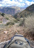
Ideally, anyone going to Cold Spring Canyon takes the time to understand the landscape before walking in it. The vegetation on the way in was robust. The overgrown mining road leading up to the spiral petroglyph boulder was easily followed after doing the 2.02 miles of FR203. Once we got to around a ¼ mile from the boulder we were pushing through brush. It was clear up to our waist with most branches ranging from torso to a little over head height. All passable, but a good reminder that we are not the only predators in this area. The predator/scavenger scat was also a good enough reminder.

We popped out of that brush just before making the turn to go up into Cold Spring Canyon. The footing area of the trail going horizontal across Cold Spring Canyon was firm with the exception of a few places that gave way and did a casual 1500' slide. Potential future padding for us? There was still plenty of evidence of prior wildfires amongst the vegetation. On the way up to the ruin, our pace was steady until the final vertical accent near a big rock face outcropping. The route turns straight up here and the ground is very soft and loose. Being in the rear, and to avoid playing tag with the loose debris, I spaced myself out to the point that we lost sight of each other. Crawling would be a more graceful description than what it took to navigate this section. This section included brief pauses with each heard but unseen rock slide to listen for the yell of a hiking partner finding a shortcut down the canyon.

After climbing back down the entrance logs of the ruins and over to where we dropped our packs it was time to push on to Pueblo Canyon. First, get off Cold Spring Canyon. As I tried to pull out some cactus needles that I slid into among the loose dirt and rock, I wondered if just sliding off the canyon face would be less painful than sliding into the prickly pear cactus 10' directly below me. Some things won’t be determined.

4:45 PM - Leaving Pueblo Canyon Ruins (V:1:130)
We stayed true to our earlier thought of “we’ll just have to walk a little faster”. My cell phone was our primary GPS and our backup was my hiking partner's Garmin watch. He didn't have this route on his watch though so he was functionally an activity tracker. On the way up into Pueblo, I checked our GPS route and noticed that the 1000' of canyon walls were throwing the GPS off. It showed us on the rock face across and up the canyon wall. Sunset was around 5:30 PM, but I noticed that we hadn’t seen the sun in the sky since about 3:30 PM as we pushed into the canyon. It wasn’t cloudy and there was plenty of ambient light so we weren’t worried about a hike back to camp in the dark. At the waterfall, we were shooting for getting off the trail to FR203 by dark. By the time we reached the ruins of V:1:130 this new plan revision included not going further to see V:1:131 & V:1:132. Add it to our growing list of future SA trips. We took ~30 minutes to eat, hydrate, and get pictures at the ruins, then headed out. With it now being 45 min before sunset our new revised revised revised thought was that we should be able to at least get back to the petroglyph boulder before dark and from there we could easily follow the old overgrown mining road to FR203.

5:50PM - Pueblo Canyon Descent
In these canyons, darkness comes quickly. The canyon rims sit over 5700’ and are backed by another ~1700’ of Aztec Peak (7684’) to the west. By 5:50 PM we needed headlamps. We had made it to the southeast side of Pueblo Canyon, a little past the large flat viewing platform that looks north to the ruins. We were comically nowhere near the petroglyph boulder. :app:

At the ruins by the old mine on the way out, I saw the temp was down to 55. With headlamps going on I tried to re-check the temp and GPS. Instead, my phone flashed “iPhone Unavailable, try again in 1 hour…59:59, :58, :57….”. No primary GPS. With the canyon walls throwing his watch off, my hiking partner had reset the map at the ruins. That meant we lost the exact track that we had used going up. No phone or watch GPS. Adding to the darkness was the new moon that had brought us here this exact day. We knew it was about 1.5 miles down the canyon to FR203 and from there it was 2.02 to the truck. Even with low water left (both with <32oz), those were very manageable distances. We'd just need to move slower. In hindsight, we were at about 5200’ and needed to drop down to the road at 3750’ in the darkness and through the overgrowth. Due to how high the canyon face was we ended up having visibility of the moon slice for about 25 min that night.

We went no further than 300’ and I felt something pierce my left bicep. I was walking in the back as we pushed through brush so I figured I had gotten a branch whip. My headlamp showed me a yellow jacket perched in the center of my arm. Having just finished a quick stop we didn’t break stride. It had been over 25 yrs but I’d been stung by a yellow jacket before. The sequence was mainly frustrating, but I was grateful that it was a bicep sting and not a calf muscle sting. This seemed like something that ¼ mile of creative language and some extra water could help flush out. I had the language part covered, but water was low. With it dark and the waterfall over a 0.5 mile back up into the canyon, it was just understood that we needed to keep walking down. Within 30 minutes I was having a hard time holding my pole as my whole left arm was getting increasingly warm/tight and that side of my neck felt like a knot was sticking out.
Not in shock though.

There were a couple of stop-and-think sections along the way down from there but we didn’t stop at the spiral boulder when we reached it. Passing it was enough to refuel us. Even this open area with a view to the rest of the Cherry Creek area was impressively black. With it being just the overgrown mining road down from here we picked up our pace.

6:15 PM - Somewhere on Pueblo Canyon
As we crawled under a downed tree we both had the same realization that we hadn’t climbed under a similar tree on the way up and that the terrain was wrong. My hiking partner also got his first good look at me since being stung and strongly urged me to take a break. As I worked on pulling diphenhydramine out of my pack, he worked to locate us on his watch face. Our senses were correct, we were about 0.4 mile or so off-trail. Our missed turn shortly after the petroglyph boulder led us onto a game trail to the north and down the southern canyon slope leading back into Pueblo Canyon. We should have been going down the eastern slope. When you are not where you're supposed to be but you kind of know where you are, are you lost?

We knew my fuzziness and low water made it unwise to attempt the bushwhack back up through the overgrown wash that the game trail had taken us down, and we knew there were potential drop-offs into the canyon in the blackness to our left. With zero interest in stumbling off a cliff or pushing further down to a truly unmanageable location, the conversation briefly shifted to staying right where we were for the night. A couple of moments of silent thinking and we resumed scrolling the map around on his wrist. If you're familiar with FR203, you know that the road continues in a generally northern direction after taking a small bend just beyond the old mining road. Its path slices slightly northwest until crossing Pueblo Canyon and turning northeast, then north again as it moves past the northern canyon face. The watch topo lines showed us that the roads northwestward diagonal was running by us about 300’ away. Having never been up that part of FR203, and with 100’ topo lines we didn’t know what that 300’ of terrain was. We had choices though. It probably took us 7 min to break through that 300’ of overgrown wash and just as easily as we were mis-located, we were located.

8:03 PM - Campsite Arrival
Beyond some early sarcastic remarks about how we nailed it on the lack of moonlight, the 90 min walk back on FR203 is still a little vague to me. My left arm was little more than a painful counter weight at that point, motor skills slow, and face was buzzing all over. Nonetheless, we made it back without further issue. Within 45 min of arriving at camp we were cleaned up and next to a fire with water and beer. The stars overhead, mid 40 temps, and whiskey on ice, our conversation turned to how we needed countless more trips to this place.

11/18/23 - 3:50-10:00 AM - Campsite
Sporadic rain, dense AM fog. My whole arm was in a knot and bruised around the sting. Combining the rain with both of our bodies being pretty well beat to trash, Cooper Forks was deemed not wise. Our back up was the Moody Point ruins via Leisure Canyon TH a few miles south of us.

Around 11:00 AM - Leisure Canyon TH (bottom of trail #140)
The rain started as we got 25’ off FR203. The trail was barely visible to us and parts were way too overgrown to see where the “trail” was. We just plowed forward in the general direction that we knew the trail went. While navigating the wash area we were occasionally on trail per GPS, but more often we weren’t. After an hr of wet cold canvasing along a barbed wire fence, and no luck finding a way through, we were puzzled. We knew our path up to the rim was right in front of us but with our hike just starting, and rain toggling between yes/no, neither of us felt like crawling through the mud under the fence. We shut it down and plotted our way back to the truck arriving at it within 20 min.

Early afternoon - Campsite
We decided to pack up camp and head out after having been rained out of Cooper Fork and Devil’s, and being unsuccessful in finding our way through the fence at the bottom of the Moody Point Trail #140. The Sawmill Flats and Workman Creek area would prove even wetter a few hours later. That was it for us. After dropping my hiking partner in Chandler, I finished the retreat to Tucson 24 hrs early.
 
Apr 29 2023
avatar

 Routes 416
 Photos 49
 Triplogs 824

43 female
 Joined Jun 23 2015
 Phoenix, AZ
Pueblo Canyon RuinsGlobe, AZ
Globe, AZ
Hiking avatar Apr 29 2023
emilystardustTriplogs 824
Hiking14.01 Miles 3,374 AEG
Hiking14.01 Miles   19 Hrs   18 Mns   1.70 mph
3,374 ft AEG   11 Hrs   4 Mns Break
 no routesno photosets
Linked   none no linked trail guides
Partners none no partners
presumably took memories and left without a trace...
_____________________
 
Sep 11 2022
avatar

 Routes 597
 Photos 9,745
 Triplogs 2,470

58 male
 Joined Jan 30 2011
 Chandler, AZ
Pueblo Canyon RuinsGlobe, AZ
Globe, AZ
Hiking avatar Sep 11 2022
JuanJaimeiiiTriplogs 2,470
Hiking7.00 Miles 2,500 AEG
Hiking7.00 Miles   4 Hrs   54 Mns   1.53 mph
2,500 ft AEG      20 Mns Break
 no routes
Linked   none no linked trail guides
Partners none no partners
I took some good friends of mine who don’t hike very often but they’re very outdoorsy types back to the Indian ruins in Pueblo Canyon. The trail is very overgrown at the moment. That didn’t stop us from having a great time. There was a little water flowing in the waterfall and the road was manageable on the way in and out. Overall a very enjoyable experience
wildflower observationwildflower observationwildflower observationwildflower observationwildflower observation
Wildflowers Observation Isolated
_____________________
 
Jan 29 2022
avatar

 Guides 94
 Routes 846
 Photos 22,643
 Triplogs 2,033

52 male
 Joined Sep 18 2002
 Tempe, AZ
Pueblo Canyon RuinsGlobe, AZ
Globe, AZ
Hiking avatar Jan 29 2022
chumleyTriplogs 2,033
Hiking6.15 Miles 2,500 AEG
Hiking6.15 Miles   5 Hrs   1 Min   1.55 mph
2,500 ft AEG   1 Hour   3 Mns Break
 no routes
Linked   none no linked trail guides
Partners partners
John9L
A couple of friends were celebrating birthdays and planned a weekend in the Ancha. Never one to turn down a group hike or stacks of rocks, I was all in from the get go! :lol:

A few of us camped nearby, while others arrived in the morning. Along the way, we encountered a few more familiar faces and destroyed whatever peace and quiet might once have existed in this wilderness.

It was brisk to start, and the shaded hillsides had plenty of ice from snowmelt runoff from above. It was downright cold in the shade, and seeking out sun was key. The waterfall had a light flow, but getting behind it was not in the cards due to the ice.

A couple of times a single jet made a flyby deep in the canyon along with some sharp maneuvers that were fun to watch. The plane was white with a red tail stripe (or two?) ... which I don't believe I've seen before.

We made our way out to the ruins and took a short break before heading back down the hill. We made a last minute decision to build a fire and spend a 2nd night at camp. Somehow we managed to cobble together enough miscellaneous food and drink to make it work.

Good times and happy birthday to Viv and Daniel! :)
_____________________
I'm not sure what my spirit animal is, but I'm confident it has rabies.
 
Dec 20 2020
avatar

 Routes 175
 Photos 2,335
 Triplogs 191

female
 Joined Jan 21 2019
 Pine, AZ
Pueblo Canyon RuinsGlobe, AZ
Globe, AZ
Hiking avatar Dec 20 2020
jillyonanadventureTriplogs 191
Hiking5.19 Miles 1,479 AEG
Hiking5.19 Miles   6 Hrs   17 Mns   0.99 mph
1,479 ft AEG   1 Hour   2 Mns Break
 no routes
1st trip
Linked   none no linked trail guides
Partners partners
jharvey33
klfranz
Day 2 of our anchas adventure! We woke up at sunrise very chilly in our tents/vehicles and slowly got ready and warmed up before heading back down the road to the TH. (I will note that our acquaintances were using allFails and that route had them parking way too far away from the actual TH, especially since they had a vehicle with the ability to go way further). You can pull off the main road or continue up a steep & rocky side road for a bit. In my opinion, if you have the 4x4, drive a bit further to avoid road walking. If you do drive it, just make sure you’re very comfortable driving back down it, and have off road tires. The trail starts going uphill right away and continues uphill the whole time. However, once you get high enough, you can see the dwellings across the canyon and excitement will take over! I was psyched to see that the waterfall still had a trickle and was iced over at the top and bottom pool! :D We checked out the mine on the way to the dwellings and that was really cool; the walls had turquoise colors that were so unique! I’ve seen a lot of dwellings all over AZ and I have to say that these were quite impressive. I enjoyed the first large set the most and we took a long break/lunch there. There was a fair amount of bushwhacking in between the different sets of dwellings and we all got grabbed by catclaw (wear pants!). We visited the first 3 sets of dwellings before deciding to turn back as they were progressively not as in tact. Very pretty views and not as difficult as the hike the day prior. Also, we only saw our mutual friends that we knew would be hiking the same trail that day, so that’s always a bonus! :) We were planning on hitting up the crack house (cold spring canyon) on the way back, but since we’d spent so much time exploring the ruins, we didn’t have enough daylight left. That just means there will be a return trip though! This wilderness area is growing on me as a nice escape from crowded trails, beautiful sweeping views and so much interesting history. I have a feeling I’ll be spending more time here soon! 8)
_____________________
Restless between adventures...
  2 archives
Nov 14 2020
avatar

 Routes 416
 Photos 49
 Triplogs 824

43 female
 Joined Jun 23 2015
 Phoenix, AZ
Pueblo Canyon RuinsGlobe, AZ
Globe, AZ
Hiking avatar Nov 14 2020
emilystardustTriplogs 824
Hiking6.80 Miles 2,500 AEG
Hiking6.80 Miles
2,500 ft AEG
 no routesno photosets
Linked   none no linked trail guides
Partners none no partners
This was definitely my favorite of the three well-known dwelling groups in the area. Waterfall was just a trickle, but still technically flowing.
_____________________
 
Apr 11 2020
avatar

 Guides 94
 Routes 846
 Photos 22,643
 Triplogs 2,033

52 male
 Joined Sep 18 2002
 Tempe, AZ
Pueblo Canyon RuinsGlobe, AZ
Globe, AZ
Hiking avatar Apr 11 2020
chumleyTriplogs 2,033
Hiking6.62 Miles 2,559 AEG
Hiking6.62 Miles   6 Hrs   7 Mns   1.30 mph
2,559 ft AEG   1 Hour   2 Mns Break
 no routes
Linked   none no linked trail guides
Partners none no partners
I'd never done this one, and it has been many years since I had even driven up the road so I was excited to make this happen. I wouldn't go for the ruins, but that's just me, I don't find much interest in them. But the hike itself is quite enjoyable. Great views, fun terrain, and a very nicely flowing seasonal waterfall. The weather was great for it, with cloud cover, some nice breezes, and a chilly rain shower to finish with.

water 1 out of 5water 2 out of 5water 3 out of 5water less than max Pueblo Canyon Medium flow Medium flow
Observed at the waterfall by the ruins.
_____________________
I'm not sure what my spirit animal is, but I'm confident it has rabies.
  1 archive
Mar 28 2020
avatar

 Routes 16
 Photos 11
 Triplogs 16

38 male
 Joined Dec 09 2019
 Phoenix, AZ
Pueblo Canyon RuinsGlobe, AZ
Globe, AZ
Hiking avatar Mar 28 2020
AZTayTriplogs 16
Hiking7.99 Miles 2,043 AEG
Hiking7.99 Miles   4 Hrs   51 Mns   1.71 mph
2,043 ft AEG      10 Mns Break
 no routesno photosets
1st trip
Linked   none no linked trail guides
Partners none no partners
Visited the Pueblo Canyon dwellings. Have been to Devil’s Chasm and wanted to check these out. Was able to drive all the way to the trail head - thanks to a fellow poster for updating on the removal of the big boulder blocking the road. So fascinating to see these dwellings! Waterfall was flowing pretty good and we even saw a black bear from across the canyon!
  1 archive
Feb 29 2020
avatar

 Routes 138
 Photos 1
 Triplogs 106

44 female
 Joined Oct 21 2016
 Tempe, AZ
Pueblo Canyon RuinsGlobe, AZ
Globe, AZ
Hiking avatar Feb 29 2020
MAPTriplogs 106
Hiking9.28 Miles 2,423 AEG
Hiking9.28 Miles   9 Hrs   25 Mns   1.20 mph
2,423 ft AEG   1 Hour   41 Mns Break
 
no photosets
1st trip
Linked   linked  
Partners none no partners
Ruins! The Sierra Anches are such an incredible area to explore ruins. We had previously visited Devils Chasm and finally decided to brave Forest Road 203 again to visit Cold Canyon and Pueblo Canyon ruins. The road is still horrible & requires HC/4WD over the couple miles before Devil's Chasm and through Cold/Pueblo (probably further too). We parked at Devil's Chasm TH after reading about a boulder in the section of the road leading to Cold/Pueblo Canyons. The boulder has been moved and that section is definitely drivable.

The hike to the Cold Canyon ruins sucks. It just does. The scree is difficult and there is little to grab onto. BUT the difficulty is quickly forgotten once the "Crack House" is reached (name taken from another hiker's triplog). Coolest. Ruin. Ever. Climb up inside. It's so worth it.

Pueblo Canyon is a beautiful hike all on it's own but the ruins make it even cooler. Huge arches with falling water and ruins tucked away are the first sight to greet you after entering the canyon. The waterfall is not far off and is just gorgeous. Pass the waterfall and come upon cluster after cluster of ancient structures. What an incredible experience. I just can't imagine how these people built high up in these canyons. How lucky are we to be able to visit such incredible places?!
_____________________
 
Sep 18 2019
avatar

 Guides 100
 Routes 1,573
 Photos 16,476
 Triplogs 1,462

male
 Joined Jan 07 2017
 Fountain Hills,
Sierra Ancha Ruins, AZ 
Sierra Ancha Ruins, AZ
 
Hiking avatar Sep 18 2019
DixieFlyerTriplogs 1,462
Hiking8.45 Miles 3,026 AEG
Hiking8.45 Miles
3,026 ft AEG
 no routes
1st trip
Partners none no partners
I had never been to the Cold Creek Canyon Ruins or the Pueblo Canyon Ruins, so I decided to go check both of them out.

Both sets of ruins were well-preserved and they were amazing to see.

The drive in to the trailhead was a bit of an adventure itself -- driving 20 miles each way on an unpaved road takes a while. The road wasn't too bad until we got about 1-2 miles before Devils Chasm, and then it was pretty rough from Devils Chasm to the Cold Springs TH. You definitely would want a high clearance 4WD vehicle for this one.

We went to the Cold Springs Canyon Ruins first. Once we got near the ruins it was a tough and slippery climb up to and down from the ruins. We did not go into the crack house -- I did not want to damage any of the structure by trying to climb up in it. However, there might have been another way to get into the ruins around the corner from the crack house, but we did not check it out.

The Pueblo Canyon Ruins were impressive also. However, the trail to the ruins was very overgrown in places and was difficult to follow. Part of it was like going through a jungle, with poison ivy, grape vines, chapparel, catclaw, scrub oak, and other assorted vegetation.

There was only a trickle of water in the waterfall at the end of the canyon. On the way back we went inside of the old mineshaft that was alongside the trail.

The high canyon walls in Pueblo Canyon wrecked havoc with my GPS -- so much so that the portion of the track in Pueblo Canyon was useless. I estimated the hike distance and elevation gain as follows: The guide for Pueblo Canyon lists the distance as 7 miles and the AEG as 2,500', so I used that for Pueblo Canyon. I measured the hike to Cold Springs Canyon as 3.45 miles; the guide lists the AEG as 1,191'. The portion of the hike from the TH to the turn for Cold Springs Canyon was right at 1 mile; so to avoid doublecounting, I subtracted 2 miles from the 3.45 distance to Cold Springs, and thus came up with 1.45 for the portion of the hike from the turnoff to Cold Springs Canyon to the ruins and back. According to the guide, the AEG for Cold Springs Canyon is 1,191'; I measured a gain of 665' from the TH to the turn for Cold Springs Canyon. Again, to avoid double counting I subtracted 665' from 1,191' and came up with an AEG of 526' for the Cold Springs Canyon portion of the hike.
_____________________
Civilization is a nice place to visit but I wouldn't want to live there
 
May 13 2019
avatar

 Routes 7
 Photos 1,242
 Triplogs 61

female
 Joined Nov 21 2015
 Phoenix
Pueblo Canyon RuinsGlobe, AZ
Globe, AZ
Hiking avatar May 13 2019
PicklesTriplogs 61
Hiking8.33 Miles 4,469 AEG
Hiking8.33 Miles   6 Hrs   57 Mns   1.20 mph
4,469 ft AEG20 LBS Pack
 no routes
1st trip
Linked   none no linked trail guides
Partners none no partners
My friend Jason had never heard of the Pueblo Canyon Ruins. I felt he needed this experience! I visited these ruins over a year ago with te-wa. I was amazed by the preservation of these magnificent structures. Visiting the ruins this time was a wee bit more adventurous due to the condition of the trail. Thanks to the level of precipitation during the winter months, anything and everything that can grow in the canyon DID grow and getting to the destination was a constant, yet exhilarating, battle!
Getting through the canyon was more like trying to make your way through a tropical jungle rather than a remote area of an Arizona wilderness. The trail is extremely overgrown, the air was humid, we had a little rain and thunder and the waterfall was flowing with far more power than we ever anticipated. We could hear the roar of the water from over a mile away!
The photos captured do not do this area justice! The scenery of this hike was stunning!
_____________________
  2 archives
Mar 06 2019
avatar

 Routes 597
 Photos 9,745
 Triplogs 2,470

58 male
 Joined Jan 30 2011
 Chandler, AZ
Pueblo Canyon RuinsGlobe, AZ
Globe, AZ
Hiking avatar Mar 06 2019
JuanJaimeiiiTriplogs 2,470
Hiking7.00 Miles 2,500 AEG
Hiking7.00 Miles   4 Hrs   1 Min   1.90 mph
2,500 ft AEG      20 Mns Break
 no routes
Linked   none no linked trail guides
Partners none no partners
My Buddy Brian is in town doing some Real Estate work. We both had a light day today so I suggested we take a ride up and check out some cool Indian ruins. I am glad we did because the waterfall was spectacular today. In fact there were sever spots where the water was flowing off the top of the Canyon walls. There was also still a little snow on the ground making the hiking tricky in spots.

The only down side for the day is that on the road in, at about a quarter mile from the trail head we had a bit of a scare. It we were in any other car besides my jeep we would have tumbled down a ravine. What has happened is the snow has washed a ton of rocks onto the road past Ellison Ranch. In addition to that there are a bunch of downed trees. I went around a downed tree and right behind it the road is washed out where the water has been flowing down. It is a 5 foot drop off and 10 feet across. The front passenger wheel went down in and started back up the other side. I hit the brakes and the jeep rocked a bit. We built up the ravine about a foot and then tied the wench around a tree for extra insurance. Then I put the lockers on and gave it a go. Luckily she popped up out of there unscathed. It added a bit of excitement to our trip and cost us an extra half hour. I thought to myself if that would have been my old Jeep it would have been real ugly.

As a word of caution I would avoid going past Devils Chasm until they get the road cleaned up. There are just too many hazards. If you are a good driver with a solid 4x4 it can be done but don't say I didn't warn you. :D
 Culture
 Culture [ checklist ]
[ checklist ]  HAZ - Hike HAZard
_____________________
 
Jan 20 2019
avatar

 Photos 42
 Triplogs 10

male
 Joined Sep 15 2002
 Gilbert, AZ
Pueblo Canyon RuinsGlobe, AZ
Globe, AZ
Hiking avatar Jan 20 2019
paceTriplogs 10
Hiking7.00 Miles 2,500 AEG
Hiking7.00 Miles
2,500 ft AEG
 no routesno photosets
1st trip
Linked   linked  
Partners none no partners
Took the entire family to the Sierra Anchas to see some ruins. We arrived Sunday at just after 10 AM. We hiked up to Cold Spring Canyon Ruins, enjoyed our lunch, then headed over to Pueblo Canyon Ruins. Great hike and everyone did great, even my 9 year old never complained. We camped down below Devil's Chasm so we could do the that hike the next day. Enjoyed the blood moon and the solitude of the Sierra Anchas. Saw one other vehicle on our way in at Devil's Chasm, but never saw them after our hike or anyone else for that matter.
_____________________
 
Mar 24 2018
avatar

 Guides 37
 Routes 567
 Photos 10,963
 Triplogs 1,065

male
 Joined Jan 21 2013
 AZ
Pueblo Canyon RuinsGlobe, AZ
Globe, AZ
Hiking avatar Mar 24 2018
FOTGTriplogs 1,065
Hiking12.00 Miles 2,600 AEG
Hiking12.00 Miles
2,600 ft AEG
 no routes
Linked   none no linked trail guides
Partners none no partners
CJ and I took her mother out here for a tour. Its a pretty tough hike for a less avid hiker to do, or someone more accustomed to the Midwest and less aggressive trails, but she hung in there and toughed it out with good spirits. Luckily, the ruins were a big hit for her. The road not so much of a hit.
_____________________
  4 archives
Feb 24 2018
avatar

 Guides 37
 Routes 567
 Photos 10,963
 Triplogs 1,065

male
 Joined Jan 21 2013
 AZ
Pueblo Canyon RuinsGlobe, AZ
Globe, AZ
Hiking avatar Feb 24 2018
FOTGTriplogs 1,065
Hiking12.55 Miles 2,816 AEG
Hiking12.55 Miles   5 Hrs   55 Mns   2.28 mph
2,816 ft AEG      25 Mns Break
 no routes
Partners none no partners
This was obviously not my first time here, but honestly this area will never get old for me. This time around some ice made the hike in a little interesting and as usual you can’t beat the nice feeling that goes along with showing someone this area for the first time.

The ruins were great as usual and as stated earlier the ice was a little interesting, or dicey in spots depending on who you ask. I still maintain that for this area the fire may have improved the area slightly, but the trail has probably suffered some due to post fire erosion, but oh well that just makes it a little tougher on the masses. There are certainly some better views along the trail now and most of the annoying scrub brushes and manzanita along the route have been eradicated, so that probably cancels out the eroded portions. We only saw two other hikers the entire day and the conditions were nearly perfect for hiking overall. I forgot about the third set of ruins in Pueblo, but the "crack house" more than made up for that small disappointment, I hope. I have said this before, but I would still be a big fan of the forest service closing the road at Devils Chasm. Currently, parking at Devils Chasm to avoid the tight boulder squeeze on the road adds an additional three miles to one’s hike, if going to Pueblo or Cold Springs.

We headed to the trailhead for the “lower” Coon Creek ruins on our way out, but after not even a half mile of walking across the drab desert there, neither of us including the dogs thought the ruins would be worth continuing. We will save that one for another day, when the creek may be a more tempting aproach to the ruins.

_____________________
  3 archives
Feb 11 2018
avatar

 Guides 9
 Routes 483
 Photos 8,569
 Triplogs 637

male
 Joined Dec 07 2010
 Phoenix, AZ
Pueblo Canyon RuinsGlobe, AZ
Globe, AZ
Hiking avatar Feb 11 2018
Oregon_HikerTriplogs 637
Hiking5.20 Miles 1,785 AEG
Hiking5.20 Miles   7 Hrs      0.74 mph
1,785 ft AEG
 no routes
Linked   none no linked trail guides
Partners none no partners
It was a guys’ weekend in the Sierra Ancha with my son-in-law, Lloyd, and his Dad, Tom. The plan was to camp near the Pueblo Canyon Ruin trailhead and then do successive day hikes to the ruins in Cold Spring Canyon and Pueblo Canyon over two days. I drove up a day early to check the road conditions and secure a campsite. The road between Ellison Ranch and Devils Chasm had some rough sections best negotiated at a crawling pace in 4x4 low range. High clearance is recommended unless you’re a risk taker and skilled at picking a path through the large rocks. The large boulder blocking the road about a half mile past Devils Chasm is still there but a fairly wide bypass has been dug around it on the uphill side. Unfortunately I didn’t have anyone with me to check clearances to the boulders on both sides as I drove through the gap. Also, I was a little over confident knowing that a FJ Cruiser and numerous Tacoma pickups had negotiated this gap with no scrapes. So I now have a couple of short AZ racing stripes along the right rear quarter panel of my FJ as well as a couple of small dents.

Our planned camping site at the trailhead was unfortunately covered with cow pies thanks to the salt block placed there by the Ellison Ranch. I camped there that first night but decided to move camp to the corral below Devils Chasm early the next morning. This time I successfully drove through the boulder gap with no damage thanks to stopping several times to check my vehicle alignment with the gap. The corral was a good choice with no cow pies and plenty of room for parking and the large tent Lloyd and his Dad would stay in. Because of the road conditions I decided to meet Lloyd and Tom on Cherry Creek Road about a mile south of Ellison Ranch. We would leave their car there and load up their stuff in my FJ Cruiser to ferry them about 4 miles up to the campsite from where we would start our day hikes. There was no way I wanted to risk damage to Lloyd's Honda Pilot on this very hazardous road - that car is my daughter's daily driver.

Side Note on Ellison Ranch History:
While waiting for Lloyd to arrive Saturday morning I had the pleasure of meeting Nathan Ellison, the owner and occupant of Ellison Ranch. I was standing by the road texting Lloyd about the change in plans when he drove up and stopped to see if I needed assistance. I had just read a short book on the Ellison's ranching history so was primed to ask him questions. Nathan is the great grandson of Jesse Washington Ellison. Jesse W. Ellison was a cattle rancher from Texas and a veteran of the Civil War. In 1885 he sold out his ranch in Texas and transported his herd of 2500-3000 cattle by train from Colorado, Texas, to Bowie, AZ. From there he and his crew drove the cattle across AZ past Globe to the current location of Roosevelt Lake. They lost many head of cattle on the drive across AZ and the herd was in poor shape by the time they got to Globe. He intended to ranch in an area now covered by the lake but ended up staying only long enough for his herd to recover from the drive. The local ranchers in that area felt there was not enough room there to accommodate another large ranch so pressured him to move on. He established his first ranch in AZ about 15 miles east of Payson. There were a number of his Texas friends who came out to that area in that same time period. Jesse had 8 children, 2 boys and 6 girls, who in 1985 ranged in age from 4 to 19. At this first ranch they planted many fruit trees and the Ellison family referred to it as the “Apple Farm”. Little physical evidence of this first ranch now remains. About 1895 Jesse left this ranch near Payson and established the Q Ranch east of Pleasant Valley. His reason for leaving the Payson area was that the range was overstocked and over grazed. He sold the Q Ranch to Pecos McFadden, a fellow Texan, in 1915 and retired to Phoenix. The current Ellison Ranch in Cherry Creek Canyon was homesteaded by Jesse’s grandson, Buster (Travis) Ellison and is now occupied by Travis’ son, Nathan.

Back to the Hike:
Sunday morning we drove from camp at Devils Chasm up to Cowpie Point where we would start our hike. This time I drove through the boulder gap with no damage thanks to guidance from my two passengers. The hiking route up the old mining road is easy to follow. There's a fork in the road just pass a very large rust colored boulder. The left fork goes to Cold Spring Cny and the right fork goes to Pueblo Canyon. The huge patch of manzanita that caused confusion on my trek six years ago is now gone thanks to the Juniper Fire. At the end of the road start following the undeveloped trail up the south side of the canyon. There's some minor route finding required to find the safest route and a number of traverses on steep hillsides can be a little scary. I rested up for the return hike at the innermost ruin while Lloyd and Tom continued on to the other two ruins which I had seen on a previous trip. We got back to camp just as it was getting dark with time to cook a spaghetti dinner before retreating from the cold night to the warmth of our sleeping bags.
_____________________
 
Oct 14 2017
avatar

 Guides 3
 Routes 656
 Photos 8,821
 Triplogs 630

55 male
 Joined Apr 13 2011
 Gilbert, AZ
Cold Spring and Pueblo Canyon Ruins, AZ 
Cold Spring and Pueblo Canyon Ruins, AZ
 
Hiking avatar Oct 14 2017
ddgrunningTriplogs 630
Hiking9.98 Miles 7,479 AEG
Hiking9.98 Miles   6 Hrs   26 Mns   1.66 mph
7,479 ft AEG      25 Mns Break
 
1st trip
Partners none no partners
After camping at Devil's Chasm TH, we awoke for a second day of adventure, tackling the Cold Spring and Pueblo Canyon Ruins.

While we were eating breakfast, a couple hiked by along the road, headed toward the Cold Spring TH. After we packed up camp, we piled in the Suburban for the rough 1.5 mi. drive down the road to the TH. Along the way, we caught up with the couple that had hiked by earlier, and offered them a lift.

There is a huge boulder that has broken away from the wall and landed on the road about half way from Devil's Chasm to the TH, making for a very tight squeeze for a suburban. We barely managed to get through unscathed.

Made it to the TH and hiked with the couple for the first 1/2 mile or so. They pointed out to us the Copper Canyon Ruins across the valley. A hike for another day ....

The couple was on their way to Pueblo Canyon, but first up for us was Cold Spring, so we went our separate ways and thought we might cross paths again somewhere in the Pueblo Canyon area.

I underestimated the amount of bushwhacking and scrambling required to access these sites. Definitely regretted leaving my long pants and gloves in the car. ](*,)

That said, it was worth the effort. The Cold Spring ruins were our favorite. What a cool structure! Especially the surprise balcony out the other side of the cliff face. There is a lot of "dwelling" packed in that little crack!

After enjoying the "crack house," we made our way back to the fork and then on to Pueblo Canyon. Once you get around to the first section of the north-facing side of the canyon, the vegetation gets pretty thick, and even with a gps track, it gets a bit difficult to follow the route. We ended up bushwhacking a fair amount in this area, and the going was slow. (We did much better on the return trip.). In this area, as a general rule, when in doubt, stay closer to the cliff face.

At the mine/north-facing ruins, we stopped for lunch and admired the 3 ruin sites which were our destination on the opposite side of the canyon wall.

The mine is not much for exploring. Doesn't go too far back, and was choked with flies/bugs.

At the crossover to the north side of the canyon, I was a bit surprised to see the waterfall flowing. Pretty magical place. Would have made a nice prehistoric shower :-).

We enjoyed all three ruin sites on the south-facing side of the canyon. These must have been impressive structures in their day, and it was fun to look around. Though frankly, at that point, we were a bit low on energy reserves and looking forward to getting back to civilization.

Speaking of which, I'm amazed and puzzled how the inhabitants of these structures actually lived on a day to day basis. Not so much in Pueblo Canyon, where water was close by and the navigation not so gnarly. But Cold Spring and Devil's Chasm? What a pain it must have been, not just to get building supplies up there, but a major daily grind to get water, food, and other necessities of life.

In any event, the return hike was uneventful.

Once back at the car, we piled in for the rough road to Cherry Creek. At the "boulder," we weren't quite as lucky as going in, and just when we thought we were in the clear, the rear wheel slipped a bit and we earned a little AZ pinstriping on the back of the Suburban :-$ Oh well; I guess that will be part of the memory of the trip ....

Speaking of the suburban, just as we got to the Cherry Creek crossing, the check engine light came on and the engine went into "reduced power mode." It didn't have enough power to get up the hills. We pulled over and let it cool down; put some water in the radiator and nursed it back to pavement. After a couple more stops, it started to run fine and we made it back to Phoenix without incident. ($425 later and a new "throttle body," we are back in business ...).

All in all, a fabulous overnight Sierra Ancha trifecta with my son.

P.S. As the track shows, Route Scout had a heck of a time trying to track us in Pueblo Canyon. So, not sure what our actual mileage/aeg statistics should be, but they are both definitely off ....
_____________________
  2 archives
Apr 02 2016
avatar

 Routes 8
 Photos 2,243
 Triplogs 204

38 male
 Joined Mar 07 2009
 Colorado Springs
Pueblo Canyon RuinsGlobe, AZ
Globe, AZ
Hiking avatar Apr 02 2016
ultrazonaTriplogs 204
Hiking7.00 Miles 2,500 AEG
Hiking7.00 Miles
2,500 ft AEG
 no routesno photosets
1st trip
Linked   none no linked trail guides
Partners none no partners
Night Hike.
wildflower observationwildflower observationwildflower observationwildflower observationwildflower observation
Wildflowers Observation Light
_____________________
 
average hiking speed 1.49 mph
1, 2, 3, 4, 5  Next

WARNING! Hiking and outdoor related sports can be dangerous. Be responsible and prepare for the trip. Study the area you are entering and plan accordingly. Dress for the current and unexpected weather changes. Take plenty of water. Never go alone. Make an itinerary with your plan(s), route(s), destination(s) and expected return time. Give your itinerary to trusted family and/or friends.

helpcommentissue

end of page marker