 Route Editor

| Guide | ♦ | 49 Triplogs | 2 Topics |
details | drive | no permit | forecast | 🔥 route |
stats |
photos | triplogs | topics | location |
| 569 | 49 | 2 |
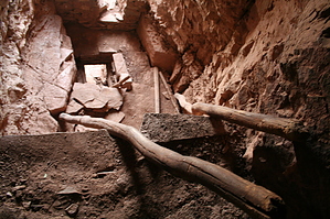
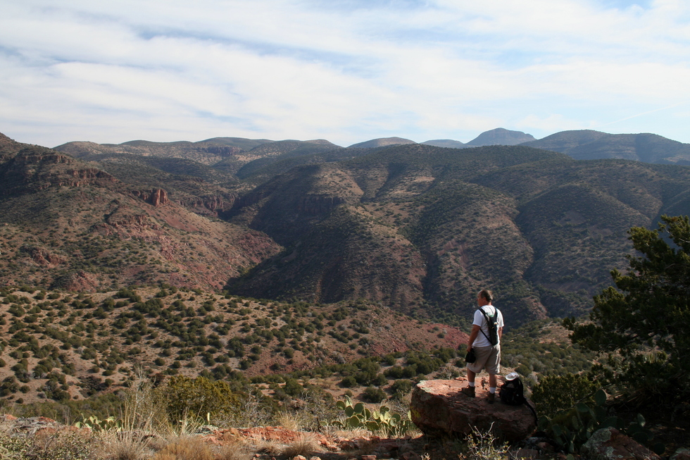
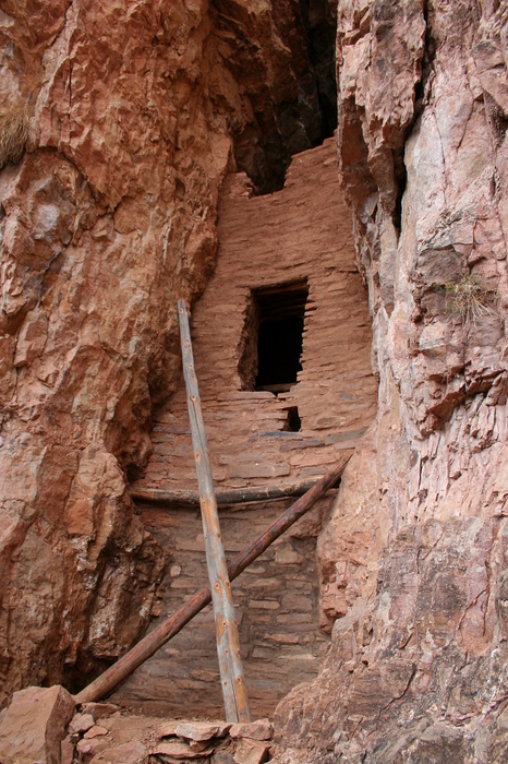
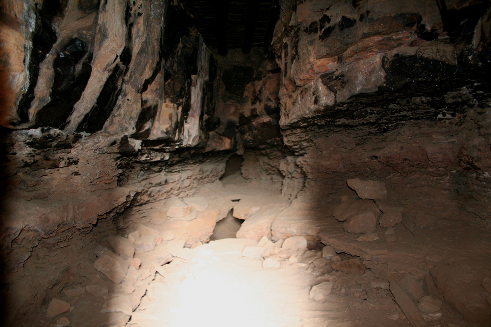
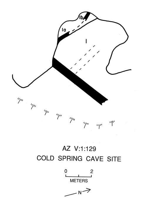
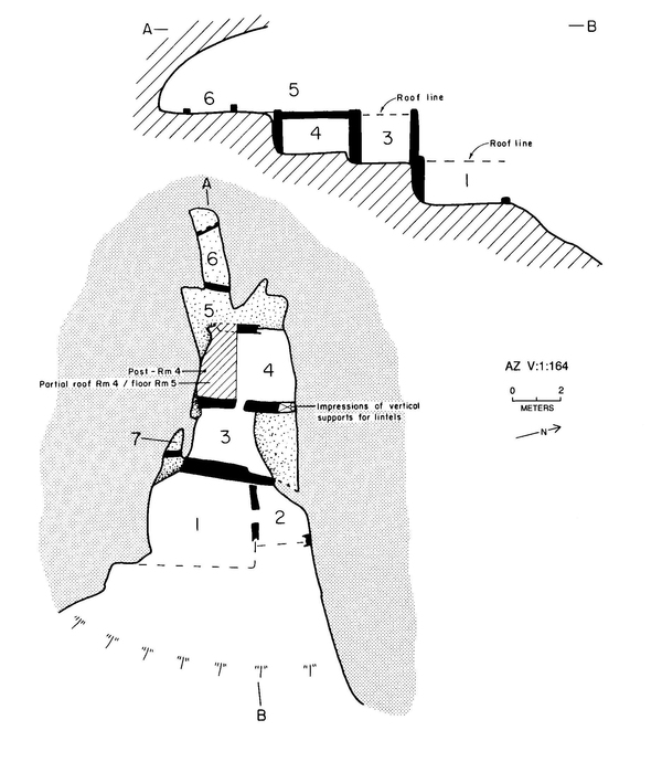
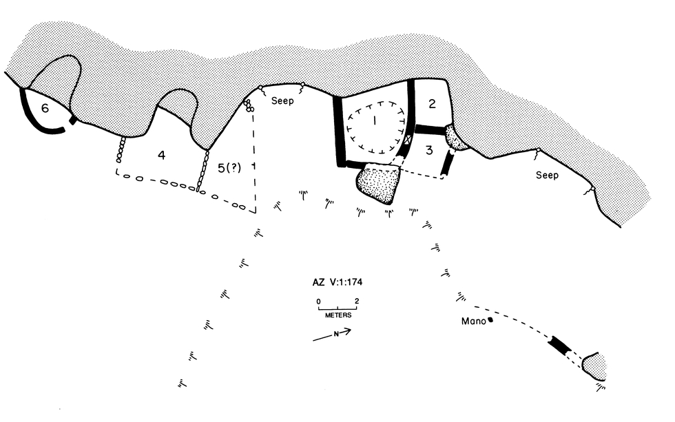
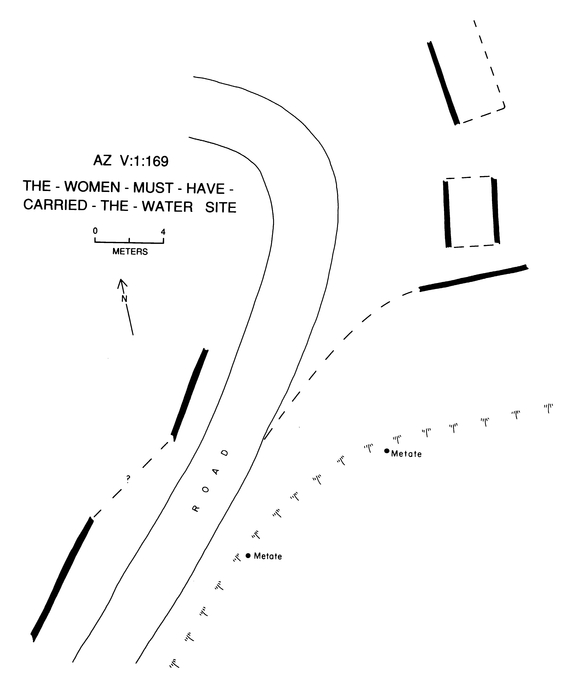
Cherry Creek Crack House? by Randal_Schulhauser   Some History Some HistoryThe Sierra Ancha (Spanish for "Wide Mountain") is an archeologically rich wilderness area known for some remarkable cliff dwellings made famous by Dr. Emil W. Haury and the Gila Pueblo Project starting in 1930. Dr. Richard C. Lange has continued that legacy with the Sierra Ancha Project beginning in 1981 and continuing to present day. Dewey Peterson was a rancher who lived on Aztec Peak circa 1900 - 1950. Peterson served as Dr. Emil W. Haury's guide during many of the Gila Pueblo Project expeditions. On one particular excursion, another local rancher, "Slim" Ellison, accompanied the Gila Pueblo Project expedition as described by Haury;
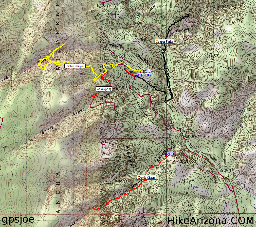
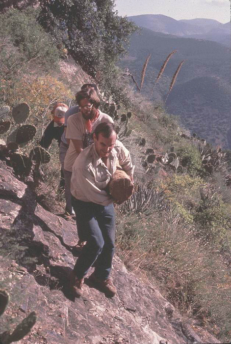
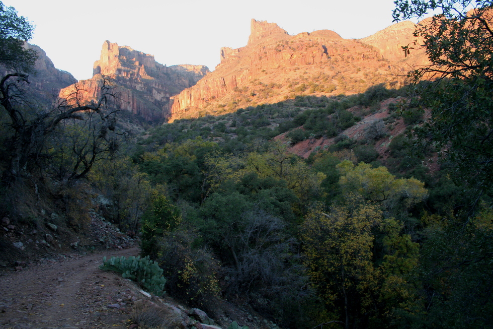
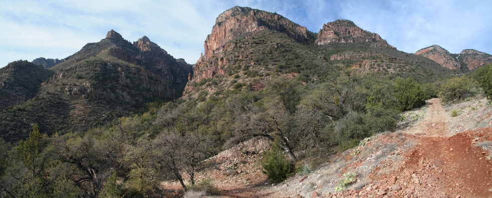
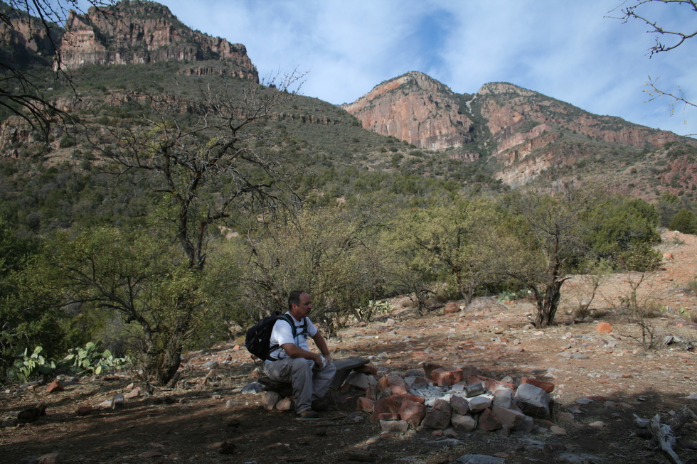
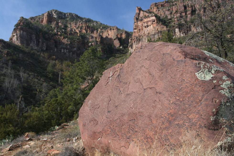
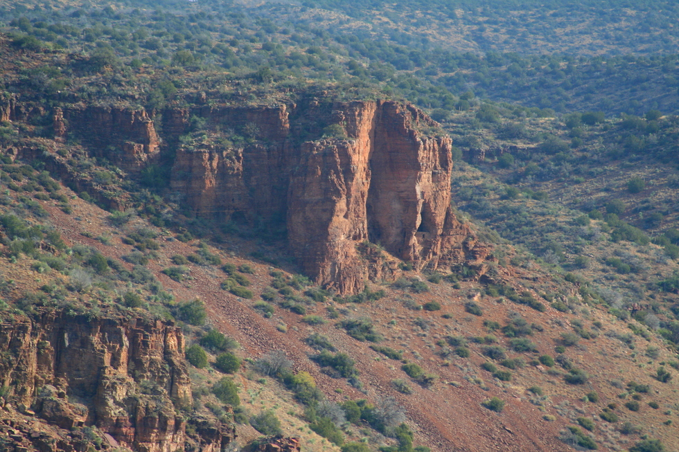
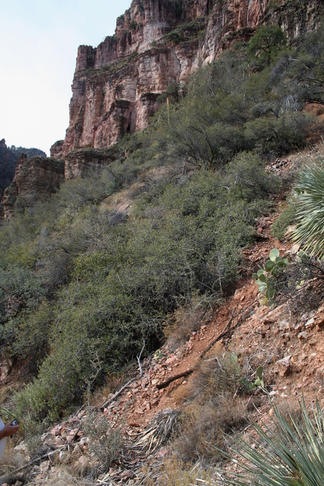
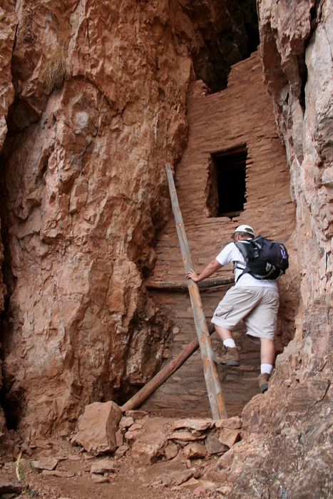
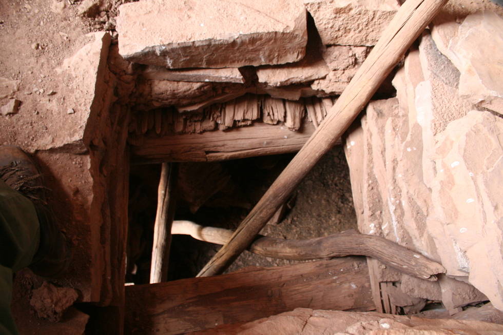
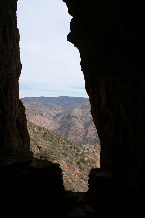
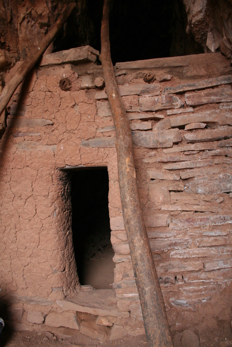
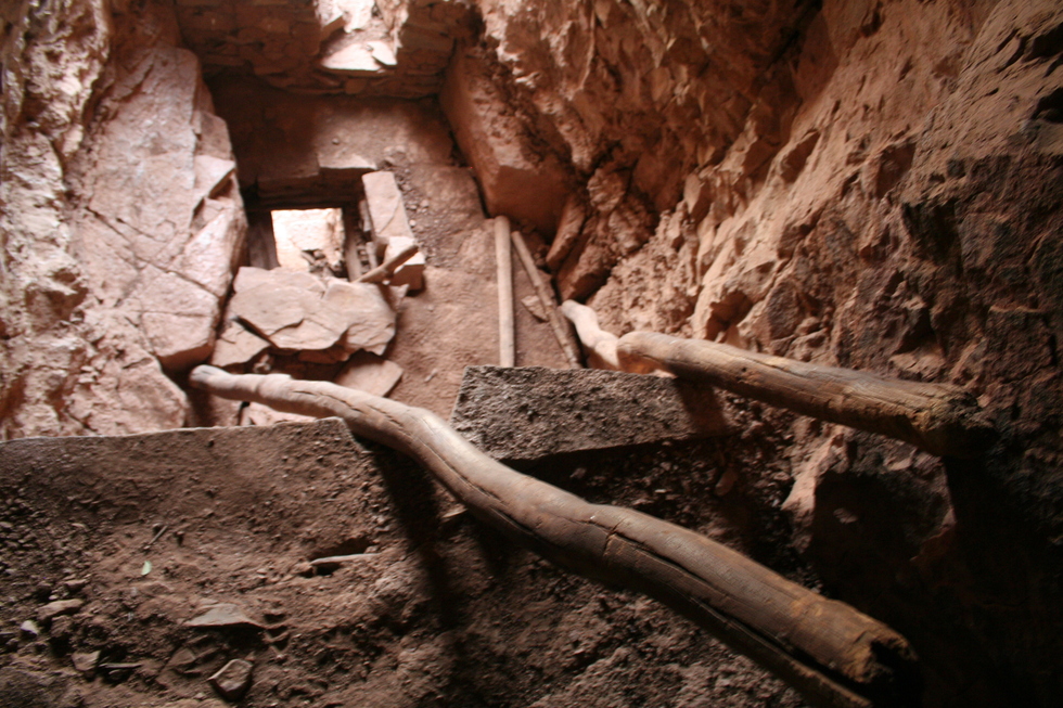
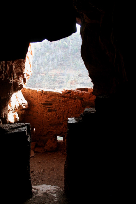
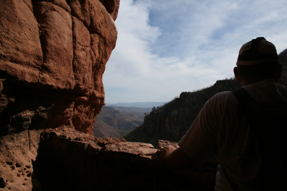
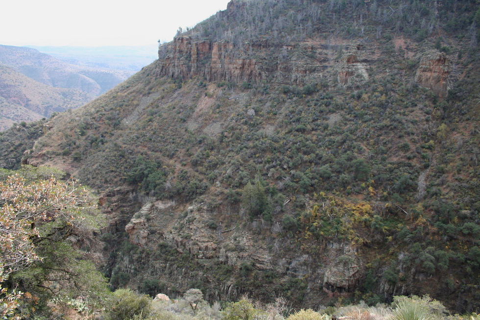
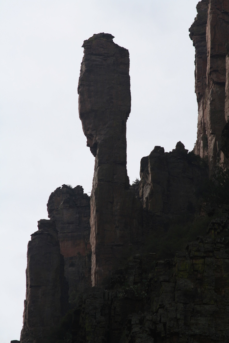
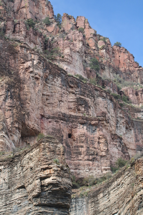
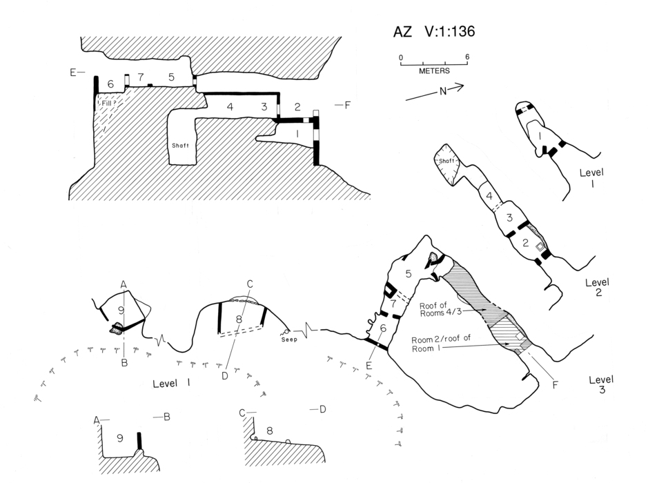
After several similar expeditions into the Sierra Ancha, Haury published his findings in 1934 as Gila Pueblo Medallion Paper #14. His seminal publication, "The Canyon Creek Ruin and Cliff Dwellings of the Sierra Ancha," was published later in the same year. You can connect to the past by viewing the remains of the Peterson Ranch near Aztec Peak. The Ellison Ranch is still a going concern within Cherry Creek Valley. Many of my favorite Cherry Creek hiking destinations are documented in Dr. Rich Lange's recent publication, "Echoes in the Canyons - the Archaeology of the Southeastern Sierra Ancha," celebrating the 25th anniversary of the Sierra Ancha Project (SAP). The SAP began in June of 1981 from a small grant by the University of Arizona Research Office to verify and update site information originally cataloged by Gila Pueblo. It soon became clear that the project's original scope was more extensive than anticipated as many new sites were discovered, and the project was stitched together piecemeal over the first 25 years of operation. One of the first major undertakings of the SAP was a main beam replacement in Cold Spring Canyon site V:1:136. Insects and water severely damaged the main roof beam, and the structure was in danger of complete collapse. In late October of 1983, a replacement beam was dragged up the old mining road by a horse. A pulley system was used to transport the beam up the scree slopes from the abandoned mining road trail to the terrace ledge near the cliff dwelling. It took four people to accomplish the final task of lifting the beam across the terrace ledge and into position within the cliff dwelling. When one ponders the magnitude of the task in the present day, you have to marvel at the determination of 700-year-old civil engineering to construct these Cherry Creek cliff dwellings. Other examples of Cherry Creek cliff dwellings have been documented within HAZ hike descriptions for; 1. Moody Point Trail #140 Moody Point Trail #140 on 2006-11-14 2. Devil's Chasm Devils Chasm on 2006-03-04 3. Cooper Forks Cyn Cliff Dwellings Cooper Forks Cyn Cliff Dwellings on 2005-09-17 4. Pueblo Canyon Pueblo Canyon Ruins on 2004-09-05 I'd like to add Cold Spring Canyon as another example of Cherry Creek cliff dwellings to the HAZ collection of hike descriptions featuring ruins. To further pique your interest, there is a remarkable mining history associated with this trail (after all, it does follow an abandoned mining road). The Big Buck Uranium Mine operated from 1954 to 1957 and is located between Devil's Chasm and Cold Spring Canyon west of FR203 at the end of the abandoned mining road. Blue Rock and Grindstone prospect deposits are also located along the abandoned mining road. The Hike From our campsite near Devil's Chasm at FR203 continue north along the Forest Road about 1 1/4 miles until you cross Cold Spring Canyon Creek. As the Forest Road bends to the east out of Cold Spring Canyon, you will notice an abandoned mining road crossing FR203 in both directions. This is the trailhead to Cold Spring Canyon and Pueblo Canyon. Follow the steady incline of the abandoned mining road constructed in 1954 to service the Big Buck Uranium Mine. Footing can be a challenge as the old road surface is comprised of ankle-rolling "baby-heads" (~6-inch diameter rocks). After completing the first quarter-mile and rising about 500 feet, take a break at the campsite remains near the Sierra Ancha Wilderness boundary. The trail will veer to the west, crossing the wilderness boundary while maintaining a steady assault on elevation gain. Around the half-mile mark, you will pass a house-sized boulder on your left. At the three-quarter-mile mark, you will pop out onto a flat terrace with a distinctive petroglyph-marked boulder on your right. The trail splits here. The trail ascending to the west takes you to Pueblo Canyon. The relatively flat trail to the south takes you to Cold Spring Canyon. Take note, if you are ascending to the west, you are on the wrong trail! We managed to take a wrong turn here but quickly recovered... The flat terrace near the Pueblo Canyon trail junction has a vista view of Cherry Creek valley. If you examine the cliff face directly to the east, you will be able to pick out the Cooper Forks cliff dwellings. Continue south along the remains of the abandoned mining road towards Cold Spring Canyon. The trail will veer to the west when it reaches the edge of the canyon. At this point, the trail will contour slowly downhill towards a dry waterfall crossing Cold Spring Canyon. Carefully scan the cliff face in front of you on the north side of Cold Spring Canyon. Look for a distinctive crack in the cliff wall forming a cave. This is the V:1:136 site described by Haury and Lange, or the more memorable name "Crack House" assigned by our hiking party... At the time you make one of the first sightings of the "Crack House," there will be a scree rock slide covering the abandoned mining road. The mining road trail becomes considerably more overgrown past the scree rock slide. Note this, as you will ascend the scree upwards towards the "Crack House". This section is nothing short of NASTY. Century plants will gouge you, prickly pear needles will penetrate you, and dust will fill your lungs. The climb is reminiscent of the scramble up to Devil's Chasm cliff dwelling. You will climb about 250 feet until you reach the cliff face. The intermittent trail will contour along the cliff face until you reach an exposed dry waterfall "punchbowl." Traverse the punchbowl heading towards a clump of trees hiding the cliff dwelling entrance. Upon passing the clump of trees, you are rewarded for your efforts! There are poles strategically located to allow entrance into the cliff dwelling. Once inside, there is much to explore. There is also a balcony view of Cold Spring Canyon. From the "Crack House" ruins, you have a clear view of the abandoned mining road traversing the south side of Cold Spring Canyon. That will take us to our next destination after negotiating our way down the scree slope. I don't know which was worse, the scree going up or the scree going down. Here's an afterthought - a good pair of work gloves would protect the hands allowing one to gain a more secure purchase on this challenging section of the trail... As you approach the dry waterfall crossing the north side to the south side of Cold Spring Canyon, you will notice rock cuts on the north side. This is the Grindstone deposit prospects (see p.114 from the Sierra Ancha mining survey). Look further west up Cold Spring Canyon to view some impressive rock spires. As you travel along the south side of Cold Spring Canyon, scan the north cliff face to spot "balcony room" from site V:1:136. The abandoned mining road is overgrown in many sections, with the occasional rock slides blocking the route. The old road will veer south, traveling another half mile to reach the Big Buck Mine site (see p.94-96 from the mining survey). The Blue Rock deposit prospects (see p.103 from the >mining survey) is located about 2000 feet SE of Big Buck Mine. Dr. Rich Lange documents 5 archeological sites in Cold Spring Canyon. We have located one of the sites. The remainder are for future adventures...
Summary The Sierra Ancha is a special area rich in history. Archeological sites and evidence of past mining activity abounds. Combine this with spectacular scenery and you've got all the ingredients of a great hike. Enjoy!
Check out the Official Route and Triplogs. Note This is a moderately difficult hike. Leave No Trace and +Add a Triplog after your hike to support this local community. | |||||||||||||||||||||||||||||||||||||||||||||||||||||||||||||||||||||||||||||||||||||||||||||||||||||||||||||||||||||||||||||||||||||||||||||||||||||||||||||||||||||||||||||||||||||||||||||||||||||||||||||||||||||||||||||||||||||||||||||


