|
| | | |
| |
|
| Hiking | 10.10 Miles |
2,255 AEG |
| | Hiking | 10.10 Miles | 9 Hrs | | 1.44 mph |
| 2,255 ft AEG | 2 Hrs Break | 15 LBS Pack | | |
|
|
| |
| Partners |
|
none
[ show ]
| no partners | | After a pleasant summer in Connecticut, I came back to Phoenix, but altogether too soon. This trip was hot! 61° when I left the car, but 84° when I got back.
As this is a well-known spot for playing in the creek, the parking lot + overflow has a huge capacity, but I was the only car when I headed out at 7 am. There is an outhouse at the trailhead. I did not see anyone until almost to The Crack, when one hiker almost caught up with me.
I stopped at The Crack, where I had a snack and refilled my water, then rock hopped across and continued up the hill to The Rim. Overnight camping is not allowed anywhere near The Crack; it is a 500 foot climb to the first allowed camping spot. It is a nice spot, but a long way from the play area. Signs at the trailhead threaten fines to anyone who ignores this restriction.
There is good signage all along this trail, but the funniest one I saw is just as you arrive at the Rim and exit the wilderness, “Trail difficult to find beyond this point.” Indeed, the trail abruptly disappears in the grass beyond the sign. No problem for me, though, as this was my planned turnaround point anyway. The meadow on the summit is beautiful and I spent an hour there.
It was getting hot by the time I got back down to the creek, so rather than rock hopping, I put on my wading shoes and forded up to knee deep. It felt soo good! There were several people around the Crack, but I didn’t stay around to socialize. The clouds were starting to build, and I could hear a few rumbles of thunder, but all the way back to the trailhead I met people still coming in, as late as 4 pm. Perhaps I am overly sensitive to the concept of flash flood, but I was glad to be back across the creek and on higher ground. |
|
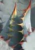
Wildflowers Observation Moderate
There was a mix of late season flowers. |
|
| | |
|
|
|
 Route Editor