username
X
password
register
for free!
help
ArticlesGuidesRoutes
 
Photosets
 
 Comments
triplogs   photosets   labels comments more
Butterfield Pass Trail - 7 members in 20 triplogs have rated this an average 3.1 ( 1 to 5 best )
20 triplogs
login for filter options
Oct 20 2024
avatar

 Guides 59
 Routes 1,100
 Photos 1,191
 Triplogs 1,290

male
 Joined Jan 01 2023
 Arizona
Mormon Battalion Trail - Christmas CampPhoenix, AZ
Phoenix, AZ
Hiking avatar Oct 20 2024
pseudalpineTriplogs 1,290
Hiking14.62 Miles 505 AEG
Hiking14.62 Miles   4 Hrs   38 Mns   3.31 mph
505 ft AEG      13 Mns Break
 
1st trip
Linked   linked  
Partners none no partners
Route Scout Route Recorded  on Route Scout | Pop | Map | Popup | MapDEX
Chilly, early morning set up of a motorcycle shuttle for this through hike. It's debatable whether this route could be rated higher than the overhyped Cabin Loop. :-k
  1 archive
Feb 04 2024
avatar

 Guides 99
 Routes 1,484
 Photos 16,072
 Triplogs 1,374

male
 Joined Jan 07 2017
 Fountain Hills,
Peak 2813 - N Maricopa Mtns Wilderness HP, AZ 
Peak 2813 - N Maricopa Mtns Wilderness HP, AZ
 
Hiking avatar Feb 04 2024
DixieFlyerTriplogs 1,374
Hiking3.98 Miles 1,132 AEG
Hiking3.98 Miles   3 Hrs   32 Mns   1.42 mph
1,132 ft AEG      44 Mns Break
 
1st trip
Partners none no partners
Route Scout Route Recorded  on Route Scout | Pop | Map | Popup | MapDEX
This was a hike to Peak 2813, the highpoint of the North Maricopa Mountains Wilderness. The unnamed peak has its spot elevation marked on topo maps, and it has prominence of 1,253 feet.

We started and ended the hike at the Margies Cove East TH. Getting to the trailhead is not straightforward these days as the "8000" roads in the area are officially closed to motor vehicles at the present time. However, I was able to get a "Letter of Agreement" from the BLM that allowed me to drive to the trailhead. Even with the Letter, I was not able to take the direct route to the trailhead because Road 8002 was closed south of Road 8003 to Highway 238. Instead I had to take Road 8004 to Road 8003, and take that over to Road 8002. From there I drove north on Road 8002 to Road 8002A, which I took to the Margies Cove East Trailhead.

We started out on the Margies Cove Trail and left it not too far past a wildlife guzzler. We made our way through a drainage, and then climbed the steep and slippery south slopes to the summit. There was lots of grus gravel on the steep ascent, which was very, very slippery. We had to scramble on and around some boulders near the top, but we got there. After enjoying the views and eating lunch, we headed back. On the way back we were slightly east of our ascent route, and it the descent went much better than the ascent.

There were a few poppies blooming out there and even a couple of lupine were blooming. I would not be surprised if this area has a good wildflower show by the end of the month.
 Flora
 Flora [ checklist ]
[ checklist ]  Coulter's Lupine
wildflower observationwildflower observationwildflower observationwildflower observationwildflower observation
Wildflowers Observation Isolated
There were a few poppies and a couple of lupine blooming.
_____________________
Civilization is a nice place to visit but I wouldn't want to live there
 
Apr 02 2020
avatar

 Photos 392
 Triplogs 67

54 male
 Joined Mar 23 2009
 Central AZ
Butterfield Pass TrailPhoenix, AZ
Phoenix, AZ
Hiking avatar Apr 02 2020
trekkintooTriplogs 67
Hiking6.50 Miles 554 AEG
Hiking6.50 Miles   4 Hrs   30 Mns   1.44 mph
554 ft AEG10 LBS Pack
 no routes
1st trip
Linked   none no linked trail guides
Partners none no partners
been awhile since ive been on the haz site. Since the pandemic advised social distancing, i decided to do a trek to the happy camp water cistern that was made for travelers along the first ‘interstate’ of southern Az, the Old Butterfield Overland Stage & mail route. From the 60,000 49’ers traveling thru on their way to the gold fields of Cali, to the first native runners on these trails centuries if not thousands of years ago. There’s something still captivating walking this area with all the history that happened. You can easily see how the Yavapai and Apaches were able to easily ambush the stagecoaches along the route. Ive seen more than a few piles of rocks to the side of the road. Possibly some old graves of some unfortunate souls that were ambushed maybe? I started from the Shawmut TH, walked north about a mile to the bathrooms. then veered east and headed to Butterfield pass and then eventually cresting at Happy Camp cistern. Very few footprints and even better views! Spent some time pondering who’s who of history that wouldve walked these trails. Then backtracked my way back to the trailhead. This area is still closed to OHV & motorized traffic, THANKFULLY!! So you will have to earn the right to see Happy Camp now by doing the over 8-9 mile rt hike. Its one worth doing!!
_____________________
 
Jan 01 2019
avatar

 Routes 36
 Photos 2,658
 Triplogs 1,347

67 male
 Joined Jul 28 2004
 Scottsdale, AZ
Butterfield Pass TrailPhoenix, AZ
Phoenix, AZ
Hiking avatar Jan 01 2019
mazatzalTriplogs 1,347
Hiking14.40 Miles 910 AEG
Hiking14.40 Miles   6 Hrs   25 Mns   2.50 mph
910 ft AEG      40 Mns Break
 no routes
Linked   none no linked trail guides
Partners partners
guitar
jhelfers
Happy New Year!
With the chilly temps we headed south to lower elevation! Did an on/off trail CCW loop in the northern section of the Maricopa Mtns. [Checked with @Alston_Neal that the area is still closed to motor vehicles: yes, mostly. Thank you.]

Started at the parking area near the Estrella signal and followed the track north to Butterfield Pass Trail and took that west to Happy Camp Cistern. From Happy Camp off trail south and then east along washes and pleasant desert back to the start.
wildflower observationwildflower observationwildflower observationwildflower observationwildflower observation
Wildflowers Observation Isolated
_____________________
 
Dec 18 2016
avatar

 Guides 1
 Photos 1,513
 Triplogs 108

69 male
 Joined Apr 19 2008
 Phoenix, AZ
Butterfield Pass TrailPhoenix, AZ
Phoenix, AZ
Hiking avatar Dec 18 2016
Alston_NealTriplogs 108
Hiking9.00 Miles 370 AEG
Hiking9.00 Miles
370 ft AEG
 no routes
Linked   none no linked trail guides
Partners none no partners
A long time old friend of mine called and asked if he could go hiking with me Sunday, since our wives would be busy with a shower. Well where should I take him? Knowing his political bent makes him make Tea Party folks look like Liberals, I thought lets go down to the Maricopas and see what drug traffic stuff we can find. This could either be really fun....or not. We parked by the Virgin of Guadalupe on the Maricopa/Gila Bend road. Not far from there I had found many sites with backpacks, carpet booties and other trafficking flotsam. I was amazed at how much more stuff had been added in the last year.
We then headed up to the old Butterfield Stage route. I had told him about a saguaro that was growing right next to the road and I always wondered how big it was when the stage passed it. A couple of weeks back the Mrs. and I were hiking Margies cove and noticed that a major storm had come through and blew down many saguaros and trees. The micro burst and massive rain had hit here also, so between the two areas we had lost hundreds of saguaros. Alas also the one by the trail I told my friend about.
[ photo ]
On our return trip we found a curious little trailer that had been pulled up a wash. Gee I wonder what it was carrying?
_____________________
Semifunctional adult


Our humble abode..
https://www.territorialindianarts.com/
  2 archives
Mar 13 2016
avatar

 Guides 1
 Photos 1,513
 Triplogs 108

69 male
 Joined Apr 19 2008
 Phoenix, AZ
Butterfield Pass TrailPhoenix, AZ
Phoenix, AZ
Hiking avatar Mar 13 2016
Alston_NealTriplogs 108
Hiking8.00 Miles 554 AEG
Hiking8.00 Miles
554 ft AEG
 no routes
Linked   none no linked trail guides
Partners none no partners
Our last foray into the Maricopa Mtns, unless a cold front moves through. In our continuing quest for historical passes and camps in this area we chose to deviate from the main Butterfield Stage route to the lesser known Oleo Pasture Stage route. We headed for a water tank that has had water in it in the past. I know where all water aprons are out here. This allows our dogger to have a water source for her. While I always carry enough for all of us, we can go much farther and longer if there is a source for Tus. Alas today the tank was dry and the temps started to climb. We still checked out some new areas and the flowers were awesome. Also found the little graveyard by Shawmut Pass that I wanted to see.
_____________________
Semifunctional adult


Our humble abode..
https://www.territorialindianarts.com/
 
Nov 21 2014
avatar

 Guides 116
 Routes 337
 Photos 11,399
 Triplogs 894

63 male
 Joined Dec 20 2010
 Sunnyslope, PHX
Mormon Battalion Trail - Christmas CampPhoenix, AZ
Phoenix, AZ
Hiking avatar Nov 21 2014
kingsnakeTriplogs 894
Hiking15.51 Miles 615 AEG
Hiking15.51 Miles   5 Hrs   43 Mns   2.71 mph
615 ft AEG
 
1st trip
Linked   linked  
Partners none no partners
FR 8003, from AZ 238, near the Estrella Siding, to Christmas Camp at North Tank, was very smooth, though some deep areas might make it difficult for cars. The deep areas were either actual powdered dirt or a very fine gravel that was smaller than pea gravel, but larger than grains of sand. There were animal tracks everywhere, especially in the powdered dirt, but also even in the hard pack to the side of the road. There was literally 0 AEG from the highway to the tank. I've never seen that: Usually there is at least some slight ups when going down. My first AEG came when I climbed the tank's berm. : rambo :

From Mile Marker 0, it is 5.5 miles and 250 AEG to the FR 8002 intersection. :sweat: The trail is mostly easy to follow but, if you lose it, the hard pack is easy to walk on, and the only cacti are a few scattered barrel cactus. 90% of the non-wash vegetation is creosote; the rest bursage or brittlebush.

While technically the Mormon Battalion trail is also FR 8003, motorized traffic is not allowed. I saw a ton of human prints on the trail, as well as a fair number of horse prints. It was odd to see so many human prints, for being in the middle of nowhere, and not altogether scenic with the nearest mountains being several miles away.

The older wooden markers were placed by the Kimball Stake, while the metal cow skull markers mostly seem to have been placed by Bryan Jarman as a 1987 Eagle Scout project for the East Stake. Troop 507 placed an additional plate under one marker in 2002. The skull marks are supposedly every mile, but I found two that were only a quarter mile apart. :-k

The east trailhead registry / de Anza sign is at the intersection of FR 8003 and FR 8002, which appears to be open back to AZ 238. There are "No motorized traffic" signs all up & down FR 8002, while they are also spaced every 100 yards or so west along FR 8003 (the Mormon Battalion / Butterfield trail). So, driving appears to be okay, as long as you stay on designated forest roads. On an otherwise shadeless hike, a rather large palo verde provides welcome mid-day relief at the intersection.

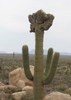
From the intersection to the top of the pass is 150 feet in 1.5 miles, which qualifies as "steep" on this hike. After leaving the intersection the vegetation changes to occotillo, saguaro and hedgehog cacti. The sign announcing Butterfield Trail Campsite is still misplaced two miles east, just before the top of the pass. Saw several interesting saguaros, including one that looked like a squid, and several others which looked like they were having quite a party. :whistle:

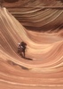
It drizzled from 1245, just after I arrived at Happy Camp, until about 1305, after I started up the saddle between Estrella BM and Hill 2065. The many washes before and after that saddle were not deep, but had quite steep sides. The key was to stay midway up the slope. Despite the saddle having a healthy field of cholla, I adroitly avoided puncture. (Until I sat down for a break, and got a few in my :pk:.)

The final half mile followed a fence to the clearing on AZ 238, just east of Shawmut. By sheer luck, I came out at the exact point my wife was waiting for me. :y:

I took 132 pictures and 30 audio notes. 8-[

Was hoping the Garmin 62S-estimated 16.7 miles would at least be close, allowing me to break a personal mileage record ( http://hikearizona.com/photoset=15253 ), and indeed it held up. Barely. :roll:

-----

Video : http://youtu.be/NB9GimcMHdM
 Flora
 Flora [ checklist ]
[ checklist ]  Saguaro
 Fauna
 Fauna [ checklist ]
[ checklist ]  Ants
 Meteorology
 Meteorology [ checklist ]
[ checklist ]  Sunrise

water 1 out of 5water 2 out of 5water 3 out of 5water 4 out of 5 North Tank 76-100% full 76-100% full
Lots of water, but damp areas along the bank indicate it might be drying out.
_____________________
http://prestonm.com : Everyone's enjoyment of the outdoors is different and should be equally honored.
  2 archives
Oct 26 2013
avatar

 Guides 5
 Routes 29
 Photos 605
 Triplogs 880

55 male
 Joined Mar 05 2011
 Pocatello, ID
Mormon Battalion Trail - Christmas CampPhoenix, AZ
Phoenix, AZ
Hiking avatar Oct 26 2013
WoodsnativeTriplogs 880
Hiking4.30 Miles 10 AEG
Hiking4.30 Miles
10 ft AEG
 
Linked   linked  
Partners none no partners
Overnight camp with a group of scouts. One of them left his tent door open and a bag of peanuts in there, so when he went to bed he met a kangaroo rat. Other wildlife included kit foxes, coyotes, deer tracks, and of course lizards.
_____________________
If you don't run, you rust.
-T. Petty
 
Feb 24 2013
avatar

 Routes 36
 Photos 2,658
 Triplogs 1,347

67 male
 Joined Jul 28 2004
 Scottsdale, AZ
Butterfield Pass TrailPhoenix, AZ
Phoenix, AZ
Hiking avatar Feb 24 2013
mazatzalTriplogs 1,347
Hiking13.50 Miles 1,660 AEG
Hiking13.50 Miles   6 Hrs   55 Mns   2.31 mph
1,660 ft AEG   1 Hour   5 Mns Break
 no routes
Linked   none no linked trail guides
Partners none no partners
We took advantage of the cooler temps to do an on/off trail clockwise loop in the northern section of the Maricopa Mtns. Started at the parking area near the Estrella signal and followed 4 washes to intersect Butterfield Trail at Fortymile Desert Tank / Desert Staion and then headed back east over Butterfield Pass and then south to the start. Saw six yellow poppies: one group of 3 and 3 singles. Not sure that counts as "isolated" on the observation meter :) but this area should be pretty good in a few weeks.
wildflower observationwildflower observationwildflower observationwildflower observationwildflower observation
Wildflowers Observation Isolated
_____________________
 
Jan 13 2013
avatar

 Routes 36
 Photos 2,658
 Triplogs 1,347

67 male
 Joined Jul 28 2004
 Scottsdale, AZ
Maricopa Mtns - Estrella BM - 2766, AZ 
Maricopa Mtns - Estrella BM - 2766, AZ
 
Hiking avatar Jan 13 2013
mazatzalTriplogs 1,347
Hiking13.60 Miles 1,560 AEG
Hiking13.60 Miles   7 Hrs   25 Mns   2.15 mph
1,560 ft AEG   1 Hour   5 Mns Break
 no routes
1st trip
Linked   linked  
Partners partners
guitar
We took a creek bed from the east side and up a ridge to the summit. We descended to the west down a steep gully :sweat: and looped back on Butterfield trail. Great day and not too chilly except at the summit.
 Named place
 Named place [ checklist ]
[ checklist ]  Maricopa Mountains
_____________________
  2 archives
Jan 14 2012
avatar

 Guides 71
 Routes 98
 Photos 9,967
 Triplogs 1,009

65 male
 Joined May 14 2003
 Ahwatukee, AZ
Butterfield Pass TrailPhoenix, AZ
Phoenix, AZ
Hiking avatar Jan 14 2012
Randal_SchulhauserTriplogs 1,009
Hiking7.50 Miles 554 AEG
Hiking7.50 Miles   4 Hrs      1.88 mph
554 ft AEG
 no routes
Linked   none no linked trail guides
Partners none no partners
With Lynn and Skippy on a trek into the Maricopa Mountains in the Sonoran Desert National Monument => http://www.blm.gov/az/st/en/prog/blm_sp ... n_des.html

Took FR8002 from the Road Closure area at SR238 and headed west along FR8002B until it dead-ended at a primo campsite. Of trail north over the saddle to join onto the Butterfield Pass Trail and loop back to the Road Closure area.

Lots of green and only a handful of wildflowers. Looks like our promising wildflower season is going to wimp out.

Dumb-founded as we leave, 2 "rice-rockets" pull into the parking area. Dude jumps out with holstered gun and a set of bolt cutters to knock down the gate. Two "rice-rockets" head north along FR8002 in a cloud of dust presumably to do some shooting... :o

Hike photos to follow...
 Flora
 Flora [ checklist ]
[ checklist ]  Saguaro
 Fauna
 Fauna [ checklist ]
[ checklist ]  Coyote
 Culture
 Culture [ checklist ]
[ checklist ]  Fraley Pose
wildflower observationwildflower observationwildflower observationwildflower observationwildflower observation
Wildflowers Observation Isolated
_____________________
  3 archives
Jan 14 2012
avatar

 Guides 5
 Routes 29
 Photos 605
 Triplogs 880

55 male
 Joined Mar 05 2011
 Pocatello, ID
Mormon Battalion Trail - Christmas CampPhoenix, AZ
Phoenix, AZ
Mtn Biking avatar Jan 14 2012
WoodsnativeTriplogs 880
Mtn Biking24.00 Miles 373 AEG
Mtn Biking24.00 Miles
373 ft AEG
 
Linked   linked  
Partners none no partners
Mountain biked north from highway 238 to Christmas Camp, and then along the Mormon Battalion trail westward. My goal was to find each 6' metal milemarker post and mark them as Waypoints along the trail. My plans went awry when I followed the wrong wash a few miles in. Even though I had been on the trail before (going west to east), the trail at this point has turned into a narrow wash, complete with shrubs on both sides. It is indistinguishable from either direction. Traces of hikers' and animals' footprints are found on both sides of the wash, --and on both sides of every wash...

After a mile side trip, I regained the trail by finding the cowpath leading to Conley Tank, going southwest, and meeting up with the trail. I backtracked a little to look for a mile marker.

Ironically, my second goal for the day was to lay down a GPS track so that others would not find themselves off trail. But what good is a track with a whole lot of wandering and backtracking? Oh well, I guess I found out where NOT to go. Anyway, thanks to some editing and checking out aerial photos back at home, I got the track straightened out and ready for uploading. Thank goodness for sattelite pictures!

After reaching the western end of the 5.2 mile trail, I signed the trail registry and got ready for stage 2 of my trip: Butterfield Pass over to the cistern. The road was very sandy in some parts, and I had to walk my bike to make it through. The Happy Camp cistern looks like it has been rebuilt, and doesn't look like it has ever had water in it. Personally, I have a hunch that a nearby depression under a tree was the original cistern...

Feeling saddle sore (I am not that great of a mountain biker), I had some lunch and a nap in the shade to regain some energy. With only 2 hours left of daylight, I decided to make a push and get back to the top of the pass quickly. I surprised a lone coyote in the process, who was returning from the guzzler.
Once I made it to the top of the pass, it was all downhill from there. I turned south at the trailhead, and cruised down the dirt road to the highway. After a few 'highway miles,' I finished the loop back to my truck.
wildflower observationwildflower observationwildflower observationwildflower observationwildflower observation
Wildflowers Observation Isolated
_____________________
If you don't run, you rust.
-T. Petty
 
Nov 11 2011
avatar

 Guides 5
 Routes 29
 Photos 605
 Triplogs 880

55 male
 Joined Mar 05 2011
 Pocatello, ID
Mormon Battalion Trail - Christmas CampPhoenix, AZ
Phoenix, AZ
Hiking avatar Nov 11 2011
WoodsnativeTriplogs 880
Hiking11.00 Miles 373 AEG
Hiking11.00 Miles   6 Hrs      1.83 mph
373 ft AEG
 
Linked   linked  
Partners none no partners
What did you do on 11-11-11? Thanks to our Veterans I had the day off, so I hit the trail with a Boy Scout troop from Gilbert. They were all age 11, hiked 11 miles, and did it on 11-11-11.
We started out near the Shawmut area (bend in highway 238) and headed north for 2 miles of cross-country. On this section we took some time to practice our map reading and route finding skills. At the Happy Camp cistern we took a break before heading east over Butterfield Pass. I started out very tired and practically fell asleep at the cistern; -but that was all I needed and I felt much better after that. In reality, most everyone in the group had their own moment of tiredness somewhere along the way.
Once we got onto the eastern section of this hike, we relied on satellite pictures of the area to help find the little-used or overgrown sections of the trail.

In the end, it was a long hike but a great accomplishment for a group who had never hiked so far in their lives. Lucky for us, all the camp gear was waiting for us at trail's end.
 Flora
 Flora [ checklist ]
[ checklist ]  Saguaro
_____________________
If you don't run, you rust.
-T. Petty
 
Mar 20 2010
avatar

 Guides 6
 Routes 13
 Photos 1,377
 Triplogs 184

41 male
 Joined Mar 29 2007
 Reno, NV
Butterfield Pass TrailPhoenix, AZ
Phoenix, AZ
Hiking avatar Mar 20 2010
sbkelleyTriplogs 184
Hiking8.50 Miles 1,700 AEG
Hiking8.50 Miles   5 Hrs   15 Mns   1.62 mph
1,700 ft AEG
 no routes
1st trip
Linked   none no linked trail guides
Partners none no partners
Been wanting to hit up this area for awhile, so tanya and I headed out to see some spring wildflowers and get another desert trek in before the heat comes. Had to start walking right off of AZ-238 as you can't drive on the roads within the monument yet. Saw a YCC crew out working on what looked be a ramada (I could be mistaken) near the highway, and also recent evidence of roadwork along the tracks we walked on. Trekked 2.5 miles in, then went cross-country to the top of Estrella Benchmark and got some great views of the Maricopas, coming back and topping out Peak 2272 on the way home. Very, very green out there right now, but a hint of summer was creeping into the air by afternoon. Both had summit logs on them, but no recorded visitors since 2005 on Estrella BM and 2008 on Peak 2272'
wildflower observationwildflower observationwildflower observationwildflower observationwildflower observation
Wildflowers Observation Moderate
_____________________
 
Mar 01 2009
avatar

 Guides 71
 Routes 98
 Photos 9,967
 Triplogs 1,009

65 male
 Joined May 14 2003
 Ahwatukee, AZ
Butterfield Pass TrailPhoenix, AZ
Phoenix, AZ
Hiking avatar Mar 01 2009
Randal_SchulhauserTriplogs 1,009
Hiking6.50 Miles 554 AEG
Hiking6.50 Miles   2 Hrs   30 Mns   2.60 mph
554 ft AEG
 no routes
Linked   none no linked trail guides
Partners none no partners
Sonoran Desert National Monument - 2009 Wildflower Hunt


Lynn and I drove up to Flagstaff Saturday to take Hannah out for dinner to celebrate her 22nd birthday. Traveling the I-17 from Deer Valley to the Carefree Highway you couldn't happen but notice the explosion of wildflower colour at the side of the road.

Looking at some last year's wildflower season photos, in particular http://hikearizona.com/phoZOOM.php?ZIP=57553 taken on March 2nd, 2008, I decided that a trek to the Sonoran National Monument would be fruitful - NOT!

I was teased by the roadside display along Hwy 347 near the Gila River crossing on the way to Maricopa - Mexican poppies and desert marigolds. As I reached Maricopa, I was dodging giant tumbleweeds rolling across the highway. This was a clue for things to come...

My F-150 was rocked by blasts of wind along Hwy 238 as I paralleled the rail line towards Gila Bend. More tumbleweed blew across the road, some exploding when they touched a passing vehicle. The weather was degenerating into a full-blown dust storm!

The wind seemed to let up as I approached the Shawmut Pass. I turned north on the Sonoran Desert National Monument access road between mile marker 18 & 17. The Trail Head Kiosk indicated temporary closure for vehicular access.

Skippy and I hopped out of the truck an hiked north along the access road towards Butterfield Pass. Certainly a dearth of wildflowers with only the odd brittlebush bloom and some unidentified purple flowers.

We did get entertained by the occasional fighter jet screaming past - very low, very fast, very loud, very cool!

Headed over to the Shawmut Trainspotting Loop to see if we could find wildflowers on the other side of the mountain...
 Flora
 Flora [ checklist ]
[ checklist ]  Wild Heliotrope
wildflower observationwildflower observationwildflower observationwildflower observationwildflower observation
Wildflowers Observation Isolated
_____________________
  1 archive
Jan 20 2007
avatar

 Triplogs 6

49 male
 Joined Jan 19 2007
 Maricopa, AZ
Butterfield Pass TrailPhoenix, AZ
Phoenix, AZ
Hiking avatar Jan 20 2007
jbeam22Triplogs 6
Hiking6.50 Miles 554 AEG
Hiking6.50 Miles   3 Hrs      2.17 mph
554 ft AEG
 no routesno photosets
1st trip
Linked   none no linked trail guides
Partners none no partners
Great family outing. My 3 year old daughter loved it! This is a good family day trip - bring a pic-nic basket. You can drive several miles in then hit the wash or 4x4 road by foot. Either way the area is beautiful and it's mostly flat trekking.
_____________________
 
Feb 18 2006
avatar

 Guides 71
 Routes 98
 Photos 9,967
 Triplogs 1,009

65 male
 Joined May 14 2003
 Ahwatukee, AZ
Butterfield Pass TrailPhoenix, AZ
Phoenix, AZ
Hiking avatar Feb 18 2006
Randal_SchulhauserTriplogs 1,009
Hiking6.50 Miles 554 AEG
Hiking6.50 Miles   2 Hrs   30 Mns   2.60 mph
554 ft AEG
 no routes
Linked   none no linked trail guides
Partners none no partners
With Lynn along the Butterfield Stage Route east of Butterfield Pass (Sonoran Desert National Monument and Maricopa Mountain Wilderness). Didn't see a single wild flower along the way and had to settle for a series of sunset photos. Guess we really need some rain...

Photo set is sequenced starting at about 6:15 pm through about 7:00 pm looking west from Rainbow Valley towards the North Maricopa Mountain Wilderness.
_____________________
 
Mar 20 2005
avatar

 Guides 71
 Routes 98
 Photos 9,967
 Triplogs 1,009

65 male
 Joined May 14 2003
 Ahwatukee, AZ
Butterfield Pass TrailPhoenix, AZ
Phoenix, AZ
Hiking avatar Mar 20 2005
Randal_SchulhauserTriplogs 1,009
Hiking2.61 Miles 554 AEG
Hiking2.61 Miles   1 Hour   45 Mns   1.49 mph
554 ft AEG
 no routes
Linked   none no linked trail guides
Partners none no partners
With Hannah and "desert dog" Buster. Hannah confirmed GPS coordinates for trail description submitted to HikeArizona.com later that day.
 Culture
 Culture [ checklist ]
[ checklist ]  HAZ Rides
_____________________
 
Feb 27 2005
avatar

 Guides 71
 Routes 98
 Photos 9,967
 Triplogs 1,009

65 male
 Joined May 14 2003
 Ahwatukee, AZ
Butterfield Pass TrailPhoenix, AZ
Phoenix, AZ
Hiking avatar Feb 27 2005
Randal_SchulhauserTriplogs 1,009
Hiking6.50 Miles 554 AEG
Hiking6.50 Miles   4 Hrs      1.63 mph
554 ft AEG
 no routes
Linked   none no linked trail guides
Partners none no partners
With "desert dog" Buster. Fantastic spring flowers, particularly poppies.
_____________________
 
Nov 18 1989
avatar

 Guides 170
 Routes 148
 Photos 5,914
 Triplogs 2,097

48 male
 Joined Apr 12 2004
 Tucson, AZ
Butterfield Pass TrailPhoenix, AZ
Phoenix, AZ
Backpack avatar Nov 18 1989
PrestonSandsTriplogs 2,097
Backpack6.50 Miles 554 AEG
Backpack6.50 Miles2 Days         
554 ft AEG
 no routesno photosets
1st trip
Linked   none no linked trail guides
Partners none no partners
My first backpacking trip, with the Boy Scouts. Summertime here would be a bad idea! :sweat:
_____________________
"…you never know when a hike might break out" -Jim Gaffigan
 
average hiking speed 2.03 mph

WARNING! Hiking and outdoor related sports can be dangerous. Be responsible and prepare for the trip. Study the area you are entering and plan accordingly. Dress for the current and unexpected weather changes. Take plenty of water. Never go alone. Make an itinerary with your plan(s), route(s), destination(s) and expected return time. Give your itinerary to trusted family and/or friends.

helpcommentissue

end of page marker