|
| | | |
| |
|
| Hiking | 6.29 Miles |
738 AEG |
| | Hiking | 6.29 Miles | 3 Hrs 35 Mns | | 2.72 mph |
| 738 ft AEG | 1 Hour 16 Mns Break | 16.2 LBS Pack | | |
|
|
| |
| Linked |
|
none
[ show ]
| no linked trail guides |
| Partners |
|
[ show ]
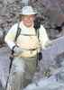
| partners | | I'd been meaning to visit the Coon Creek Ruins for almost two years...something always seemed to come up, but today was finally the day. Turning off Cherry Creek Road, we started the high clearance part of the drive on FR 38. It wasn't in bad shape--a few rocky areas, but no major issues for high clearance vehicles. The brush closes in tight on both sides of the narrow road, and after a few tenths of a mile, I decided to just pull over and park...it didn't seem worth the extra pinstripes on the truck just to avoid some fast, easy road hiking. Of course, once we got out and started hiking, the road was flatter, smoother, and wider than it had been up to that point. Lesson learned...once you've driven the early part of FR 38, you might as well keep going  . .
As expected, it was easy hiking along the roads, and we saw a lot of footprints along the way. Between those and the fairly well marked, well worn path when we left FR 1078 to circle around to the far side of the hill where the ruins are located, it seems like this site gets quite a bit of traffic, at least by Sierra Ancha standards.
I had a Geiger counter in my pocket on the hike...not that I was expecting to be near any uranium mines, but I was carrying it more out of curiosity. When we made the final scramble up toward the ruins, near the colorful red and yellow rock along the base of the cliff wall, the Geiger counter beeping and continued occasionally going off while we explored the site. The peak readings were still safe, in the 50-55 CPM range, but it was interesting to see the small spikes near the more colorful areas--those beautiful reds and yellows apparently contain some low-grade uranium.
The site itself exceeded expectations--I hadn't spent any time looking at pictures beforehand, so I didn't realize there were as many structures as there are or that the walls are in such good shape. The first main structure appeared to have once been a two-level dwelling, and part of the roof/floor was still intact. The neighboring rooms were built further up the hillside, terraced up the slope, and overlooked the lower rooms. The front walls were in good shape, and the middle room, especially, had a lot of color in the canyon wall. There's a standalone wall with a window in the middle on the near side of the site that's in great shape...it would be interesting to know what that room looked like when it was fully intact.
[ youtube video ]
Like so many of the Sierra Ancha cliff dwellings, finger marks were visible all over the mortar, and the structures had quite a few small windows/vents built into the walls. The craftsmanship of the dwellings is impressive, as is the consistency of the construction throughout all the sites scattered around the Sierra Anchas...there are plenty of modern contractors who would struggle to build that well with the benefit of modern tools and blueprints .
This site was unique among the other Sierra Anchas ruins for several reasons. These dwellings face north/northwest, whereas most of the others have a south/southeastern exposure. And these were much more easily accessible than so many of the other cliff dwellings that were built on high ledges or inside caves at the top of steep slopes...that makes it all the more impressive that these are as well intact as they are. But this site does has beautiful surroundings--there are nice rock formations high above on the opposite canyon and some nice spires down lower.
There weren't many pottery sherds here--we only saw a few, which made me wonder if the pottery that had been there was made from the colorful clay nearby and was more desirable for visitors to remove from the site. I did find one small, white sherd with a black pattern painted on it the dirt outside the ruins, which was a nice find.
We eventually packed up and hiked the roads back to our parking spot along FR 38 and then headed over to the check out the Lower Coon Creek ruins for the second hike of the day. This was an impressive, unique site that was much better than I'd expected. This being a fairly well-known site, the only thing missing from the experience was the fun of having to search for it . |
| | |
|
|
|
 Route Editor