|
| | | |
| |
|
| Hiking | 4.60 Miles |
1,755 AEG |
| | Hiking | 4.60 Miles | 5 Hrs | | 0.92 mph |
| 1,755 ft AEG | | | | |
|
|
| |
| Linked |
|
none
[ show ]
| no linked trail guides |
| Partners |
|
none
[ show ]
| no partners | | By the way it took me about 40 minutes to drive from the turnoff onto Price Road to the trailhead. The first 4 miles are paved and the rest is primitive road. The grading is quite good most of the way. For the final 4 miles, there are some rocky sections, some ruts, and some sandy areas. I took my high clearance RWD truck and easily made it. The drive should be possible with a regular car if the ground is dry. There are a few larger rocks to maneuver around. In the sandy areas, it's better to keep the momentum going and don't slow down too much.
On the drive in and from the trailhead, I was able to see the top of North Butte. I found a route on HikeArizona.com which was helpful and used that as a baseline, referring to it at times when I was not sure.
Starting out, I crossed the road and within a few minutes came to a cliff's edge, at least 30 feet vertical. I found a channel a few hundred feet to the North which allowed me to descend into the canyon below. Once in the sandy canyon, I saw evidence of cattle roaming around this area. I kept moving forward and saw a U-shaped saddle ahead to the left. This is where I needed to go. I ended up climbing the steep slope that went up just to the right of the U-shaped saddle. When I got higher up, I found a very steep trail going up in the direction of the saddle. I wasn't sure if this was a human made trail or animal trail, but it was very steep in a couple areas and the loose gravel/dirt made it difficult.
Once at the saddle, I saw a large rock formation about 500 feet away. The route I had went right of the rock formation on the way up and left of the rock formation on the way down. I decided to go right. As I continued, up ahead I saw a rocky messy canyon coming from the right and running into the rock formation. The canyon was quite messy, so I stayed close to the rock formation and kept moving forward. Eventually, I had to cross the canyon, but it wasn't so bad where I crossed. I kept moving forward and found a channel where I could climb up and be on a ridgeline. Once here, the hike got a bit easier. I could look ahead and see the butte from here. In the middle there was a channel going up to a low saddle, but along the way, there were huge rock formations to go around. I avoided the canyons and ended up following a ridgeline between 2 canyons up. This ridgeline go me all the way up to a cliff. I had the option to go left or right. Going left I would have had to drop down into a messy canyon, so I went right. I followed the cliff and was able to go around it. Once around I believe I had to cross one more canyon and then I was able to get on another ridgeline heading up. This final ridgeline appeared to go all the way up to the top of the butte. The ridgeline heading up so very steep near the top so I needed to zig-zag a bit.
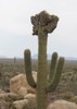
Finally I reached the top of the butte, but I still needed to walk South and Southwest to get to the high point. I had to walk over or around some boulders and rock slabs which where all over the place. Eventually, there was a lot more dirt and the ground became easier to walk on. I continued until I reached the high point. At the high point, I found a rock pile with a jar registry. I signed in and proceeded to walk to the Southern edge where I had some better views of the Gila river. I was so high up, it made the river look pretty small and insignificant, but the views were very nice. I should see South Butte on the other side of the Gila river. On the peak, I saw a lot of palo verde trees, some cholla, creosote, etc. The only wildlife I saw on the peak were a few birds, a few bees, and a few common flies. I can't imagine too much else gets up here. Maybe some deer, javelina, etc...
On the way down, I walked North along the butte to get a view from the North side. I walked to the Northern high point, got my photos and then decided to head back. There was nothing more to see up here and I've seen and took photos of the best views up there. I went to the lowest part of the saddle and started my descent down. Rather than be in a canyon, I felt it would be better to stay on the same ridgeline that I used to come up, even though it was incredibly steep. I just took my time. Partway down, I decided to get on a different ridgeline heading down which was South of the ridgeline I took up. This worked out fine for a while, but eventually the ridgeline got very rocky so I needed to curve back and meet my original track. I ended up taking roughly the same route back to where I parked.
Stats:
---------
Distance (round trip): 4.6 miles
AEG: 1,755 feet
Strava moving time: 3 hrs 4 mins
Strava elapsed time: 6 hrs 2 mins |
| _____________________
Michael Williams
IT Professional
Rocky Point Vacation Rentals
Ocean Front Condo in Rocky Point, Sonora, Mexico
www.beachfrontmexico.us
 |
| | |
|
|
|
 Route Editor