|
| | | |
| |
|
| Backpack | 4.05 Miles |
424 AEG |
| | Backpack | 4.05 Miles | 2 Days | | |
| 424 ft AEG | | | | |
|
|
| |
| Linked |
|
none
[ show ]
| no linked trail guides |
| Partners |
|
[ show ]
| partners | | An adventure and a half. Jon, Daisy and I met at Basha's in Gold Canyon around 9:30 AM on Friday, then after stopping for last minute supplies and Subway we were off to the wilderness.
Before turning on to Cherry Creek road we made a stop on the Salt River bridge to check out the rapids. While Daisy went off and did whatever schnauzers do, Jon and I peered upstream and discussed a future trip into the Salt River Canyon Wilderness starting at that bridge. Soon, after taking in the view, we were getting back into our trucks to head back out, when I heard Jon exclaim that something smelled like s***. From my truck, I smelled nothing. He couldn't figure out what it was and even suggested that the truck that had just passed us on the highway had farted (thinking back, that comment makes me lol). After looking at Daisy, however, the source of the smell became apparent- she had gone and found a pile of dung and smeared her face through it. Of course, stringy, matted schnauzer hair is not easy to clean, so Jon ended up pulling out his leatherman and giving her an impromptu haircut, groaning the entire time about how bad it smelled. Meanwhile, I had a great time laughing and taking cell phone pictures. After that mini-adventure we were on our merry way to Coon Creek.
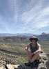
The hike down the creek was super-fun. We stayed on the path some of the way, but spent most of our time in the creek. It got better the closer we got to the river- the canyon narrows in spots and the small waterfalls become more abundant. Finally we got to the mighty Salt River and a perfect campsite under a sycamore, just shy of the river crossing.
When I did this trip in June '09, crossing the river was a cinch. It was almost chest deep in the middle, but still very much crossable because there was no current. This trip was a different story. It was up to my chest almost as soon as I got into the river, then up to my neck after a couple steps. After a failed attempt at crossing we realized we would ahve to change plans. Hiking through Redmond Flats is quite easy, but requires crossing. Any travel on our side of the river would be a different story. Tamarisk galore. And if not tamarisk, then mesquite.
We decided to try and make our way to Chalk Creek, which was about a half mile downstream, and try crossing the river there. It started out as a tree-whack and soon we made our way up the hill and into the desert, traversing a fairly steep, talus slope. I remember saying at one point that what we were doing was pretty stupid- trying to safely repeat this in the dark could be potentially disastrous (the plan was to shoot sunset then return to camp). Once the floodplain increased in size we were able to descend the slope and find a fairly decent game trail through the mesquites and into the bed of Chalk Creek. After thrashing through some more tamarisk and dipping under mesquites we were finally on the shore of the Salt and an easy crossing through some shallow rapids. The entire process of getting from Coon Creek to Chalk Creek took about 45 minutes. Sweet! We crossed the river, climbed up various ridges, and took a series of unsuccessful photos. Scouting for the next trip I suppose.
After we met back up at the rapids, the sun was below the horizon and we had to hurry to get as far as we could before dark. Stupidly, we decided to dive right into the forest of tamarisk and attempt to battle those all the way back to Coon Creek. That was mistake number 2 (#1 being the initial decision to head over to Chalk Creek, knowing we'd be back after dark). For those who have never been in a dense forest of tamarisk after dark, it's like something out of a horror movie. You're lost the second you step through the first tree. We were crawling, climbing, breaking, tearing and constantly getting punched in the face and all over the body by stiff branches. It was pitch black in there and all we could see was the web of branches right in front of us. At one point we emerged at the river and I suggested maybe we could walk the edge of the river downstream rather than battling the trees, so long as it wasn't too deep. I stepped in to test the depth and was immediately chest-deep in the water. So much for staying dry. Finally, while standing in a small clearing of tamarisk (clearing being a space just barely big enough for us both to stand up), we decided that continuing would be pointless and we had to go back to where we started. So, we turned around and thrashed our way back. An hour and a half after starting our hike back to camp, we were back at the rapids next to Chalk Creek. I'm positive we didn't make it more than 300 feet through that forest before turning around.
We spent a couple minutes regaining our composure and discussing what the plan of action would be. Logically, we decided to backtrack the way we had gotten there a few hours prior. Locating the actual bed of Chalk Creek wasn't too difficult, and soon we were making our way up the dry creek. It wasn't long before we were in another dense thicket of vegetation, and dry channels and drainages seemed to start appearing everywhere. Once again we were disoriented and had no idea where to go. Dejected, we turned around and retraced our steps back to the rapids on the river (but not before I fell into the river again, at the same spot I had soaked myself an hour earlier).
We discussed a little bit more and remembered we hadn't actually followed Chalk Creek all the way to the river. At one point we had left the creek bed and done some minor tree-whacking before walking a long, sandy floodplain down to the river. So, we decided to recreate that as our next plan. We headed up the sandy floodplain along what looked like a decent game trail paralleling the tamarisk forest and what we figured was Chalk Creek. Eventually the tamarisk forest took over and our nice path took us right into it. We dipped down into a small drainage and into the forest, over a small hump and into another drainage, then into an impenetrable wall of trees. We turned around to walk the 20 feet back out of the forest and realized we couldn't see our path in. It took us 5 minutes to get back out of what had taken us 10 seconds to get in.
Once back onto the sandy floodplain we had to discuss again. Jon still had momentum, but the claustrophobia of the dark tamarisk forests was starting to get to me, not to mention the impending feeling of hopelessness after getting lost over and over again. It had been two hours, and it was clear the only route back to camp would involve conquering a forest of tamarisk, which up to that point had been impossible.
In my pack I had a sleeping bag, rainfly from my tent, flannel, gloves, beanie, basic survival stuff (compass, lighter, first aid), and two pale ales (which could also fit in the 'basic surival' category  . Enough for two men and a small dog to make it to daylight. Without the rainfly it would have been a more difficult thing to consider (one sleeping bag?), but with it, it seemed reasonable. The main issue was Jon had given his wife a rather early ETA- he was planning to leave camp before sunrise. Staying near Chalk Creek until it was light out would certainly make him a couple hours late, thus raising some pretty serious concern that he didn't want to make his wife endure. But, I insisted it was the safest bet. As an often solo backpacker, I tend to err way on the side of caution, and my brain kept telling me that we had to balance a stupid decision (staying out there until dark) with a safe decision (staying put until daylight). . Enough for two men and a small dog to make it to daylight. Without the rainfly it would have been a more difficult thing to consider (one sleeping bag?), but with it, it seemed reasonable. The main issue was Jon had given his wife a rather early ETA- he was planning to leave camp before sunrise. Staying near Chalk Creek until it was light out would certainly make him a couple hours late, thus raising some pretty serious concern that he didn't want to make his wife endure. But, I insisted it was the safest bet. As an often solo backpacker, I tend to err way on the side of caution, and my brain kept telling me that we had to balance a stupid decision (staying out there until dark) with a safe decision (staying put until daylight).
We found a decent sandy spot, laid out the rainfly, tied up daisy, and I changed into dry clothes. As I warmed up I was able to relax a bit. We sat and let the idea of staying overnight set in for about 10 minutes before I brought up the possibility of giving it one more shot. It was subconscious at the time, but the change in momentum was what I needed to really clear my thoughts. I think we both needed to accept staying overnight so we could work more intelligently and less frantically to get back to our camp at Coon Creek. After a few more minutes it was certain we were going o try again, so we packed back up (slowly) started off again (slowly). The idea at this point was to make it as far inland as we could without hitting tamarisk, then use a combination of cottonwood waypoints and staying as close to the base of the ridgeline as possible to make it back. We would reach a cottonwood, and if we couldn't see another cottonwood in the distance (or the silhouette of one) we would stay close to the ridge to ensure travel in the proper direction. After fourty-five-or-so minutes of following cottonwoods and the ridge, we were back in the creekbed of Chalk Creek, just downstream from where it narrows into a canyon. Familiar territory! A couple minutes later we found our bootprints from earlier that day. Even more exciting! After that we were able to follow our bootprints all the way until they led back up to the talus slope below the ridgeline. Fortunately, the game trail continued along the floodplain, so we traveled that instead of risking what would be a dangerous traverse in the dark. Eventually we hit more thick tamarisk, but it we were close enough to camp that we only had to deal with it for a couple minutes before we could hear the pleasant trickle of Coon Creek nearby. Before we knew it we emerged from the brush and into Coon Creek and we could see our campsite. Success!
We both got warm clothes on and dipped into the beers while the schnauzer scarfed down all her food. A couple IPAs and a few pales later and we retreated to our sleeping bags.
The next morning Jon left around 6:30AM so he could catch some sporting event or something on that box that shoves advertisements down your throat, while I stayed in my sleeping bag until 10:30AM with some more exploration and another night on the river planned. I had an extremely leisurely morning, as I was thoroughly tuckered from the previous night's adventure. I built a small fire and hung wet clothes over it to dry, ate a slow breakfast, took my time packing up. Finally, around 1:30, I was packed up and ready to return to the rapids near Chalk Creek to properly photograph the area. I started through the tamarisk and my body yelled for me to stop. I tried another route, and another, and my arms and legs just weren't having it. I went up higher and tried the mesquite route- nope. I returned to camp and decided to head up to the ridgeline above the campsite to see if I could gain any decent photo-worthy overhead views from there. Gaining the ridge wasn't bad, but the views were boring, at best. Finally, I decided to head back up the creek and try my hand at more intimate creek shots, which is what I was secretly hoping for the entire time. I just had to justify it.
After a fun hike back I hopped in my truck to head home. Sometime around Gold Canyon I realized that I was still itching for some camping, so I made a quick turn on Peralta Rd and beelined to the Peralta TH. It was about 8PM by then, and I just crashed in the back of my truck. Woke up pre-sunrise and hiked into Barkley Basin to photograph sunrise, thus ending an awesome weekend of adventure. |
|
Autumn Foliage Observation Substantial
|
|
| _____________________
"Arizona is the land of contrast... You can go from Minnesota to California in a matter of minutes, then have Mexican food that night." -Jack Dykinga
http://www.joelhazelton.com |
| | |
|
|
|
 Route Editor


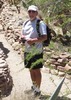
 …. Definitely worth it all for the views and magnificent rock formations surrounding the ruins!!! How they managed to stack the stones on those steep hillsides is beyond me.


 .
.


