|
| | | |
| |
|
| Hiking | 16.22 Miles |
4,343 AEG |
| | Hiking | 16.22 Miles | 7 Hrs 50 Mns | | 2.32 mph |
| 4,343 ft AEG | 51 Mns Break | 14 LBS Pack | | |
|
|
| |
| Partners |
|
[ show ]
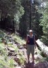
| partners | | Been 3 years since I'd been up The Ord. When Joe through it out, I though if we could get some cloud cover, it should be doable with a forecast 88 below and 77 on top.
It was 88% humidity I'll bet, when we started. It was a sweatfest on the way up under cloud cover. We took a side trip on the @PrestonSands Oak Spring Ridge to shake it up a bit. The Ladder stand was gone.
Up to the top, we circled, looked down at Eagle Peak, said maybe next time and started down.
We decided to shake it up a bit again. There was a route down I'd always wanted to try that basically rides the ridges down and meets up with FR27, the Slate Creek trail we'd taken up. It's pretty easy going and offers up some great views that you don't get on the road walk.
We did happen on some unexpected Private land that was not signed when coming down from the south. Didn't expect that on Mt. Ord. It was complete with a Container Cabin that looks pretty new.
The few times the sun came out, it was a tad warm. Downhill with the clouds, it was comfortable.
|
|
Wildflowers Observation Isolated
|
|
| _____________________
There is a very fine line between "hobby" and "mental illness."
Dave Barry  |
| | |
|
|
|
 Route Editor