|
| | | Picture Mountain and Picture, AZ | | | |
|
|
Picture Mountain and Picture, AZ
| | |
| |
|
| Hiking | 3.16 Miles |
783 AEG |
| | Hiking | 3.16 Miles | 4 Hrs 23 Mns | | 2.08 mph |
| 783 ft AEG | 2 Hrs 52 Mns Break | | | |
|
|
| |
| Partners |
|
none
[ show ]
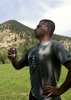
| no partners | | Years ago, while traveling on Rte 188 to the Roosevelt Reservoir area, I took notice of a mountain to the north that appeared to have ‘etchings’ on its vertical, southwest face. It turns out I was looking at Picture Mountain. After a bit of planning, I decided I’d find the way to the top and look around. I also knew there was a benchmark atop the mountain, and an azimuth mark off the mountain somewhere..
I hiked up a faint resemblance of a road (FR875) that goes up the mountain from the north. The makeshift road will get you part way to the high point, before it meanders to the east and goes over to Bear Head Mountain.
For a short stretch, the narrow, rock-filled road is as steep as the Thompson Pk road. I was laughing at its steepness while I huffed and puffed going up.
I actually did three hikes the day I climbed up Picture Mountain.
One hike before going up the mountain, and one hike after. Both of those hikes were my futile attempts to locate the azimuth mark associated with the actual benchmark located on top of the mountain. My information stated that the azimuth mark is located - “Off the mountain - In a boulder, on the west bank of a wash”. Which wash ? - Who knows? (There are three washes out there in the direction of the azimuth mark).
I do know I got all scratched up on both failed azimuth hunts. Hiking through and near three vegetation filled washes, while looking at all the boulders, tends to be a pain in the … arms ….
The actual hike up Picture Mtn is a fun little hike, with scenic views only on the edges of the mountain. Most of the interior is covered in trees and brush. There are some treeless sections up there however, where the ground is open and covered with red rocks. The Picture Mountain area is known for ruins, but this ‘ruin rookie’ couldn’t verify these open areas were once used as dwelling locations.
The etchings on the mountainside (from afar) are really unique, especially the ‘Horseman-Carrying-a-Spear’. Ironically, the horseman’s spear tip is pointing to the benchmark location atop the mountain.
I wish the spear was pointing to the azimuth mark. If it was, I might have located it.  |
| _____________________
Not All Those Who Wander Are Lost
J.R.R.TOLKIEN |
| | |
|
|
|
 Route Editor