|
| | | |
| |
|
| Hiking | 7.00 Miles |
2,500 AEG |
| | Hiking | 7.00 Miles | | | |
| 2,500 ft AEG | | | | |
|
|
| |
| Linked |
|
none
[ show ]
| no linked trail guides |
| Partners |
|
none
[ show ]
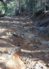
| no partners | | | Me and my 4 friends set out for Pueblo Canyon today (4/13/2013) The drive out to the ruins is mostly grated road up until you cross the river by the ranch. Then it gets a lot more rugged. Most high clearance vehicles could make this but 4x4 is a good idea. None of the road was washed out today so we drove all the way up to the trail head. We walked up the mine road/jeep path (offical path on the gps) for a good portion of the trail Its wel l marked and easy. The tail doesn't really get hard until you get up past 5500 foot level. I mean its a hike for sure. 1000 feet in a mile will test your heart rate. But clear path and no bush wacking. This trip only had a few spots that were sketchy (a little slippery and steep) The water fall was flowing and quite a site to see. The ruins were totally worth it. Theres a cool mine a water fall and a bunch a old ruines. TAKE THIS HIKE! |
| _____________________
| | |
|
|
|
|
|
| | | |
| |
|
| Hiking | |
517 AEG |
| | Hiking | | 5 Hrs 30 Mns | | 0.00 mph |
| 517 ft AEG | 3 Hrs Break | 3 LBS Pack | | |
|
|
| |
| Linked |
|
none
[ show ]
| no linked trail guides |
| Partners |
|
none
[ show ]
| no partners | | I did this trip on 3/3/2013 and it was really fun. We went to martinez mine via box canyon which i highly recommend. I was in my jeep wrangler which was needed for a few of the rocks. I would recommend a good 4x4 (mines stock with 32 inch tires and no lift.) I made it with out an issue. I will say one thing after looking at other peoples pictures im sad to say some of the stuff is now gone or destroyed. the rock cabin looks as if someone dismantled it and took parts of it away. And some of the machinery is gone too. Not sure if someone stole it or what. The bridge that once crossed the river to the mine/mill is collapsed now. They have gated off the main road leading up to the cabins and mine so you can't drive up there (which might be good to keep people honest). But the hike is short and easy.
From when we turned onto Box Canyon Rd to when we reached the mine was about 2.5 hrs give or take but we stopped a lot and got a little turned around.
i suggest go sooner than later its very run down and might not be there in a few years like it is. |
| _____________________
| | |
|
|
|
|
|
| | | |
| |
|
| 4x4 Trip | 7.00 Miles |
2,014 AEG |
| | 4x4 Trip | 7.00 Miles | 11 Hrs 14 Mns | | 0.62 mph |
| 2,014 ft AEG | | 25 LBS Pack | | |
|
|
| |
| Partners |
|
none
[ show ]
| no partners | | | I took this trip on Sept 30, 2012 as a way to get out and do a little hiking and off roading. I loaded up my jeep headed towards globe. The first thing we saw was the "angel wings", that's what the locals call the tailings from the mine. They sort of resemble the wings of an angel. The first part of the trip is all paved (globe-young hwy) so we took in the view. The jeep path to the top isn't marked all that well and i drove right by the first time. After looking at my GPS i found the jeep path. The first thing i noticed was all the trees. The first 10 mins of the drive up was pretty easy. If you don't want limbs scratching your paint don't bother with this trail. As i made my way up the rocky hill there really was only about 3 places where i had to take pause and figure out my line. After about 30 mins of driving i reached a camp site pull out so we stopped and had lunch. After this point (N33 46.481 W110 56.929) the trail becomes much more steep and difficult. We ate lunch and proceeded to climb up the rest of the way. There were fallen trees and some good size rocks that gave me pause more than once. The trail is only as wide as a single vehicle and some of the path has steep drop off's. I would not recommend doing this in snow or rainy conditions. After about 45 mins we finally reached the top and the views were spectacular. We walked up the the mine and peaked in but didn't really enter it. There was a nice cold breeze blowing out of it. After walking about for about 15 mins then started out trip down.. the trip down was MUCH easier for and we did it in about 1hr 15mins. |
|
Wildflowers Observation Light
|
|
| _____________________
| | |
|
|
|
|
|
| | | |
| |
| |
| |
| Linked |
|
none
[ show ]
| no linked trail guides |
| Partners |
|
none
[ show ]
| no partners | | | The drive out to Cherry Creek was easy from phoenix. It took about 3 hours to get the stopping point. We drove in a 4x4 and we needed every bit of it. After we got about 20 miles into the dirt road the road ended abruptly. Even our truck could not make it over the hole in the road. So we walked about 2 mile to the trail head. After passing it and wondering around for about an hour we found the trail head. This hike is not for the faint of heart. I would highly recommend gloves and long pants. You WILL get cuts and thorns if you don't. There is hands and knees crawling that you will need to do if you want to get to these ruins. But the effort is worth it. |
| _____________________
| | |
|
|
|
|
average hiking speed 0.62 mph
WARNING! Hiking and outdoor related sports can be dangerous. Be responsible and prepare for the trip. Study the area you are entering and plan accordingly. Dress for the current and unexpected weather changes. Take plenty of water. Never go alone. Make an itinerary with your plan(s), route(s), destination(s) and expected return time. Give your itinerary to trusted family and/or friends.
 Route Editor