|
| | | |
| |
|
| Hiking | 14.00 Miles |
|
| | Hiking | 14.00 Miles | 8 Hrs | | 1.75 mph |
| | | |
| |
| Linked |
|
none
[ show ]
| no linked trail guides |
| Partners |
|
none
[ show ]
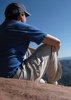
| no partners | | On Saturday (9 Feb 2008), I decided to take our traditional hike a bit further afield. So the dogs and I drove out Shea Blvd, north on Hwy 87 toward Payson, and then east on Forest Road 143 into Four Peaks Wilderness Area. Thus began what would turn into a huge misadventure.
First of all, I underestimated how long it takes to drive 20 miles on a 4WD road that winds through Arizona's craggy desert and up into the mountains. So what I thought would be about an hour's drive to the trailhead turned into 2.5. But the drive was kind of fun and my little CR-V did really well. The dogs survived all the bouncing and jolting, too, with minimal complaint.
We finally made it to the Lone Pine trailhead at 4 o'clock in the afternoon. Yes, we should have turned back then. But I'm stubborn and hated to drive all that way without getting a hike in. So we hit the trail, intending to do the Four Peaks Loop.
Fortunately, we got past other humans in a matter of minutes and I was able to let the dogs off their leashes. Boy was Reese happy to see the snow! He rolled in it, ran in it, shoveled it with his nose, ate it, rolled in it some more... Reese likes snow. Anne just enjoyed being able to run free in the woods.
Now, the book had said that the hike was about 3 hours long, so we took off at a good clip. When I could, I even jogged (leading to a couple slips and scratches, I admit). I'd forgotten my boots, but my trail running shoes have good traction and the snow wasn't deep.
So we hiked and had a good time. Then it got to be dark and way past when I thought the trail should have made the loop it was named for. My feet were wet from lots of snow and from crossing creeks, the temperature was dropping so if I stopped for more than a few minutes I got chilled through my sweatshirt (from being sweaty)...I was getting worried. But I was still stubborn and kept thinking it would be shorter to finish the loop than to turn back. It would have been if we'd been on the loop!
Finally, at 7:30 I decided we had to turn back or else we might not survive. Whenever I could, I hiked using the ambient light, but I did have a little pen light for the 2/3 of the return journey that was pitch dark. The dogs were invaluable as they knew exactly how way we had come and came and showed which way to go whenever I couldn't tell anymore. I made it back to the car at about midnight after a solid 8 hours of strenuous hiking.
FINAL ROUTE (see photoset for map): Lone Pine TH along Four Peaks Trail, turned south on Alder Trail and followed it quite a ways until lost the trail before Alder Saddle and ended up following a contour (mountain goat trail, I swear) behind Four Peaks themselves. Retreated the way we'd come. |
| _____________________
| | |
|
|
|
 Route Editor