|
| | | |
| |
|
| Hiking | 35.00 Miles |
|
| | Hiking | 35.00 Miles | | | |
| | | |
| |
| Linked |
|
none
[ show ]
| no linked trail guides |
| Partners |
|
none
[ show ]
| no partners | | | Spent 6 days in the area for a class in college. Started at Sowats Point and headed down into the canyon. The first night we spent on the esplanade right above Indian Hollow Canyon. The next day our route went straight down into Indian Hallow to Jumpup Canyon. There was some scrambling over some boulders and a swimming hole in Indian Hollow. We went down Jumpup Canyon to Kanab Creek where we spent the night on an island at the confluence of Jumpup and Kanab. From this point up to an area called the ledges the water is contaminated with old uranium tailings. Although half way between the confluence there is a water source at the bottom of crack baby canyon which can give you enough water to make it to the next water source. In between Crack Baby Canyon there is a sweet side hike up a side canyon that has petroglyphs and pictographs all over. After spending a night at the ledges we hiked cross country to the nail trail leading us to seasonal watersource. Highlights of this trail are one indian ruin which had shards here and there and petroglyphs near the ruin. This night we had slept near a drainage where we were visited by a tarantula and a few scorpions. Moving on the next day we headed into back towards Sowats Point which if I remember correctly we ended up walking through a few different canyons and left Jumpup Canyon for the last canyon of the trip and headed to a rock formation at the bottom of Sowats Point called the space station for our last night. Kanab Creek is a magical area to explore and is a mirror for self reflection. |
| _____________________
| | |
|
|
|
|
|
| | | |
| |
|
| Hiking | 3.15 Miles |
578 AEG |
| | Hiking | 3.15 Miles | | | |
| 578 ft AEG | | | | |
|
|
| |
| Linked |
|
none
[ show ]
| no linked trail guides |
| Partners |
|
none
[ show ]
| no partners | | | Was in my Arizona's 52 best day hikes book, so I decided to check it off the list. Went by myself and checked out ever square inch of the place and on the way in I hiked a bit with another man who was on the trail. I had a hard time leaving the place after being inside of it and I see why it is in the hiking guide. |
| _____________________
| | |
|
|
|
|
|
| | | |
| |
|
| Hiking | 5.00 Miles |
|
| | Hiking | 5.00 Miles | | | |
| | | |
| |
| Linked |
|
none
[ show ]
| no linked trail guides |
| Partners |
|
none
[ show ]
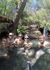
| no partners | | | Headed down to PHX from Flag, got off the I-17 and hiked and relaxed by the water for a few hours. Best way to spend a Friday morning. |
| _____________________
| | |
|
|
|
|
|
| | | |
| |
|
| Hiking | 9.00 Miles |
1,657 AEG |
| | Hiking | 9.00 Miles | | | |
| 1,657 ft AEG | | | | |
|
|
| |
| Linked |
|
none
[ show ]
| no linked trail guides |
| Partners |
|
none
[ show ]
| no partners | | | Went with my Dad with an intent of finding the ruins. Instead we hiked to the foot of the mesa on trail 4 then turned back in time for dinner. Lots of wildflowers and a cooling breeze. |
| _____________________
| | |
|
|
|
|
|
| | | |
| |
|
| Hiking | 7.00 Miles |
400 AEG |
| | Hiking | 7.00 Miles | | | |
| 400 ft AEG | | | | |
|
|
| |
| Linked |
|
none
[ show ]
| no linked trail guides |
| Partners |
|
none
[ show ]
| no partners | | | presumably took memories and left without a trace... | | _____________________
| | |
|
|
|
|
|
| | | |
| |
|
| Hiking | 6.00 Miles |
400 AEG |
| | Hiking | 6.00 Miles | | | |
| 400 ft AEG | | | | |
|
|
| |
| Linked |
|
none
[ show ]
| no linked trail guides |
| Partners |
|
none
[ show ]
| no partners | | | Still a lot of snow left, because of the warm days we've had in the last week a lot of water as well. Great place to read a book though! |
| _____________________
| | |
|
|
|
|
|
| | | |
| |
|
| Hiking | 7.00 Miles |
200 AEG |
| | Hiking | 7.00 Miles | | | |
| 200 ft AEG | | | | |
|
|
| |
| Linked |
|
none
[ show ]
| no linked trail guides |
| Partners |
|
none
[ show ]
| no partners | | | The trail and river were frozen over but that doesn't mean that nature cannot be enjoyed. |
| _____________________
| | |
|
|
|
|
|
| | | |
| |
|
| Hiking | 10.25 Miles |
3,313 AEG |
| | Hiking | 10.25 Miles | 9 Hrs | | 1.14 mph |
| 3,313 ft AEG | | | | |
|
|
| |
| Linked |
|
none
[ show ]
| no linked trail guides |
| Partners |
|
none
[ show ]
| no partners | | | Great hike! Went with two friends and spend a few hours on top. We were the only three on top of Arizona for 45 min before another group showed up. Will be doing it again. |
| _____________________
| | |
|
|
|
|
|
| | | |
| |
|
| Hiking | 1.50 Miles |
|
| | Hiking | 1.50 Miles | | | |
| | | |
| |
| Linked |
|
none
[ show ]
| no linked trail guides |
| Partners |
|
none
[ show ]
| no partners | | | Did this for the first time after moving to Flag very humbling and exciting all at the same time. |
| _____________________
| | |
|
|
|
|
average hiking speed 1.14 mph
WARNING! Hiking and outdoor related sports can be dangerous. Be responsible and prepare for the trip. Study the area you are entering and plan accordingly. Dress for the current and unexpected weather changes. Take plenty of water. Never go alone. Make an itinerary with your plan(s), route(s), destination(s) and expected return time. Give your itinerary to trusted family and/or friends.
 Route Editor