username
X
password
register
for free!
help
ArticlesGuidesRoutes
 
Photosets
 
 Comments
triplogs   photosets   labels comments more
1, 2, 3, 4  Next
72 triplogs
login for filter options
Aug 15 2023
avatar

 Photos 490
 Triplogs 189

69 male
 Joined Feb 06 2012
 Mesa, AZ
Wind River Mountains, WY 
Wind River Mountains, WY
 
Climbing avatar Aug 15 2023
DennisWilliamsTriplogs 189
Climbing
Climbing8 Days         
65 LBS Pack
 no routes
1st trip
Linked   none no linked trail guides
Partners none no partners
It just may have been the trip of a lifetime, but I hope not.

Last summer my cohorts and I packed into the Cirque of the Towers in the Wind River Mountains of west central Wyoming. We brought climbing gear and there we climbed several relatively easy routes as an intro to larger scale wilderness multi-pitch climbing and mountaineering. I had been meaning to write it up but never got around to it. We all agreed that we had left unfinished business up there and planned for a return this year. I trained up again with the cardio, several hikes up Humphrey's, and weighted backpack on the stepper at the gym. Then with about 3 weeks until departure my partner (we had planned on an efficient climbing team of two) bailed out. Life will do that. I had given up hope when I decided to look for a partner on the universal climbing web-site (which shall go unnamed). To my surprise I received an enthusiastic response from a local guy who was dying for a trip to the Windies. We met up and climbed several times at Pinnacle Peak to look each other up and down, make sure each were safe, reasonable, capable, etc. I suppose it is something like computer dating but rather more consequential. Hell, computer dating is just sex, this is climbing! He turned out to be 32, an excellent and experienced trad climber (much better than I), and extremely fit. A substantial miss-match but he wanted to go so go we did.

On d-day (Tuesday 8/15) we caught the 5:40am flight to Salt Lake City, rented a car, drove the 4.5 hours to the Big Sandy TH, shouldered packs and hiked in the 10.5 miles to Deep Lake to camp. A rather long approach for climbing. My pack had 8 days of backpacking stuff plus 21.5lbs of climbing gear/rope for a total of 66lbs. A fair load to lug up to 10,500'.

Our first climb began with reveille at 0400, a quick bite and coffee, packing up and hiking the final approach by headlamp. A classic "alpine start". Our objective was a route called Minor Dihedral on Haystack Mountain 11,978'. Rated 5.9 and about 1150' of climbing, 10 pitches, grade III. It is always a thrill to be gearing up at the base of a tall climb. Its wilderness so there is no fixed hardware. You have what you bring with you in terms of rope, cams and nuts, slings, etc., your partner, and your ability and self confidence. That's it. Look up and go solve the problem. No bailing out early or calling your mommy. Very committing. I led the first pitch of 5.8+/5.9 and some of the route after the tougher dihedral pitches. Some of it was pretty spicy. I will say that the Windies' climbs were pioneered by guys like Royal Robbins, Yvon Chouinard, Fred Becky and other stalwarts back in the '60s. They are majorly sand-bagged by today's standards. A 5.9 is a real climb, at least in my opinion. We topped out and scrambled off down the "Grassy Goat Trail" descent. Back in camp by late afternoon for the second of many horrible freeze dried dinners and some Lagavulin 16. Crashed early.

Our second climb began with another alpine start and hike up past the unnamed lake at 10,602' under the incredible north face of East Temple Peak. We chose the North Ridge route on Steeple Peak 12,030' rated at 5.8. Grade III, 5 pitches, 650' of climbing. Described as an adventure climb, the salient feature of Steeple Peak is the chimney that splits the summit into two enormous vertical slabs. Quite simply unreal. It's like a cathedral in there, or maybe the inside of the Great Pyramid of Khufu. As the term "chimney" suggests, you use body friction to hold yourself in place as you wriggle and thrutch upward between two walls with barely enough space to admit your body, gaining a big block wedged between the walls to belay. From there the chimney is wide enough to stem and use classic chimney technique (back and hands against one wall, feet against the other) to move upward. Not much protection so you just move up and depend on friction not to fall. The total chimney sections are about 150' of climbing. Spooky. Don't fall. Exit the chimney for a final 110' of 5.9 climbing (an alternate finish to the usual 5.8 route) to top out directly on the summit. Amazing views. Scrambling and 4 rappels take you back down to the talus slopes above the unnamed lake, then back to camp for more freeze dried slop and Lagavulin.

Friday we moved camp over to the the Cirque of the Towers. Something like 7 miles and the "climber's pass" just below 11,000' above Arrowhead Lake. Camped a couple hundred yards north of the waterfall in the upper cirque, positioned for the ensuing climbs. The next day I planned to sleep in and take an easy hiking/recon day to recover from 4 days in a row of activity. Around 7:00am my partner left camp to "hike around". I got up late and enjoyed doing some recon over to Pingora to get familiar with the approaches to a couple of routes on our list. This is good to do so that when you are on the trail in the wee hours of a climbing day you know where to go, important junctions, landmarks etc. and you aren't stumbling around in the dark looking for the climb. I returned to camp after noon to find him there, where he revealed that he had just free soloed the East Ridge route on Wolf's Head. He explained that he had not wanted to freak me out with worry and so he had kept the plan on the down low. Even though this route is only graded 5.6 and 1000', 10 pitches, grade IV, a free solo is a significant climbing accomplishment. And I can assure you, it also is sandbagged and is way more than 1000' of climbing. I know, we did it together 2 days later.

Sunday we were up at 0300 for an even earlier alpine start. Weather was reported to be on the way and we had planned to combine the South Buttress route on Pingora 11,889' graded 5.8 with the East Ridge of Wolf's Head (which he had just done). The route on Pingora was a very cool hand/finger crack route. A longish approach with maybe 550' of climbing, we topped out but decided not to pursue the link up with Wolf's Head due to the approach of weather and the need for some pretty nasty class 5 down-climbing from Pingora to the connecting ridge. The guide book called it "easy class 5" but like everything up there, way sandbagged. We rappelled off the southwest side of Pingora and were hit with rain just as we were getting back to camp around 1:00pm. Pretty happy I wasn't up there on the ridge in it. Later that evening we talked to a party that was and they reported hairy wet conditions and a pretty scary day. They were glad to be down off of it.

Monday was to be our final climbing day. My partner said he was good to do whatever I wanted, and Wolf's Head had been my primary objective all along. He said cool so another alpine start and up the "grassy ledges" approach listed as class 4 in the guide books, but of course, that is total nonsense. There are plenty of places where a fall would be fatal for certain. That means class 5. We were un-roped and in approach shoes carrying ropes flopping around. Sketchy to say the least. The climb is amazing. It begins with a class 5.2 but totally un-protectable pitch up the "sidewalk" a smooth ramp 18" wide. Not difficult but if you fall off either side you're dead. After several hundred feet of climbing up the knife edge that is Wolf's Head you traverse a thousand feet westward, weaving in and out between several towers along the spine. The drop is dead vertical on either side and about 600'. There are several places where you traverse along a single finger or toe crack above that drop off. Mighty airy and exposed. Really cool. Add a squeeze chimney (a chimney so narrow that you need to take off your pack and sling it from your harness down between your knees) right in the middle of the ridge. I was leading in there and at one point had to keep my head oriented sideways because my helmet would not fit through the chimney in the long direction. The summit was terrific and 6 rappels and several hours of scrambling got us back to camp. A long and exhausting day but a real bucket list climb for me.

Tuesday we broke camp and packed down to Big Sandy Lake, breaking the hike out into two chunks so we wouldn't be racing the clock on the last day to get out and drive to SLC for our flight. Lightening and thunderstorms rolled in and hail rendered the tents less than comfortable, but all in all we had good weather by high mountain standards for the trip. Wednesday we hiked out the last 6 miles, ate everything in sight at country stores and gas stations along the route back. Got home totally exhausted. Needed to sit on the couch for several days to recover. The whole thing had been pretty much at my limit. I guess I now have a better idea of what that is.

This trip shares top billing with only one or two others on my list of all-time toughest adventures. The climbs from my partner's perspective were pretty easy and he led all of the tougher stuff and most of the climbing in total. Any one of those four climbs rates as a destination climb for me. In fact Wolf's Head and Pingora are two of the "Fifty Classic Climbs of North America", a book that Roper and Steck published in 1979 as a sort of climbers bible that drove the climbing scene for two generations. I'll have a hard time topping this one. Hauling heavy loads at altitude is getting tougher, VO2max is decreasing year by year and there isn't a damned thing I can do about it, and it is taking longer to recover with advancing age. That explains my opening remark. But oh, wait, I've heard about this awesome place with awesome climbs and August of '24 is only 11 months away. Better start training up now.
_____________________
"Aequanimitas."

- Antoninus Pius
  1 archive
Jul 25 2021
avatar

 Photos 490
 Triplogs 189

69 male
 Joined Feb 06 2012
 Mesa, AZ
The Great Northern Sangre de Cristo Traverse, CO 
The Great Northern Sangre de Cristo Traverse, CO
 
Backpack avatar Jul 25 2021
DennisWilliamsTriplogs 189
Backpack47.00 Miles
Backpack47.00 Miles7 Days         
48 LBS Pack
 no routes
1st trip
Linked   none no linked trail guides
Partners none no partners
Thirty-five years in the making.

In 1975 my father inaugurated the first of what would be close to 40 yearly one-week family backpack trips somewhere in the American west. None of us, my father, myself, nor four brothers attended all of them, life getting in the way at various times. I participated in maybe 30 of those but memory fades over the years. In the early years my brothers designed the hikes in the Sierra Nevada, Gila Wilderness, Weminuche, etc. I moved to Colorado Springs in 1985 and was keen to design a hike on my own turf. We liked high country and tree-line lakes. I was looking for a string of high lakes connected by passes, 5 - 10 miles per day, and as much country above treeline as possible. I loved the Sangre de Cristos but was having a tough time finding a week long route that did not dead-end up in high cirques requiring retreat out to lower elevations. Poring over the San Isabel NF map I suddenly hit it. There were six lakes connected by trail that met my criteria in a point-to-point route. The group would drive up Friday night and arrive Saturday, arrange vehicle logistics, and camp Saturday night at the TH. Hike in Sunday and hike back out Saturday, arriving back in town in the early morning hours of Sunday. It looked do-able so I got the 7.5' topos and went to work. The route turned out much better than I could have possibly imagined. Six lakes at or above tree-line, forty-seven miles with packs, over thirty of those well above 11,000', opportunity for several 13,000' summits, eight passes over 12,000'. A kick-pumpkin route if there ever was one. In late July of 1986 we executed that hike with a party of ten, my father, my 29 year old self, and three of my four brothers included. It turned out to be a legendary hike within our circle and was always rated in the top five of the all-time best we ever did. So set the stage for the next thirty-five years.

Time passes but I had always wanted to go back and re-do some of our best hikes in complete detail, the Sangres in particular. In recent years I had suggested this to my brothers and our children but had always been met with "can we shorten it, make it easier, change the dates, etc.?" They were just not interested in a full-on backpack trip in the style we had done long ago. It occurred to me that I had some potential stalwart hikers in my climbing buddies so after one of our climbs I pulled out the notebook on the 1986 hike and made the proposal. Their eyes lit up like Christmas and I knew I had them. We set firm dates. I then invited my family, and informed them that the itinerary was not open to discussion. No takers.

Since my partners were 21 and 30 years of age I figured I had better improve my fitness. Over the 2-3 months prior to jump off I doubled my regular cardio and added stair stepper with a weighted backpack. Beginning 2 months ahead with 35lbs in the pack for 20 minutes I got it up to 60lbs for 40 minutes on the stepper, 3 times per week. Ordinarily I enjoy everything I do at the gym in some fashion. Weighted backpack on a stair stepper is just plain medicine. No joy whatever. But it pays off.

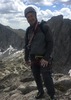
Angel and I left Phoenix Friday evening and drove through the night. We met Matt in Westcliffe, CO, the nearest town to the TH and a great little hamlet located at 7800' elevation at the foot of the Sangres in the Wet Mountain Valley. About as pretty a spot as there is. It is the seat of Custer County and has maybe 600 residents. We organized the vehicle logistics leaving one at the output TH some 19 driving miles from the Alvarado campground which is near the Venable/Comanche TH and our campsite and starting point for the hike. We car camped Saturday night and prepared for the adventure. I could scarcely believe we were there and about to go in.

The first day is a tough day. Alvarado is about 9,000'. Our destination, the Venable Lakes at 12,000', are maybe six miles in. My pack weighed in at 48.5lbs with 1 liter of water for the trail. Treeline is about 11,500' depending on N/S situation. We passed an old cabin site where the trees were thinning out. In 1986 we stopped there for lunch and took some photos. Back then the cabin still had walls and a roof. It does no longer, just a few logs in a heap. Testimony to the passage of time which we would see more of as the hike went on. No fire at camp. No wood at that elevation. Trout were rising but Matt had no luck.

The second day took us up over Venable Pass at 12,750', higher than the summit of Humphrey's Peak and with heavy packs. On the way up we saw a bachelor herd of about fifteen mule deer bucks. All big animals. Then down to 11,550' and back up over a second unnamed pass at 12,450'. Below that we bushwhacked side-hill around a big bench to get to San Isabel Lake at 11,625'. About seven miles total. I congratulated my cohorts on getting two 12,000' passes in one day. It would not be the last time. Camped at San Isabel in exactly the same location as 35 years previously. You start to hear the echos. It seemed as though we were more than three.

Day three was our shortest day. North up over an unnamed pass at 12,200' and then to Rito Alto Lake 11,327'. Maybe only three miles. We had hoped to drop packs in the pass and go for the summit of Rito Alto Pk. 13,794' but the sky was threatening and you dare not break the rules when in the high mountains. I have been chased off a summit by lightening in the past. Hair sizzling and standing up. Rocks chattering. Then a huge blast, only to repeat the process. A truly frightening experience that we wanted to avoid. Back in '86 we had clear weather and went up. That was the only departure from the original itinerary and it was due to circumstances beyond our control. At Rito Alto Lake trout were going crazy. At any given time we saw 2-3 going air-born. This went on all afternoon into the evening. Matt had a kludged fishing set up, really just hand-lining with a two foot stick for throwing. He managed to catch two nice cutthroats. We ate one and my two bites were the best food I tasted the entire trip. He kicked himself for not bringing his good spin casting setup. It would have been a massacre.

Day four took us north again down to just barely below the 11,000' line where the air felt thicker. Here is where we started to notice more changes, as in the disappearance of actual trail. The valley bottom is fairly open up past Iris Lake (just a wide spot in the creek) so the route is not hard to follow but it was becoming plain that the forest service has simply abandoned miles of trail in this northern section of the route. We saw a herd of about seventy elk and pushed up through an unnamed pass at 12,500' where we dropped packs and Matt and I went up to the summit of Silver Pk. 13,513' just as we had done 35 years earlier to the day. Wonderful sweeping views of the entire northern Sangre de Cristo range. Then we descended to Cotton Lake 11,500' to make camp. Maybe eight miles total with the summit.

Day five we were really getting into the belly of the beast. Little actual trail to speak of. Tested our route finding skills. Headed northwest and down to just below the 10,800' line, the lowest spot on the entire route, then northeast up through Horsethief Basin and then over two passes on the shoulders of the same 13,060' peak. No trail at all down in the timber. Hours of climbing over dead-fall and looking for trail. We would catch glimpses of improved trail shoulders at what used to be switchbacks or some tree blazes but everything was covered in decades of downed trees and overgrowth. The trail here, for the most part, is just gone. The first pass is at 12,800' and the second at 12,900'. Both higher than Humphrey's. The route then follows established trail down a 45 degree talus slope. The trail is visible here because it was hacked into a huge boulder field and because the elk have been using it so it stays open. The route drops down to Banjo Lake at 12,400', one of the strangest places I have camped. Maybe 9.5 miles with the bushwhacking. With the passes, a tough day.

No-one goes to Banjo Lake. There is now no trail in or out. It is possible that the 1986 party was the last to go there before us. There never was a trail all the way out down the drainage to the east, even in 1986. The lake lies in a cirque and is really just a large pond of snow melt. I am sure it freezes solid in winter. No trees. No willows or even bushes. Just a grassy hillside near the lake at the end of a high cirque. Minimalist. Oddly and starkly beautiful. A zen haiku executed in rock, grass, and water. Katsu! Back in '86 the ten of us sat in a circle on that green hillside above the lake. We had set up the tents and finished dinner. With nothing to burn we just sat down in the grass and started to tell stories. The sun went down and nightfall covered the faces so that only voices could be heard in that high, still, darkness. Many of those who were there would later remark on how that experience had affected them. They, and I too, likened it to a group of ice-age hunters sitting there in the dark telling stories into the night. The experiences 10,000 years ago and that day would have been indistinguishable. We were unhooked in time. On the present occasion we stayed up late in the dark drinking whisky and discussing the merits of the Stoic philosophers of the first and second centuries in Rome. Seneca, Marcus Aurelius, and of course, Epictetus. Meritorious indeed! There must be something about Banjo Lake. I am not one for crystal power and vortexes but if such places exist Banjo Lake just might be one. The earlier experience had haunted me for 35 years. When I would run into rough patches Banjo Lake was one of a few places I would retreat to in memory. Just to know that it exists gave me comfort. I found my time there highly emotional. If you want to go there anticipate substantial difficulty. It haunts me still.

Day six was another tough day. The route (no trail) descends Middle Brush Creek for 1.5 miles then cuts up through dense timber loaded with dead-fall and then high up steep grassy tundra slopes to traverse a shoulder at 12,500', then drops back down into South Branch Lake at 11,550', then back up over our last high pass at 12,350'. Another big elk herd, maybe eighty animals. After the pass we dropped down to Upper Brush Lake 11,550' for our last camp. Nine miles with almost no trail and two high passes. A lovely lake, I made some decent photos of reflections and morning light. Matt caught another trout, a rainbow this time. He put him back for the future.

Day seven found us hiking out the easy five miles downhill to the truck. The trail here is good. I guess the forest service maintains it for the fishermen and women. I have always hated hiking out on these trips. The lure of hot food and a comfortable bed just fall far short. This trip afforded a very different view from those past. Long ago I saw them with the eyes of a man on the front end with possibilities and a probably long future stretching out before me. Now that view is foreshortened and the rear view mirror reaches farther. Don't get me wrong, I am supremely grateful to view it at all. Another epic (a grossly overused word, but not here) trip in the books. Of those young men who traveled with me long ago some are gone and the rest are old. I toasted them all. It was my privilege to carry their memories with me up there. My honor. It was magnificent!
 Flora
 Flora [ checklist ]
[ checklist ]  Bristlecone Pine
 Fauna
 Fauna [ checklist ]
[ checklist ]  Cutthroat Trout
wildflower observationwildflower observationwildflower observationwildflower observationwildflower observation
Wildflowers Observation Extreme
Flowers of every color and description covering almost every hillside. Maybe the best I have ever seen.
_____________________
"Aequanimitas."

- Antoninus Pius
  4 archives
Dec 16 2020
avatar

 Photos 490
 Triplogs 189

69 male
 Joined Feb 06 2012
 Mesa, AZ
Superstition Mtns - NW / FlatironPhoenix, AZ
Phoenix, AZ
Climbing avatar Dec 16 2020
DennisWilliamsTriplogs 189
Climbing6.00 Miles 3,000 AEG
Climbing6.00 Miles
3,000 ft AEG35 LBS Pack
 no routes
1st trip
Linked   none no linked trail guides
Partners none no partners
••••• Field Of Dreams 5.10dTradG5 Pitches450 ft
Mixed route with some bolts on all pitches but predominantly gear. Varied movement with a bit more crack climbing than typical for the region.
The culmination of several months of planning and training, this climb had been my stretch goal for the last half year.

I look up at it every day. The Flatiron of the Superstitions. I have been there any number of times as a destination or as part of a Ridgeline hike. This would be different. Straight up the prow on a route called Field of Dreams. My partner Angel and I picked this one because of the beautiful location, the difficulty, the splendid line right up the nose, and the added challenge of the approach. Also, all of the bolts on the route were put in prior to the expansion of the wilderness in 1984 to include the Flatiron. No new bolts may be added, forever. The bolts use old steel hangers rusting slowly into oblivion so the climb, in it's present form, will be gone in another decade or two. The climb begins after the 3 miles and 3000' of AEG humping your gear up there: rope, harness, helmet, shoes, trad gear, anchor materials, extra clothes, food, and a lot of extra water. In all probably 35 lbs in the pack.

The old cliche applies. If your dreams don't scare you they aren't big enough. This one was plenty big enough for me. Started thinking about it last June. Knew it was at or beyond my skill at that time so began to train up and maybe shed a few pounds. Climbed quite a bit over the covid shutdown and pushed it. We had chosen a date around Thanksgiving but had to postpone so Angel could finish up some classes. Definitely felt the pressure as the day approached. A much better climber than I, Angel put a brave face on it but confessed afterward that he had been nervous about it too. Silent jitters as we hiked in and then geared up at the base. Cold and breezy, as it would be all day. Time to go.

Angel led the first pitch. It is around 125' of 5.10c/d. The guide says 150' but I think that's being generous. Some bolts but mostly gear. The crux comes near the finish after pulling a small roof. Hand and finger jams were useful and it was good that I had practiced some crack climbing beforehand to get a little more proficiency in that style. I could have used a lot more as I found it tough and was happy to follow and not lead.

I led the next two pitches. P2 is 50' of easy class 5 to move up the anchor, and P3 is 80' of 5.9. Many parties run the two together but I chose to be conservative and did them serially. When I looked up at P3 I saw 4 bolts and thought "piece of cake". Then the bolts ran out and I soon found myself following a rather stingy finger crack up past several so-so gear placements. At one point I had to hang on a nut placement to shake it out. It is difficult to feel comfortable with 200' of air under your feet while hanging on a tiny piece of aluminum wedged in a crack. If it blows you can only hope that the next pieces, more nuts and cams, will hold. That was the most challenging segment for me. During the pitch Angel saw a banana peel come falling down past us. Objects thrown from the top by visitors are another hazard. Finished up P3 and got Angel up on belay.

Angel led P4, 150' of 5.10c/d. The crux required some odd stemming positions and movement and was tough. As before I was glad somebody else had led it. As the second climber you climb on top-rope and it is easier to trust sketchy holds and move up knowing that if you blow it you will only fall a foot or two. It is another thing entirely to move up maybe 10' beyond your last placement on those same sketchy holds and find a stance to clip a bolt or place gear and then get the rope clipped in, all the while the clock ticking on your ability to hold on. But then, that is both the primal excitement and the gut wrenching terror that can be lead climbing. That's why they call it "the sharp end of the rope".

Pitch 5 is really just an easy class 5 scramble up the last 40' to the summit. Popping up out of nowhere gave quite the surprise to the eight or so hikers already up there. "You came from where?!!!." That, of course, is a nice pay-off at the end of a challenging and wonderful climb. Hiking out we were already discussing possibilities for our next big stretch goal. The selection will require great scenery, climbing challenge at or slightly beyond our abilities so as to push us forward, and the thought of standing at the base while gearing up must be a little terrifying.

You may wonder why I take the time to detail such an event on what is ostensibly a hiking website. Yes, there are many climbers out there and many good triplogs of climbs are posted here but it must be 100 to 1. Why not post on a climbing site? It is because climbers already know what I'm talking about. That would be preaching to the choir. Hiking and climbing share many of the same motivations and values. It may take just one little nudge to get someone to take the leap, so to speak, and try climbing. So I address you, dear reader, yes you. Come. Anybody. Any age (and in this I know whereof I speak). You can have experiences as intense as anything in your youthful past, indeed, moreso. Now what would you not give, for that?
 Culture
 Culture [ checklist ]
[ checklist ]  Route - finding Labels
_____________________
"Aequanimitas."

- Antoninus Pius
  2 archives
Jun 08 2020
avatar

 Photos 490
 Triplogs 189

69 male
 Joined Feb 06 2012
 Mesa, AZ
Queen Creek Cyn / Devil's Canyon - LowerGlobe, AZ
Globe, AZ
Climbing avatar Jun 08 2020
DennisWilliamsTriplogs 189
Climbing
Climbing
 no routes
Linked   none no linked trail guides
Partners none no partners
••••• The Shmotem Pole 5.10bTrad3 Pitches250 ft
Varied multi-pitch adventure climb, including entering a cave from the face and climbing through the ceiling to continue.
Taking advantage of the weather window to do more high desert climbing in June. This one has been high on my list since I became aware of it last winter: The Shmotem Pole in Lower Devil’s Canyon.

As seen in a prior trip-log there is a notable destination climb in Lower Devil’s Canyon called The Totem Pole. The first ascent is unknown. The climb is widely popular with local climbers and for good reason, even attracting climbers from other countries. From the climbing crags at Lower Devil’s one can look across the canyon to the east and see an amazing collection of spires, spoken of by climbers in hushed tones of awe and admiration and with knowing glances as Lower Devil’s East. There lies one of the tallest free standing spires in Arizona.

First climbed in 2009 by a party led by Marcy Makarewicz, local climbing lore tells that upon reaching the summit and looking across the canyon to the west at the much smaller Totem Pole, she roared out “Shmotem Pole!” in triumph, and so the name has come down to us. And what a climb it is!

Brett, Angel, and myself drove in to the crossing at Hackberry Creek and hiked in the rest of the way. A sketchy cairned path leads beyond the saddle near the Glitter Box down into the main canyon of what I believe to be Monument Creek (the water body that runs through Devil’s Canyon). There are large sycamores providing canopy to sandy beaches along the creek where trout rise. Yes, you read that right, trout in a stream that flows where saguaros grow. I saw them yesterday. Not many places like that. There is also poison ivy so wear long pants. I found that out the hard way some weeks back. Past the creek the path leads up to the crags: The Entrance Tower, The Coop, The Hatch, Climbology, The Microskunk (otherworldly), The Shmotem Pole, and some others. This is surely a place where the gods dwell, at least part time.

We geared up and Angel led the first pitch, 110 feet of 5.10b that has a few bolts to protect key moves but requires substantial placement of gear for safety. A mixed route. A combination of face, bulge, crack, and a bit of off-width, the pitch tops out by crawling into a cave affectionately known to climbers as the “Shmotem Hole”. There is a two bolt belay in the cave and room for all three of us to hang out inside.

I led the second pitch, 50 feet of 5.8 that goes up through the ceiling of the Shmotem Hole and back out onto the face. There are a couple bolts but they are in an awkward arrangement and I placed a couple extra pieces to protect what would be a pretty big pendulum fall into a crack. Not hard climbing but fairly big exposure. Again, weird off-width stuff with stemming up moving onto face climbing. From the top of pitch 2 you move the belay up some easy ground to another belay at the bottom of pitch 3. Back out onto face climbing the views here are terrific.

Brett led the third pitch, 90 feet of 5.10a that pulls a bulge down low and then moves to hero climbing on easier ground up to the summit. A couple bolts and gear. The route wanders around on this pitch so it is good to extend your alpines to minimize rope drag, of which there was considerable. The summit is big enough for several people to stand on and the views are sublime. In particular the Microskunk towers look like they don’t belong on this planet. I plan to visit them in the fall. There is a summit register with probably fewer than 100 names (didn’t count) going back to 2009. It contains some notable names of Arizona rock climbing. Naturally, we sipped a bit of Lagavulin 16 to mark the occasion. Two rappels to get down, both free hanging for big sections, the second requiring two ropes at about 150 feet. A 70m rope won’t do it but an 80m might. If you try that expect the ends to be hanging a few feet off the deck.

Hiking out we were dive bombed by a Harris Hawk. Using field glasses we had seen the nest over on the Coop, several hundred yards from where we were climbing, but that was too close for her. She dove on us again and again while we hiked through the creek bottom, probably a half mile from her nest, screaming the whole time. She made certain we were good and gone before breaking off the attack. We finished up with ice cold Spaten beer back at the truck. A fine day indeed.
 Culture
 Culture [ checklist ]
[ checklist ]  Cag Shot
_____________________
"Aequanimitas."

- Antoninus Pius
  2 archives
Apr 15 2020
avatar

 Photos 490
 Triplogs 189

69 male
 Joined Feb 06 2012
 Mesa, AZ
Baboquivari - Western ApproachTucson, AZ
Tucson, AZ
Hike & Climb avatar Apr 15 2020
DennisWilliamsTriplogs 189
Hike & Climb9.00 Miles 4,254 AEG
Hike & Climb9.00 Miles   7 Hrs   50 Mns   1.26 mph
4,254 ft AEG20 LBS Pack
Solo I  • 5.2 Granite Good • 100 Feet 1 Pitch
 no routes
1st trip
Linked   none no linked trail guides
Partners none no partners
Babo el viejo solito.

This one had been on my radar for years but the distance from home and the technical section had allowed me to put it off. Having the taxes done and yielding to pressures to isolate (not much of a pressure for me) I decided that today was the day.

It is a 3+ hour drive from my house to the TH. Reveille was 0330. Driving by about 0415. Still dark enough to clearly observe Jupiter but also a faint Saturn and Mars next to a bright half moon. I took the western approach out to Sells. No need to visit Tucson. Arriving at the turn off from IR19 there was a sign stating Park Closed, but heck, the road wasn't closed, so I figured I'd proceed the final dozen or so miles to the park. Besides, having driven well over 2 hours I wasn't going to be stopped quite so easily. At the park entrance was an identical sign, this time located in the middle of the road. I could see the picnic tables and restrooms just beyond, so I reversed course for a couple hundred yards and found a pull off and parked there, interpreting "the park" to apply only to the immediate environs. Shortly thereafter a nice gentleman in a pickup with his dog pulled in behind me. Some years past I would have said "nice older guy" but now I need to be careful. We seem to be about the same age.

"What are you doing here?"

"Visiting."

"I live here, right over there. Did you see the signs?" (His house cannot be seen from the road but can be from high up on the trail)

"Yes. I saw that the park is closed, but the road isn't closed, so I thought I'd hike around a bit. It is beautiful here. Am I parked in your driveway? Very sorry. Would you like me to leave?"

"No. I can pull around you. There is a guy from Sells at the Indian Bureau that comes out to check the park. He might have something to say. I've seen some people come out, just for the day."

"Do you mind if I park here?"

"No. Have a nice day."

Parsing my language I concluded our conversation had provided tacit approval, at least from a local person, to be there "outside the park". I began hiking around 0800. The trail goes up. I would guess that over the entire distance the total trend downward might add up to a negative 100 feet. For the most part it is nicely switched back, varying from loose and rocky to pleasantly soft, but up. The trail is easy to follow and refreshingly free from cairns. At the higher elevations just below the Great Ramp it is steeper and there is some dead-fall but the direction is never in doubt. Eventually it deposits you at the ramp, a steep gash angling up and to the left. Scramble up this and find the bottom of the the only real technical pitch: the Ladder Pitch.

I had brought a light 8.0mm X 60m rope, super light harness, a couple carabiners and a belay device. Reports had indicated the route was easy class 5 climbing, possible to solo, but I didn't want to get all the way there and be turned back for want of gear. The plan was to solo up and use the rope to rappel the harder bits on the way down. I tied the rope on my back, slipped on the harness, stuffed everything else into my pockets, and began to climb. I would rate the Ladder Pitch as slightly riskier than the first pitch on the east C4 route of Weaver's. After the ladder the route exits to the right and follows a path along the base of the rock face to find a 10 foot face. It took a little while to find this spot but eventually got it. The climbing there is easy to scramble up and back down. The next section is in a brushy chute with a few cairns leading the way to the summit. All pretty easy to follow but do take mental note of your route. I think if you got even a little bit off on the way down you might be in big trouble.

At the summit I paid my respects to I'itoi and deposited my offering, adding to the many already there. Kitt Peak is plainly visible to the north with it's many gleaming white instruments probing the mysteries of the universe. The views in all directions exceed 100 miles. I also took a moment to celebrate the occasion with a couple mouth-fulls of Lagavulin 16 year old.

The descent was straightforward. I set up the rappel at the chains at the top of the Ladder Pitch. The 60m rope ends just make it to the bottom. The hike out was uneventful and fairly rapid. The truck was where and as I left it and no official had posted any invitation to court. All day long the gentleman in the truck was the only human being I encountered between leaving and returning home just before 1900 hours. I had the entire place to myself. I'itoi must have been pleased with my offering as no calamity had been visited upon me and the day was splendid.

Post script: I have appended the photo set with an image of the ladder taken in the autumn of 1951.
 Culture
 Culture [ checklist ]
[ checklist ]  Benchmark
_____________________
"Aequanimitas."

- Antoninus Pius
  2 archives
Apr 08 2020
avatar

 Photos 490
 Triplogs 189

69 male
 Joined Feb 06 2012
 Mesa, AZ
Queen Creek Cyn / Devil's Canyon - LowerGlobe, AZ
Globe, AZ
Climbing avatar Apr 08 2020
DennisWilliamsTriplogs 189
Climbing
Climbing
 no routes
Linked   none no linked trail guides
Partners none no partners
••••• Totem Pole Second 5.10cSportR2 Pitches120 ft
Perma-nut indicated in prior logs is gone. Loose block at key hold on final pitch. It could hit belayer if it comes off.
Another fine trip to Lower Devil's Canyon, and a notable Arizona destination climb.

Late post of a climb we did in LDC last April. Randy, Angel, and myself went for the Totem Pole, a 120 foot spire located in the Totem-Proto area of the Lower Devil's Canyon climbing crags. We had done a recon earlier in the spring and climbed only the first relatively easy pitch at the end of a long day, deciding to come back later to get the whole thing. Today was that day.

Angel led and got us all up the first pitch to the belay station. Randy opted to rap off from there. I followed Angel's lead up to the top. Apparently there had been a nut stuck in a crack commonly used to protect the final run-out moves above the last bolt to the top. It had been there for years and was relied upon by climbers who would clip it on the way up. Such a nut is commonly called a "perma-nut" in climbing lingo. Well, it was gone, but we had a selection of nuts and a few small cams with us just in case and used a nut there. Come prepared.

The summit is flat and about 2 square meters in area, just barely big enough for two people to stand upon. It is a good 120 feet vertical down on all sides. It was a blast to get up there and I would like to go back some time and lead it.

While climbing in and around the Lower Devil's area we had been casting our view due east across the canyon to the famed but less visited climbing area of Lower Devil's East. More on that to come.
_____________________
"Aequanimitas."

- Antoninus Pius
 
Mar 29 2020
avatar

 Photos 490
 Triplogs 189

69 male
 Joined Feb 06 2012
 Mesa, AZ
Queen Creek Cyn / Devil's Canyon - LowerGlobe, AZ
Globe, AZ
Climbing avatar Mar 29 2020
DennisWilliamsTriplogs 189
Climbing
Climbing
 no routes
Linked   none no linked trail guides
Partners none no partners
 Disappointment Lead 5.7TradG2 Pitches190 ft
 Easy Street 5.7SportG1 Pitch120 ft
Wonderful climbing in an extraordinary place.

Lower Devil's Canyon is a marvel. I have climbed there many times but my selfishness has made me a little hesitant to share. Having read canyoneering triplogs on HAZ I suppose the cat is already out of the bag. Located at the end of a 3 mile 4-wheel drive road off of the Magma Mine Rd. it is close by but tough to get to by ordinary sedan. The climbing area is split into several crags; Glitter Box area, Totem Pole, Lower Devil's East, and my favorite, Hackberry Creek. With a narrow gorge sided by walls and spires reaching up hundreds of feet plus a roughly 60 foot waterfall it is by any standards outdoor-magazine beautiful. Many excellent climbing routes are to be found there. All are very tall routes, the usual being over 100 feet. Bring a 70m rope. You will need every inch of it. Most routes will have the rope ends hanging several feet from the deck when rappelling down or top roping.

My climbing buds Randy, Angel, and myself went out for a full day of climbing but got only 2 routes in. Randy led Easy Street, an excellent and very tall 5.7 sport route with 12 bolts. The second climb of the day was a muli-pitch trad route that also required a bit of bushwhacking to get to the base. I had been eying Disappointment located on The Wonder Wall in Hackberry for some time. The route follows various crack systems up what is arguably the most impressive face in an area full of impressive faces. In all it took a lot more time than we anticipated but it was delightful nevertheless. Listed as a 2-pitch route, Disappointment now has 3 double-bolted anchors, so it can be split into 3 pitches if desired. It requires at least 2 rappels with a single rope. A double rope rap should get you all the way down but then you would have to haul or trail a second rope up with you. Be wary of loose rock. There is plenty to be found. In fact, the summit block is topped by a 0.5m3 boulder that oscillates like a rocking chair if you touch it, ready to come down.

A splendid adventure climb to the very top of an impressive geographical feature. In my estimation there is nothing at all disappointing about Disappointment.
_____________________
"Aequanimitas."

- Antoninus Pius
  1 archive
Mar 27 2020
avatar

 Photos 490
 Triplogs 189

69 male
 Joined Feb 06 2012
 Mesa, AZ
Superstition RidgelinePhoenix, AZ
Phoenix, AZ
Hiking avatar Mar 27 2020
DennisWilliamsTriplogs 189
Hiking11.50 Miles 4,480 AEG
Hiking11.50 Miles   8 Hrs   10 Mns   1.57 mph
4,480 ft AEG      50 Mns Break18 LBS Pack
 no routes
Linked   none no linked trail guides
Partners none no partners
My 10th Ridgeline and first time back since December of 2018.

Wacky weather for late March. Forecast for Globe indicated 10% chance of rain, and for Payson 10% rain/snow. I threw an extra thermal layer and my shell into the pack just in case, which turned out to have been wise. It was sprinkling at the Carney Springs TH but I thought I saw the occasional white lump. It got lumpier at West Boulder Saddle and snowed on us for maybe 30 minutes, leaving a dusting on the higher elevations. Cold and windy pretty much the entire route, except the very bottom of Siphon Draw on the way out.

Traded leads with a party of 7 women and 1 man as we went along. They were celebrating a birthday, an admirable adventure for such an occasion. Lots of folks in Siphon, naturally. Some of them asked if we had been to the Peralta TH. They had called ahead and been told the the TH was closed but that the trail was open (?). When we got down and went to retrieve our vehicle over at Carney we drove up to Peralta and sure enough, the road was closed just above the Lost Goldmine TH, adding 0.5 mile to any hike there on both ends. Seems like some federal notion of distancing to be imposed on we recalcitrant Arizonans though I can find no evidence on the internet, as in the TNF Alerts and Notices section of their website. Maybe they are just fixing the road at some wash-outs just below the TH. Looked at First Water also but no indication of closure. Is it open? At least Lost Dutchman STATE Park was open, as of yesterday, for the enjoyment and satisfaction of our residents and visitors to our beautiful state. It was easy enough to pass hikers and keep reasonable distance so that the "nattering nabobs of negativism" in Washington can rest easy. No need to kiss as we passed on the trail.

An added bit of trivia for the so-inclined: I offer a photo of the highest elevation saguaro that I know of, and challenge anyone to provide evidence and location of one higher. This one is found on the south facing (of course) slope of the little divide just south of peak 5024, above the trail over to the Flatiron. According to my topo the noble plant sits right on the 4800 foot contour. I know of none higher. There are a few others in the area but all are below it though I did not do an exhaustive search. Something to occupy the mind during our collective semi-confinement.
_____________________
"Aequanimitas."

- Antoninus Pius
  1 archive
Mar 16 2020
avatar

 Photos 490
 Triplogs 189

69 male
 Joined Feb 06 2012
 Mesa, AZ
Queen Creek Cyn / PondGlobe, AZ
Globe, AZ
Climbing avatar Mar 16 2020
DennisWilliamsTriplogs 189
Climbing
Climbing
 no routes
1st trip
Linked   none no linked trail guides
Partners none no partners
 Pony Express 5.5SportG30 ft
 Pocket Warmer 5.6SportG45 ft
 Adventure Quest 5.8SportG70 ft
 Arete Horizon Lead 5.10aSportG75 ft
 Pocket Pulling Pansies 5.10aSportG70 ft
 Pocket Puzzle Lead 5.10aSportG85 ft
A fine day climbing at The Pond.

Most folks just roar past The Pond on US60 heading east towards Globe. Upon exiting the Queen Creek Tunnel look for turn-outs on the right. The first one immediately after the tunnel is the parking area for Atlantis. Fine climbing there down and to the right. Drive another half mile and look for a turn-out with a free standing rock feature in the middle of the parking area. That is the one for The Pond. Park here and walk along the south side of the highway for a couple hundred yards and use the culvert to go under the highway. Look up to see a large waterfall. The cliffs above you and all around have dozens of bolted climbing routes and on most sunny days, particularly weekend days, are hanging with climbers. If there are cars at the turn-out just look up and you will see them as you drive past.

My climbing partner Randy and I met a young climber named Jacob up there. He was doing some soloing so we decided to hang together for the day. Randy led Pony Express, Pocket Warmer, and Adventure Quest. I led Pocket Puzzle and Arete Horizon. Jacob led Pocket Pulling Pansies. PE, PW, and AQ are good routes for the new leader. PP and AH both have difficult overhanging starts but then turn into fun jug hauls. I thought PPP was the most difficult route of the day. Mostly small sharp pockets and crimps. Sustained difficulty. I got that one clean on TR but thought it would be a challenging lead.

My gym just announced it's temporary closure so I suppose I will be doing a lot more hiking in the meantime to keep up fitness. Beautiful weather and no sign of any respiratory illnesses out there.
_____________________
"Aequanimitas."

- Antoninus Pius
 
Sep 14 2019
avatar

 Photos 490
 Triplogs 189

69 male
 Joined Feb 06 2012
 Mesa, AZ
Jacks Canyon / Main WallPayson, AZ
Payson, AZ
Climbing avatar Sep 14 2019
DennisWilliamsTriplogs 189
Climbing
Climbing
 no routes
1st trip
Linked   none no linked trail guides
Partners none no partners
 Blackened Lead 5.10aSport1 Pitch40 ft
 TakeYour Pick Lead 5.10aSport1 Pitch55 ft
 Windchill Lead 5.10aSport1 Pitch55 ft
A pretty good day climbing.

My climbing buddy Brett and I spent the day at Jack's Canyon, located about half-way between Clint’s Well and Winslow along SR87 just as the pines give way to the cedars and junipers. A cool and scenic hiking destination as well as a climbing crag. It has over 200 bolted routes on decent limestone. The climbs tend to be short and with hard first moves. This means that it can be tough just to get started on a route with somewhat easier but sustained climbing above. The upshot is that you can really go for it knowing that the toughest stuff will be over quickly and you don’t have to conserve energy for higher up. The routes also tend to be pretty much vertical or overhung, reducing the risk of a lead fall as long as you are above the second bolt. It may seem counter-intuitive that overhung routes are less dangerous but with proper rope handling the risk in falling is from hitting things on the way down and not so much from hitting the ground. An overhung route has nothing to hit, leaving you hanging in space if you fall.

The three routes listed are all on the Main Wall and are the easiest to be found there. We also did Mickey Goes To Vegas over on the nearby Casino Cliffs at 5.9. I led these four and on-sighted them all. In fact, this was my first experience leading at 5.10. It's true that it is sport climbing and Jack's has a reputation for soft grading, but I'll take it! We spent the rest of the time burning ourselves out on nearby 5.11s that we top roped from anchors we could reach from the easier routes.
_____________________
"Aequanimitas."

- Antoninus Pius
 
Jan 26 2019
avatar

 Photos 490
 Triplogs 189

69 male
 Joined Feb 06 2012
 Mesa, AZ
Weaver's Needle Summit - East c4 RoutePhoenix, AZ
Phoenix, AZ
Climbing avatar Jan 26 2019
DennisWilliamsTriplogs 189
Climbing8.45 Miles 3,235 AEG
Climbing8.45 Miles   8 Hrs   30 Mns   1.13 mph
3,235 ft AEG18 LBS Pack
 no routes
Linked   none no linked trail guides
Partners none no partners
Further adventures in geriatric free solo climbing.

Almost 2 years since my last visit. Took a different route this time. Ascended by the eastern route but brought a rope and gear to rappel off the western side on the way down. You could think of it as a loop going out Bluff Springs Trail and up the Bark's Canyon / Needle Canyon side, crossing the divide between the drainages at the chock-stone on Weaver's with a climb of the summit, then returning via the East Boulder Canyon / Peralta Canyon side and down the Peralta Trail. Solo, naturally.

Like most, I hike and climb because it makes me feel something. The more challenging the objective the stronger the emotions. I write about it to share the experience and to fix it in my mind, and to leave a record of the event so I can recall it later with satisfaction. I write up maybe one in ten adventures when I find I have something to say. Weaver's is such a one.

How fortunate we are to have a natural wonder in our back yard. The dimensions are similar to the Devils Tower in Wyoming, though of lower technical rating as a climb. You can drive right up to the Devils Tower and take a short loop hike around it and use the lodges, restaurants, and visitor's center near the base. A tourist destination, it is visible from miles in all directions. Weaver's, on the other hand, lies distant, enfolded in a vast wilderness. Shielded on the west from prying eyes by the colossal rampart of the Superstition Ridgeline it may be glimpsed from US60 looking north and is visible as part of the grand Superstition panorama seen from SR87 looking south. It is 13 miles at it's nearest to the Beeline, yet stands proud and mighty, brooding in it's isolation. You have to want to visit Weaver's and put in some work to get anywhere close. No person that sees it does not at some point entertain the thought of what it must be like to stand up there, and secretly wish they could some day do so. That thought first occurred to me over 50 years ago. It occurs to me still.

I can't just casually toss off a quick climb of Weaver's. This one stirs me up inside. I guess I'm a little afraid of it. I like to go solo but I feel like this one presents rather thin margins for safety. I am confident hiking alone on established trails even during the week. If something were to happen somebody would likely find me, even before my safety contacts kicked in. I make it a habit to carry extra food, clothes, and first aid kit just in case, and always come out with a liter of water. You never know when you or another hiker will have to spend more time than planned out there. This hike, with the need to carry a pack with rope, helmet, harness, and gear up over the chock-stone, required that I leave all non-essential weight behind. Solo climbing is one thing, climbing with a heavy and bulky pack is another, adding to the risk. This time no first aid kit, no extra clothes, no extra food, no extra water. More of a sortie instead of a campaign. A quick strike from the comfort of my home into the very heart of the wilderness. A raid. If I were to so much as twist an ankle, coming in from the seldom traveled east side, the whole thing goes downhill very quickly. Nervous.

When hiking or climbing in company there is interaction with other people to offer distraction from the impending risk. No such distraction when approaching Weaver's by myself. My mind engages in a series of dialectics that increase with intensity as the climb gets closer:

"Why are you doing this? You have done it before. You're getting older. Grow up for God's sake. What is left to prove?"

"Because if I don't I will wonder if I'm over the hill, and I don't want to grow up."

"Cut it short or head back now. Who will know?"

"I will." And on and on.

Then there is the conversation with the Needle as it looms up ahead:

"Who do you think you are? Puny mortal. Insignificant smudge of nothing. You can neither add to nor subtract from me. Why should I let you do this?"

"I come as a humble supplicant seeking inspiration in your grandest of sanctuaries. Please don't kill me."

That introspection intensifies until the moment when I strap on the harness, helmet, and pack, reach for a hold and take my first step up onto the wall. Then execution mode mercifully takes over. The focus required drives the voices down into the subconscious.

In fifteen minutes I'm at the chock-stone, to substantial relief. I know I can rappel down the western side from here and get out. No need for hairy down-climbing. After a brief minute I hear voices down below. Climbers are coming up. A young woman and young man, both early twenties, soloed up the west side. Like me they carry a rope but are not using it in the ascent. Not yet having the nerve to come up the west side without gear I am impressed. Other climbers up there provides further stress relief, and some disappointment. I won't have the summit to myself, but I'm equally certain that my presence has the same impact on them. We climb up the little wall, the ramp, and the final pitch together, but without gear, bringing the ropes with us. Topping out I enjoy a moment of blessed exhilaration, and then catastrophe strikes. I have forgotten my little bottle of Bowmore 18 years in my pack down at the chock-stone. Damn! Damn! Damn! Now it will have to wait. I spot the summit register entry by jtaylor just the day before. We don't know each other and I don't connect it with HAZ until the next day when I read his trip-log. Well done sir. You said you would not be back but by now you have had another day or two for it to sink in. I'm sure the idea has already crept back into your mind. Who could blame you?

After a few minutes it is time to descend. Together we set up a rope at the rappel rings located on the SW corner of the summit a few feet below the top. A nice 50 foot free hanging rappel takes us back down to the ramp. In fact, this was part of the reason I chose this route and brought the rope: rappelling from the summit of Weaver's. Real Hollywood stuff. We scramble back down the ramp and down-climb the little wall. Back at the chock-stone I finally get to celebrate properly with the Bowmore. Now THIS is living! We again set up the rappel from the rings located on the west side of the chock-stone. The 70 meter rope takes us down in one rappel not to the bottom but to a spot where down-climbing is now safe enough. Off come the helmets and harnesses. We pack up and say our goodbyes and they take off ahead with youthful alacrity. I see them ahead as I descend the west slope, gradually opening the distance between us.

I confess that hiking back out over Freemont Saddle carrying rope is an ego boost. The crowds on the trail simply cannot resist the urge to ask what I have done, and respond in wide-eyed wonder when I tell them, particularly given my obvious advancing age. I know I should not be susceptible to such trifles but it does feel rather good. 62 years, 4 months. Not done yet. Sometime too soon no doubt, but not yet.
_____________________
"Aequanimitas."

- Antoninus Pius
  1 archive
Dec 28 2018
avatar

 Photos 490
 Triplogs 189

69 male
 Joined Feb 06 2012
 Mesa, AZ
Superstition RidgelinePhoenix, AZ
Phoenix, AZ
Hiking avatar Dec 28 2018
DennisWilliamsTriplogs 189
Hiking12.50 Miles 4,480 AEG
Hiking12.50 Miles   10 Hrs   10 Mns   1.36 mph
4,480 ft AEG   1 Hour    Break18 LBS Pack
 no routes
Linked   none no linked trail guides
Partners none no partners
As best I can determine, this was my 9th Ridgeline.

Great day for a nice long hike. Cool and breezy. Could see my breath the entire day. Myself, my buddy Russ, and his friend Iso, a first time Ridgeline hiker, chugged along making decent time. Quite a few other hikers on the route. More than I am used to for a week day. I suppose folks have some time off during the holidays and are making the very best of it. Great cloud play as we topped out 5057. Ten hours of outright spectacular, as always.

Seems to me that over the years the ups have gotten longer and more up. The overall route feels longer too. Some freak of geology no doubt.
_____________________
"Aequanimitas."

- Antoninus Pius
  1 archive
Dec 01 2018
avatar

 Photos 490
 Triplogs 189

69 male
 Joined Feb 06 2012
 Mesa, AZ
Long Dong Taiwan, WW 
Long Dong Taiwan, WW
 
Climbing avatar Dec 01 2018
DennisWilliamsTriplogs 189
Climbing
Climbing
 no routes
1st trip
Linked   none no linked trail guides
Partners none no partners
Rock climbing at 龍洞, Long Dong (The Dragon's Cave) on the NE coast of Taiwan about 30 minutes drive from the port city of Keelung.

Though fully in keeping with the climbing ethos, the name is only coincidentally offensive. Extended a business trip to take advantage of the offer by my young colleagues there to take me to a renowned climbing site. Packed my shoes, harness, and helmet and off I went. Lucky with the weather. This is the beginning of the rainy season when it typically rains at least 2 days out of 3. You book your tickets and hope for the best. A lovely day along the sea cliffs and a busy location as a result.

The first crag is a 5 minute walk from the parking area. Great rock. Some of the best I have climbed. A fused conglomerate hard as quartzite and bullet proof. All sorts of cracks, knobby protrusions, and even chicken heads to grab onto, but also some smooth faces. All of the routes we did were in the 5.8 to 5.10 range and they all had roofs to pull at 20 feet up. Big under-clings and super fun. Lots of families with kids there, some of whom were pretty darned good climbers! It is inspiring to watch a seven year old boy or girl zip up a tough looking route. Fearless.

Long Dong is also a renowned scuba diving location and people come from across the globe to climb and to dive there. A cool day in a cool place doing fun things with great friends.
_____________________
"Aequanimitas."

- Antoninus Pius
 
Nov 17 2018
avatar

 Photos 490
 Triplogs 189

69 male
 Joined Feb 06 2012
 Mesa, AZ
Sedona Spires / Queen VictoriaSedona, AZ
Sedona, AZ
Hike & Climb avatar Nov 17 2018
DennisWilliamsTriplogs 189
Hike & Climb3.00 Miles 600 AEG
Hike & Climb3.00 Miles   4 Hrs      0.75 mph
600 ft AEG
II  • Trad • 5.7 Sandstone  • 250 Feet 3 Pitches
 no routes
1st trip
Linked   none no linked trail guides
Partners none no partners
My first Sedona climb. Can't wait to go back for more!

Jack, Greg, and myself headed for Sedona on Saturday morning for a weekend of climbing and camping. The TH to Queen Vic is about 1.5 miles up the Schnebly Hill Rd. High clearance vehicle definitely required. Short hike in but really beautiful. Love the sections where you just cruise along on the red sandstone benches above the trees. A very cool hike even without the climb.

The climb is a blast. A nice 3-pitch 5.7 trad climb with bolted rap stations. Greg led. A mix of easy big holds, cracks of differing widths from finger to off-width, a few nice lie-backs, and a mantel or two. The top is flat and about 10 feet in diameter, so plenty of room to stand up and to get everybody up there together. A cool spot with terrific 360 degree Sedona views. Love it! Two fun rappels to get down. Perfect bragging weather. A great day.

Had dinner in town at the Tara Thai Restaurant in Oak Creek Village. Good tom yum and curries. Drove over toward Prescott and camped at the Powell Springs CG. Only one other vehicle there. Lagavulin 16 year old scotch and Warsteiner beer to celebrate. Breakfast at the Cracker Barrel to stoke up for the day. Climbing at the Granite Dells on the back side of the main high rappel area. Did a few nice sport routes, maybe 5.7 or 5.8 ish. Don't know their names but really fun. The granite near Prescott is a huge change from the sandstone and limestone in Sedona. Smooth, slabby, and committing. Early dinner at Garcias and then back to town. Another perfect weather day.

As much eating and drinking as climbing and camping but hey, life is short. Go big!
_____________________
"Aequanimitas."

- Antoninus Pius
  1 archive
Apr 17 2018
avatar

 Photos 490
 Triplogs 189

69 male
 Joined Feb 06 2012
 Mesa, AZ
Pass Mountain RidgelinePhoenix, AZ
Phoenix, AZ
Hiking avatar Apr 17 2018
DennisWilliamsTriplogs 189
Hiking7.40 Miles 1,422 AEG
Hiking7.40 Miles   5 Hrs   22 Mns   1.83 mph
1,422 ft AEG   1 Hour   20 Mns Break15 LBS Pack
 no routes
1st trip
Linked   none no linked trail guides
Partners none no partners
Full ridgeline route south to north. Had not planned to hike in the middle of the week but the forecast called for a high of 74F, so got my butt out of bed early to enjoy some of the last cool weather before summer.

Started at the Medicine Wheel TH at the N end of Meridian Rd. Just after crossing the gully bushwhacked NW up the closest spur to make the ridgeline. Threaded the cliff band at the top of the ridge taking the narrow notch about 50 yds. from the SE end. The top is iffy so I dropped over to the NE side and skirted the base of the cliffs for another 100 yds. From that point I stayed on the top of the ridge for the entire length of the mountain, stopping at the summit of 3312 for lunch. Continued N along the top and scrambled up the last little knob on the N end before finally dropping down right where the PM Loop Trail cuts across the northern slopes of the mountain. Followed the trail back up over the saddle and down to the TH.

My first time hiking in the Pass Mountain area. Very nice trails and quite a lovely valley on the E side, with cliff bands and standing rocks. Gunfire audible on the W side from the shooting range. Big "POWs" followed by a long rolling hiss for several seconds characteristic of large caliber rifles heard at a distance in open country. Not complaining. They have been there a very long time and everybody should get to make use of part of the desert in the fashion that suits them. At least the shooters there are not out trashing the desert. Hazy out today. Ordinarily the views would be quite good from up top but today it was limited to maybe ten miles. Could barely make out Four Peaks, and the Supers were washed in haze. I think the PM loop is supposed to be 7.4 miles. This route was more direct and therefore theoretically shorter, but it felt like 7-ish miles due to all the bushwhacking. Fun little traverse. Sort of like a mini-Supers Ridgeline, but much easier. I'll have to go back when the air is clear.
_____________________
"Aequanimitas."

- Antoninus Pius
 
Feb 23 2018
avatar

 Photos 490
 Triplogs 189

69 male
 Joined Feb 06 2012
 Mesa, AZ
Red Tanks Super Loop - Peralta THPhoenix, AZ
Phoenix, AZ
Hiking avatar Feb 23 2018
DennisWilliamsTriplogs 189
Hiking18.40 Miles 2,500 AEG
Hiking18.40 Miles   10 Hrs   40 Mns   2.03 mph
2,500 ft AEG   1 Hour   35 Mns Break18 LBS Pack
 no routes
1st trip
Linked   none no linked trail guides
Partners none no partners
A fine day out in the Supers, deep into the wilderness. Did this loop as a CCW lasso out of Peralta, going out Dutchman to Coffee Flat, to Red Tanks, north past the Hoolie Bacon junction to Whiskey Spring, then back on the Dutchman to Peralta. Finally got 5.6 miles of new trail out on the southern side.

Departed the TH just before dawn. Love that spot where you top out and all of Barkley Basin is spread before you. As mentioned before, Barkley Basin is the parade ground of the 194,308th Saguaro Division, AKA the "Big Green One". Continue past Sisyphus Rock, the cluster of spires just east of the Miner's Needle. Mountain Project indicates that there are some 5.7, 5.8 multi-pitch trad climbs there. Would love to do that sometime.

Going further east over a little rise takes you into Coffee Flat Basin, another lovely basin just south of impressive Coffee Flat Mountain, a mighty uplift ringed by stacked cliffs. Starting to get into areas that see little traffic. Reed's Water is a nice spot. Continue on through Randolph Canyon to Dripping Spring. Every time I have been there it barely drips, but it does. Past the spring bang a left on the Red Tanks trail and head north and then northwest. Terrific country in there. Never seen it before. The trail is a little sketchy at times but I never lost it. More views of the east side of Coffee Flat Mountain. The pull up to Red Tanks Divide is a little bit of a puffer but not too bad. After the Hoolie Bacon junction veer west on through the Upper La Barge Box. Very cool. The north side of Picacho Butte has some of the most jagged cliffs I can think of. Loved threading the box along the north side of the canyon. I could not stop making mental compliments to it's creator like "I love this place! Nice job! Way to go!"

The tank at Whiskey Spring was full. In fact, most all of the larger canyons had small pockets of water, but nothing actually flowing. Roll back on up and over the Miner's Summit and pick up the Dutchman for the march back through Barkley's. Overall a terrific loop and not much AEG. Can pretty much cruise the whole thing. One of the easier big loops in the western Supers with very little traffic and views of things that few people ever see.
wildflower observationwildflower observationwildflower observationwildflower observationwildflower observation
Wildflowers Observation None
A few ocotillo starting to show.

water 1 out of 5water less than maxwater less than maxwater less than max Randolph Canyon Pools to trickle Pools to trickle

water 1 out of 5water less than maxwater less than maxwater less than max Red Tanks Canyon Pools to trickle Pools to trickle

water 1 out of 5water less than maxwater less than maxwater less than max Upper LaBarge Box Canyon Pools to trickle Pools to trickle

water 1 out of 5water less than maxwater less than maxwater less than max Whiskey Spring Canyon Pools to trickle Pools to trickle
_____________________
"Aequanimitas."

- Antoninus Pius
  1 archive
Jan 13 2018
avatar

 Photos 490
 Triplogs 189

69 male
 Joined Feb 06 2012
 Mesa, AZ
Weaver's Needle CrosscutPhoenix, AZ
Phoenix, AZ
Hiking avatar Jan 13 2018
DennisWilliamsTriplogs 189
Hiking6.00 Miles 1,000 AEG
Hiking6.00 Miles   4 Hrs      2.00 mph
1,000 ft AEG   1 Hour    Break10 LBS Pack
 no routes
1st trip
Linked   none no linked trail guides
Partners none no partners
The last time I was up to Weavers Needle I noticed a curious standing rock along the Terrapin Trail about a half-mile further in from the Bluff Springs trail junction. It is up and to the right of the trail about 150 yards. It is very close to the parent rock face and only becomes visible from the trail as a completely free standing rock for about a 4 foot section of trail. I'm sure most people just cruise by and never notice. As you walk along you have to be looking up at precisely the right moment to see the sliver of blue sky between the rocks. I had always intended to go back and recon that rock to see if it can be climbed. Today was that day.

The hike in is very pleasant. I love the Bluff Springs Trail with all of the fantastical rock along Barks Canyon. At the saddle I scrambled up the slope and managed to get to the neck. I took a quick look around the south and north sides, going under the rock. The rock itself is dramatically overhung on the south, east, and north sides. The separation from the parent rock varies from 6 - 12 inches. It is not directly climbable, at least not by me. I looked for access via the parent rock. This rock is probably doable with rope, at least from the vantages that I had. Summing up the recon; not doable by me as a casual scramble. I'm sure some worthy out there can figure a way up by going the long way around from the west, but it will involve a great deal of bouldering and scrambling. I encourage somebody out there to go for it, although even the parts I did involved some exposed C4 stuff. Don't fall.

I made some observations of the neck and the dimensions of the rock. The neck is about 2.5 X 4 feet. The rock is about 35 feet long by 17 feet high by about 12 feet wide. Not being a perfect rectangle I estimated the volume and mass. Converting to metric I estimate 108 cubic meters of rock. The rock itself is probably a granite and the neck is probably a welded tuff, a soft stone prone to weathering, hence the neck. For the interest of the truly nerdy out there I went on line and got some beta on the density of granite and failure modulus of welded tuff. I get a rough mass of 240,000 kg, and compressive stress of about 2 MPa at the neck vs. a failure modulus of about 100 MPa for welded tuff. It is not likely to fall soon unless directly hit by a violent wind micro-burst.

A fun little recon.
_____________________
"Aequanimitas."

- Antoninus Pius
 
Jul 29 2017
avatar

 Photos 490
 Triplogs 189

69 male
 Joined Feb 06 2012
 Mesa, AZ
Chicago Basin - Weminuche Wilderness, CO 
Chicago Basin - Weminuche Wilderness, CO
 
Backpack avatar Jul 29 2017
DennisWilliamsTriplogs 189
Backpack30.00 Miles
Backpack30.00 Miles7 Days         
 no routes
1st trip
Linked   none no linked trail guides
Partners none no partners
Weminooooch!!!

The Weminuche Wilderness. Need I say more? But I will. Meant with the deepest possible respect, a mighty upthrust in southwestern Colorado so lovely that God keeps a summer home there. Peaks with names that echo when spoken aloud, sending a shiver up your spine. Peaks like Leviathan, Storm King, Jagged Mountain, Jupiter, Eolus, Sunlight, Arrow, Vestal, Mt. Silex, and The Guardian. If there is a more stunningly beautiful place within 1000 miles of Arizona then I'm sure I don't know of it.

Late post of an easy summer backpack into the Needle Mountains, Chicago Basin, and the surrounding area, starting and ending out of Needleton. Sitting around the hotel room in Taipei over a long holiday weekend with little to do so I thought I'd post this. I've been coming to Taiwan for years and have already exhausted 99% of the good tourist stuff.

Day 1: Boarded the train in Durango headed for Needleton, a whistle stop on the Durango and Silverton line in the middle of the Weminuche Wilderness. Nothing there but a bridge over the Animas River and a trail leading up into the mountains. We were a party of six. Brother and sister-in-law, nephew and niece, family friend Tom, and myself. Most of the group had gotten to the platform early and watched their packs get loaded into the box car next to the coach. Tom and I had been busy with vehicle logistics and so got to the platform a few minutes later. We located a conductor and he told us to leave our packs on the platform next to the open box car where we could see the other packs piled inside. We offered to load them but he assured us he'd take care of it. We boarded the train and took our seats. We could see our packs from the window. Moments later we heard the whistle and the "all aboard!" call. We jumped up and found the nearest conductor and told him about our packs. We hopped off the train and stood right there while we watched the conductor grudgingly re-open the box car and load the packs, then we re-boarded the train. If we had been seated on the other side of the car we would not have seen the packs outside and would have had a very nasty surprise at Needleton. Lesson learned: If you take the train from Durango stand right there and personally witness your pack getting loaded into the box car.

The forecast had called for several days of rain. Started to rain during the train ride. Rained as we got off at Needleton and rained as we hiked in a few miles along Needle Creek. Decided to camp so we found a decent site down in the trees and set up the tents. Maybe 11,000 feet of elevation there. Deer were walking around when the rain let up a little.

Day 2: Tom, my nephew Rex, and myself decided to go for Windom Peak, a 14'er in upper Chicago Basin. Got up at zero dark thirty and went for it. Pretty much just a hike up with a little scrambling and boulder hopping. Our first encounter with the mountain goats that live in Chicago Basin. Novel at first but the novelty wears off after several days of constant pestering by them right in your camp. The summit of Windom at 14,093' offers sublime views in all directions. They are not named the Needle Mountains without cause. Splintered rock all around. An amazing place. Hiked back down to camp and packed it up and followed the rest of the group up into Chicago Basin proper for a high camp there. Chicago Basin is a destination in itself and rightly so. Unreal. A long tough day and it kicked my butt.

Day 3: Pack it up and head over Columbine Pass 12,680' to camp at Columbine Lake, 12,320'. No trees. Just tundra. A short day and provided an opportunity for nice day hikes in the area.

Day 4: Decided to stay over at Columbine Lake, so more opportunity for day hikes. My original itinerary called for a lot more mileage and a good bit of bushwhack, but the group decided to dial it back. Oh well. Guess I'll have to go back by myself sometime and get the whole shindig, so there won't be any re-negotiating the route. Did a really nice day hike over Trimble Pass 12,850' and over to Silver Mesa to visit the site of the old Pittsburg Mine. Really cool. Located at about 12,500' it sits in vast rolling open tundra meadows. Ideal elk habitat. We saw two different groups of about thirty. At the mine we found ruins of extensive buildings and window glass, the remains of a head-frame and winch, a well defined shaft, old purple bottle glass and even newer composite materials from an electrical service box. Looks like it had been in operation from maybe the 1880s through about 1940. Probably only in summer. Silver ore all over the place up on Silver Mesa. A matrix of whitish quartz-like rock with greasy looking black veins running through it. Much heavier than other types of rock nearby. Probably some lead mixed in there too. The mine sits in some chunks of patented private property surrounded by national forest. If silver goes up they might go back in to operate. Remote place and short season. Hostile winter environment.

Day 5: Knock down camp and head back over Columbine Pass into Chicago Basin and set up a high camp below the pass. Another short day. Took a nice side hike over to Hazel Lake at 12,435', a beautiful tundra lake right below Jupiter Mountain. Would make a terrific remote camp site. Deer and goats running all over camp. Nice 4X4 muley buck in velvet maybe twenty yards away munching the grass, broadside in the open. Doubt if he will be so accommodating come September. The goats have a nasty habit. They appear to crave human urine. If they see you get up to walk out of camp they come running expectantly and won't leave you alone while you do your business. Go figure.

Day 6: Rex and I decided to go for Mt. Eolus, another 14'er above Chicago Basin. Wonderful hike and climb with a traverse of "the catwalk" a narrow ridge-line approaching the summit. Very cool. More utterly spectacular views. Jaw dropping. Just as we were leaving the summit we heard distant thunder. Time to go. It hailed on us for an hour and a half on the way back to camp. The rest of the group had day hiked up into Needle Basin and they got hailed on too. Doesn't matter how good your rain gear is if you are caught in the open above tree line and it hails on you for an hour. We were all soaked and frozen when we got back to camp and just dove into the tents, stripped down, got into the sleeping bags for warmth, and drank whisky. Man, does that feel good!

Day 7: Back out to Needleton to catch the train back to Durango. Chowed down in Durango and drank cold beer. Nice!
 Fauna
 Fauna [ checklist ]
[ checklist ]  Mountain Goat
_____________________
"Aequanimitas."

- Antoninus Pius
  1 archive
Jul 10 2017
avatar

 Photos 490
 Triplogs 189

69 male
 Joined Feb 06 2012
 Mesa, AZ
Brown's PeakPhoenix, AZ
Phoenix, AZ
Hiking avatar Jul 10 2017
DennisWilliamsTriplogs 189
Hiking5.20 Miles 2,064 AEG
Hiking5.20 Miles
2,064 ft AEG
 no routes
Linked   none no linked trail guides
Partners none no partners
I have been to the top of Brown's many times but this may be the most memorable of all.

My 14 year old granddaughter Megan is visiting from New Hampshire on summer vacation. She runs track at school, specializing in sprints and relays. She and her team have set state records. Her fitness showed through as she powered up the hike and climb without so much as slowing down except for a short break at Brown's Saddle, at my suggestion. Living at sea level, the elevation didn't seem to bother her a bit. It was 79F at the TH when we left and about 90F when we got back. Quite nice on the summit with a little breeze where we enjoyed our lunch and the terrific views.

It is a rare day indeed in one's lifetime when such a wonderful experience can be shared with someone so dear. Long, long after I am gone she can remember this day and show her own granddaughters the photos and encourage them in the words I used: "Live a big life."

p.s. Get well soon Joe. A speedy and complete recovery.
 Culture
 Culture [ checklist ]
[ checklist ]  HAZ - Selfie
_____________________
"Aequanimitas."

- Antoninus Pius
 
May 26 2017
avatar

 Photos 490
 Triplogs 189

69 male
 Joined Feb 06 2012
 Mesa, AZ
Camelback Mountain / Praying MonkPhoenix, AZ
Phoenix, AZ
Climbing avatar May 26 2017
DennisWilliamsTriplogs 189
Climbing1.00 Miles 500 AEG
Climbing1.00 Miles
500 ft AEG20 LBS Pack
 no routes
1st trip
Linked   none no linked trail guides
Partners none no partners
 South East Corner 5.6SportPG1 Pitch90 ft
First 20 feet are the most difficult.
Fun climb up an iconic Phoenix landmark. We were a party of three: friends Jack, Ray, and myself. I am the youngest of the three, so up there old guys ruled! This was Ray's first destination rock climb and he nailed it. None of us had been up there before so we wandered around on the approach figuring out the right gullies to use to get up the canyon head-wall, wasting at least an hour. Nice free hanging rappel off the south side.

Good to finally get up there. Another one of those high places that I have been looking at for fifty years. Used to fool around in Echo Canyon as a teenager doing all sorts of foolish and memorable teenager things. Finished up with Mexican food and Margaritas at Los Olivos in Scottsdale, another place that I have been going to for over forty years. Ah, the memories.

Lovely day. Breezy, sunny, and 80s during the mid-morning with low humidity. A splendid day!
_____________________
"Aequanimitas."

- Antoninus Pius
 
average hiking speed 1.49 mph
1, 2, 3, 4  Next

WARNING! Hiking and outdoor related sports can be dangerous. Be responsible and prepare for the trip. Study the area you are entering and plan accordingly. Dress for the current and unexpected weather changes. Take plenty of water. Never go alone. Make an itinerary with your plan(s), route(s), destination(s) and expected return time. Give your itinerary to trusted family and/or friends.

helpcommentissue

end of page marker