username
X
password
register
for free!
help
ArticlesGuidesRoutes
 
Photosets
 
 Comments
triplogs   photosets   labels comments more
12 triplogs
login for filter options
Feb 21 2022
avatar

 Routes 10
 Photos 121
 Triplogs 12

47 male
 Joined Mar 19 2012
 Phoenix, AZ
Angering My Knee, AZ 
Angering My Knee, AZ
 
Hiking avatar Feb 21 2022
AsTheCrowFliesTriplogs 12
Hiking1.39 Miles 421 AEG
Hiking1.39 Miles      38 Mns   2.19 mph
421 ft AEG
 no routesno photosets
1st trip
Linked   linked  
Partners none no partners
I have recently started jogging a little when I go for my evening walks and today my knee was severely agitated. The trails were busy as all get out due to the holiday so after I slowly crawled to the first bench on the trail I was done. Managed to move about 1.4 miles in 38 minutes so not a record pace by any stretch of the imagination. When I got home I iced my knee and drank a cold beer. All in all, good practice for our upcoming backpack trip. The good news is I have been stretching and warming up more before I try to jog and it has been much better on my knee. Crucial for the 50lb pack weight!
_____________________
 
Mar 11 2021
avatar

 Routes 10
 Photos 121
 Triplogs 12

47 male
 Joined Mar 19 2012
 Phoenix, AZ
Reavis Ranch via 109 SouthGlobe, AZ
Globe, AZ
Backpack avatar Mar 11 2021
AsTheCrowFliesTriplogs 12
Backpack14.40 Miles 2,455 AEG
Backpack14.40 Miles4 Days         
2,455 ft AEG50 LBS Pack
 no routes
1st trip
Linked   linked  
Partners none no partners
This is from a hike in March 2021, ignore the late posting :)

Thursday morning I picked up my buddy Jason from Seattle at his sisters house and then picked up my friend who we call Erik the Red... Total Viking looking dude. Went back to my place to meet up with Clayton, Jerbear, Dan, and Shaun. At this point we decided to ditch my Kia (should have taken it) and take Jerry's 2wd Taco... 4 of us rode in the Taco and 3 went in a 4wd F250. Off we went to Roger's Trough.

So.. Last time we tried this hike was a few years ago and we had to turn around because of WAY TOO MUCH SNOW (more on this later), this time made me realize just how bad the roads are. In 2011, I made it almost the whole way to Roger's Trough in a Corolla before I had to turn around. No joke, this time we almost didn't make it to the top because of a huge dip in the road on the way up. It took 4 attempts for my buddy's 2wd Taco to make it.. I seriously got out to help guide him through this debacle and was so irritated I walked the rest of the way up. At this point I knew I should have brought the Kia! (AWD)

Anyway, I've done this hike before and it was the first time we found Reavis' Grave on the way up. Was pretty interesting to see. When we got to the top of Reavis Saddle it was crazy to see all of the burn damage. There were pockets of trees that were still living but it was mostly a charred wasteland of trees.. Found a whole package of discarded backbacking equipment and was like WTF..

We got to Reavis Ranch at about 4 PM and set up camp and noticed there were about 3 groups of Backpackers already setup. We had been watching weather forecasts before our trip and it predicted snow or rain in most of Arizona for the weekend... Thursday night was pretty much the only day of calm weather. We set up camp, drank a few beers (and some whiskey) and went to bed. It rained on us off and on from about 1am to 3am and then it started snowing. I slept like a log anyway and woke up to see all of the other backpackers loading up and heading out. We talked to a few and they were cold the night before and didn't like the look of the weather so they left.

Friday we decided that due to the weather we weren't going to hike to Angel Basin through Frog Tanks and stayed where we were at. Instead we explored the ranch in light snow, rain, wtf ever and had a pretty decent day once it all stopped at about 2pm. Had a random group of people show up who were hiking the entire AZT around then to get water and wait for their friend to show up. The girl in the group is some youtuber who has quite a few followers. They had a smoke, joke, and a few shots with us before heading out without their partner showing up. We asked if they were going to wait and they said they had an agreement.. "Hike your own hike". (so true in some cases) We drank a bunch more beer and whiskey and went to bed after a fantastic steak dinner and some impromptu music and entertainment from Erik and Jason.

Saturday was a bit more glum because it rained and snowed almost all day off and on. I think most of us were not looking forward to hiking down a wet sloppy trail on Sunday. There were pockets of enjoyment but most of the day was spent trying to keep our fire going and ignore the crappy weather. I won't say it was bad (I was still out of Phoenix!), but it was mildly annoying that the weather didn't let up. Good thing is, I still slept like a baby :)

Sunday morning we woke up and had our coffee's and breakfast while we let everything dry out a bit. Weather was clear and crazily enough, the hike out was dry and very enjoyable. We made it to the trailhead at about 1pm and had a pretty uneventful exit on the way out other than seeing a car flipped over on the side of one of the inclines. We stopped for a look (and a pee) and the car was a Subaru about halfway down one of the hills (mountains?). There was no one it but I'm curious what happened.

Had I known Sunday would have been a cake walk I probably could have weathered the storm better on Saturday.. All in all, even though my last two trips to the Supes have not gone as planned, we had a good time. What's funny is both trips have had to be altered because of snow.. What are the odds.

We had a group of deer run into camp one day and there was plenty of water to filter. This is quite frankly what guides our backpacking trips so it was nice to see as it gives us more room for beer and extra perks :) Our original trip plan was to go to the Matazels and hike Barnhardt to Horse Camp but that hike seemed a little more sketch with this type of weather. Last time we did that in crappy weather was enough to change our plans.

I also must mention that Jason lost his wallet in my Kia before flying back to Seattle. We found said wallet while my wife and I were in Arkansas a few months later.. Not sure how he got back to Seattle.
 Named place
 Named place [ checklist ]
[ checklist ]  Reavis Grave
_____________________
  1 archive
Feb 15 2020
avatar

 Routes 10
 Photos 121
 Triplogs 12

47 male
 Joined Mar 19 2012
 Phoenix, AZ
Piestawa Peak Summit (Fail), AZ 
Piestawa Peak Summit (Fail), AZ
 
Hiking avatar Feb 15 2020
AsTheCrowFliesTriplogs 12
Hiking1.59 Miles 624 AEG
Hiking1.59 Miles      56 Mns   1.70 mph
624 ft AEG
 
no photosets
1st trip
Linked   linked  
Partners none no partners
Well.. I failed this one. I was super excited to get out and hike but my body and head just weren't having it. Parking was relatively easy so I got going up the Summit Trail after a quick stretch. Didn't make it too far though because I hadn't been feeling well and the further up I went, the worse my sinuses and head felt. I'm used to just hauling butt (for me) up the trail with minimal stops but this trip I had to take breathers quite often. I pushed myself as far as I could go before turning around and calling it quits.

Mental note... Hiking may help you burn off a hangover, but it won't cure sinus pressure and/or a cold.
_____________________
 
Feb 02 2020
avatar

 Routes 10
 Photos 121
 Triplogs 12

47 male
 Joined Mar 19 2012
 Phoenix, AZ
Papago Park Walking PathPhoenix, AZ
Phoenix, AZ
Hiking avatar Feb 02 2020
AsTheCrowFliesTriplogs 12
Hiking3.29 Miles 163 AEG
Hiking3.29 Miles   1 Hour   29 Mns   2.27 mph
163 ft AEG      2 Mns Break
 
no photosets
1st trip
Linked   none no linked trail guides
Partners none no partners
Took the family out for another hike today. My wife wanted something easier than Piestawa so we settled on the walking path at Papago Park. Found a parking spot relatively easy and unloaded the kids from the car.

The path is wide and very easy to follow. My oldest son (9) made it the whole way with minimal complaints. My youngest (6) started to complain at about the 1.5 mile mark. The boys were a little wore out at the end and ready to pile into the air conditioned car. This was their longest hike ever so I was super proud of them.
_____________________
 
Jan 25 2020
avatar

 Routes 10
 Photos 121
 Triplogs 12

47 male
 Joined Mar 19 2012
 Phoenix, AZ
Circumference Trail w/ the Family, AZ 
Circumference Trail w/ the Family, AZ
 
Hiking avatar Jan 25 2020
AsTheCrowFliesTriplogs 12
Hiking1.94 Miles 398 AEG
Hiking1.94 Miles   1 Hour   13 Mns   1.66 mph
398 ft AEG      3 Mns Break
 
no photosets
1st trip
Partners none no partners
Had a nice hike with the entire family for a change today. My wife decided to come with the boys and I so we didn't try and tackle the summit as her hip has been bothering her. Managed to find parking right at the Summit Trail parking lot for a change which was a little surprising.

We made it about a 3/4 for a mile before the boys started complaining that they wanted to go home so I pushed them a little further and then we turned around. I love taking them out because they always complain and go slow until we turn around and then its smooth sailing all the way back to the car.

Little do they know, slowly but surely I will be increasing the distance on them.
_____________________
 
Jan 11 2020
avatar

 Routes 10
 Photos 121
 Triplogs 12

47 male
 Joined Mar 19 2012
 Phoenix, AZ
Piestawa with the kid, AZ 
Piestawa with the kid, AZ
 
Hiking avatar Jan 11 2020
AsTheCrowFliesTriplogs 12
Hiking1.89 Miles 694 AEG
Hiking1.89 Miles
694 ft AEG
 
no photosets
1st trip
Linked   none no linked trail guides
Partners none no partners
Took my 8 year old out with me today. He made it much further than last time with only minimal complaints when I kept saying "just a little further" :) Parking lot was a Zoo. Had to park along the road so we took the Alternate Summit Trail on the way up and the Summit Trail on the way down.

There were a lot of people today and some of the "runners" were really aggravating with how impatient they seemed to be hiking behind a kid. I thought a few of them were about to shove him down the mountain with how they acted. Not a single "excuse me".
_____________________
  2 archives
Nov 27 2019
avatar

 Routes 10
 Photos 121
 Triplogs 12

47 male
 Joined Mar 19 2012
 Phoenix, AZ
Piestewa Summit, AZ 
Piestewa Summit, AZ
 
Hiking avatar Nov 27 2019
AsTheCrowFliesTriplogs 12
Hiking2.23 Miles 1,062 AEG
Hiking2.23 Miles   1 Hour   15 Mns   2.79 mph
1,062 ft AEG      27 Mns Break
 
no photosets
1st trip
Linked   none no linked trail guides
Partners none no partners
Finally got a chance to get all the way to the top of Piestewa Peak for the first time this year. Need to start hitting some trails hot and heavy now so I can get in shape for an upcoming backpack trip.

Trail was busy as all get out but I have to say that the parking lot situation is much better now that most of the lots have been upgraded. I've been there a few times this year now and it is much easier to find a spot. The downside is that now the trails are even more busy.

Anyway, the hike wasn't too bad considering I'm not in the greatest shape but I still managed to get up and back down in about 75 minutes. It was a pretty leisurely stroll this time around so next time I will step up the pace. Need to get back to my 45-50 minute round trip time.
_____________________
 
Nov 24 2019
avatar

 Routes 10
 Photos 121
 Triplogs 12

47 male
 Joined Mar 19 2012
 Phoenix, AZ
Mini Summit Hike, AZ 
Mini Summit Hike, AZ
 
Hiking avatar Nov 24 2019
AsTheCrowFliesTriplogs 12
Hiking1.04 Miles 369 AEG
Hiking1.04 Miles   1 Hour      1.04 mph
369 ft AEG
 
no photosets
1st trip
Linked   linked  
Partners none no partners
Well, time to get my butt back in shape so I took *both* boys hiking today. Yesterday I took the 8 year old, today I took him and the 5 year old. Hike was about a 1/4 mile longer overall today. We hit the summit trail and made it a little further up. The younger one wanted to keep going but changed his mind after he had a break and a chance to think about it. Will try again this weekend :)
_____________________
  1 archive
Nov 23 2019
avatar

 Routes 10
 Photos 121
 Triplogs 12

47 male
 Joined Mar 19 2012
 Phoenix, AZ
Piestewa Peak Alternate Summit TrailPhoenix, AZ
Phoenix, AZ
Hiking avatar Nov 23 2019
AsTheCrowFliesTriplogs 12
Hiking0.81 Miles 218 AEG
Hiking0.81 Miles   1 Hour      0.81 mph
218 ft AEG
 
no photosets
1st trip
Linked   linked  
Partners none no partners
Took a short little hike with my 8 year old. He has hiked before but not too far so we took it easy with this one. Parked in the overflow lot and headed up the summit trail. He was ready to leave when we reached the Alternative Summit Trail junction so we took that way back down for a little added distance. Going to get him out more so we can get his endurance up. Moving at his pace made for a leisurely stroll for me. He was excited to see a little gopher on the side of the mountain. Excellent weather!
_____________________
 
Apr 06 2016
avatar

 Routes 10
 Photos 121
 Triplogs 12

47 male
 Joined Mar 19 2012
 Phoenix, AZ
Modified Mazatzal Peak Loop, AZ 
Modified Mazatzal Peak Loop, AZ
 
Backpack avatar Apr 06 2016
AsTheCrowFliesTriplogs 12
Backpack17.46 Miles 3,927 AEG
Backpack17.46 Miles3 Days   6 Hrs   49 Mns   
3,927 ft AEG47 LBS Pack
 
1st trip
Partners none no partners
Well, this triplog is a little behind but I figured I would post it while I have the chance....

It was time for our annual backpacking trip and this time we decided to hike the Mazatzals starting at Barnhardt TH with intentions of Spending two days at Chilson Camp and two days at Horse Camp Seep with a long final day to get back out on Barnhardt. That was until we saw (and experienced) the weather forecast for the next few days. With the thought of hiking out 10 miles in the rain on Sunday we decided at Chilson Camp to hike around the peak back over to Y-Bar Spring for an easier hike out on either Saturday and Sunday....

Okay, enough backstory! Wednesday morning I picked up my friend Shaun who didn't make the beer run a few days earlier and we were off to Claytons. Jerry and Clayton were ready and waiting so we threw their bags in and went to pick up our 5th crewmember, Larry.. With the Kia groaning under our weight (and the 4+ pounds of frozen meat in my backpack) we took off for the 87. Once again we stopped at the house of Ronald McDonald and had some coffee and grease before hitting the trailhead. Good thing I don't go backpacking this direction all the time!

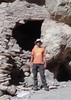
Once at the trailhead we all loaded up and got to it, after I *finally* managed to snap a group photo... It only took about 8 times of setting the timer, adjusting focus, and running to the group. With a 47lb pack on...
Camera 7 - Me 1.

The trail was a little tougher on me the second time around with my "everything and the kitchen sink" packing method but hey, I love roughing it! It also didn't help that at around the 5 mile mark we uncovered our beer from the burnt out stump (https://www.youtube.co...) and I threw another 13 pounds on... That last two miles to Chilson Camp seemed to take forever but I'm pretty sure I actually moved faster just to get the 60lbs off as soon as possible. Good thing I had new hiking shoes and a pack that didn't get uncomfortable with the weight, it was just that my feet didn't want to lift off the ground!

Before we finally made it to Chilson Camp I tried to find the spring via the location on my GPS. It shows it on the right side of the trail about 40' above your location on the trail. Every description I've read said there is a spring box up there and it's where the water goes across the trail. Well, there was no water on the trail so I dropped my pack and hiked up. Found water on the ground and followed it to an 18" or so diameter pipe with a lid. Removing the lid revealed brown mud water about 1" deep..... Discouraged I went back down and grabbed my pack to continue onto camp. Wasn't looking forward to backtracking for the water we saw in the canyon about a mile back. Funny thing is when we got to camp, there was a Homer's bucket with about 20 unopened bottles of water by the table and fire pit.

We got camp all set up and decided to hike back for water before making dinner so we grabbed our pumps and a few of us decided to cut straight up to the trail and avoid having to go north before we could head southeast.... 3 went one way and two went the other... As we were scoping for a clear path to bushwhack, we managed to find a beautiful hole in the ground about halfway up that was full of water :) We finally found the spring but it was nowhere near the GPS coordinates I had. (If you would like to find my coordinates, there is a geotagged photo in the photos section). It took about 15 minutes for the other folks that didn't want to hike up with no trail to finally get above us so we could tell them to come back. They promptly decided to come right down the side in about 2 minutes... Probably should of came with us to begin with!

Anywho, we drank some beer that night and had a good cheeseburger for dinner.. After catching a healthy buzz we caught some sleep and were woke up about 2am to a nice rain on our tents.. Next morning Jerry discovered his tent was not waterproof... Good thing we hung tarps above us beforehand!

On Thursday we cooked some breakfast and hiked down the Brody Seep trail for a bit and shot west to check out some pools of water in a nice V rock formation.. There was little trail so we followed the creek bed. This should have been a good notion for us to not go this way on Friday when we hiked to Y-Bar but I will get to that madness in a bit.... We drank a few beers and hiked back to camp to be lazy the rest of the day. Later, while we cooked dinner, a thru hiker on the Arizona Trail stopped in and asked if he could set up camp by us which was fine by us. His name was Mike and you can read his excellent blog here: freeroamingphotogra ... amp/ After filling up on a massive steak, potatoes, sweet peppers, and mushrooms, it was time to finish off the rest of our beer to lighten the load the following day. We also decided at this time to not go up to Horse Camp Seep, instead we would head to Y-Bar and spend one day there instead of two. With all the rain, we didn't want to be hiking out on Sunday when it was raining.. When we went to bed we had the notion we would sleep in, cook breakfast, and head out around noon. This was a bad idea...

So... Friday morning we woke up and took our sweet time getting ready. While we ate our breakfast Larry and Clayton decided we should take the Brody Seep trail back to AZT rather than backtracking on the Barnhardt trail to the AZT.. After what we had learned so far, we should have said no... But we went anyway. We left about noon and it was started to get cloudy and sprinkling a little bit. The trail on the way to Brody Seep was pretty hard to follow and I'm pretty sure we were on it only about 10% of the time. As we closed in on Brody Seep the going got worse and we could not find a clear trail anywhere. The amount of felled trees was crazy to say the least. I was a little ahead of the group and came to a *very* steep incline with no indication of a trail. In the end it started raining and I decided to just power up the hill. I had to grab whatever I could to pull myself up very slowly. I think it took me about 30 minutes to get up about 300' in a 10th of a mile. Once up I finally found the trail and it started raining a little. I dropped my pack and headed down the trail only to have it disappear. I switchbacked a few times on my own avoiding the vegetation and finally found the group after quite a yelling fit.. They were still at the very bottom of the hill and only Shaun was on his way up. I made him come to me and then I headed back to my bag to put my rainfly on it as it started pouring (and hailing) on us. Long story short, this little ordeal cost us about 3 hours of time to get everyone to the top.... After that the trail was decent enough but it was a steady uphill most of the way to Y-Bar spring. We passed it by and found an excellent camp... It was a very long day and we were all ready to eat and rest.

Sidebar, on our way we were expecting to find a branch in the trail to Y-Bar Tanks... Where the heck is it at? We could not find it at either end!

After we set up camp that night we really wanted another beer but we were running low on water. Most of us had Pat's Backcountry Brew's but it took water to make it... I was pretty filled up after a roast beef sandwich and some beef stew so I volunteered to go with Clayton and Larry back to Y-Bar Spring. I had a new water filter in a bag and was ready to try it out! After the quick quarter mile hike I dropped my bag under a small waterfall and filled it up.. Didn't take long to have 10L of water. Larry and Clayton used UV treatment on Nalgene bottles and the light was so bright moths kept flying into the water. After we got back I made a few flat beers (Larry has it down, the rest of us suck) it was time to pass out. We watched the sky go back and forth from bright stars to dark clouds and were pretty confident we should head out the next day.

Saturday morning we woke up and made some breakfast. I had Spam and a Mountain House dehydrated biscuits and gravy which was pretty awesome I must admit :) We were out of camp fairly early and on the way back via Y-Bar I'm pretty sure everyone in the group was thinking we were making the right decision by leaving a day early. The trail back was fairly steep going downhill and I'm sure no one wanted to do it in the pouring rain. We were back at the car by 2pm or so and decided to stop for a drink on the way home. I'm pretty sure we scared a little with our stench at Circle K.. Good thing I couldn't smell myself :)

Sunday around noon there were a flurry of text messages from everyone stating they were glad we left a day early because it was pouring rain! Fun trip, can't wait to check out more of the Mazatzal's!
 Culture
 Culture [ checklist ]
[ checklist ]  Campsite  HAZ Food
 Named place
 Named place [ checklist ]
[ checklist ]  Chilson Spring
wildflower observationwildflower observationwildflower observationwildflower observationwildflower observation
Wildflowers Observation Isolated

water 1 out of 5water less than maxwater less than maxwater less than max Big Kahuna Falls - Mazatzal Wilderness Pools to trickle Pools to trickle

water 1 out of 5water less than maxwater less than maxwater less than max Chilson Spring Dripping Dripping
Couldn't find the location on the map. Spring was actually closer to camp.

water 1 out of 5water 2 out of 5water less than maxwater less than max Y Bar Spring Quart per minute Quart per minute
_____________________
  2 archives
Apr 03 2016
avatar

 Routes 10
 Photos 121
 Triplogs 12

47 male
 Joined Mar 19 2012
 Phoenix, AZ
Barnhardt Trail #43Payson, AZ
Payson, AZ
Hiking avatar Apr 03 2016
AsTheCrowFliesTriplogs 12
Hiking9.99 Miles 1,975 AEG
Hiking9.99 Miles   7 Hrs   38 Mns   2.02 mph
1,975 ft AEG   2 Hrs   41 Mns Break25 LBS Pack
 
1st trip
Linked   none no linked trail guides
Partners none no partners
Well, we finally got a taste of the Mazatzals today when Jerry, Clayton, and I decided to head up to Barnhardt Trail to scope for water and bury some beer for our main backpacking trip in a few days. Clayton chose a 12 pack of Rebel IPA and I had a 12 pack of hand selected IPA's as well as 2 32oz cans from Total Wine. I think the lowest alcohol percentage was around 7.5% with most in the 9% range.

We met at Clayton's about 5am and they piled into the Kia carpool. On the way out we stopped for a gut-bomb at McDonald's and were probably at the trailhead about 7. After loading my new pack up with beer, water, and cameras we headed out. And up, and up...

My normal weekend hike is the Summit Trail at Squaw Peak so I was prepared for the constant vertical grade but I tell ya, I was taking breaks on a few of the switchbacks! After reaching Big Kahuna Falls I was happy to drop my pack and take a breather. The falls still had a trickle coming down and several large pools but who knows for how long. I want to make it here again when they are actually gushing!

It started to level out around the 3.5 mile mark and I was happy to no longer be going up, but the denseness in the low vegetation increased so we didn't necessarily move faster. There were patches of wild flowers and a lot of low brush on the way but it was hard to miss the devastation from the fires in the area. I was honestly a little discouraged thinking there would be no shade trees for our backpacking trip but this turned out to not be a concern as you will find out in my next triplog.

We had intentions of making it all the way to Chilson Camp but it was getting late so we decided to bury our beer around the 5 mile mark because we didn't think we could make it all the way there and be back before dark. After scouting around the vicinity of our stopping point we settled on a burned out stump and used Clayton's trowel to dig the dirt out of the base and bury our beer. At this point I realized that we still didn't know if there would be water at Chilson Spring when we returned so I was a little bummed but we ended up running into an older couple on the way out who reassured us that it shouldn't be a problem. I was pretty happy to hear that considering I just left $60 of beer in the middle of nowhere :)

We finally returned back to trailhead about 2:45 and immediately took off to get a Gatorade for refreshment. To finish up I will add that the trails were in pretty good shape with a few rocky areas that aren't easy on your feet. There are also a few areas where you must step over some high logs. When you get to the flatter area around the 3.5m mark the vegetation is much denser and some of it has thorns so I would recommend packing tall instead of wide if you are carrying a backpack.
wildflower observationwildflower observationwildflower observationwildflower observationwildflower observation
Wildflowers Observation Isolated

water 1 out of 5water 2 out of 5water less than maxwater less than max Big Kahuna Falls - Mazatzal Wilderness Light flow Light flow
Some trickling falls if you climb up and a huge pool at the trail crossing.
_____________________
 
Mar 26 2016
avatar

 Routes 10
 Photos 121
 Triplogs 12

47 male
 Joined Mar 19 2012
 Phoenix, AZ
Dripping Springs from WoodburyGlobe, AZ
Globe, AZ
Hiking avatar Mar 26 2016
AsTheCrowFliesTriplogs 12
Hiking8.60 Miles 1,012 AEG
Hiking8.60 Miles   3 Hrs   45 Mns   2.46 mph
1,012 ft AEG      15 Mns Break6 LBS Pack
 
1st trip
Linked   none no linked trail guides
Partners none no partners
Woke up early this morning to scope for water at Dripping Springs before our 5 day backpacking trip in two weeks. I left the house about 4am and reached the Queen Valley turnoff about 5. When I finally got the Kia onto Hewitt Canyon I was surprised at how much worse the road was than the last time I was out here. Two years ago I drove a Corolla almost to Rogers TH before turning around. Definitely won't be doing that again!

I hit Woodbury about 6 and was on the trail shortly after. I had never done this route to Dripping Springs and was pretty surprised at how easy of a hike it was. Other than the steep climbs up the road at the beginning and end of course!

The trail started out easy to follow but shortly after the ranch house I lost it a few times and followed the creek bed. It didn't really matter though because either way it was pretty smooth sailing. It was a cool morning and I was pretty stunned by some of the views! Lots of cacti!

I ran into some water right around Musk Hog Canyon but I wouldn't have wanted to pump it because it wasn't flowing and had a nice scum on the surface. Fraser Canyon was much more promising as there were several large pools to filter and some areas were flowing lightly. I stopped for a break before turning around and had my breakfast near the Dripping Spring Beach (at least that's what I call it). Overall this looks like a good spot to work into a Superstitions loop in a few weeks. Always like to camp near water so I have more room for beer in my pack!

On my return trip I found a few sections of trail that I hadn't seen on my way in. The sun was finally coming over the mountains and that was when I realized I forgot my floppy hat... Bummer. I walked for about 15 minutes with my hand over my eyes before the sun was finally high enough to stop blinding me. Pretty sure that led to even more walking in the stream bed!

After I passed the ranch again I decided to take the road all of the way up to Woodbury rather than the trail. I thought better of that decision about halfway up as it seemed much steeper than the trail would have... Oh well, I guess it added a little variation to my trip!

I finally got to the car about 9:45 and headed back to civilization. Next week we are going to check out the Barnhardt Trail and see what the water situation is like there. Afterwards we have to decide where to go. After this morning, I really want to come back to the Superstitions!
wildflower observationwildflower observationwildflower observationwildflower observationwildflower observation
Wildflowers Observation Isolated

water 1 out of 5water 2 out of 5water less than maxwater less than max Fraser Canyon Light flow Light flow
Light flow and some deep pools near the sandy beach.
_____________________
  6 archives
average hiking speed 1.88 mph

WARNING! Hiking and outdoor related sports can be dangerous. Be responsible and prepare for the trip. Study the area you are entering and plan accordingly. Dress for the current and unexpected weather changes. Take plenty of water. Never go alone. Make an itinerary with your plan(s), route(s), destination(s) and expected return time. Give your itinerary to trusted family and/or friends.

helpcommentissue

end of page marker