 Route Editor

| Guide | ♦ | 266 Triplogs | 32 Topics |
details | drive | no permit | forecast | 🔥 route |
stats |
photos | triplogs | topics | location |
| 2.8k | 266 | 32 |
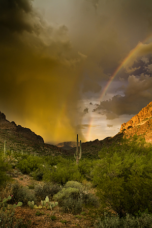
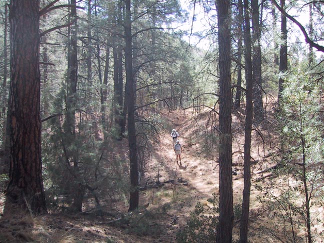
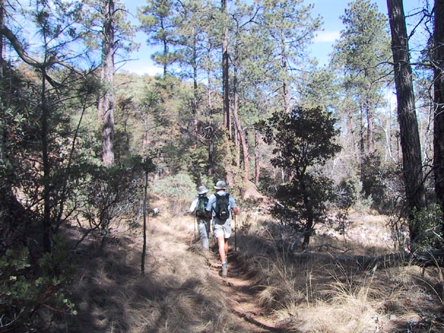
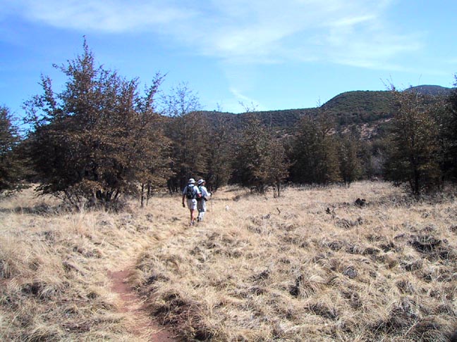
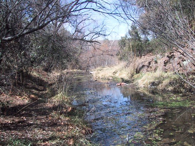
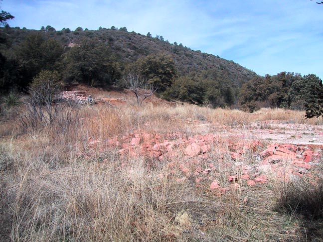
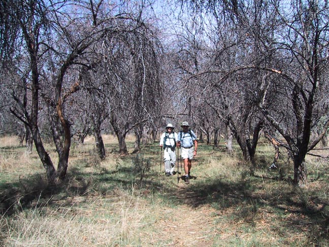
Thoroughly Therapeutic by Fritzski  Overview OverviewThis extremely pleasant hike through the Eastern Superstitions begins at the Rogers Trough trailhead and takes the southern section of the Reavis Ranch Trail (109) northbound to the old abandoned Reavis Ranch homestead. History The only permanently flowing stream in the Superstitions nourishes this Eden-like valley. This is likely due to the fact that it is fed by a true spring, tapping the aquifer below, as opposed to the abundance of other "springs" which are merely seepages of drain water finding an outlet as it slowly migrates downward from the hilltops.
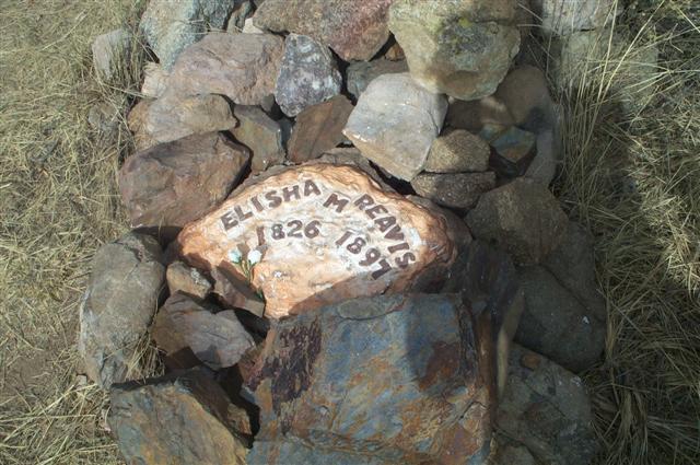
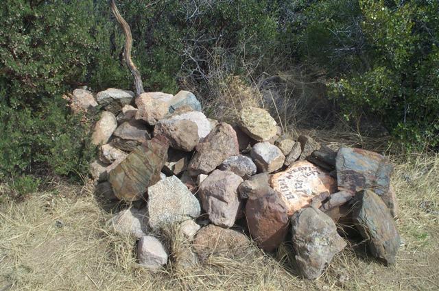
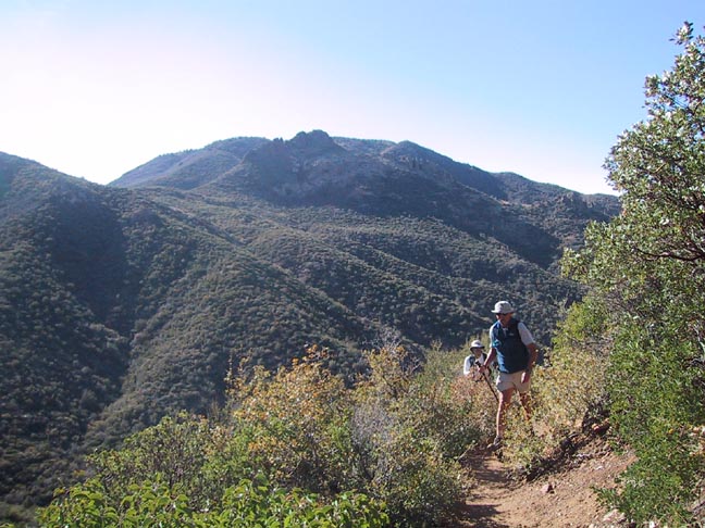
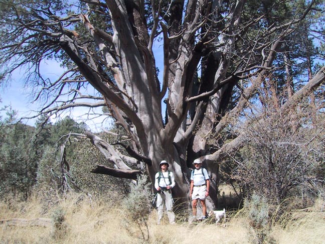
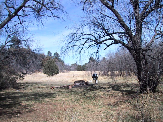
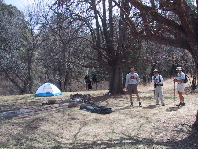
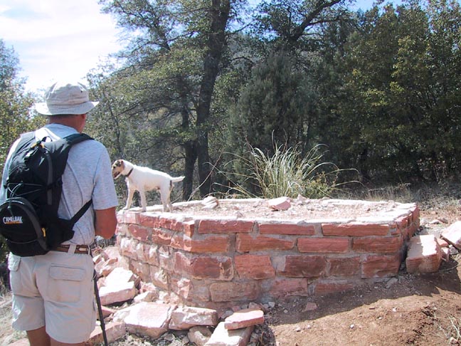
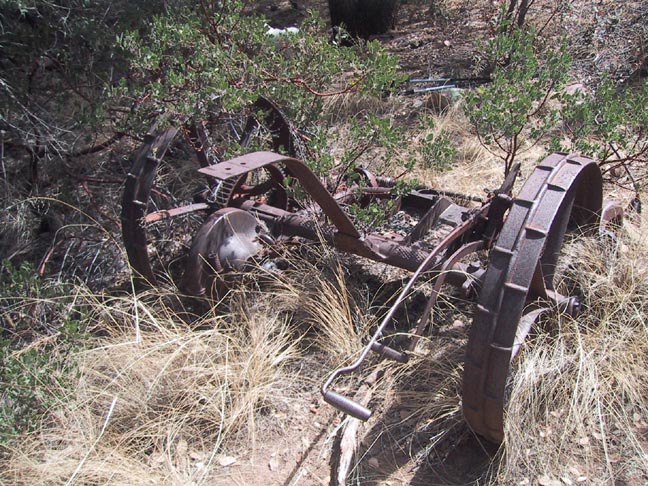
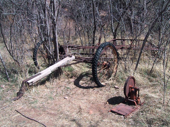
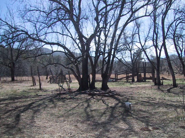
He grew vegetables, which he would take to market periodically down in the Florence area. In contrast to his disheveled and somewhat scary appearance (his picture can be seen on the front cover of J.Carlson & E.Stewart's Hiker's Guide to the Superstition Wilderness), he was known to be not only respectful and courteous to those he met, but also kind to visitors and even more surprisingly somewhat of a reader and scholar for those times. He died on the trail in 1896 while bringing down a load of produce. His body was found and buried on the spot and to this day remains marked by a gravesite alongside his beloved trail. Ron Feldman in his book Crooked Mountain alleges that local rancher Jack Fraser had long coveted Reavis' land and water for his cattle operation and had him murdered by a henchman. It is a fact that Fraser did take over the land shortly after Reavis' death and moved the JF Ranch headquarters there. The land later went to Twain Clemens who subsequently planted the apple orchard, built the first house, and even attempted to establish a resort business there. The house finally burnt down in 1991. Hike From Rogers Trough trailhead take the Reavis Ranch trail north into Rogers Canyon. This will be downhill as you pass the West Pinto Trail intersection at about a quarter mile and then the Rogers Canyon Trail at about 1.5 miles. For a more detailed description of this section, refer to the Rogers Canyon hike in the HAZ database-TrailDEX ( aka Find ). At the Rogers Canyon Trail intersection bear right or northwest and begin the long uphill climb to Reavis Saddle. The climb, although lengthy, is not too difficult and the views from the upper portions are spectacular. Initially, it stays in the creek bed till just beyond the 2 mile point where it climbs out to the north and begins a series of numerous switchbacks to the top of the saddle at @3 miles. The reward at the top is a refreshing terrain of Junipers and Pinon Pine. This is a great place to stop for a quick breather. From here you begin a gentle and consistent descent down through the floor of Reavis Canyon all the way to the ranch. This is where the beauty truly begins as you are quickly engulfed in the shady forest of Ponderosa pines and open grassy meadows. Along the way, you'll pass a monstrous old Juniper that looks to be extremely ancient. At about 5.5 miles you'll cross the flowing creek (clear and filterable) and at 6 miles arrive at the Fireline Trail #118 intersection. From here you quickly enter the main meadow on which the ranch is located. There is an abundance of camping spots in this popular area, some of which are likely to be already occupied. You may notice a level berm running along the base of the ridge on your left. It is our learned opinion ;) that this was most likely designed to catch runoff water from the slope above and divert it into the old pond basin which is now empty. The ruins of the old farmhouse consist of little more than the foundation, but a little poking around will yield some very interesting antique farming implements and cattle enclosures. While the south orchard consists of only a few trees, the north orchard is quite extensive and VERY overgrown. If you want to see the entire ranch property you must proceed north to the far end of the orchard and the intersection with Reavis Gap Trail #117 at 6.8 miles. This is the turnaround point and a great place to meander back through the orchard to one of the many scenic spots along the creek for a well-deserved lunch break. In the excellent company of two other core HAZ members, this was one of the more pleasant and purely enjoyable hikes I've taken this season. Note that while I list the hiking time as seven and a half hours, add at least another hour for sightseeing. If you rush this one, you're missing the whole point! Check out the Official Route and Triplogs. Leave No Trace and +Add a Triplog after your hike to support this local community. | ||||||||||||||||||||||||||||||||||||||||||||||||||||||||||||||||||||||||||||||||||||||||||||||||||||||||||||||||||||||||||||||||||||||||||||||||||||||||||||||||||||||||||||||||||||||||||||||||||||||||||||||||


