|
| | | |
| |
|
| Hiking | 1.75 Miles |
323 AEG |
| | Hiking | 1.75 Miles | 2 Hrs | | 2.33 mph |
| 323 ft AEG | 1 Hour 15 Mns Break | 15 LBS Pack | | |
|
|
| |
| Linked |
|
none
[ show ]
| no linked trail guides |
| Partners |
|
[ show ]
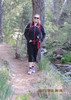
| partners | | | This was a pretty easy hike, especially on the way in. It was a bit difficult to find, if you are not familiar with the area. The first time we crossed the water was actually the 2nd river crossing and where we needed to park. We spent about 20 minutes at the wrong crossing, the third crossing, looking for the darn path. The first crossing must be dry. Look at the signs in the parking lots for the name of the crossing. When you cross the road and go up the path (very visible), you will reach the gate of the now closed road. Follow the road until you see a wide path (at least a few feet) with a trash can. Don't go down the smaller paths that look more like water run-offs. When you get down to the water, follow the river until you see the very big tree trunk with notches and names carved into it. That is where the pools are. The big pool is where I swam. It was cold for the first 10 seconds, then it felt wonderful. |
| _____________________
| | |
|
|
|
 Route Editor