|
| | | |
| |
|
| Hiking | 10.25 Miles |
3,313 AEG |
| | Hiking | 10.25 Miles | | | |
| 3,313 ft AEG | | | | |
|
|
| |
| Linked |
|
none
[ show ]
| no linked trail guides |
| Partners |
|
none
[ show ]
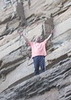
| no partners | | I will say this one was pretty challenging for me but definitely worth it. I came up Sunday afternoon and spent some time in Downtown Flag seeing the sights then decided to go see what I'd be hiking in the morning. I drove up to the trail head and saw quite a few people up there to watch the sunset, it was quite nice then everyone started to pull away. I was planning on sleeping in the car anyways so I got things prepared watched a netflix movie I downloaded and called it a night. I was awakened by a slamming door. I looked up and saw two guys loaded up and headed up, so much for being first! It was crisp 45 degrees but felt good. From here on you are going up till you get to the top. Quite a few switchbacks and then you get up into the snow. At this time it wasn't bad at all, just put you feet in the foot holds, on the way back different story, the snow was starting to melt and get slushy/slippery I did fall one time and there had to be a rock just waiting to greet my shin. More up up up. finally got to the 11,400 ft marker after that the trail was a bit hard to follow but did the best I could. I did take a nice break up at the saddle, had a snack and got ready for the final push.
I'm not going to lie I did take a few breaks and did get passed by a few groups but I did finally make it. Just before the last false peak the two guys that woke me up were on there way down. I asked how much farther and they said the next one is it. That gave me the boost I needed and was so glad to finally see the marker on the top. I rested for about 45 min up there walking around trying to figure out what I was seeing, taking pics, and refueling although my sandwich was a little smashed it still tasted good.
Going down was so much better, except for the slushy snow, a ways down I ran into Tim a guy I talked to up top and we went down the rest of the way together. I usually hike for the solitude but I had enough of that on the way up, so thanks for the company Tim, if your reading this. Had a couple beers on Ice that we broke out and enjoyed and then called it a day. Thanks for the adventure. |
| _____________________
| | |
|
|
|
 Route Editor