 Route Editor

| Guide | ♦ | 22 Triplogs | 0 Topics |
details | drive | permit | forecast | 🔥 route |
stats |
photos | triplogs | topics | location |
| 128 | 22 | 0 |
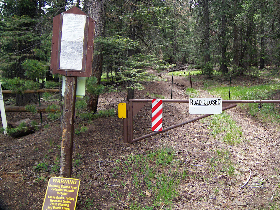
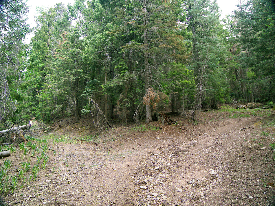
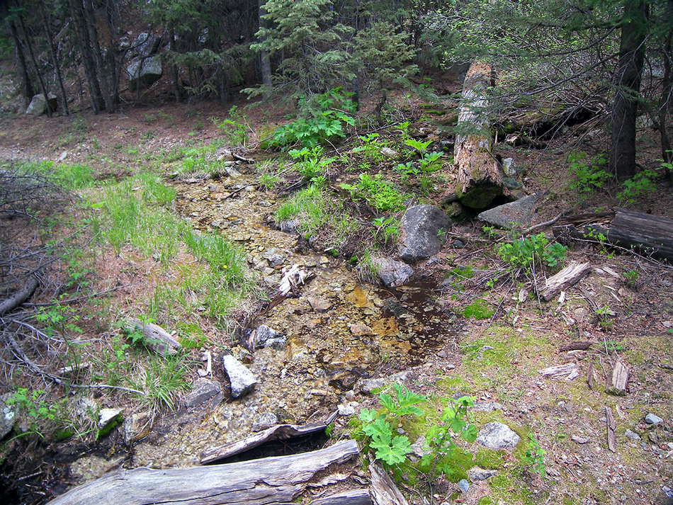
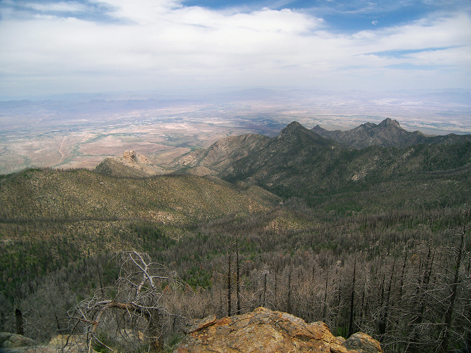
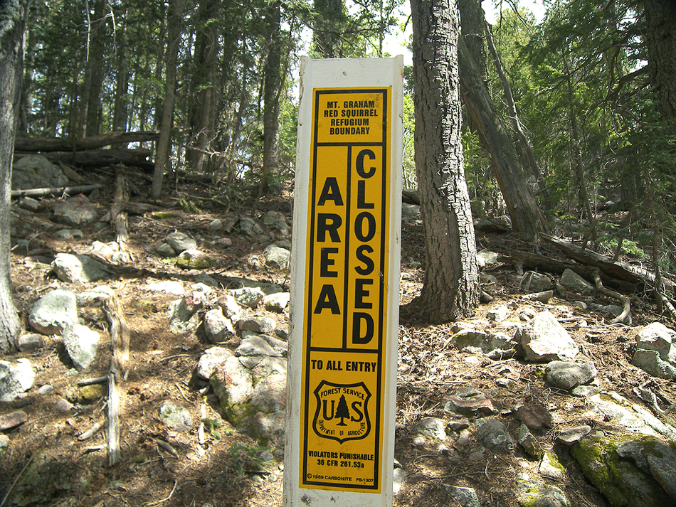
Sweet alpine lovin' by PrestonSands  The Deadman-Highline Trail #325, in Arizona's Pinaleno Mountains, travels among the highest peaks of the range. Currently, only the northern 2 miles are legal to hike, as more than half of this trail lies entirely within the Mt. Graham Red Squirrel Refugium, which is closed to the public. The Refugium, which encompasses the main mass of Mt. Graham above the 9800 to 10,000-foot level, was set aside to protect the endangered Mount Graham Red Squirrel, whose population is around 300. If you look carefully on this hike, you may see one of the Red Squirrels' food caches. Known as middens, these piles of shredded conifer cones form unusual mounds on the forest floor. The mileage given in this description is for a round trip hike on the open portion of the trail (total round trip mileage for the entire trail is 11.2 miles). Hikers are welcome to hike this trail from its northern terminus up to the Refugium boundary at the 10,000-foot level. This trail, which apparently sees very little use, is in good condition, with many old tree blazes and occasional cairns marking the way. The Nuttall (Gibson) Fire only lightly burned the last 0.7 miles of the open section of this trail. The Deadman-Highline Trail #325, in Arizona's Pinaleno Mountains, travels among the highest peaks of the range. Currently, only the northern 2 miles are legal to hike, as more than half of this trail lies entirely within the Mt. Graham Red Squirrel Refugium, which is closed to the public. The Refugium, which encompasses the main mass of Mt. Graham above the 9800 to 10,000-foot level, was set aside to protect the endangered Mount Graham Red Squirrel, whose population is around 300. If you look carefully on this hike, you may see one of the Red Squirrels' food caches. Known as middens, these piles of shredded conifer cones form unusual mounds on the forest floor. The mileage given in this description is for a round trip hike on the open portion of the trail (total round trip mileage for the entire trail is 11.2 miles). Hikers are welcome to hike this trail from its northern terminus up to the Refugium boundary at the 10,000-foot level. This trail, which apparently sees very little use, is in good condition, with many old tree blazes and occasional cairns marking the way. The Nuttall (Gibson) Fire only lightly burned the last 0.7 miles of the open section of this trail.From the unsigned trailhead along the Old Columbine Road, walk past the locked vehicle barrier gate, and begin heading uphill into the forest on an old road. At the time of this writing, a small "trail closed" sign in the middle of the road. Disregard the sign; the Forest Service says the trail is open. Within a few hundred feet, the road splits; take the left fork (there will be a water tank visible on the right fork). The old road contours east along the 9300-foot level for the first quarter-mile, through a beautiful forest of Engelmann Spruce and aspen. At 0.3 miles, the old road crosses an unnamed creek with a healthy flow of ice-cold water. At this point, the road ends, and the trail begins. The Deadman Highline Trail begins to climb a little and soon crosses another unnamed creek among some old-growth Douglas-Firs. A short distance later, the trail passes a couple of springs, whose frigid water trickles down the steep mountainside, crossing the trail. After a little climb, the trail passes a boulder on the left, on top of which views of the Ash Creek area and distant Mt. Turnbull can be had. The trail continues to contour northeastward around the 9600-foot level and arrives in a flat saddle at mile 1.3. The edge of the Nuttall Fire is encountered here, but the forest isn't trashed along the trail. I strongly recommend heading north from the saddle, out to a spectacular overlook (32.72029 N, 109.88302 W) on the eastern side of the 9655' point. It's about a quarter-mile round trip hike through aspens and a little meadow to the overlook, making a great spot for a rest stop or lunch break. From the overlook, you'll have an unobstructed, sweeping view of the Gila Valley, the distant White Mountains, and into New Mexico.
The remainder of the Deadman-Highline Trail is within the Refugium, so here is a general trail description if the Refugium ever reopens to the public. Beyond the closure boundary/turnaround point, the Deadman-Highline Trail continues up the ridge and crests a 10,516-foot peak at the top of rugged Frye Canyon before dropping down to Highwater Cienega at the head of Frye Creek. From there, the trail turns east and passes along the north side of Hawk Peak and Bearwallow Spring. The trail then switchbacks down the north face of Mt. Graham, coming within a quarter-mile of the 10,720-foot summit. After rounding a point on Mt. Graham's northeast ridge, the Deadman-Highline Trail turns south and begins to climb below the cliffs of Mt. Graham's east face. At the 5.6 mile point, the Deadman-Highline Trail comes to an end on the north side of 10,370 Plain View Peak, where it meets the Gibson Canyon Trail #308 at the 10,000-foot level. Gate Policy: If a gate is closed upon arrival, leave it closed after you go through. If it is open, leave it open. Leaving a closed gate open may put cattle in danger. Closing an open gate may cut them off from water. Please be respectful, leave gates as found. The exception is signage on the gate directing you otherwise. Check out the Official Route and Triplogs. Leave No Trace and +Add a Triplog after your hike to support this local community. | |||||||||||||||||||||||||||||||||||||||||||||||||||||||||||||||||||||||||||||||||||||||||||||||||||||||||||||||||||||||||||||||||||||||||||||||||||||||||||||||||||||||||||||||||||||||||||||||||||


