 Route Editor

| Guide | ♦ | 34 Triplogs | 0 Topics |
details | drive | permit | forecast | 🔥 route |
stats |
photos | triplogs | topics | location |
| 138 | 34 | 0 |
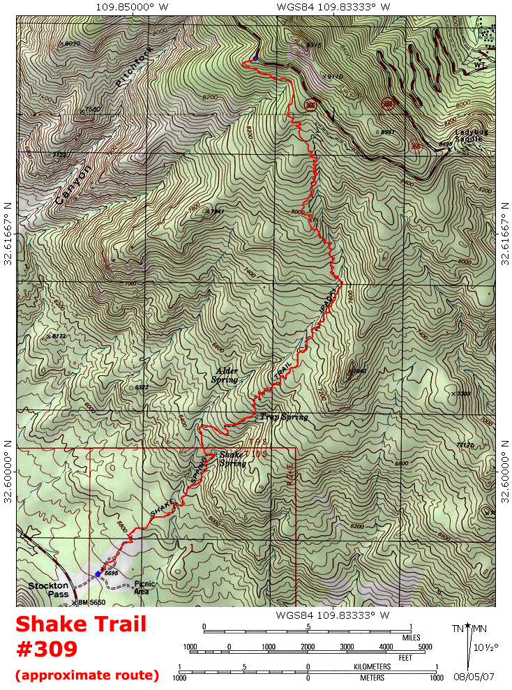
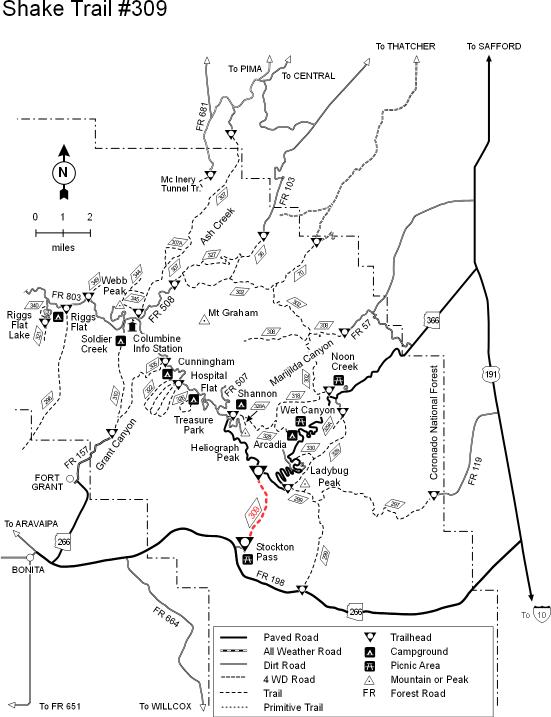
Do you want flies with that? by PrestonSands   One of the Pinaleno Mountains' many mountain climbing trails, the Shake Trail #309 climbs some 3000 feet in a little over 4 miles. With a trailhead at both ends, the Shake Trail offers the opportunity for a shuttle hike as well as a round-trip hike. One can start at the upper trailhead in summer, or the lower trailhead if the Swift Trail is snowed in. The lower trailhead is signed, but the upper trailhead has no markings whatsoever. This lightly traveled trail is poorly marked and rather faint in some places, so allow yourself plenty of time in case you lose the trail. I recommend bringing a topographical map on this hike. This description is of a bottom-to-top hike on the Shake Trail. One of the Pinaleno Mountains' many mountain climbing trails, the Shake Trail #309 climbs some 3000 feet in a little over 4 miles. With a trailhead at both ends, the Shake Trail offers the opportunity for a shuttle hike as well as a round-trip hike. One can start at the upper trailhead in summer, or the lower trailhead if the Swift Trail is snowed in. The lower trailhead is signed, but the upper trailhead has no markings whatsoever. This lightly traveled trail is poorly marked and rather faint in some places, so allow yourself plenty of time in case you lose the trail. I recommend bringing a topographical map on this hike. This description is of a bottom-to-top hike on the Shake Trail.At the lower trailhead at the Stockton Pass Campground, there are a couple of small signs indicating the start of the Shake Trail. The trail takes off towards the main mass of the Pinaleno Mountains, initially passing through an open grassy area surrounded by oak and juniper woodlands. High above on the Pinaleno ridgeline, the barren gray rock of peak 9315 rises like an oversized gunsight in the midst of a blanket of forest. Just out of sight below the peak lies the upper trailhead along the Swift Trail.
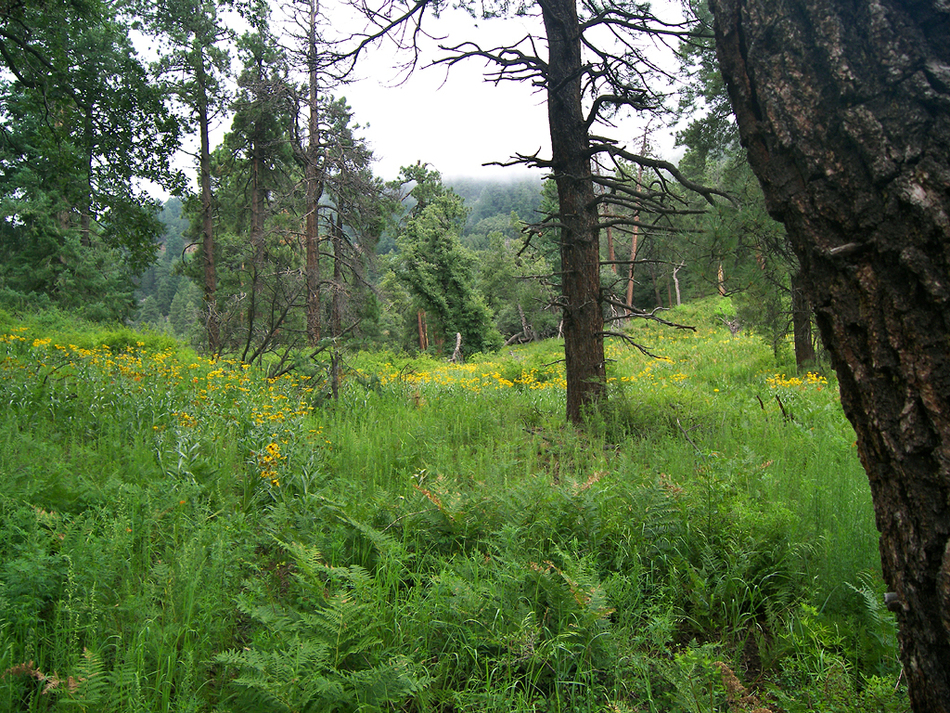
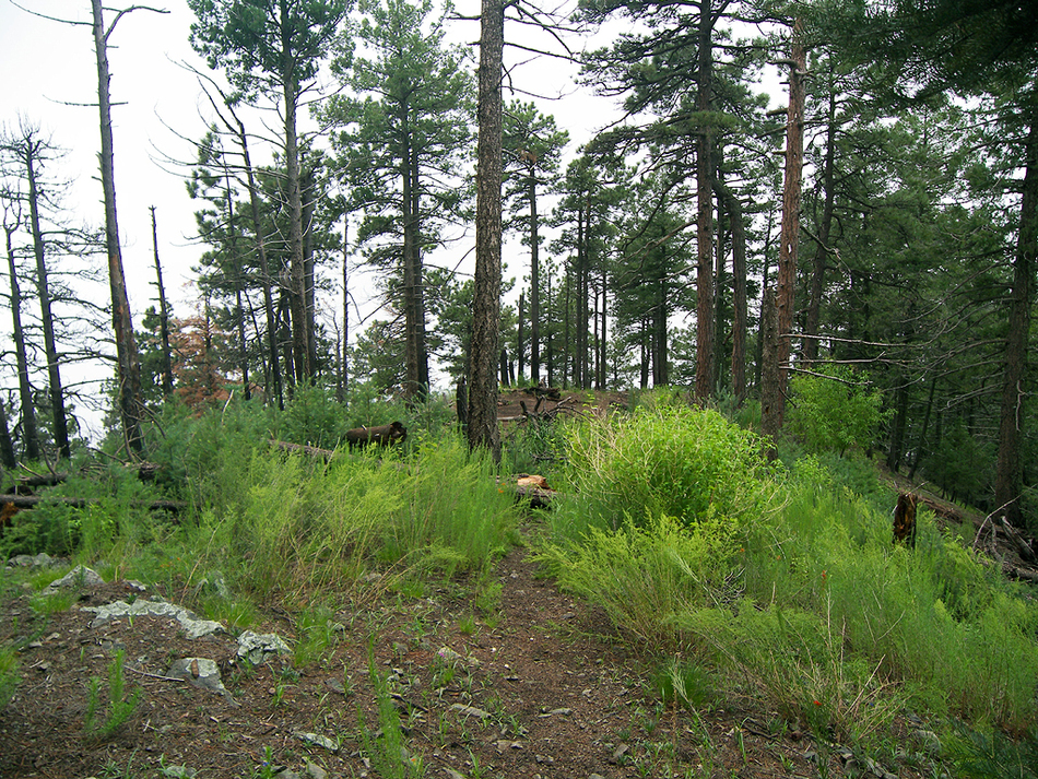
At mile one, you'll pass by Shake Spring. This spring consists of a pipe dripping into an open metal tub, and a sign saying non-potable water. This tub was full of clear water when I hiked past it, but check with the forest service before relying on it as your water source. Continuing upward, the Shake Trail climbs through a forest of Mexican blue oak and alligator juniper, while the southern portion of the Pinaleno Mountains (a.k.a. the Greasewood Mountains) seem to shrink in height behind you. As the trail climbs higher, it crosses over to the west side of Stockton Wash and begins to enter forest. Oaks and junipers begin to give way to ponderosa pines and Douglas firs. At the 8300 foot level, the Shake Trail crosses a little bench before arriving in a small saddle around the 8500-foot contour. One of the highlights of the hike lies here at the saddle: a beautiful meadow perched on the side of the mountain. During summer this meadow is filled with bracken ferns and wildflowers which completely obscure the trail. Leaving the meadow on its north side, the Shake Trail begins a final 200-foot climb up the southern slope of the 9315-foot peak. The trail then climbs atop a little ridge coming down from the peak, which it follows for several hundred feet before arriving at a large pull-off area along a curve on the Swift Trail. Return the way you came, or for a much longer return hike, head east to Ladybug Saddle and take the Bear Canyon Trail #299 back.
Check out the Official Route and Triplogs. Note This is a more difficult hike. It would be unwise to attempt this without prior experience hiking. Leave No Trace and +Add a Triplog after your hike to support this local community. One-Way Notice This hike is listed as One-Way. When hiking several trails on a single "hike", log it with a generic name that describes the hike. Then link the trails traveled, check out the example. | ||||||||||||||||||||||||||||||||||||||||||||||||||||||||||||||||||||||||||||||||||||||||||||||||||||||||||||||


