 Route Editor

| Guide | ♦ | 23 Triplogs | 0 Topics |
details | drive | permit | forecast | 🔥 route |
stats |
photos | triplogs | topics | location |
| 76 | 23 | 0 |
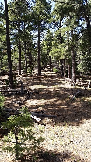
Bear of a Hike by HAZ_Hikebot   Bear Canyon Trail provides access to four Forest trails that lead down the mountain from Ladybug Saddle. Ladybug Trail #329, Dutch Henry Canyon Trail #297, Turkey Flat Trail #330, and Ladybug Peak Trail #300 all connect to the Bear Canyon Trail. In addition to offering access to several other trails, Bear Canyon Trail provides good views to the south. Among the features you can see from the upper reaches of this trail are the Dos Cabezas Mountains east of Willcox, with the Greasewood Mountains in the foreground and Sulphur Springs Valley in the distance. Closer in, you'll enjoy good views of the lower slopes and southern peaks of the Pinalenos as well. Bear Canyon Trail provides access to four Forest trails that lead down the mountain from Ladybug Saddle. Ladybug Trail #329, Dutch Henry Canyon Trail #297, Turkey Flat Trail #330, and Ladybug Peak Trail #300 all connect to the Bear Canyon Trail. In addition to offering access to several other trails, Bear Canyon Trail provides good views to the south. Among the features you can see from the upper reaches of this trail are the Dos Cabezas Mountains east of Willcox, with the Greasewood Mountains in the foreground and Sulphur Springs Valley in the distance. Closer in, you'll enjoy good views of the lower slopes and southern peaks of the Pinalenos as well.The trail essentially starts among mixed conifer forest surroundings and drops down to an oak- and juniper-dotted desert grassland. As you might suspect, Bear Canyon is a good place to see black bears which are quite common on this mountain range. (Remember that bears are secretive creatures, and usually, you have to be looking for them to see them.) Bear Canyon Trail is also a good place to see a much smaller predator-ladybugs, lots of them. Ladybug Peak Trail #300 branches off the main trail and leads to the summit of Ladybug Peak. Here, during the summer, rocks and trees are sometimes covered with these aphid-eating insects.
Check out the Official Route and Triplogs. Note This is a moderately difficult hike. Leave No Trace and +Add a Triplog after your hike to support this local community. One-Way Notice This hike is listed as One-Way. When hiking several trails on a single "hike", log it with a generic name that describes the hike. Then link the trails traveled, check out the example. | |||||||||||||||||||||||||||||||||||||||||||||||||||||||||||||||||||||||||||||||||||||||||||||||||||||||||||||||||||||||||||||||||||||||||||||||||||||||||||||||||||||||||||||||||||||||||||||


