 Route Editor

| Guide | ♦ | 36 Triplogs | 0 Topics |
details | drive | permit | forecast | 🔥 route |
stats |
photos | triplogs | topics | location |
| 152 | 36 | 0 |
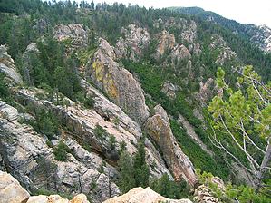
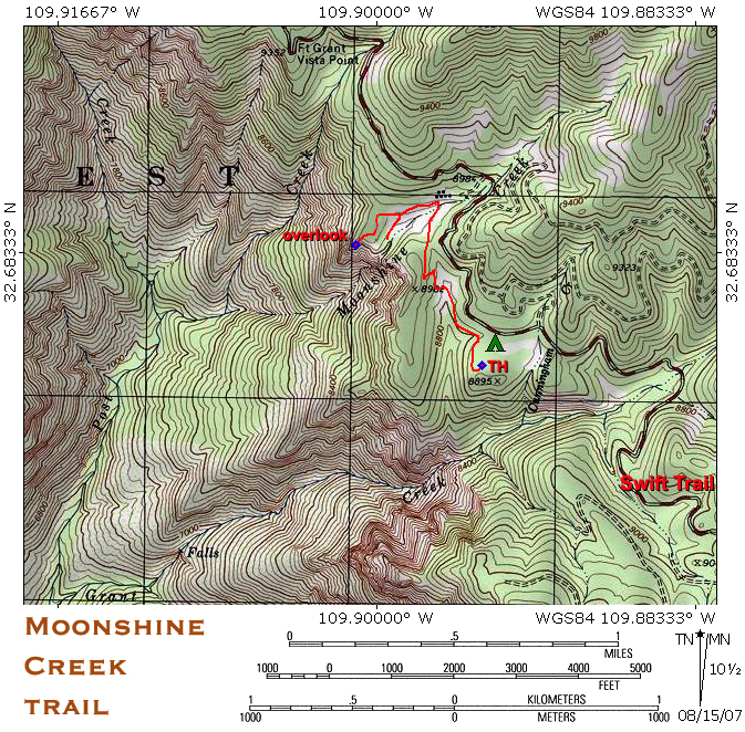
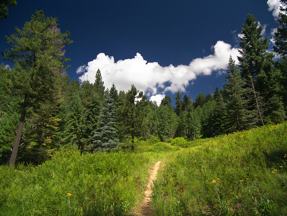
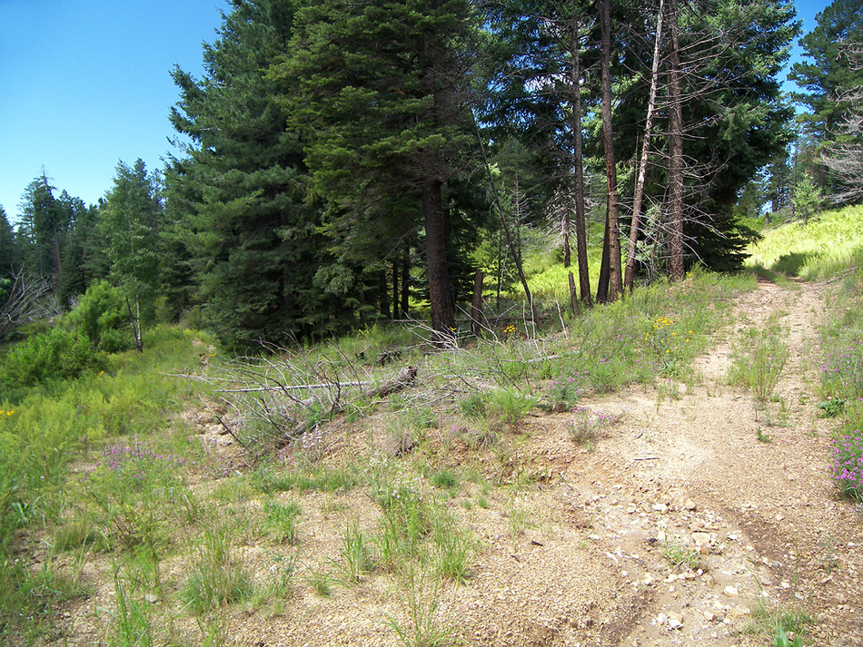
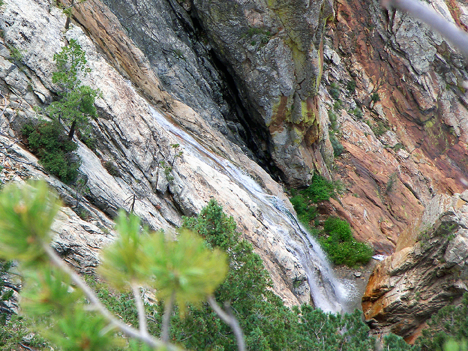
have a taste of moonshine by PrestonSands  This short hike in the Pinaleno Mountains has plenty to offer: alpine forest, wildflower-filled meadows, a perennial creek, a waterfall, and extensive views. The main attraction of this hike is a spectacular overlook of Grant Creek Canyon, at the bottom of which four significant creeks come together. Visible from this overlook is a 200-foot cascading waterfall, where Moonshine Creek plunges over the edge of the 2000 foot deep canyon. State highway 366, which provides access to this hike, is closed yearly due to snow from November 15 to April 15, about 3.5 miles before the trailhead. This short hike in the Pinaleno Mountains has plenty to offer: alpine forest, wildflower-filled meadows, a perennial creek, a waterfall, and extensive views. The main attraction of this hike is a spectacular overlook of Grant Creek Canyon, at the bottom of which four significant creeks come together. Visible from this overlook is a 200-foot cascading waterfall, where Moonshine Creek plunges over the edge of the 2000 foot deep canyon. State highway 366, which provides access to this hike, is closed yearly due to snow from November 15 to April 15, about 3.5 miles before the trailhead.The hike starts at the Grant Creek trailhead in the Cunningham Campground. Begin hiking down the Grant Creek Trail, which descends through a cool forest of fir and white pine. The trail soon enters one of the Pinaleno's most attractive alpine meadows. Waist deep ferns and wildflowers carpet the meadow while quaking aspens guard the edges.
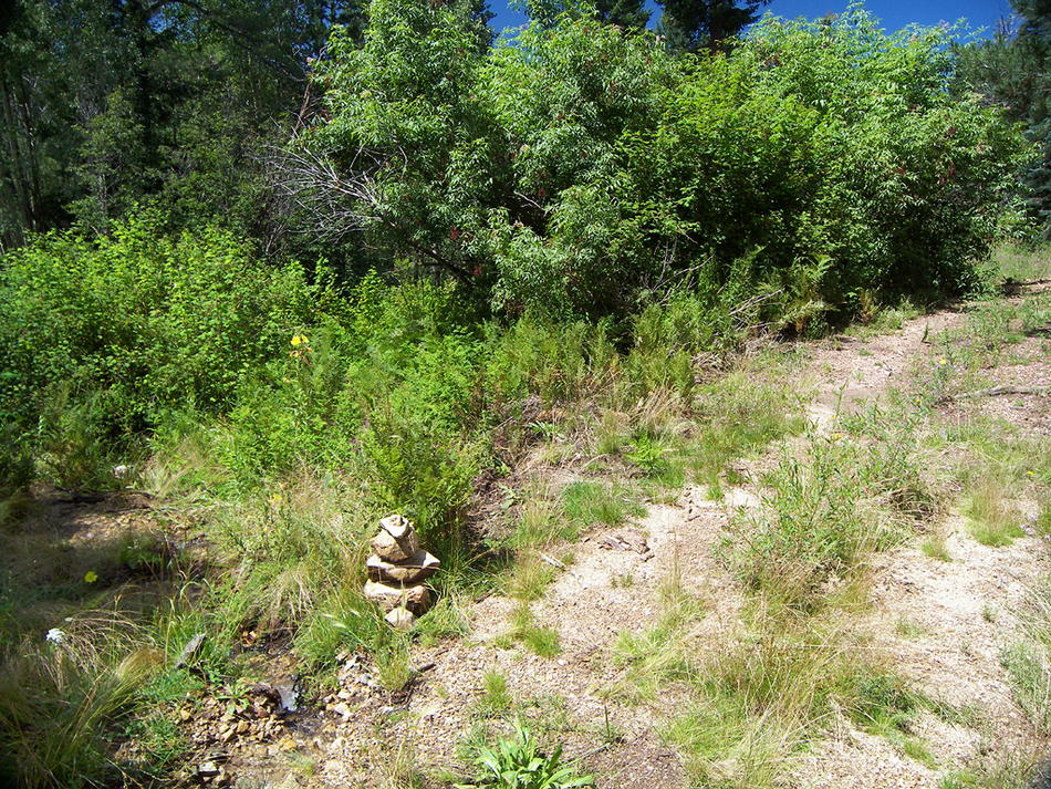
The Moonshine Creek trail descends gradually among aspens and more little fern and wildflower-filled meadows until it reaches Moonshine Creek. Cross the creek, then wade through the lush riparian greenery for a few feet, and you'll come to a junction (32.68554 N, 109.89665 W) with a two-track, four-wheel-drive road, marked by a cairn ( missing as of 2016 ). Turn left (west), and follow the primitive road down Moonshine Creek's fern-filled valley. A little ways down, the road forks. The less traveled left fork dead-ends at the creek in a few hundred yards. Take the right fork, which climbs a little and soon dead-ends at a flat camping spot near Grant Creek canyon. Head southwest towards the edge of the canyon from the end of the road. A rocky butte should come into view about 500 feet from the road's end, sticking out from the canyon rim. Scramble up the granite butte and check out the view from the top (32.68368 N, 109.90109 W). On three sides of you, the land falls away into Grant Creek's 2000 foot deep gorge. Fort Grant prison can be seen at the mouth of the canyon, while the Pinaleno's highest summits rise behind you. To the southeast is Moonshine Falls, cascading down the bare granite cliffs in a jet of white water. A telephoto lens is helpful if you are looking to photograph the falls. You can return the way you came or take the Moonshine Creek 4x4 road back to the Swift Trail and follow it back to the Cunningham Campground.
Check out the Official Route and Triplogs. Leave No Trace and +Add a Triplog after your hike to support this local community. | |||||||||||||||||||||||||||||||||||||||||||||||||||||||||||||||||||||||||||||||||||||||||||||||||||||||||||||||||||||||||||||||||||||||||||||||||||||||||||||||||||||||||||||||||||||||||||||||||||||||||||||||||||


