 Route Editor

| Guide | ♦ | 19 Triplogs | 0 Topics |
details | drive | permit | forecast | route |
stats |
photos | triplogs | topics | location |
| 63 | 19 | 0 |
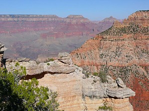
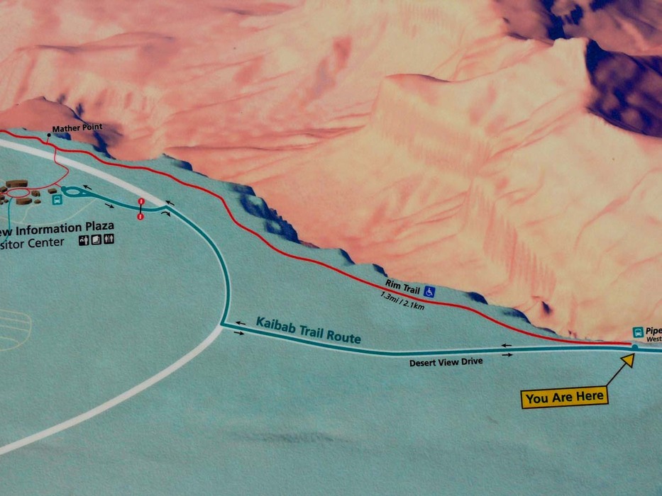
South Rim Views by Dschur   Hike HikeRim Trail is an easy hike that wanders along the rim of the Grand Canyon South-Rim. The trail is paved and makes a good trail for anyone; it is wheelchair accessible. There are also fewer people than on most of the trails along the rim of the canyon. The best place to park is at the Pipe Creek overlook, which is a stop for the shuttle busses on the Kaibab Trail shuttle. It is the first overlook on the East Drive of the canyon. There are three parking places along the road that you can park. The trail starts to the East of the parking areas and the shuttle drop-off. It is easy to find and takes you along the rim of the canyon to Mather Point, which is about 1.5 miles along the trail and is one of the busiest points at the canyon. The trail goes thru an area where a fire has burned, so it is a little bit open in that area. There are many unfenced overlooks, so be careful in approaching the rim. There are all kinds of wildlife, from Western bluebirds and lizards, and there are deer too along the trail. Once to the Mather point (you will be able to tell because the number of people will increase, including the tour groups, but they tend to stay close to the point itself and don't wander too far down the trail), you can turn around and go back to the start or hike along some more of the Rim Trail. It goes all the way to Bright Angel Lodge. At Mather point, it is just a short hike to the Visitor Center with restrooms and drinking fountains if more water is needed, or you can catch the shuttles to the rest of the canyon. It is an easy hike back to the parking area the way you came.
Check out the Official Route and Triplogs. Leave No Trace and +Add a Triplog after your hike to support this local community. One-Way Notice This hike is listed as One-Way. When hiking several trails on a single "hike", log it with a generic name that describes the hike. Then link the trails traveled, check out the example. | ||||||||||||||||||||||||||||||||||||||||||||||||||||||||||||||||||||||||||||||||||||||||||||||||||||||||||||||


