 Route Editor

| Guide | ♦ | 69 Triplogs | 0 Topics |
details | drive | no permit | forecast | route |
stats |
photos | triplogs | topics | location |
| 160 | 69 | 0 |
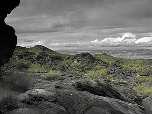
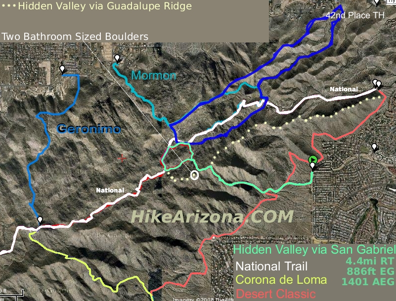
Valley to Valley, Dust to Dust, Park to Park by joebartels  Overview OverviewHere's the quickest route to Hidden Valley from Ahwatukee. Heads Up! I recommend downloading the GPS Route. Otherwise seriously study the map or you will likely get lost. More specifically, you can likely get in but getting out may prove nearly impossible. All the rocks leading out of Hidden Valley appear to be black boulders. All the houses are cream-colored with a red hue roof. You should also be familiar with Hidden Valley and understand the location of the two slides. Check out Hidden Valley via Pima Canyon & Guadalupe Ridge for more Hidden Valley information. Hike From San Gabriel & 40th Place go left down through the wash and right back up. Follow the powerlines for 0.1mi then turn right onto a wide worn path. Follow the wide path 0.25mi to Desert Classic post #21. The 4x4 steel post may not say #21 but it does say Desert Classic. Turn left onto the Desert Classic and follow 0.3mi to post #23. #23 is currently marked as of this writing.
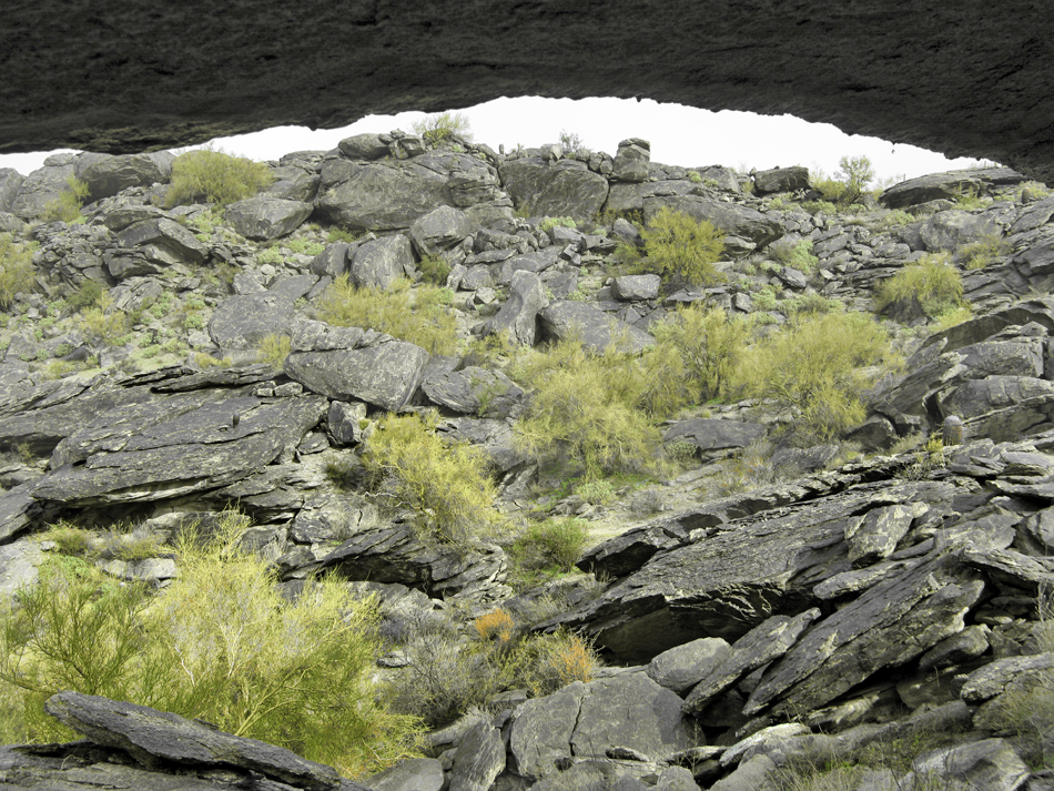
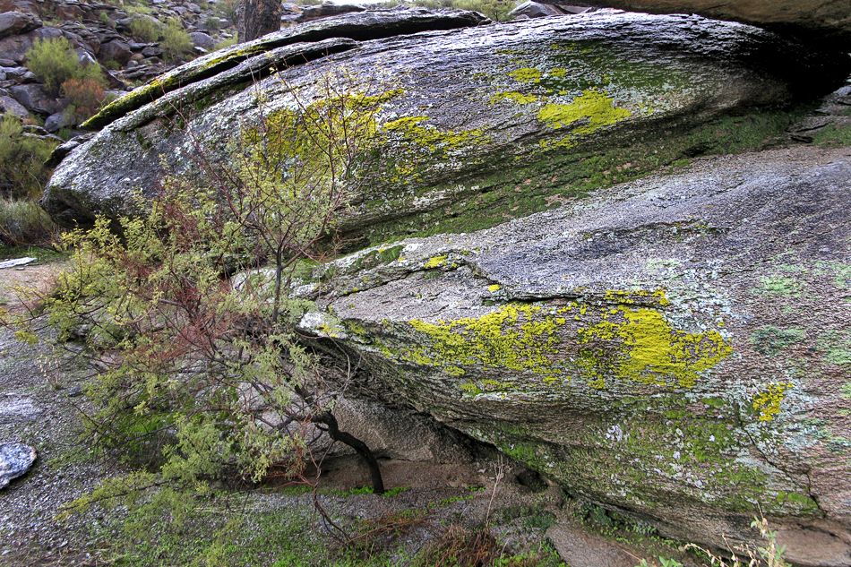
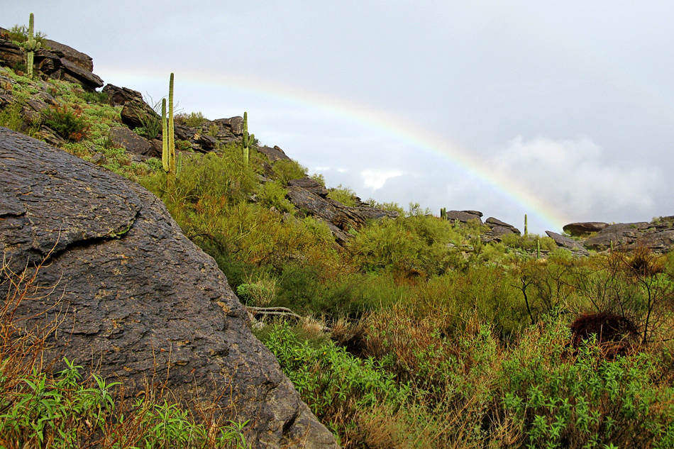
It's a mere 0.12mi down to Hidden Valley. The trail down is well worn to shelter rock. Shortly after a flat boulder becomes the trail. Continue right and out across the boulders and the trail reappears on the other side. If you're a climber you can downclimb the 10-15 dryfall. Otherwise, it's much quicker to take the switchback down. This switchback is faint where it "switches" back. The bottom switch coming back takes you under a TREE! You can easily identify the popular Hidden Valley route in the distance. This drops you in between the two slides of Hidden Valley, practically right before the eastern slide. It's imperative you note where you turn off into Hidden Valley. I remember it as the intersection with two-moss rock. Enjoy the short Hidden Valley / National loop. Going clockwise will be the eastern slide, the tunnel, cross back on the National Trail, down Fat Man's Pass ( aka Wonder Rift ), through the western ( covered ) slide and enjoy a saguarobow.
Check out the Official Route and Triplogs. Leave No Trace and +Add a Triplog after your hike to support this local community. | ||||||||||||||||||||||||||||||||||||||||||||||||||||||||||||||||||||||||||||||||||||||||||||||||||||||||||||||||||||||||||||||||||||||||||||||||||||||||||||||||||||||||||||||||||||||||


