tap row or icons for details
Difficulty
3 of 5
Route Finding
2 of 5
Distance One Way
4 miles
Trailhead Elevation
1,424 feet
Elevation Gain
1,141 feet
Accumulated Gain
1,783 feet
Kokopelli Seeds
9.94
Backpack No
Will recalculate on button tap!
4
2026-04-18
Hidden Valley via San Gabriel
ddgrunning
10
2026-03-08
Marcos De Niza - South Mountain
astrobrewer
4
2025-12-03
8
2025-11-05
3
2025-08-29
Marcos - Guadalupe
johnlp
1
2025-07-20
8
2025-05-29
3
2025-05-09
Page 1 , 2 , 3 , 4 , 5 ... 28
list
map
done
Phoenix Region
Historical Weather
Trailhead Forecast Radar Map
Preferred Dec, Jan, Feb, Mar → 7 AM
Seasons Winter to Early Spring
Named Locations Coordinate Links
Guadalupe Ridge - AKA Midlife Cri...
Official Route HAZ_Hikebot
4.03 mi
Guadalupe Ridge - AKA Midlife Cri...
3.39 mi
Guadalupe Ridge - AKA Midlife Cri...
8.59 mi
Guadalupe Ridge - AKA Midlife Cri...
9.11 mi
Guadalupe Ridge - AKA Midlife Cri...
8.52 mi
Guadalupe Ridge - AKA Midlife Cri...
9.01 mi
Guadalupe Ridge - AKA Midlife Cri...
11.37 mi
Guadalupe Ridge - AKA Midlife Cri...
9.5 mi
Guadalupe Ridge - AKA Midlife Cri...
4.62 mi
Guadalupe Ridge - AKA Midlife Cri...
9.36 mi
Guadalupe Ridge - AKA Midlife Cri...
5.63 mi
Guadalupe Ridge - AKA Midlife Cri...
8.69 mi
Guadalupe Ridge - AKA Midlife Cri...
11.88 mi
Guadalupe Ridge - AKA Midlife Cri...
9.16 mi
Guadalupe Ridge - AKA Midlife Cri...
8.68 mi
Guadalupe Ridge - AKA Midlife Cri...
8.89 mi
Guadalupe Ridge - AKA Midlife Cri...
6.37 mi
Guadalupe Ridge - AKA Midlife Cri...
9.02 mi
Guadalupe Ridge - AKA Midlife Cri...
5.43 mi
Guadalupe Ridge - AKA Midlife Cri...
5.42 mi
Guadalupe Ridge - AKA Midlife Cri...
8.96 mi
Guadalupe Ridge - AKA Midlife Cri...
6.82 mi
Guadalupe Ridge - AKA Midlife Cri...
7.6 mi
Guadalupe Ridge - AKA Midlife Cri...
8.64 mi
Guadalupe Ridge - AKA Midlife Cri...
8.4 mi
Guadalupe Ridge - AKA Midlife Cri...
8.39 mi
Guadalupe Ridge - AKA Midlife Cri...
8.63 mi
Guadalupe Ridge - AKA Midlife Cri...
6.31 mi
Guadalupe Ridge - AKA Midlife Cri...
2014-08-24
Tortoise_Hiker
8.49 mi
Guadalupe Ridge - AKA Midlife Cri...
8.82 mi
Guadalupe Ridge - AKA Midlife Cri...
2010-03-02
Lord Cain Yebng
9.61 mi
Guadalupe Ridge - AKA Midlife Cri...
4.1 mi
Hidden Valley via San Gabriel
5.18 mi
Marcos De Niza - South Mountain
9.47 mi
Hidden Valley via Guadalupe Ridge
6.57 mi
Hidden Valley via Guadalupe Ridge
5.92 mi
Hidden Valley via Pima Canyon
6.65 mi
Marcos - Guadalupe
8.45 mi
SoMo San Gabriel - Young - Guadalupe
7.72 mi
Hidden Valley via Guadalupe Ridge
6.62 mi
SoMo Guadalupe - Corona - Nationa...
11.03 mi
Mormon Trail - South Mountain
12.7 mi
Buena Vista Lookout via Guadalupe...
11.08 mi
San Gabriel loop
5.5 mi
Benjamin Button loop
6.8 mi
Pima to Benchmark
11.49 mi
Young Man San Gabriel
3.57 mi
Hidden Valley via Guadalupe Ridge
11.6 mi
Hidden Valley via Guadalupe Ridge
12.08 mi
Crumpled Bikini-top
15.89 mi
Mormon Midlife Crisis
9.75 mi
Mormon Midlife Crisis
9.81 mi
Sisirc Efildim Nomrom
9.84 mi
San Gabriel Loop
7.73 mi
Pima Canyon Corona de Loma Loop
15.59 mi
Hidden Valley via San Gabriel
7.67 mi
Sisirc Efildim Nomrom
9.9 mi
Hidden Valley via San Gabriel
6.2 mi
SoMo Crumpled Bikini Top Route
17.03 mi
Marcos De Niza - South Mountain
10.91 mi
Mormon Midlife Crisis
10.14 mi
South Mountain Pima-Corona-Dobbin...
22.5 mi
Sisirc Efildim Nomrom
9.69 mi
San Gabriel Guadalupe National
7.96 mi
Mormon Midlife Crisis
9.89 mi
Beverly to Benchmark
10.52 mi
Young Corona
8.93 mi
Young Marcos Gabriel
7.89 mi
Hidden Valley via Guadalupe Ridge
7.49 mi
Young Man Loop
3.18 mi
Young Man - Corona loop
8.49 mi
Hidden Valley via Guadalupe Ridge
8.96 mi
Hidden Valley via San Gabriel
7.66 mi
San Gabriel-Guadalupe-Young Man
4.96 mi
Mormon Midlife Crisis
10.08 mi
Crumpled Bikini-top
15.75 mi
Mormon Midlife Crisis
10.22 mi
CdL MLC YM and DC
8.72 mi
SoMo Sueno
11.21 mi
Mini Infinity
12.56 mi
SoMo Infinity Loop
32.85 mi
SoMo Freestyle
7.93 mi
SoMo Medley
7.46 mi
South Mountain Benchmark Blitz
13.83 mi
SoMo Sueno
11.57 mi
Hidden Valley via Guadalupe Ridge
6.1 mi
SoMo east
6.01 mi
South Mountain Pima-Corona-Dobbin...
21.29 mi
Partial Enchilada
15.94 mi
National Trail - South Mountain
10.35 mi
The Fortress of Solitude
7.09 mi
SoMo Freestyle
6.26 mi
Hidden Valley via Guadalupe Ridge
8.7 mi
Hidden Valley from Buena Vista
4.91 mi
Young Man-Corona loop
8.67 mi
Corona de Loma East - AKA Old Man...
6.32 mi
East SoMo Loop
13.02 mi
Hidden Valley via San Gabriel
4.39 mi
Geronimo National Midlife Crisis ...
7.62 mi
East SoMo Loop
11.58 mi
SGR MLC CdL and DC
7.1 mi
Mormon Midlife Crisis
11.22 mi
Mormon Loop Trail
7.67 mi
San Gabriel Ridge
6.58 mi
Hidden Valley via San Gabriel
7.58 mi
Geronimo National Midlife Crisis ...
7.11 mi
Corona Loop via San Gabriel
11.7 mi
Young Man Trail - South Mountain
6.26 mi
Hidden Valley via San Gabriel
5.07 mi
Old Man-Young Man loop
6.72 mi
Hidden Valley via Guadalupe Ridge
6.51 mi
Guadalupe Ridge-Hidden Valley loop
8.7 mi
Hidden Valley via Guadalupe Ridge
7.6 mi
Guadalupe Ridge - Beverly - National
3.42 mi
SoMo east explore
8.41 mi
Hidden Valley via San Gabriel
5.28 mi
National Trail - South Mountain
9.84 mi
Young Man-Geronimo-Mormon loop
11.18 mi
Guadalupe Ridge-Pima Wash loop
9.39 mi
Marcos Gabriel
3.7 mi
Hidden Valley via Guadalupe Ridge
6.6 mi
Corona Loop - Hidden Valley
9.22 mi
Little Guadalupe Loop 4/4/18
7.9 mi
Guadalupe - National - Ridgeline ...
9.18 mi
Little Guadalupe Loop
4.69 mi
Little Guadalupe Loop
6.59 mi
Marcos - HV - Ridgeline Loop
12.03 mi
Little Guadalupe Loop
6.34 mi
San Gabriel - Guadalupe Loop
6.23 mi
San Gabriel - Guadalupe Loop
9.22 mi
Little Guadalupe Loop
5.88 mi
Super SoMo
41.71 mi
Geronimo Trail via Hidden Valley
7.39 mi
Little Guadalupe Loop
6.93 mi
Little Guadalupe Loop
6.64 mi
Guadalupe - Hidden Valley - Ridge...
9.43 mi
San Gabriel - Guadalupe Loop
6.81 mi
San Gabriel - Guadalupe Loop
7.88 mi
San Gabriel - Guadalupe Loop
7.66 mi
Guadalupe Ridge - National
7.38 mi
San Gabriel - Guadalupe Loop
7.53 mi
Corona - Guadalupe Ridge - Hidden...
7.5 mi
Corona Loop & Guadalupe Ridge
7.72 mi
San Gabriel-Guadalupe-Young Man
4.72 mi
Corona-Guadalupe Ridge loops
11.28 mi
Corona - Guadalupe Ridge - Hidden...
10.5 mi
San Gabriel - Guadalupe Loop
6.91 mi
San Gabriel - Guadalupe Loop
9.36 mi
San Gabriel - Guadalupe Lasso
6.6 mi
Mormon Guad Rdg Hidden Vly Mormon...
6.31 mi
San Gabriel-Guadalupe Ridge-Young...
4.72 mi
Corona-Guadalupe Ridge-Hidden Val...
9.63 mi
Tuesday Night on SoMo
6.61 mi
Tuesday Night on SoMo
6.9 mi
Tuesday Night on SoMo
6.98 mi
Tuesday Night on SoMo
7.94 mi
Hidden Valley via Guadalupe Ridge
6.42 mi
Guadalupe Ridge-Hidden Valley loop
6.41 mi
Hidden Valley via National
8.47 mi
South Mountain Wander-Again
6.8 mi
Guadalupe Ridge-National loop
8.58 mi
Guadalupe Ridge Loop Plus
12.35 mi
National Loop Plus
7.17 mi
South Mountain Wander
8.22 mi
Little Guadalupe Loop
6.51 mi
Ridgeline Loop
3.94 mi
Marcos and West Loop
2.16 mi
Hidden Valley loop
7.18 mi
Marcos De Niza - South Mountain
3.38 mi
Hidden Valley loop
7.27 mi
Marcos Guad Ridge Beverly Canyon ...
3.03 mi
Corona-National-Young Man loop
9 mi
Hidden Valley via the wash from N...
8.45 mi
Hidden Valley via Pima Canyon
8.7 mi
Hidden Valley via the wash from N...
9.43 mi
Hidden Valley via the wash from N...
8.9 mi
Hidden Valley via the wash from N...
8.93 mi
Lil Guadalupe Loop
7.54 mi
Guadalupe Loop
10.55 mi
Guadalupe Loop
9.17 mi
Lil Guadalupe Loop
6.83 mi
Lil Guadalupe Loop
6.83 mi
Guadalupe Ridge Loop
10.95 mi
Guadalupe National Hidden Loop
9.97 mi
Guadalupe Ridge
10.27 mi
Guadalupe National Loop
10.02 mi
National Guadalupe Ridge
10 mi
Guadalupe National Hidden Loop
7.31 mi
Guadalupe National Hidden Loop
7.4 mi
National Fatman Loop Plus
7.37 mi
Young Man's Loop
5.89 mi
Guadalupe - Fat Man - National
9.5 mi
South Mt. Unmarked Trails
9.95 mi
Guadalupe Rdg-National-Hidden Val...
8.81 mi
Guadalupe Ridge National Loop
8.4 mi
South Mountain Geocache Walkabout
6.1 mi
South Mountain Saunter
8.49 mi
guadalupe ridge-corona loop
11.55 mi
Corona Mormon Geronimo Loop
11.31 mi
From Pima Canyon Trailhead head out on Desert Classic, immediately turn up to Marco de Niza rock. Trail continues up either side and meets quickly. Trail continues up and down along ridge to junction with
Beverly Canyon Trail - South .
The trail heads up and becomes a tad more difficult to follow after passing
San Gabriel Ridge (keep left, don't go right down to National. Once past the route trouble, the trail is easy to follow all the way to the junction with
San Gabriel Canyon .
The faint use trail continues on over to
Corona de Loma - East Ridge . The Guadalupe Ridge ends here at Eagle Pass. On the other side of Eagle Pass is
Corona de Loma . A right quickly takes you down to the
National Trail , Buena Vista Trailhead is near.
This trail is not signed anywhere. It is a heavily used use-trail. Especially in the middle section where residents of the San Gabriel neighborhood utilize the ridge for various loops.
One-Way Notice This hike is listed as One-Way.
When hiking several trails on a single "hike", log it with a generic name that describes the hike. Then link the trails traveled, check out the
example .
 Route Editor

 From Pima Canyon Trailhead head out on Desert Classic, immediately turn up to Marco de Niza rock. Trail continues up either side and meets quickly. Trail continues up and down along ridge to junction with Beverly Canyon Trail - South.
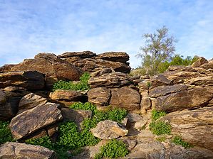


